DOWNLOADS
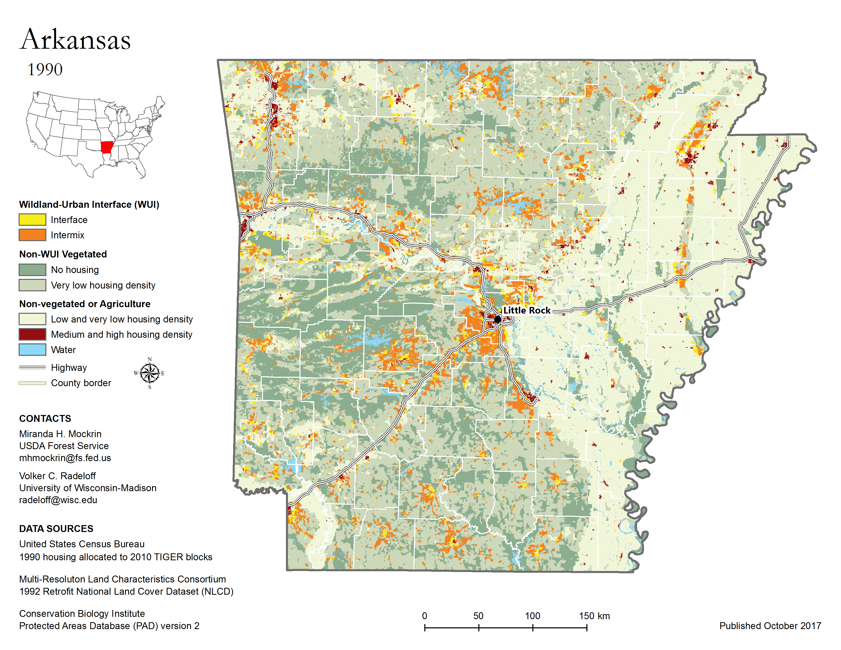
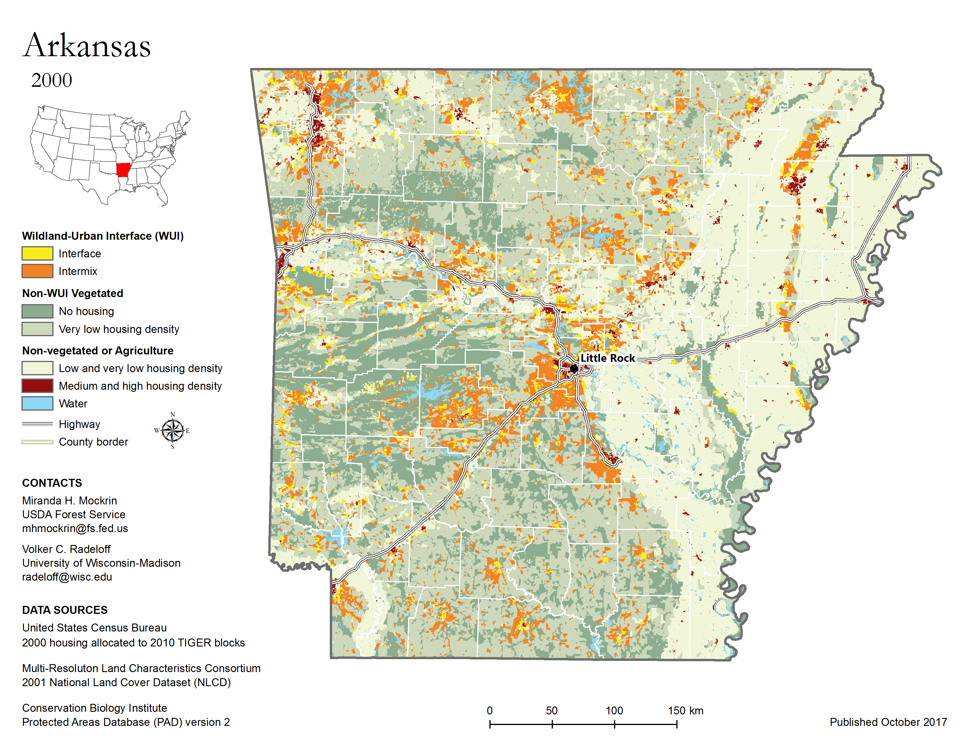
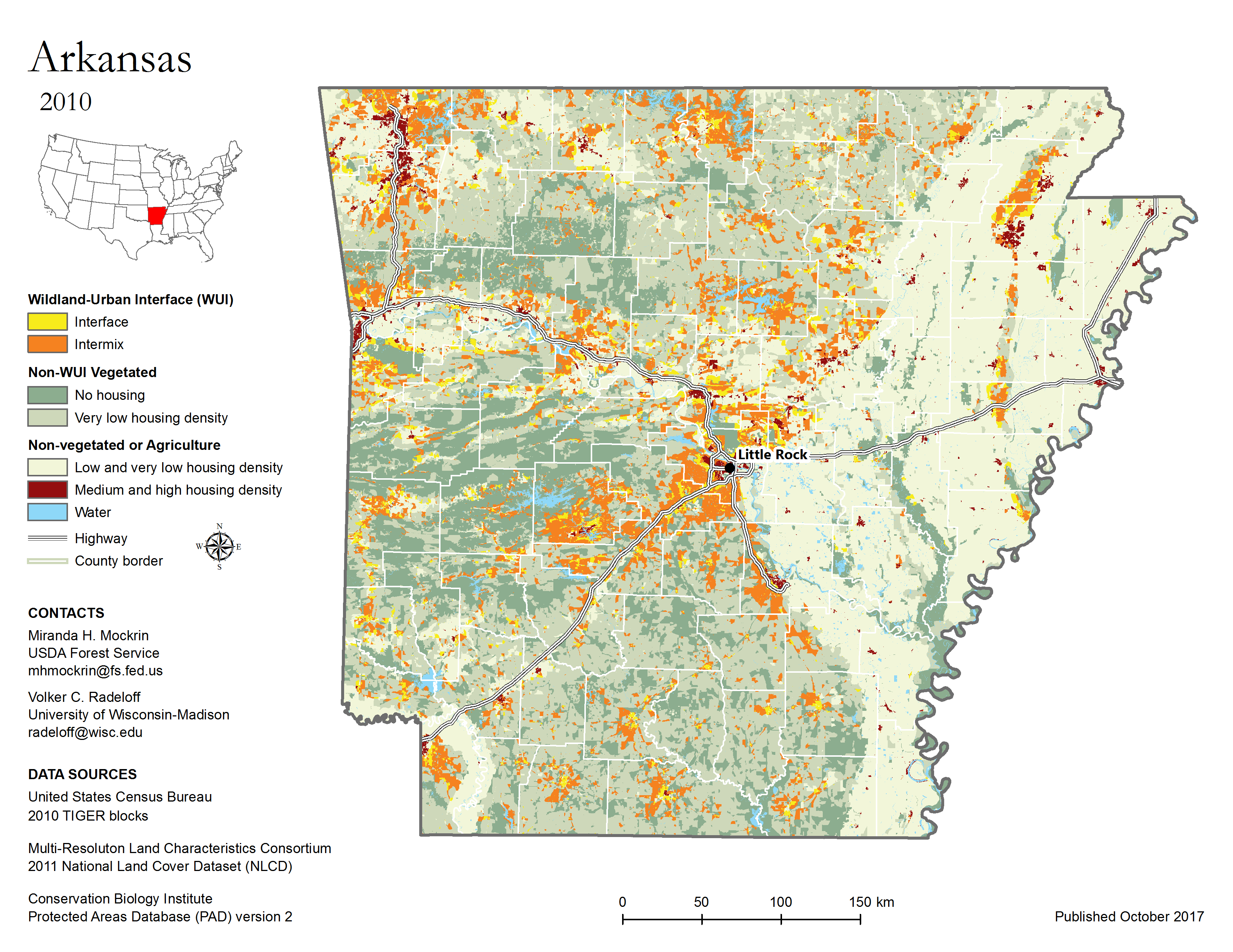
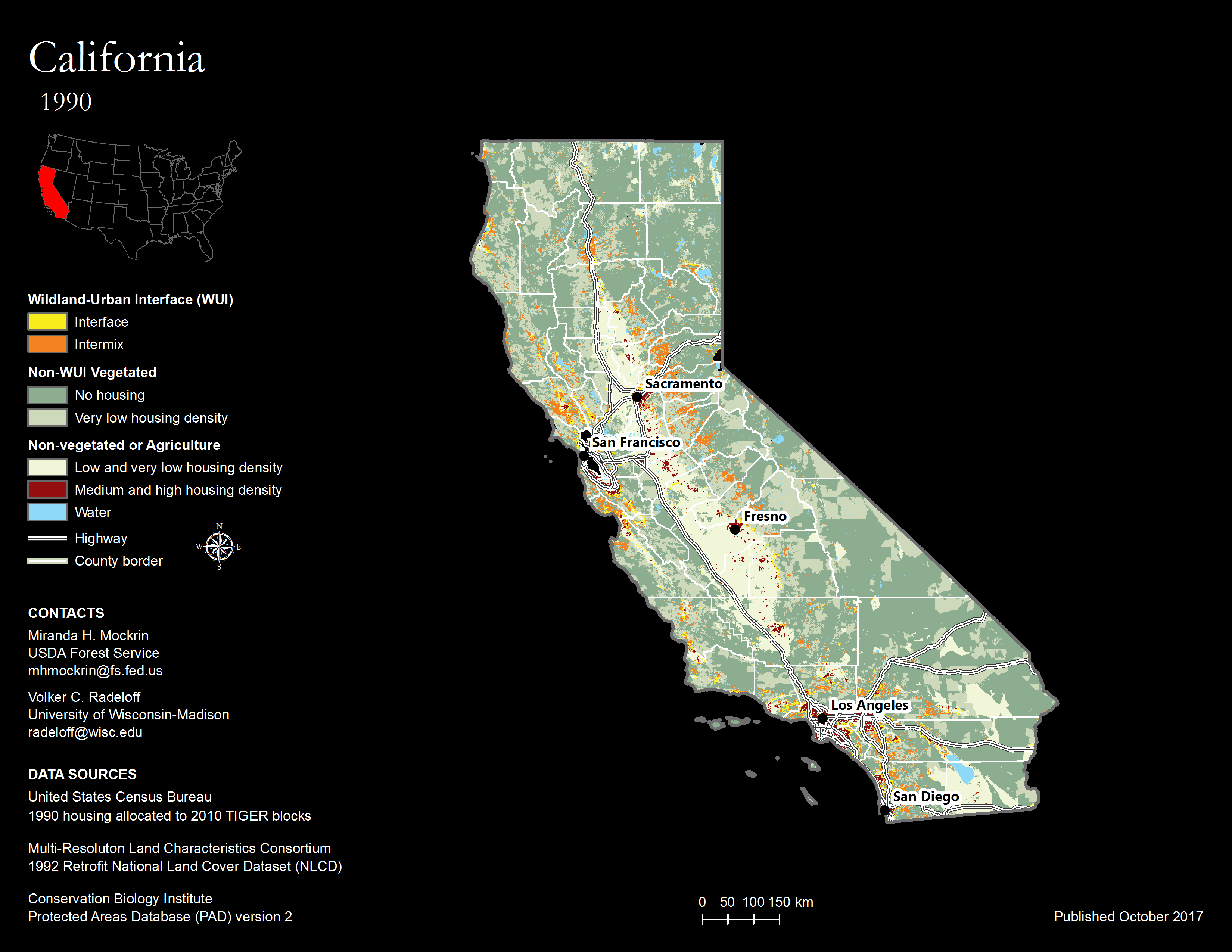
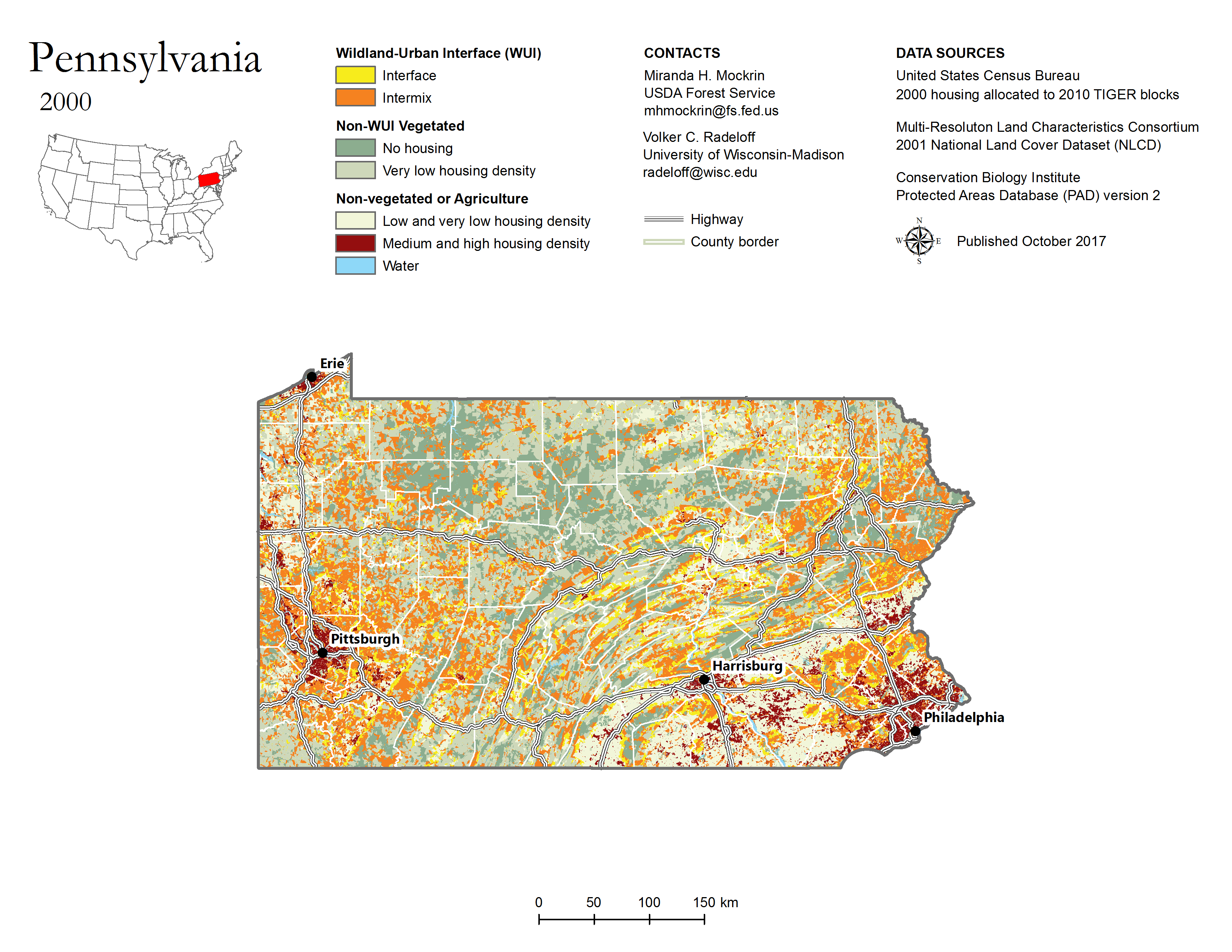
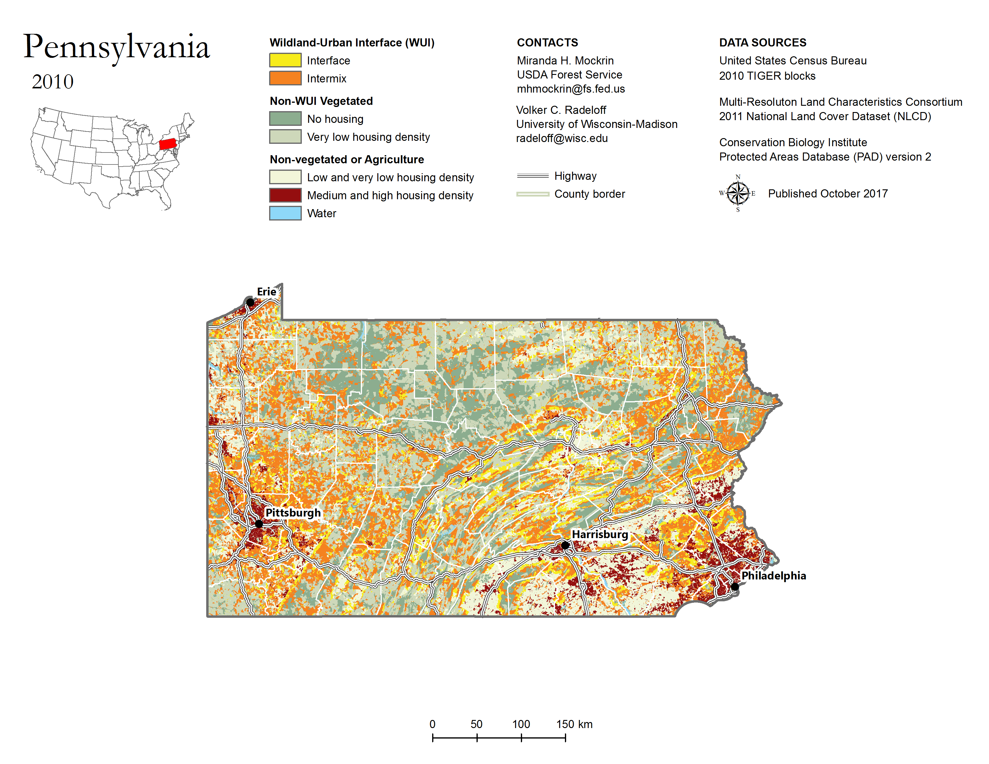
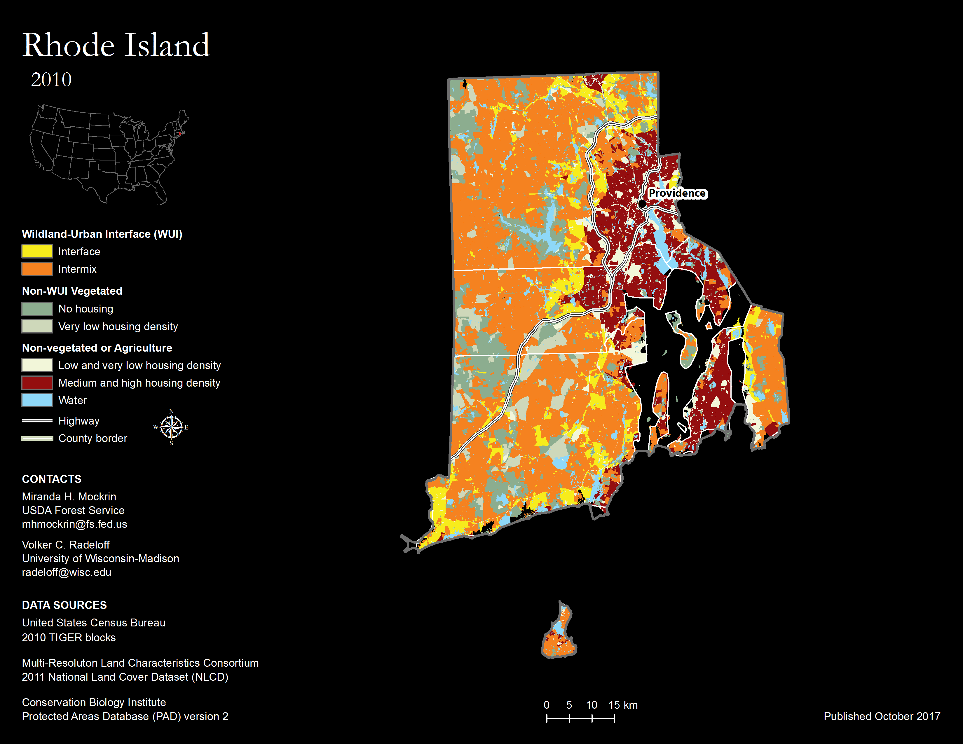
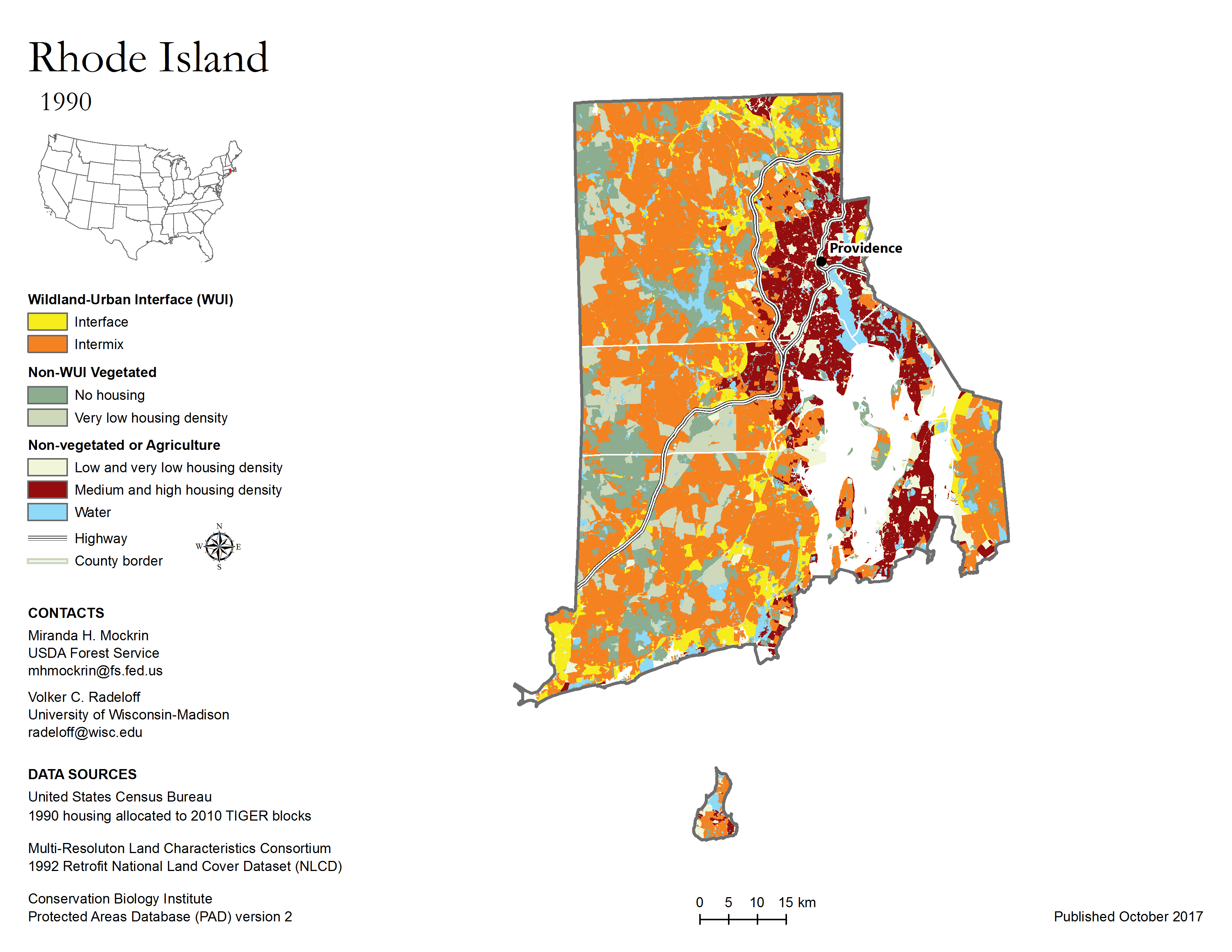
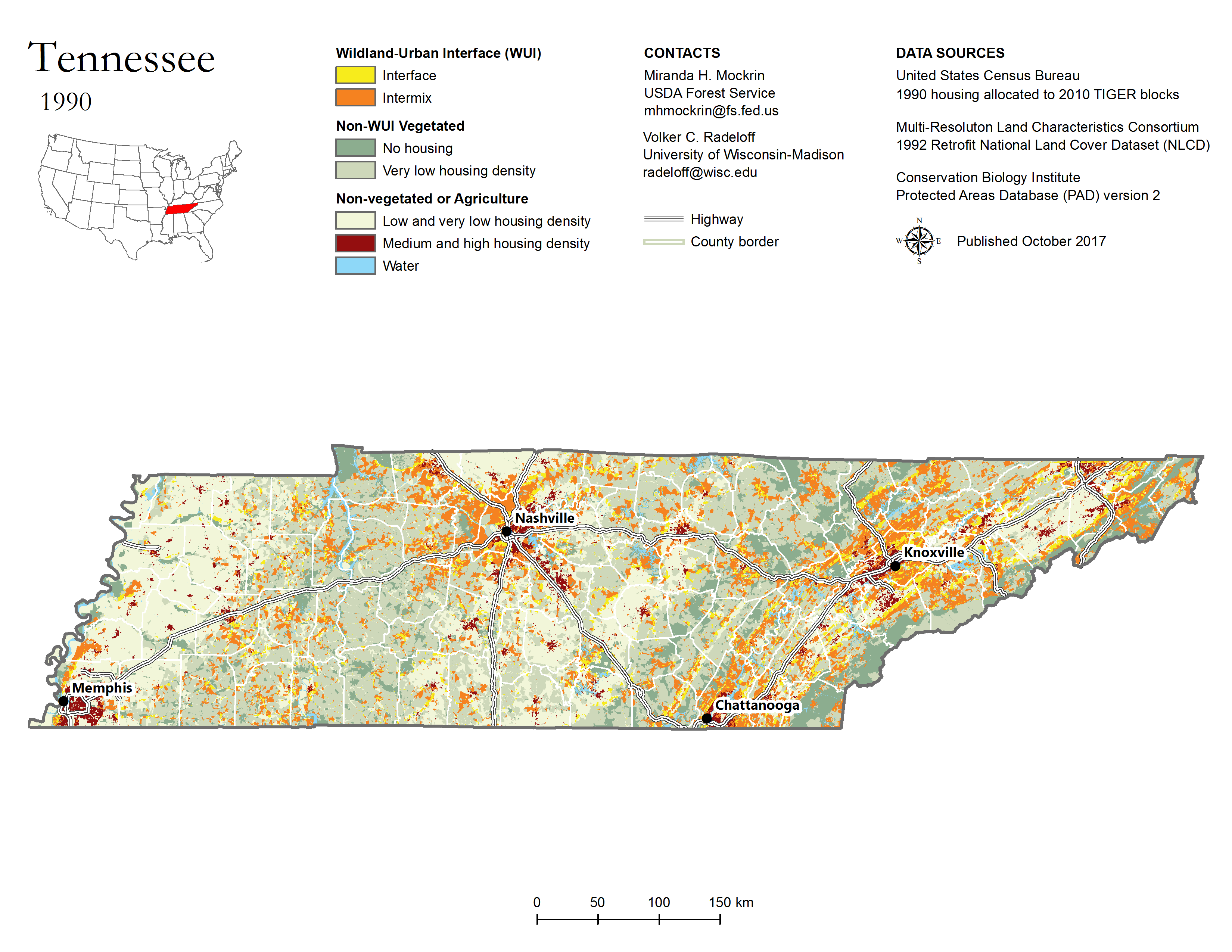
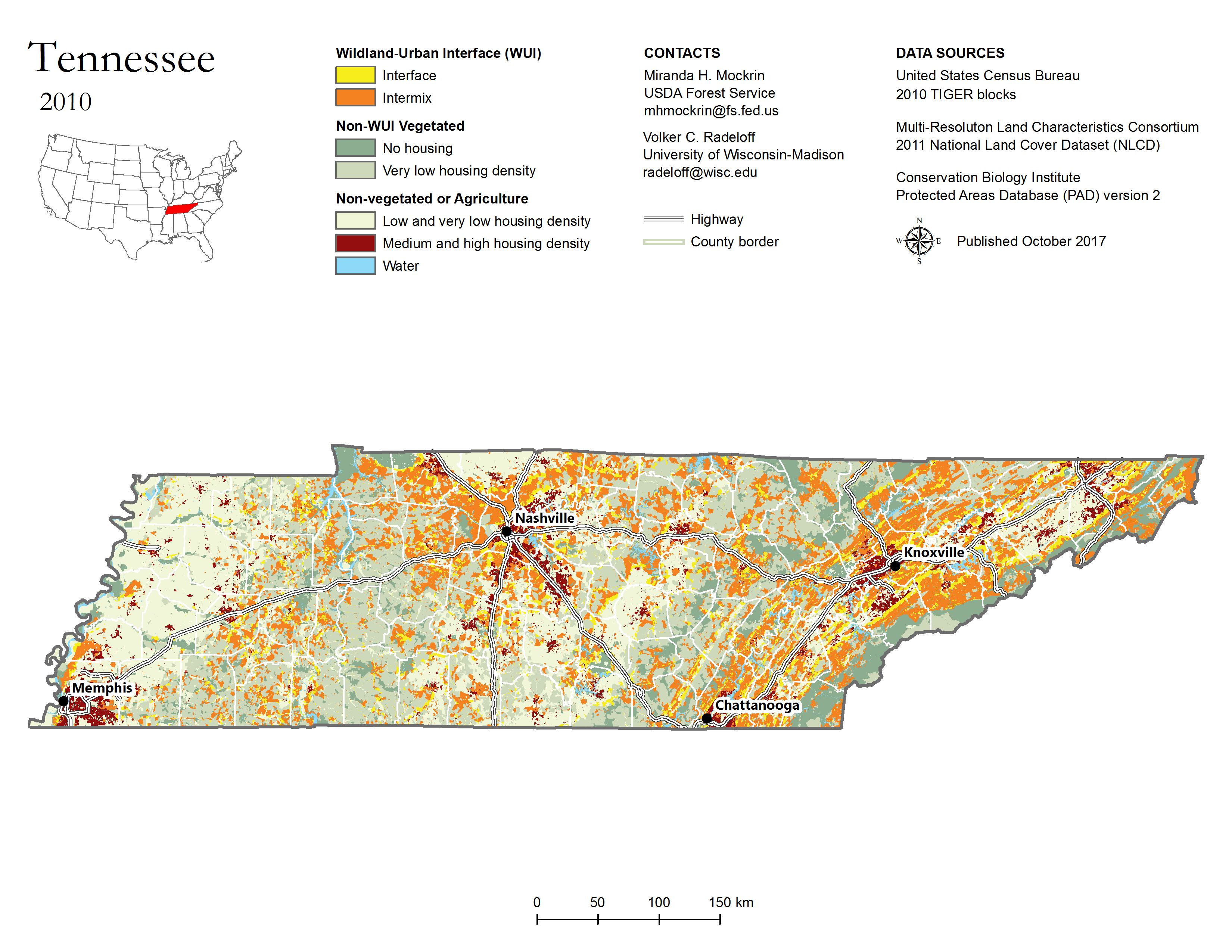
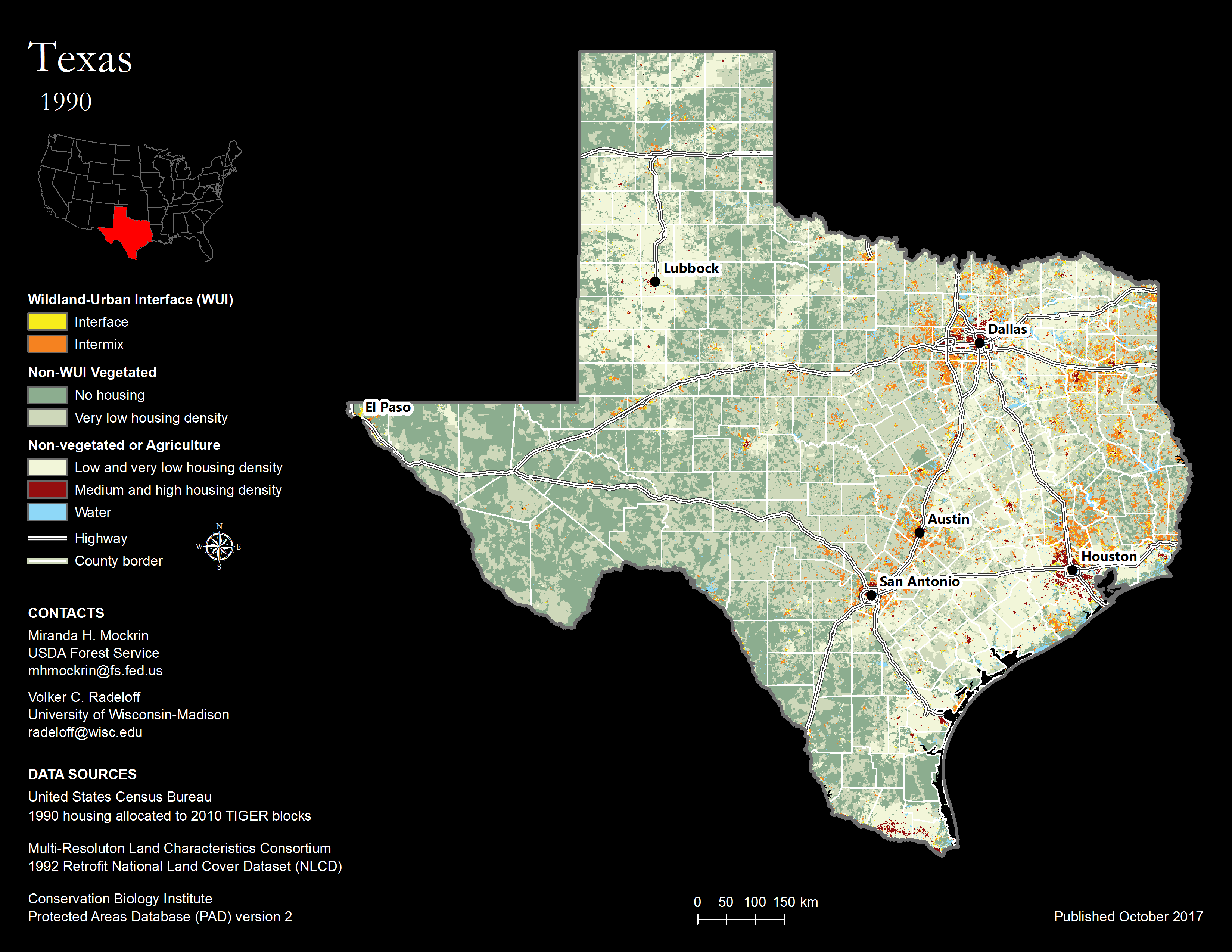
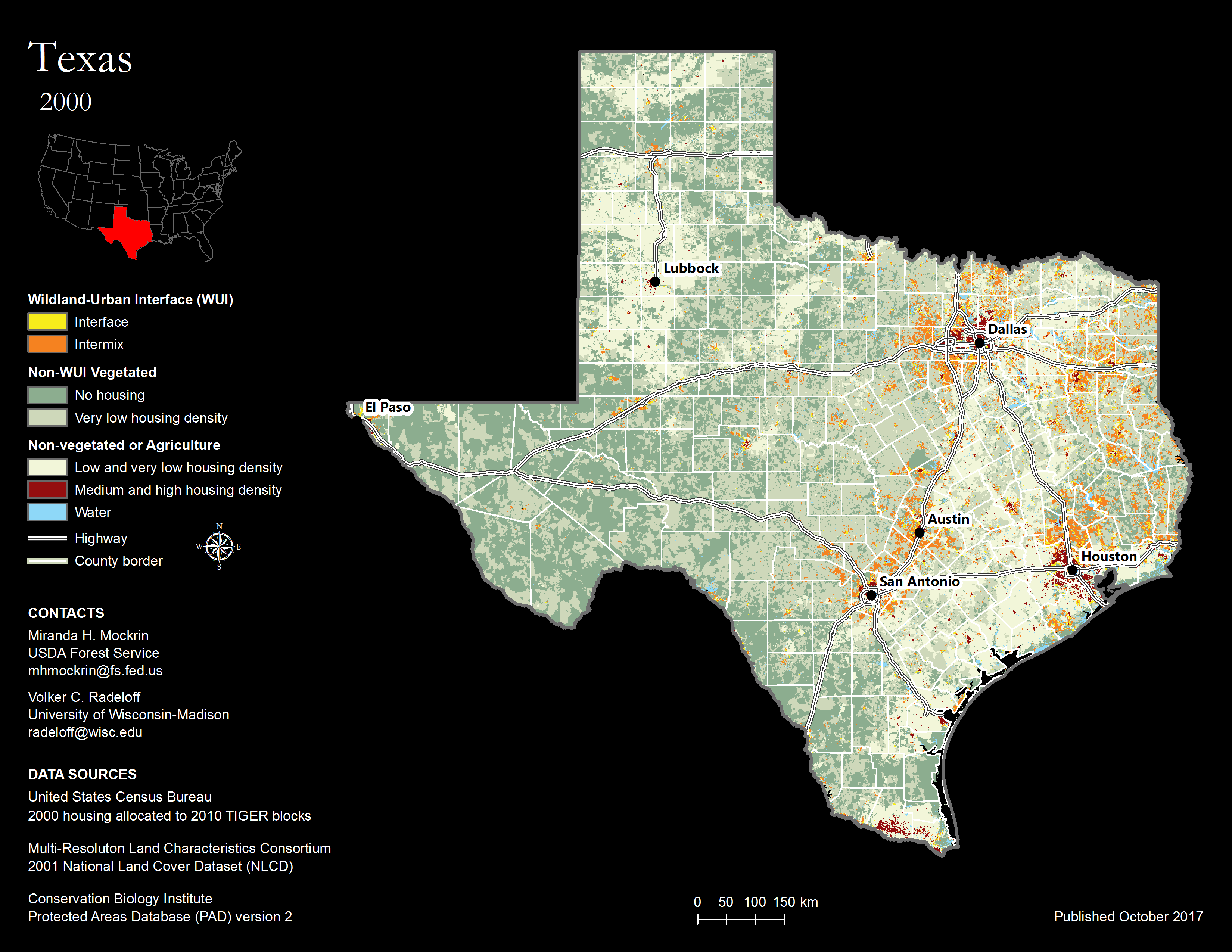
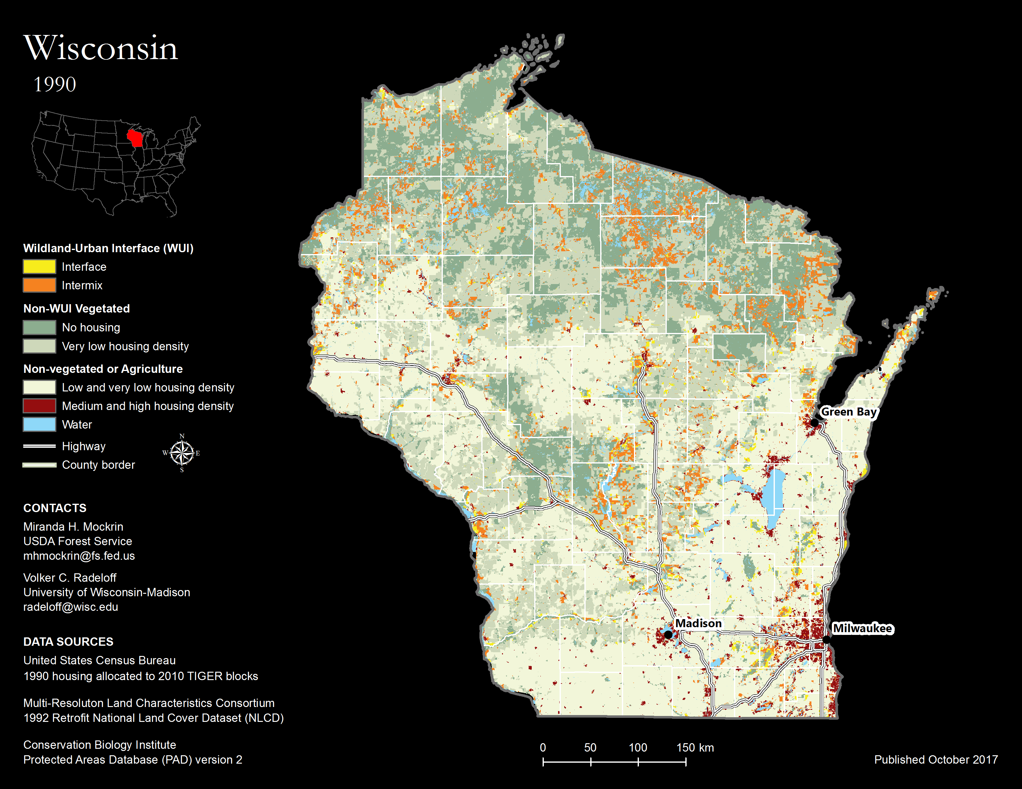
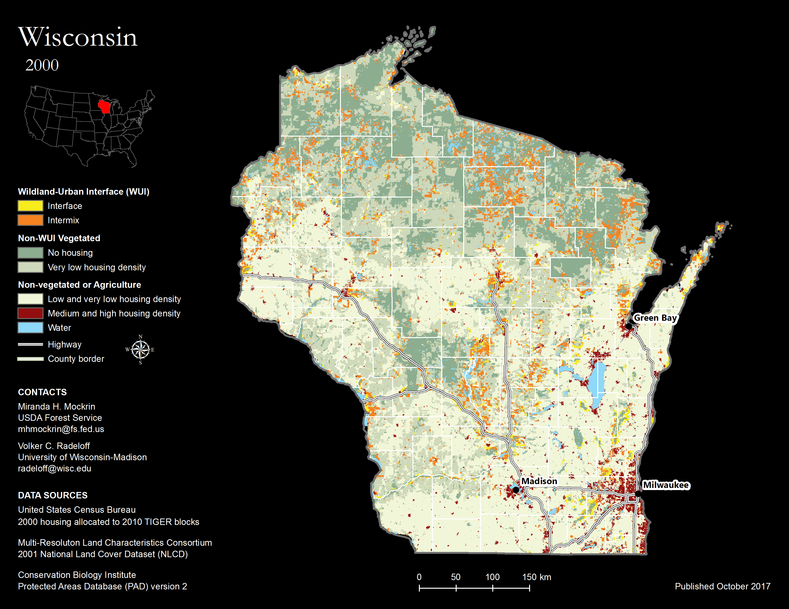
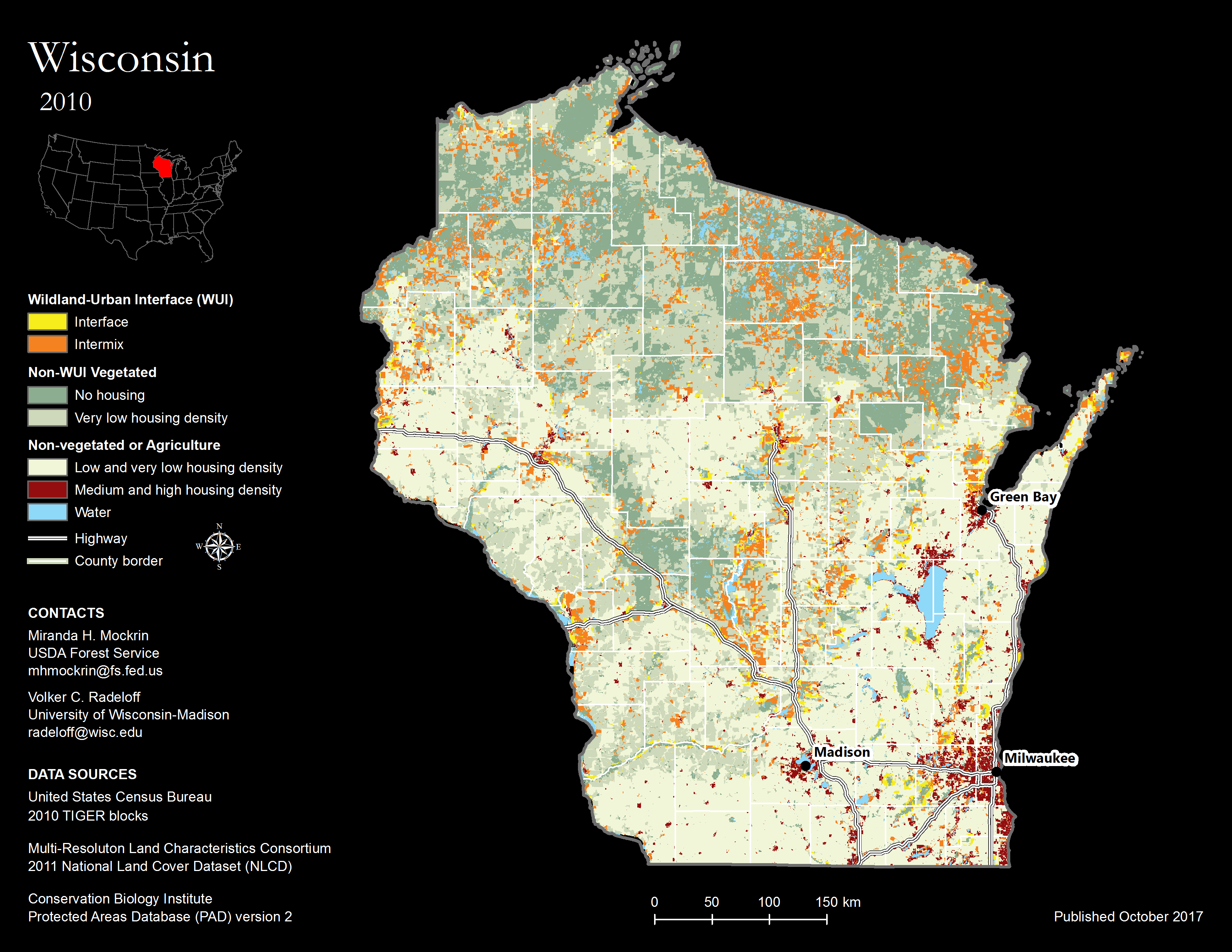
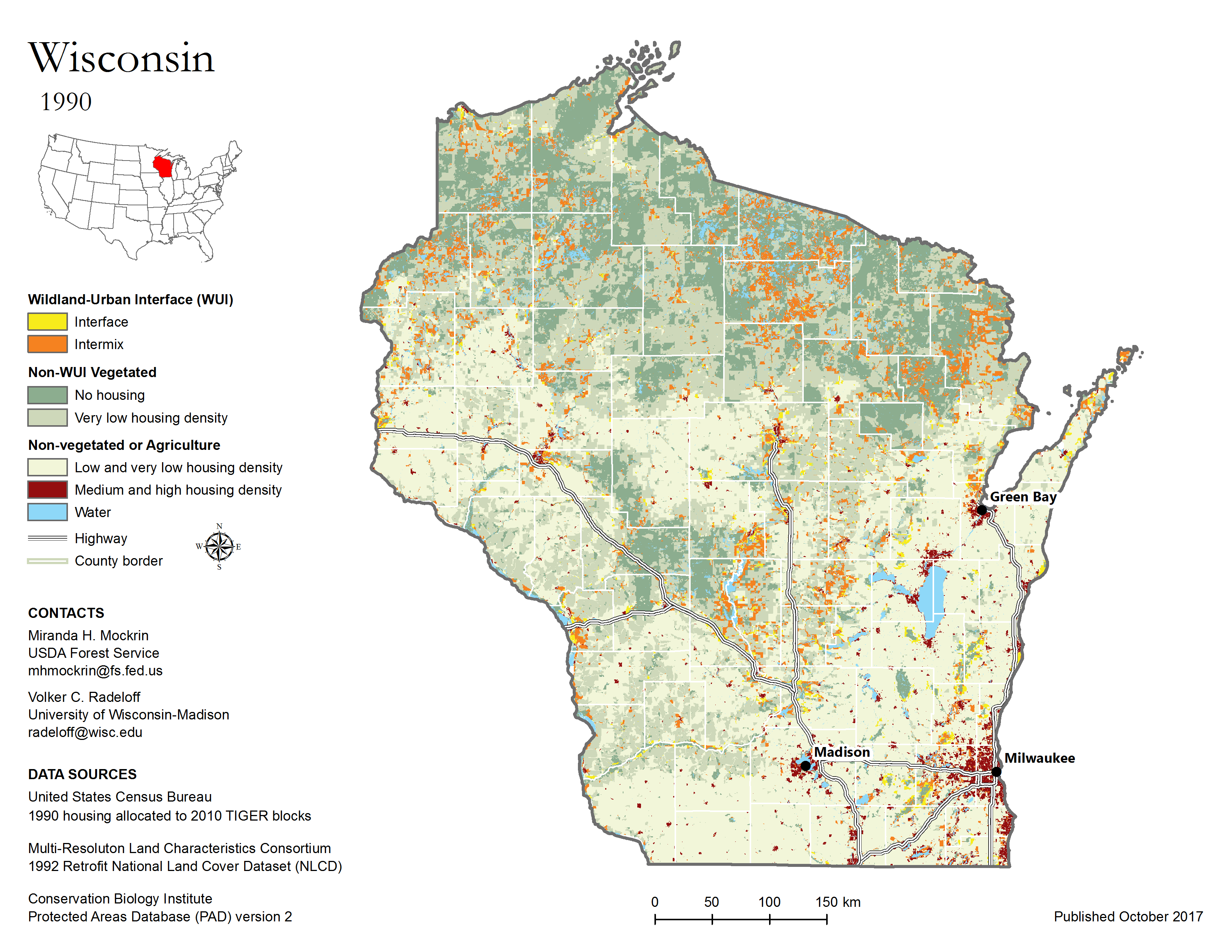
WUI DATA DESCRIPTION
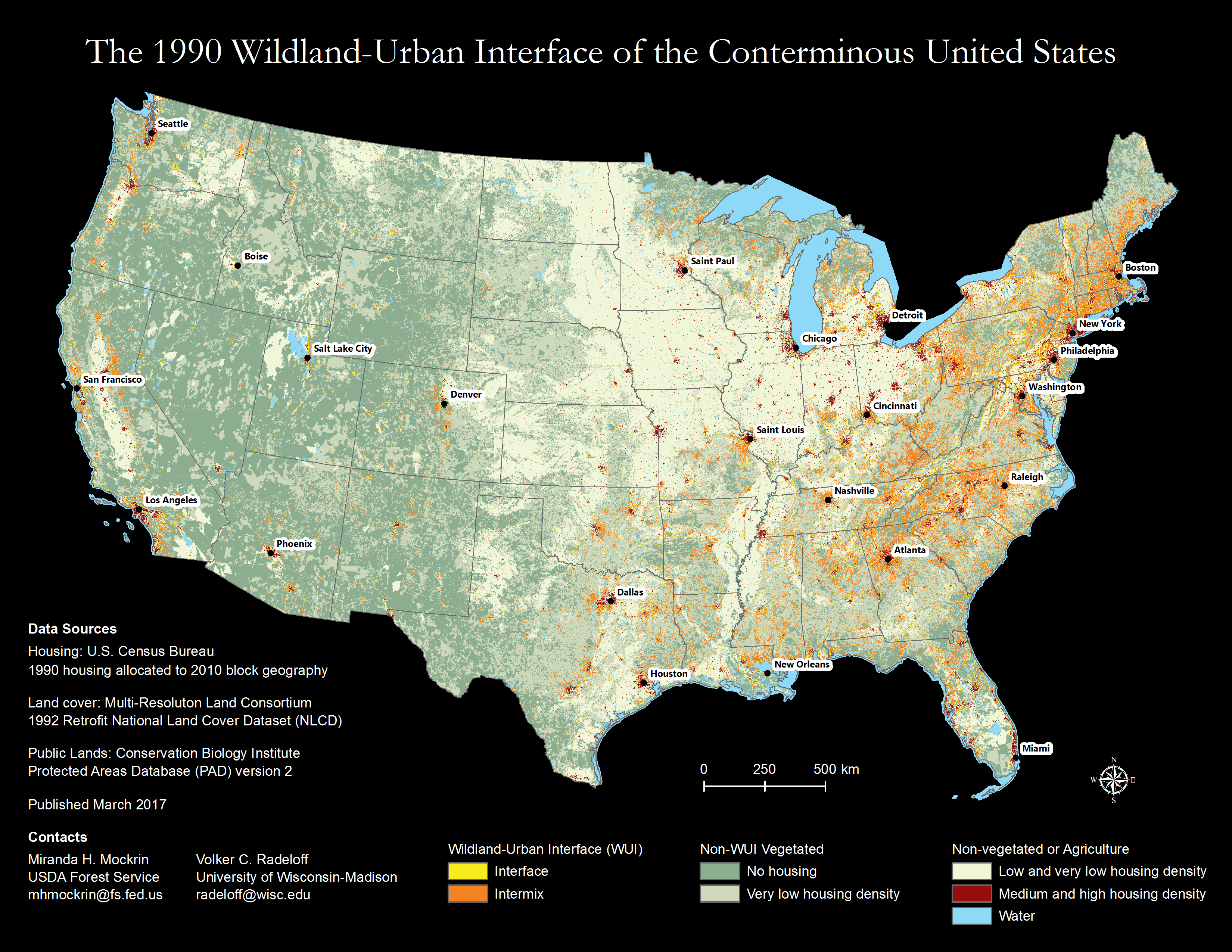
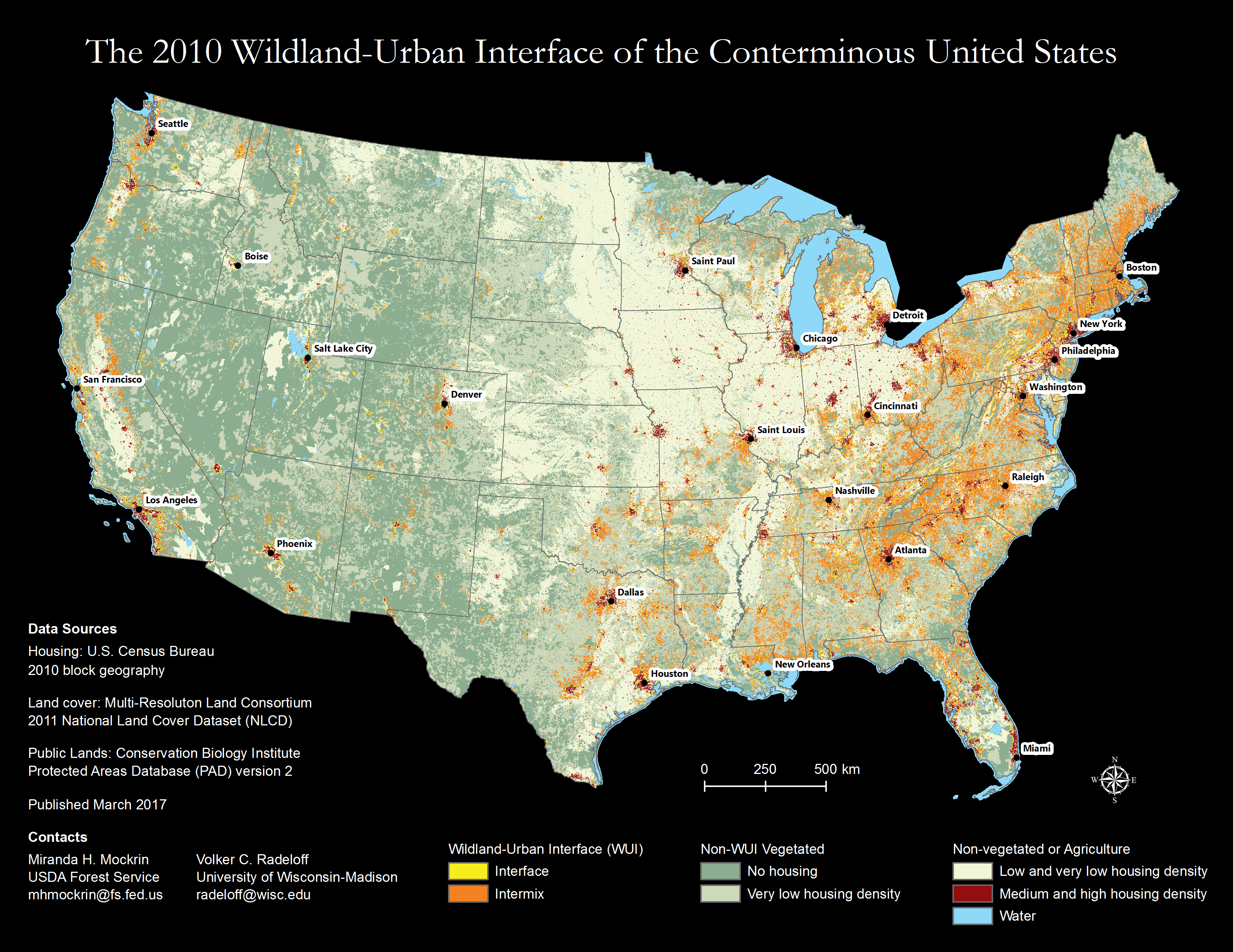
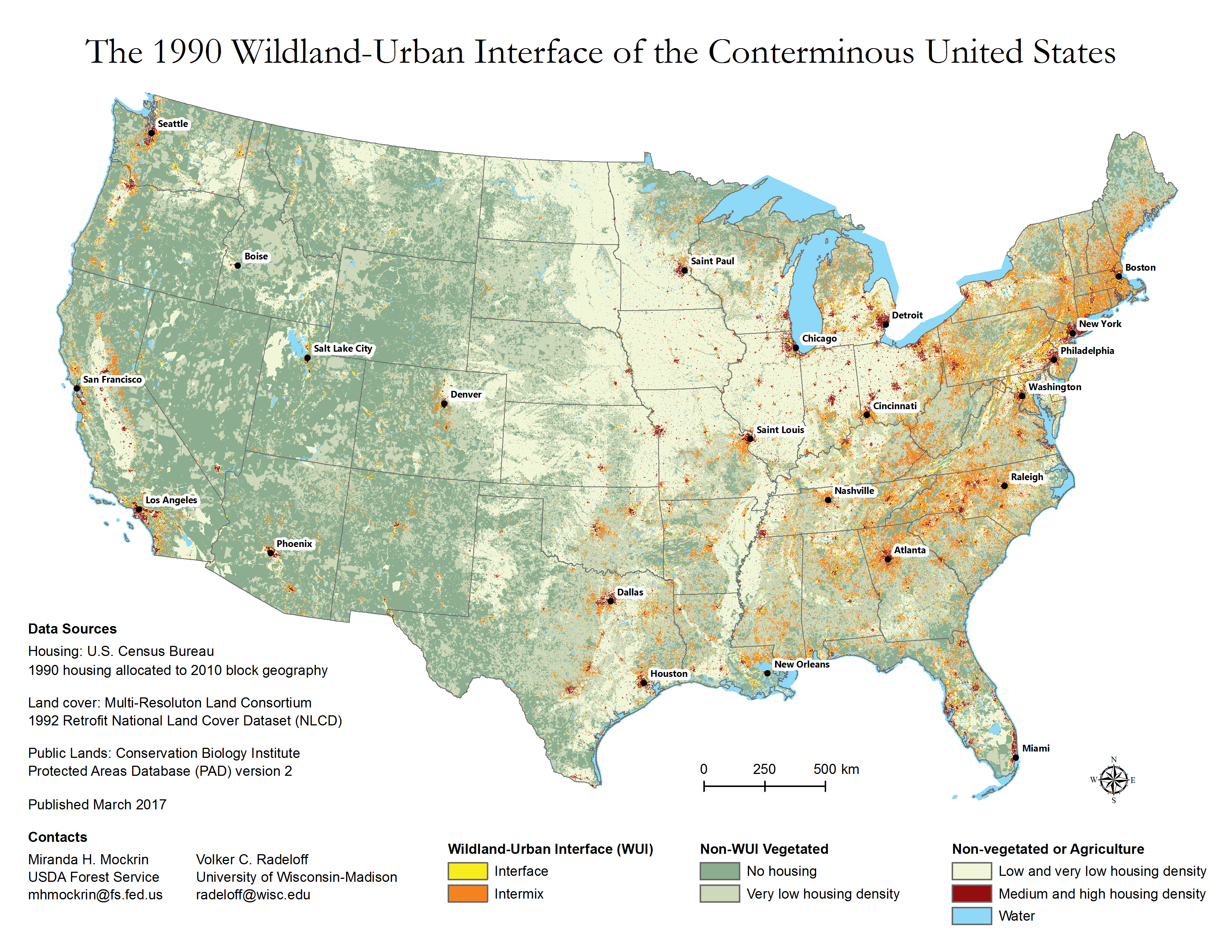
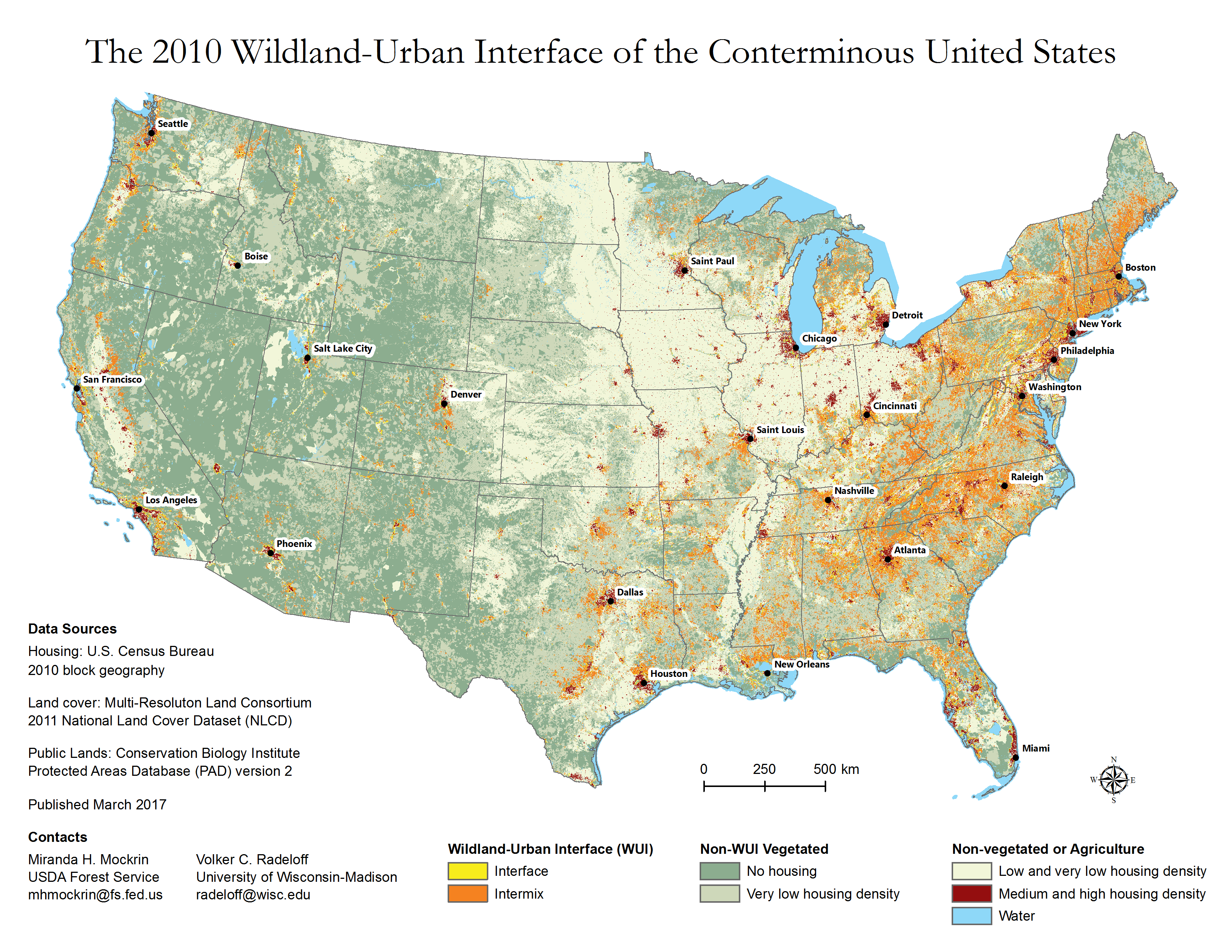
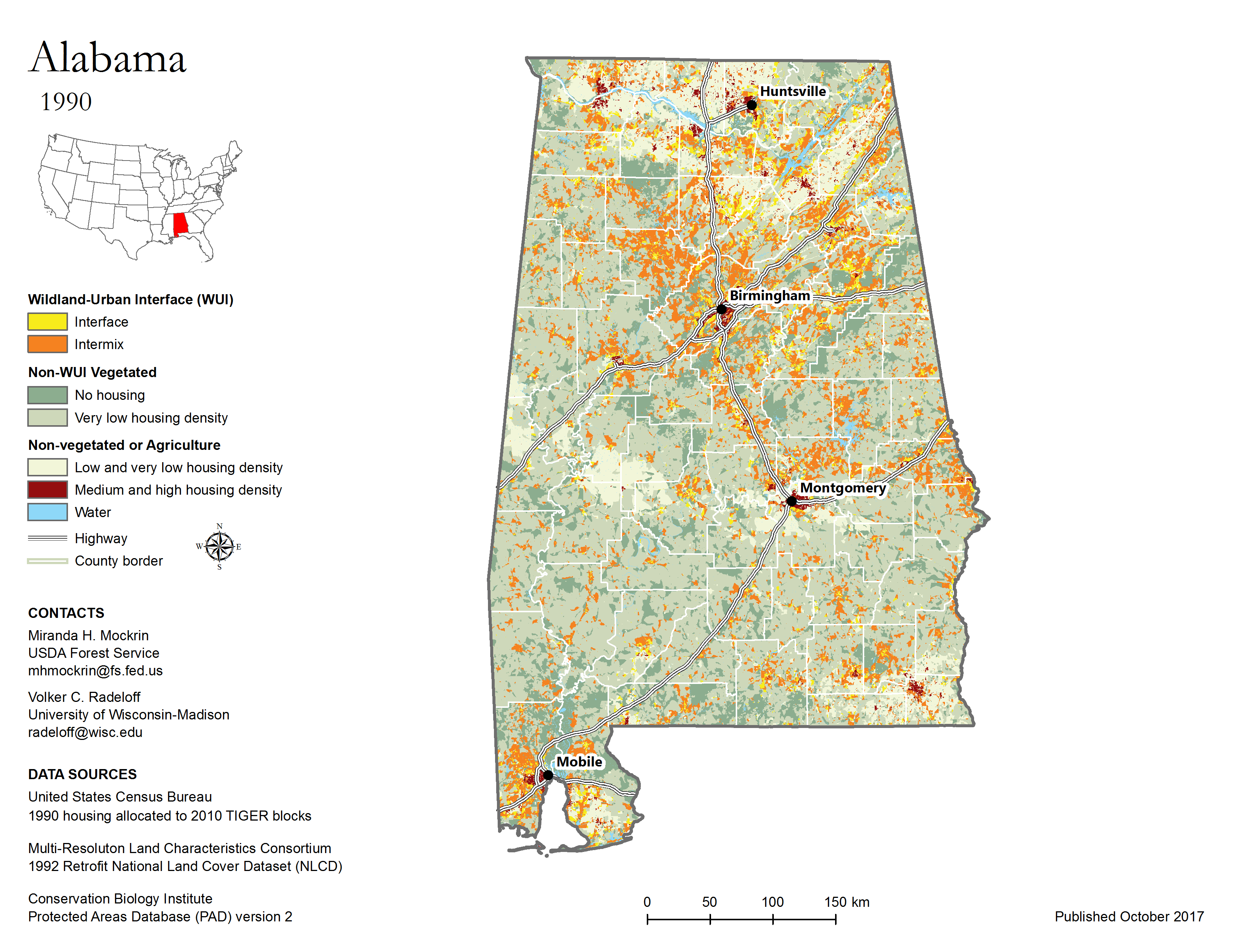
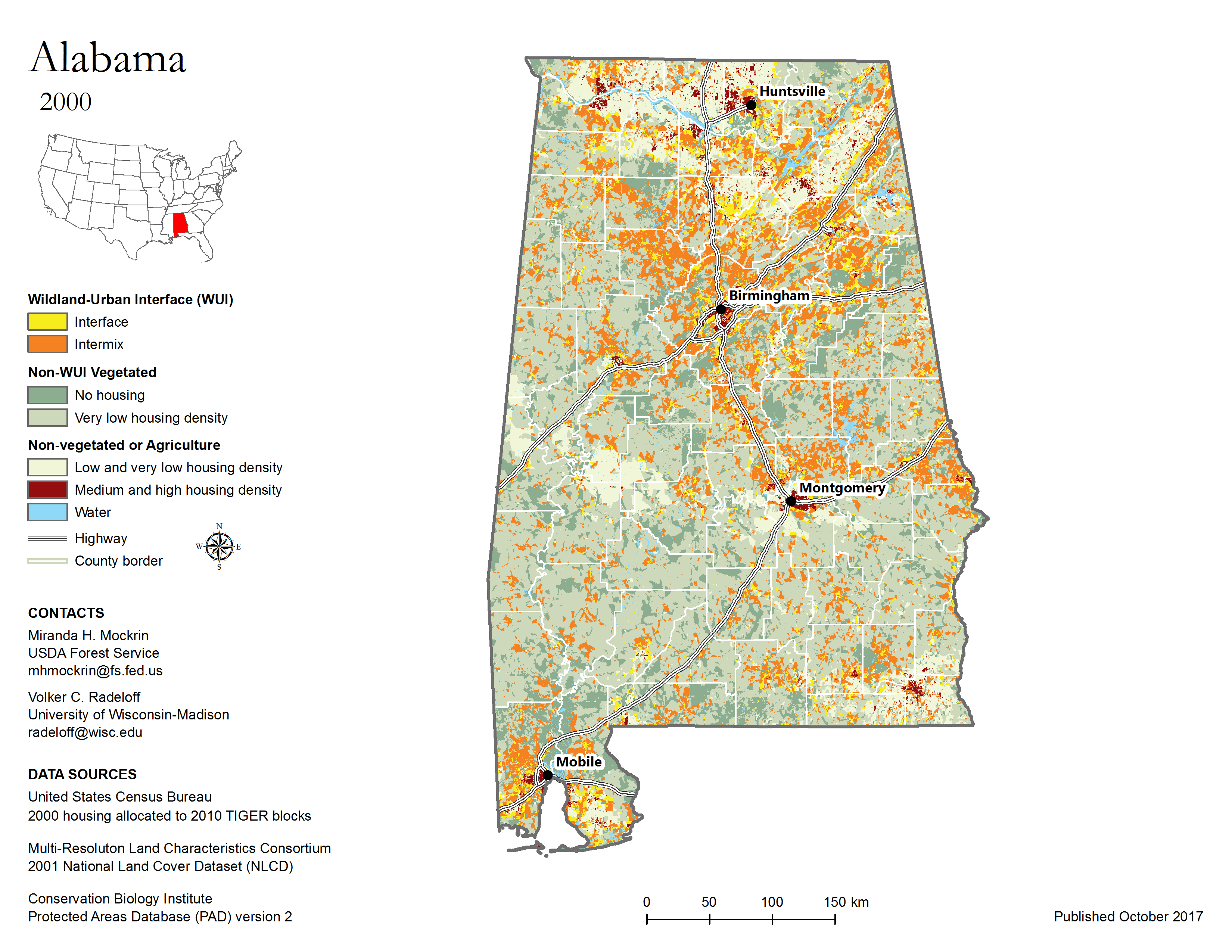
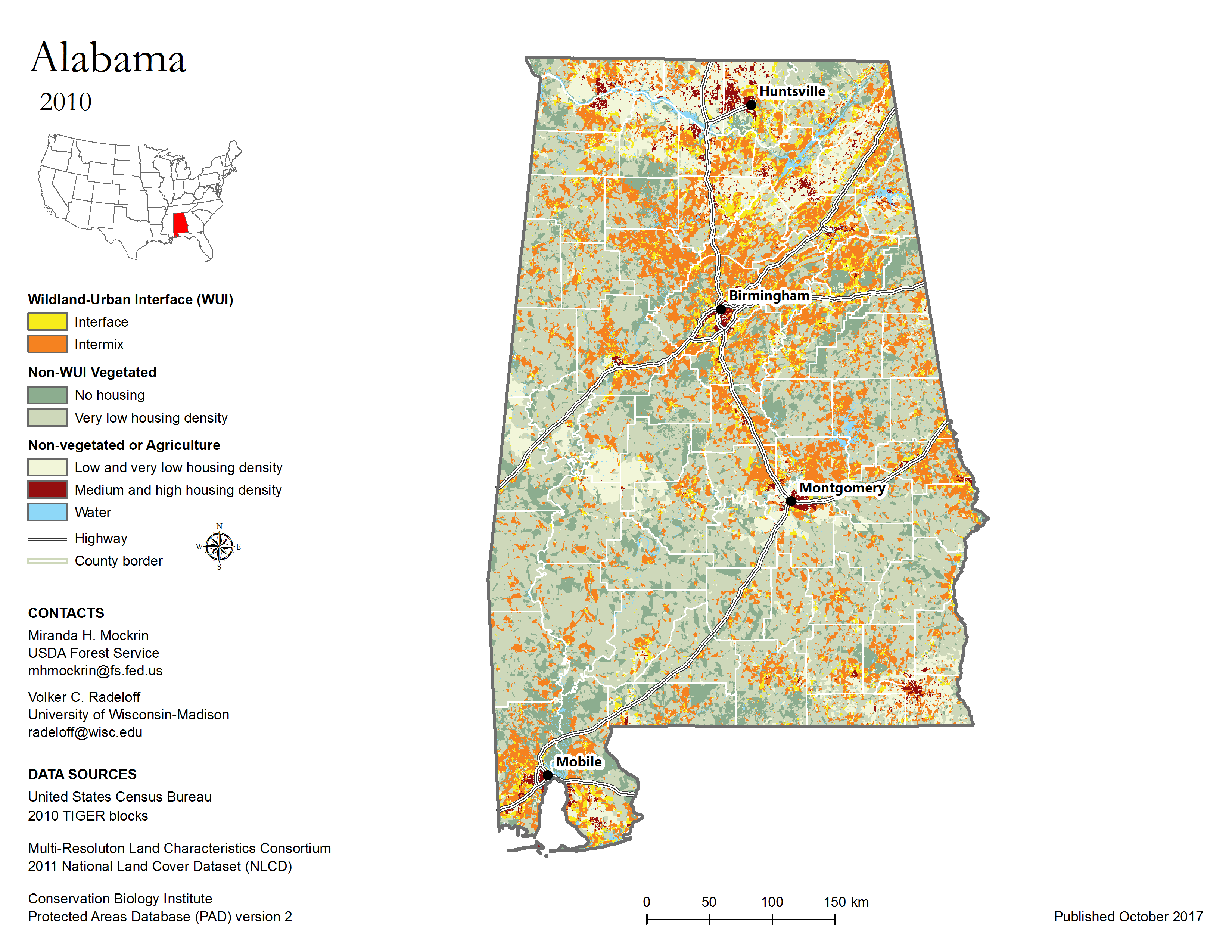
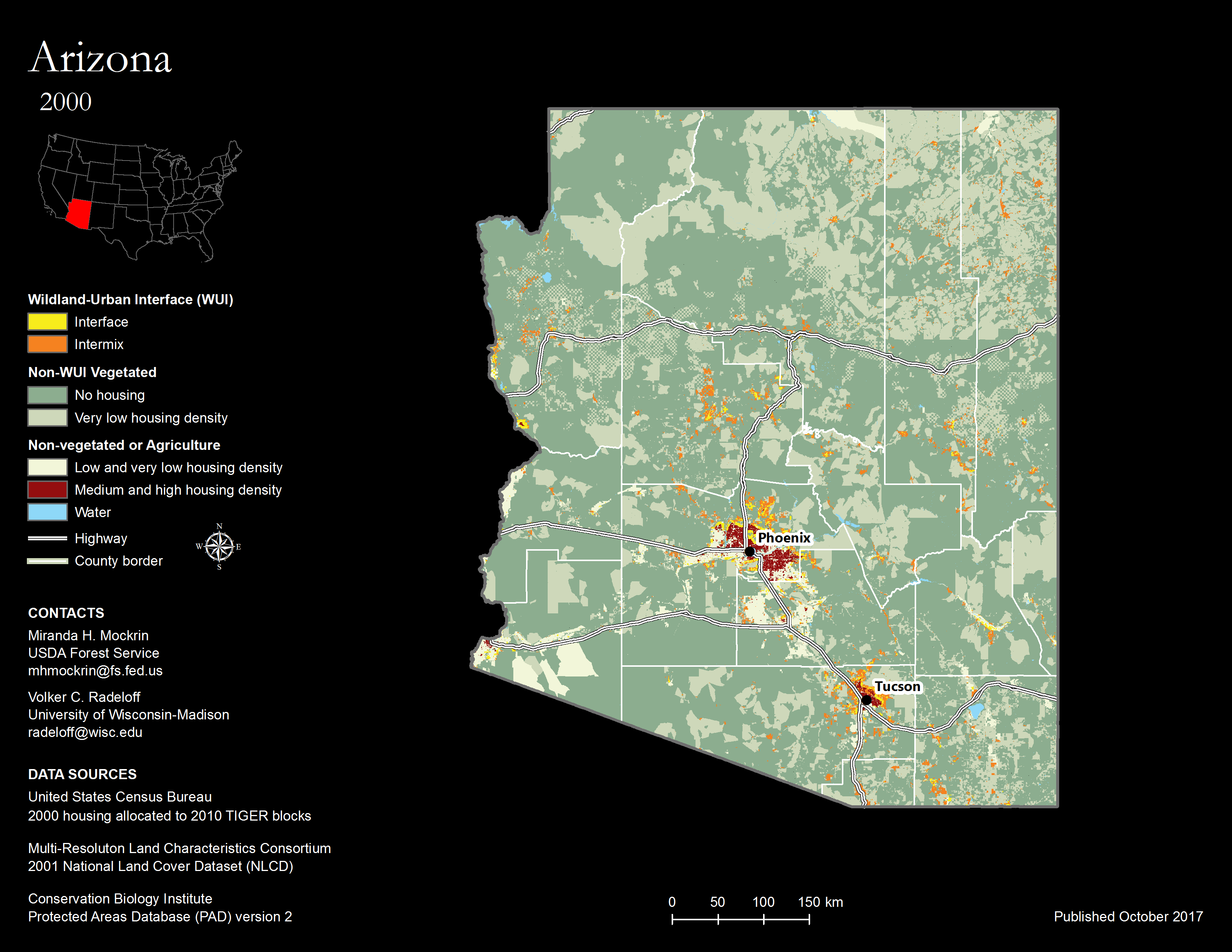
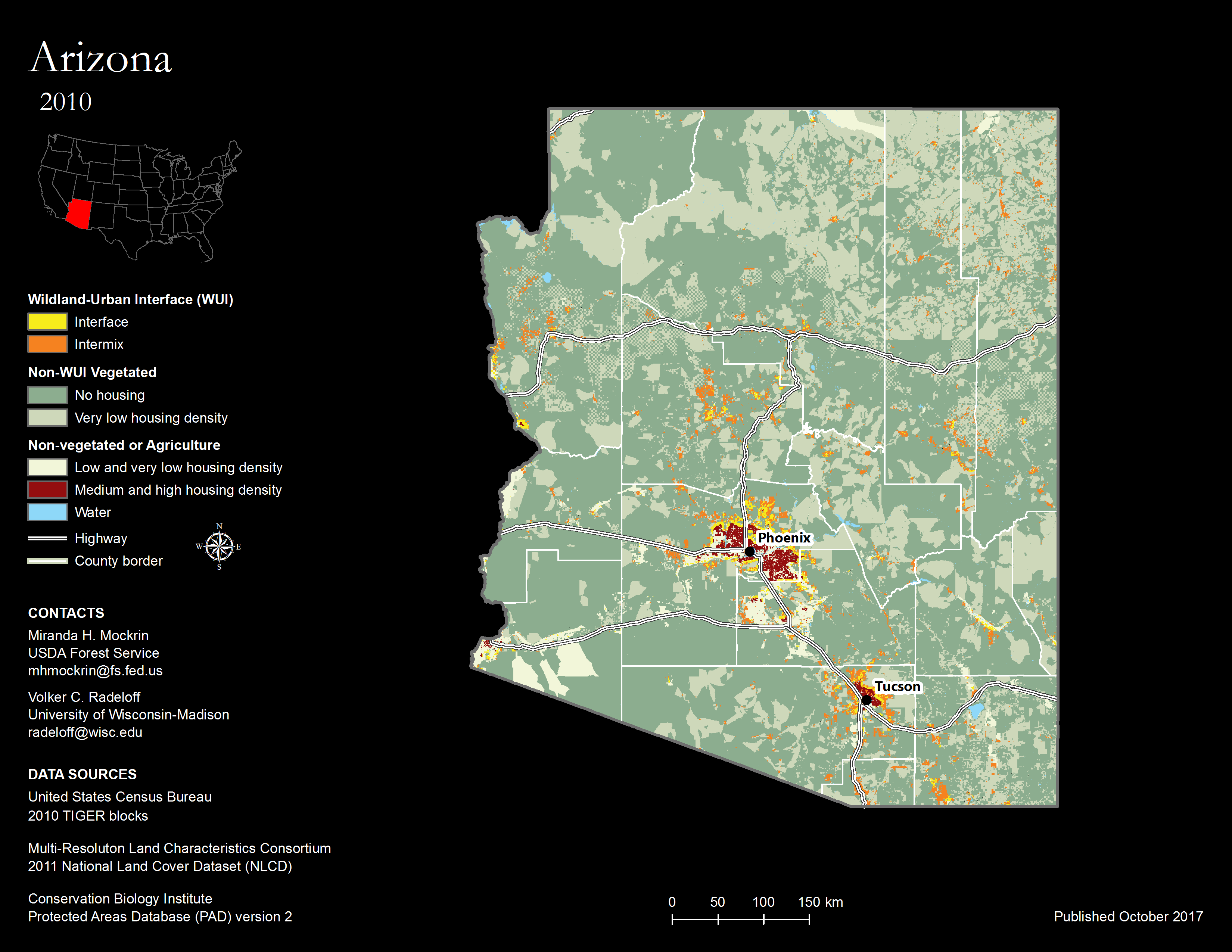
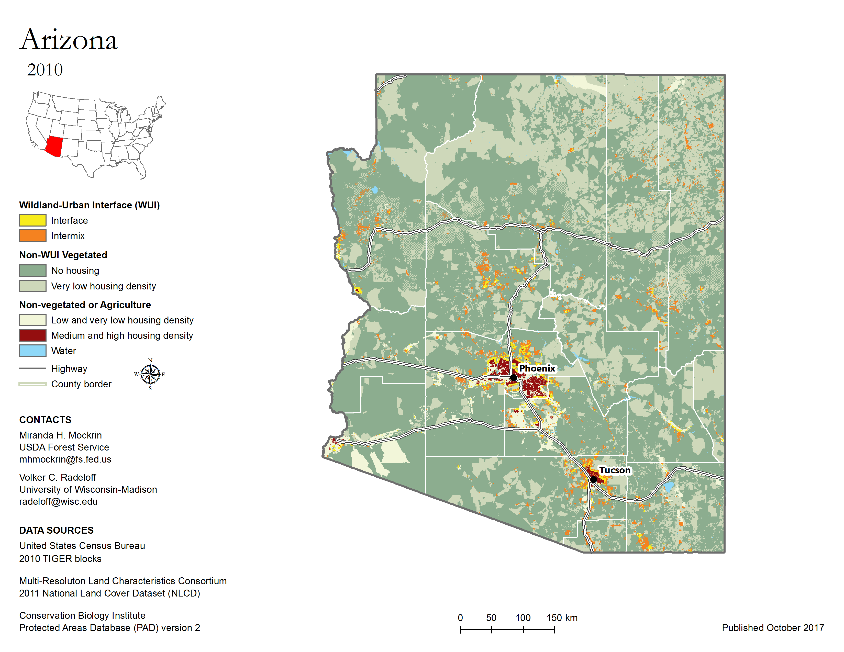
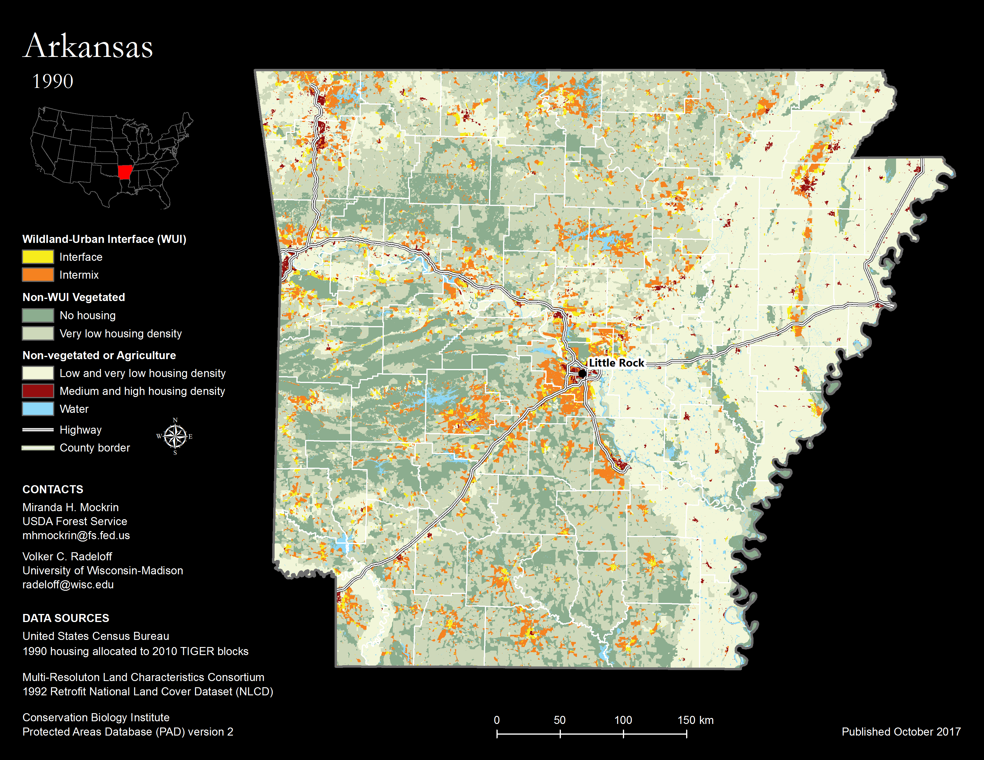
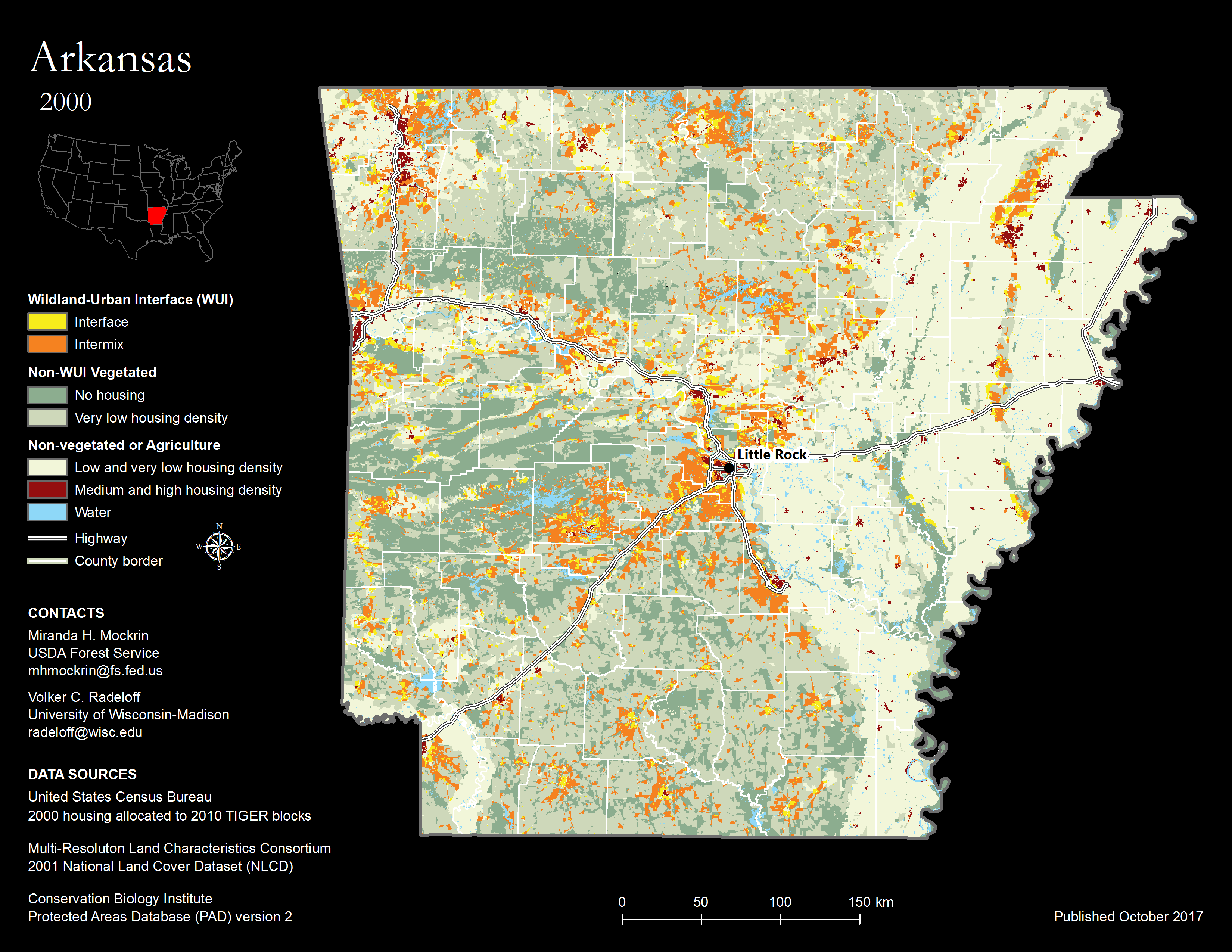
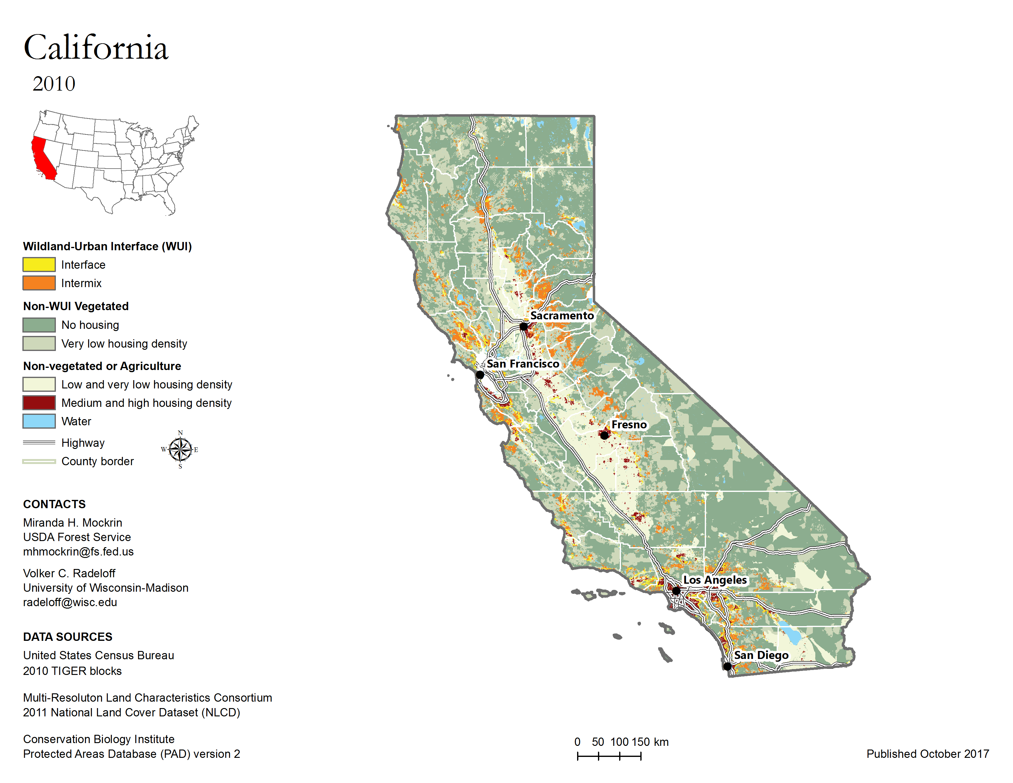
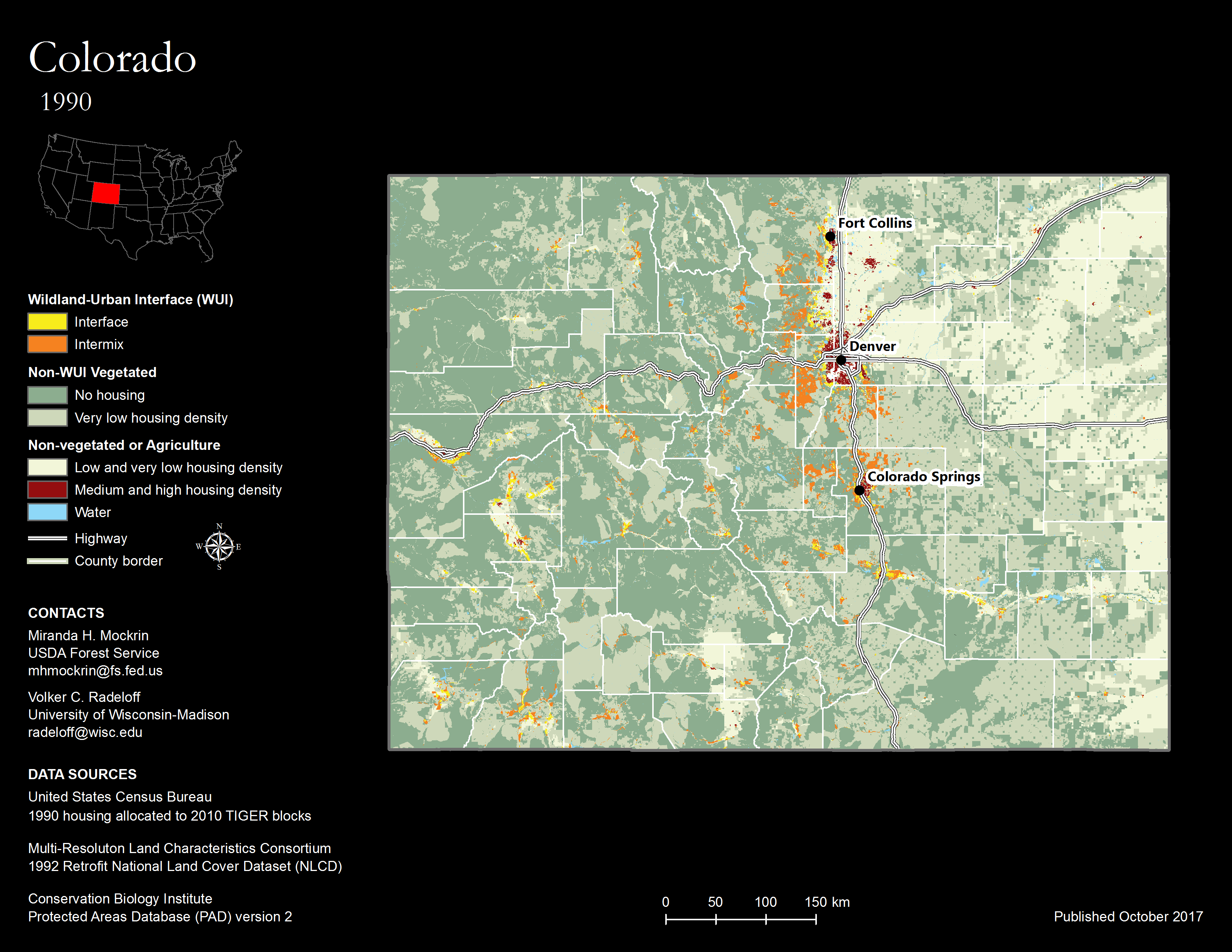
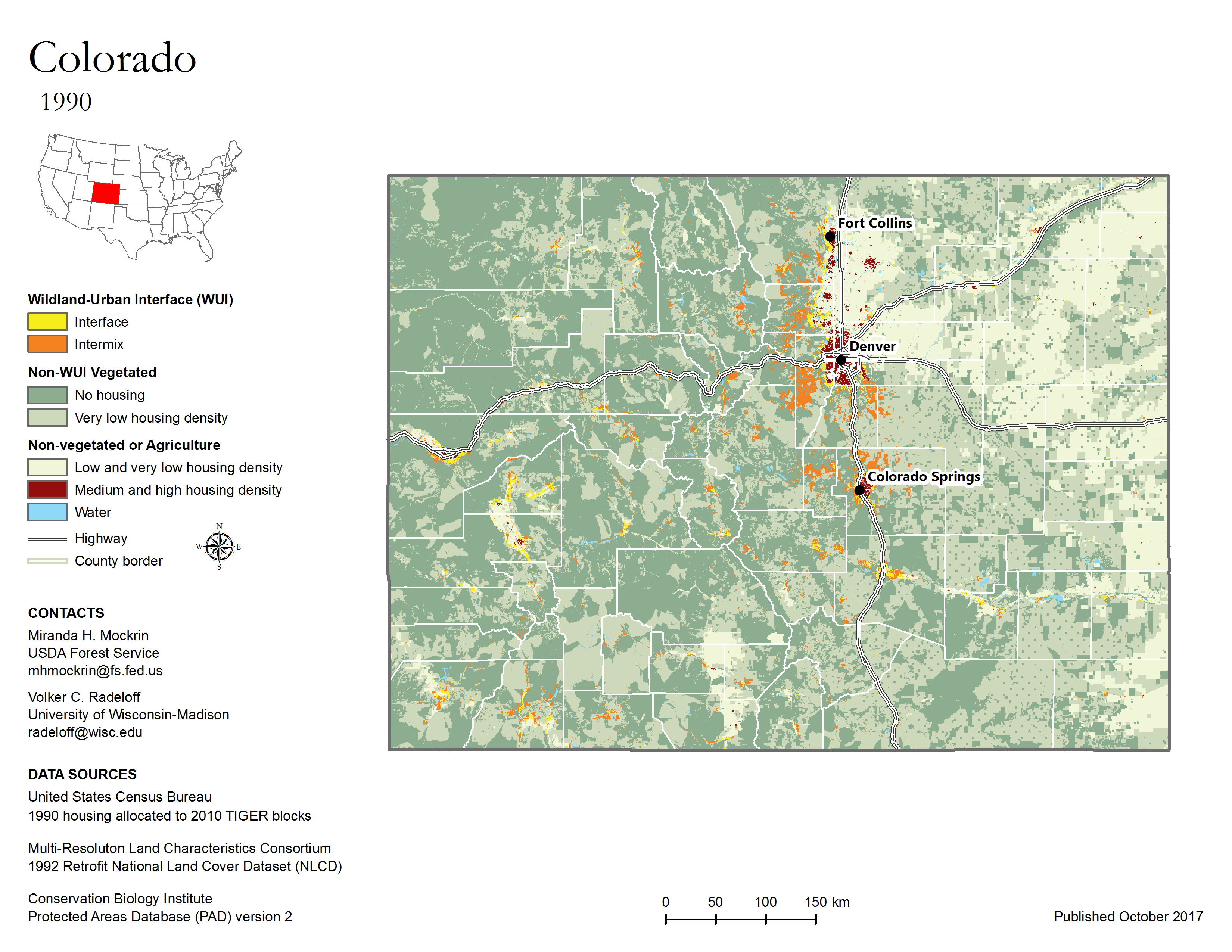
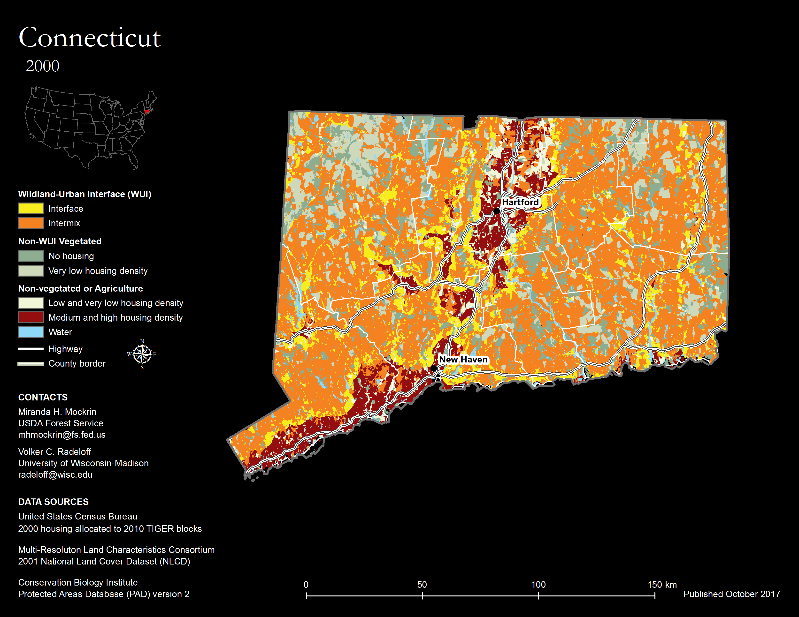
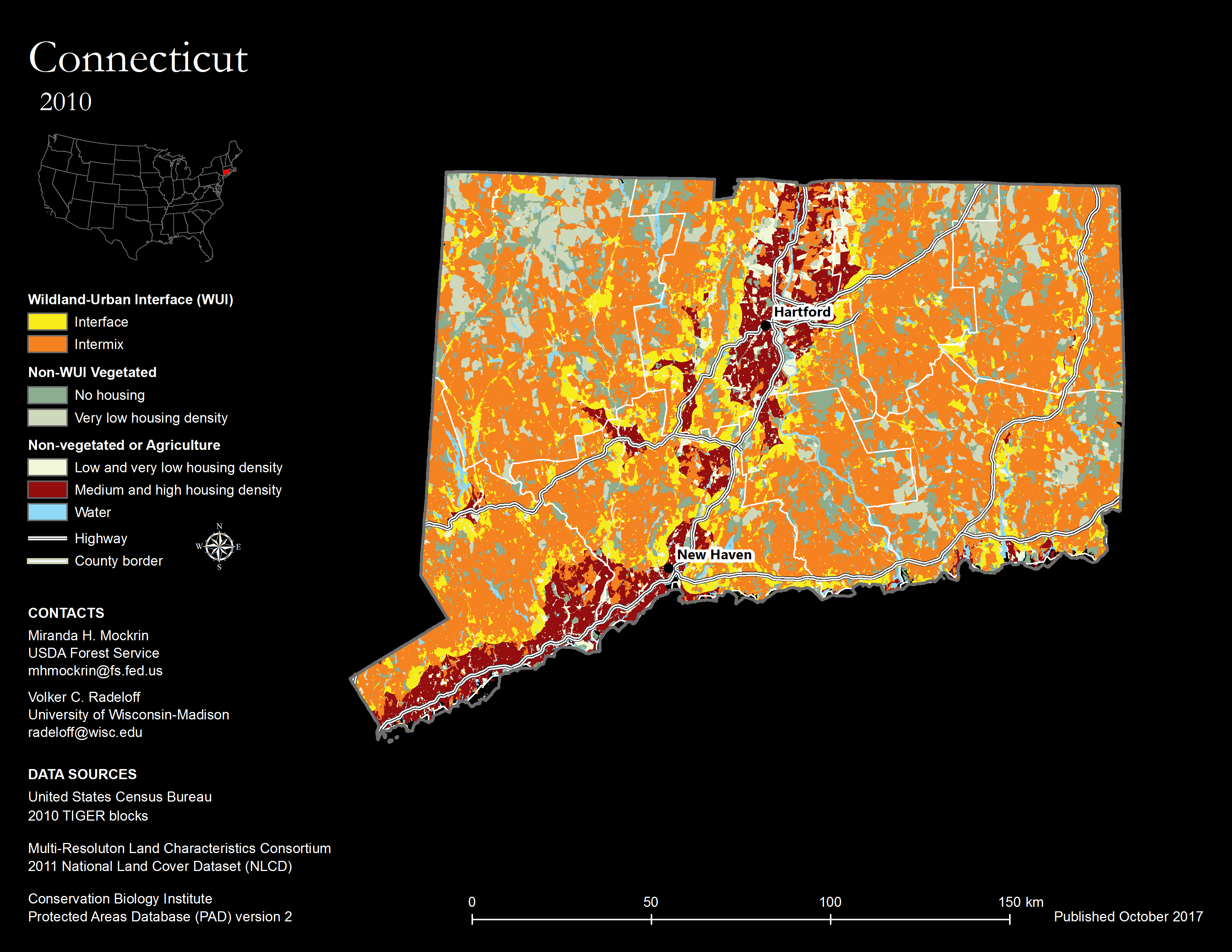
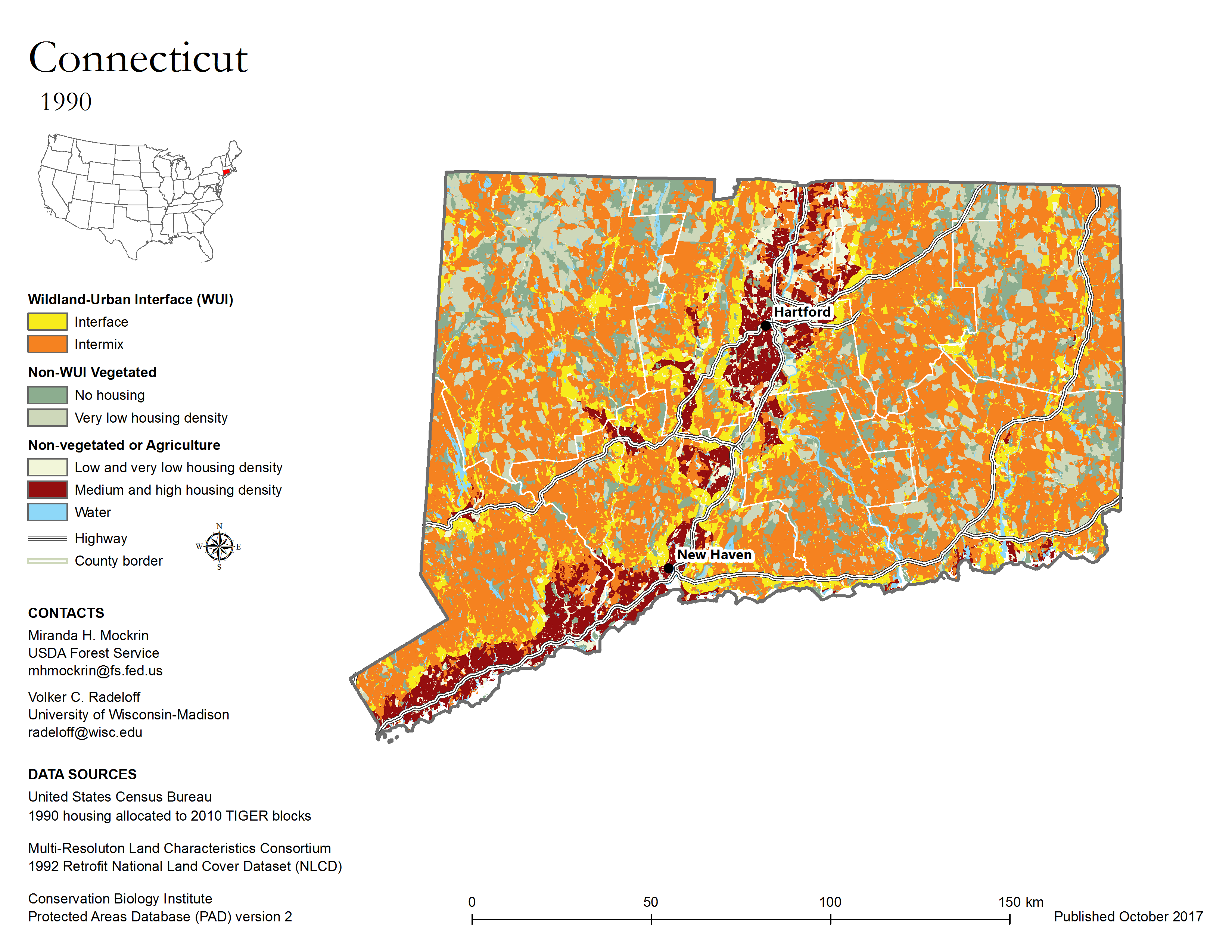
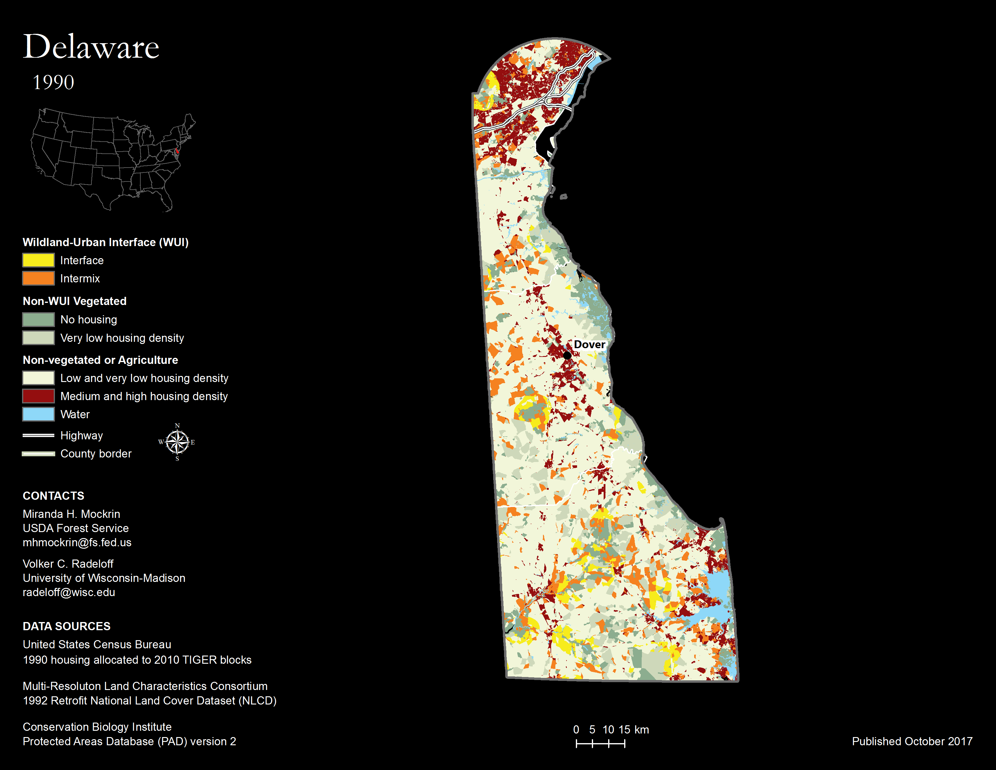
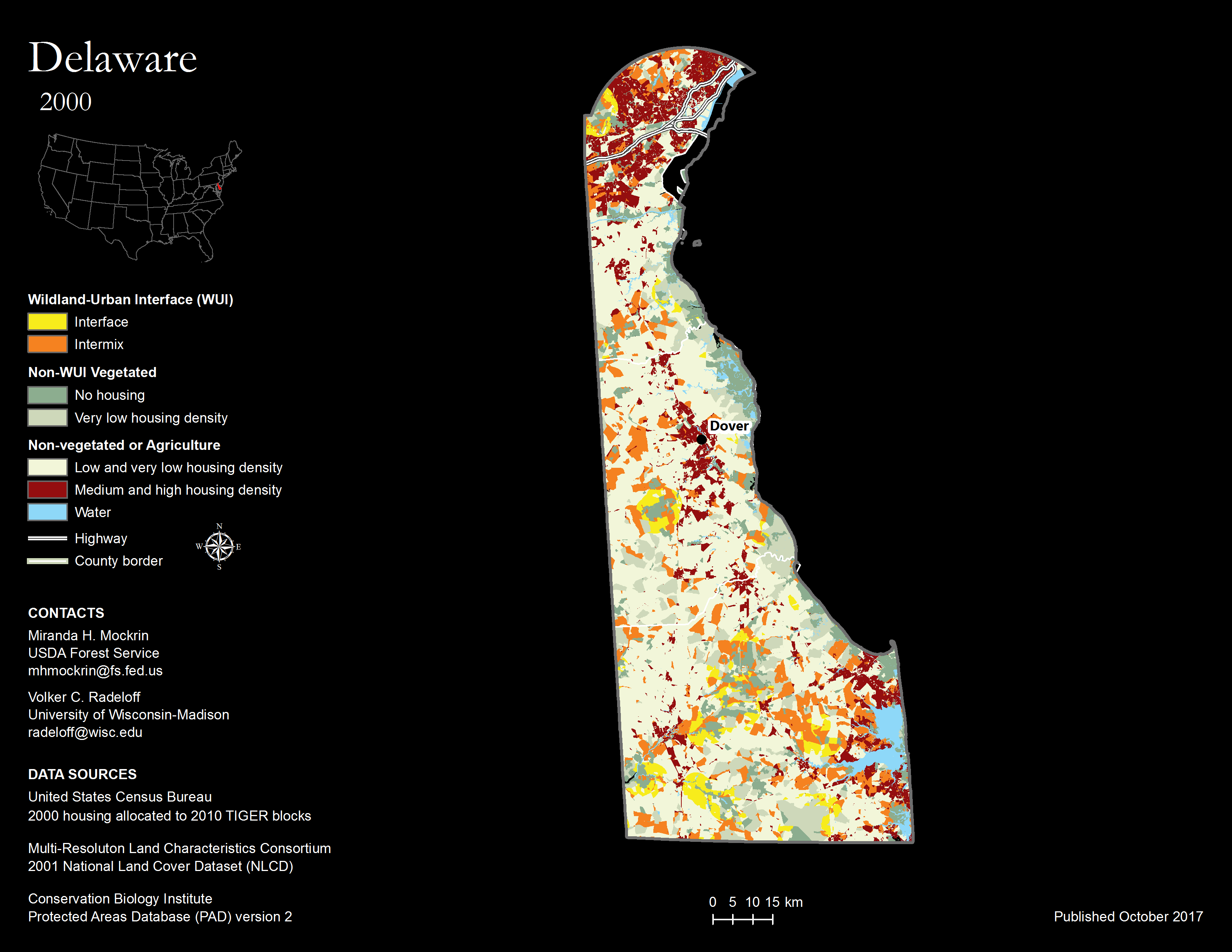
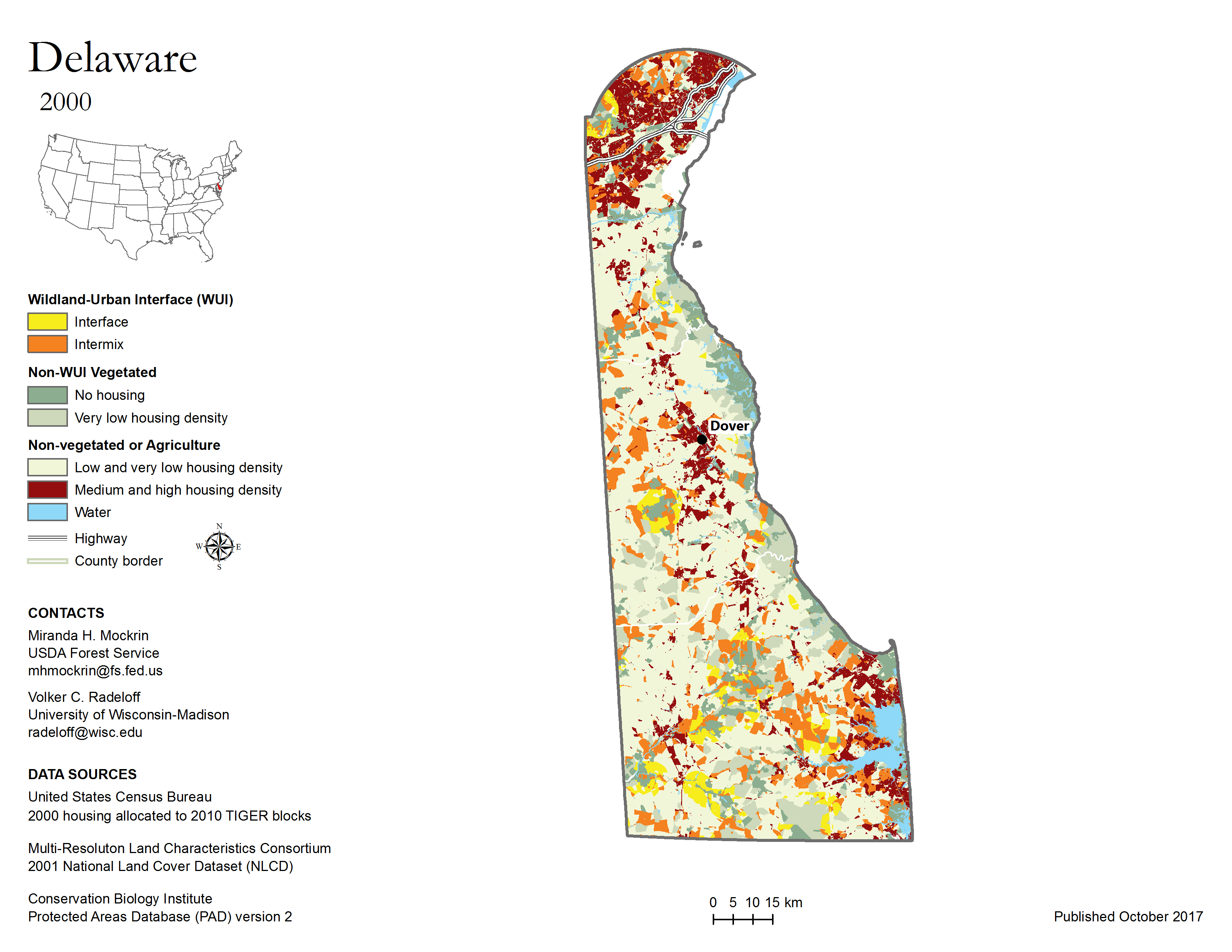
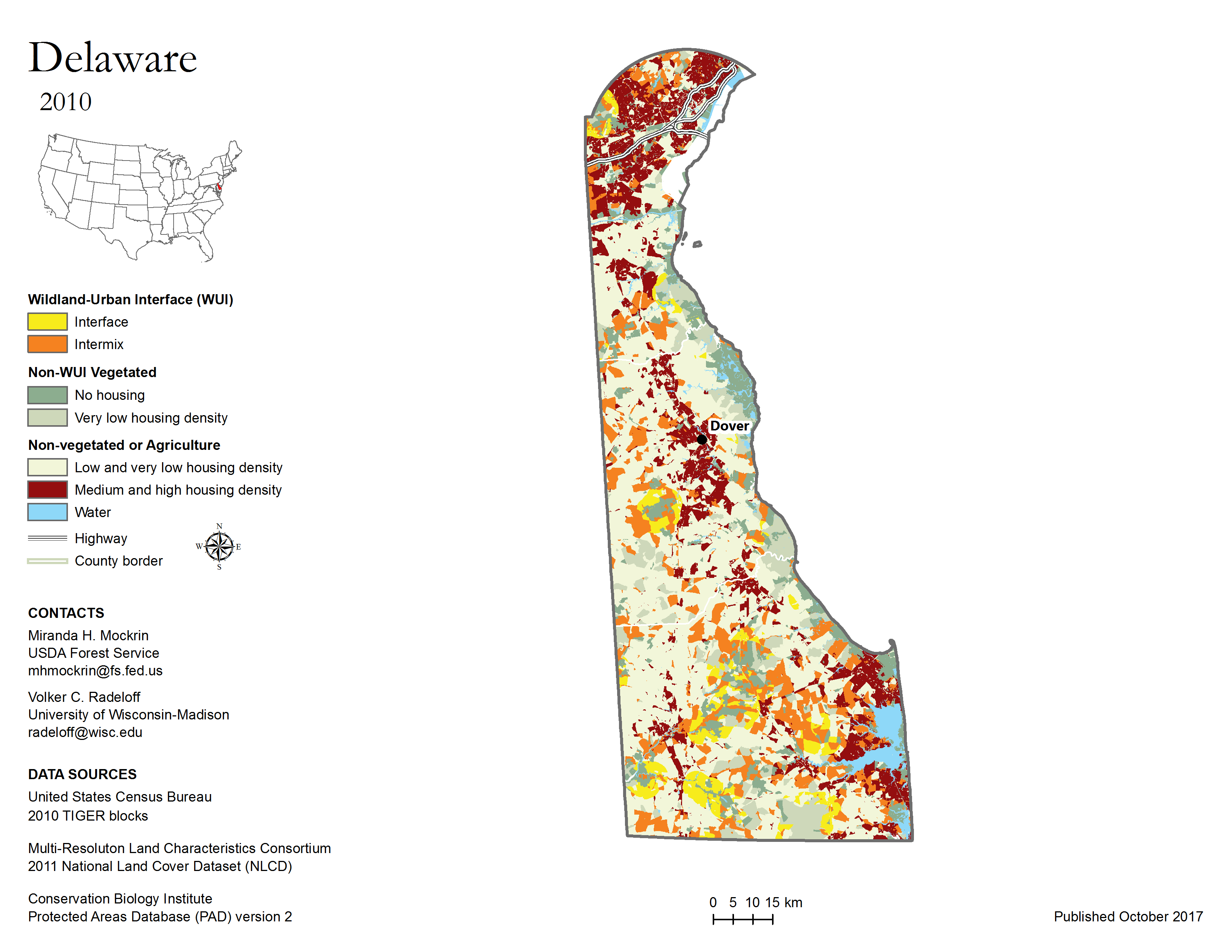
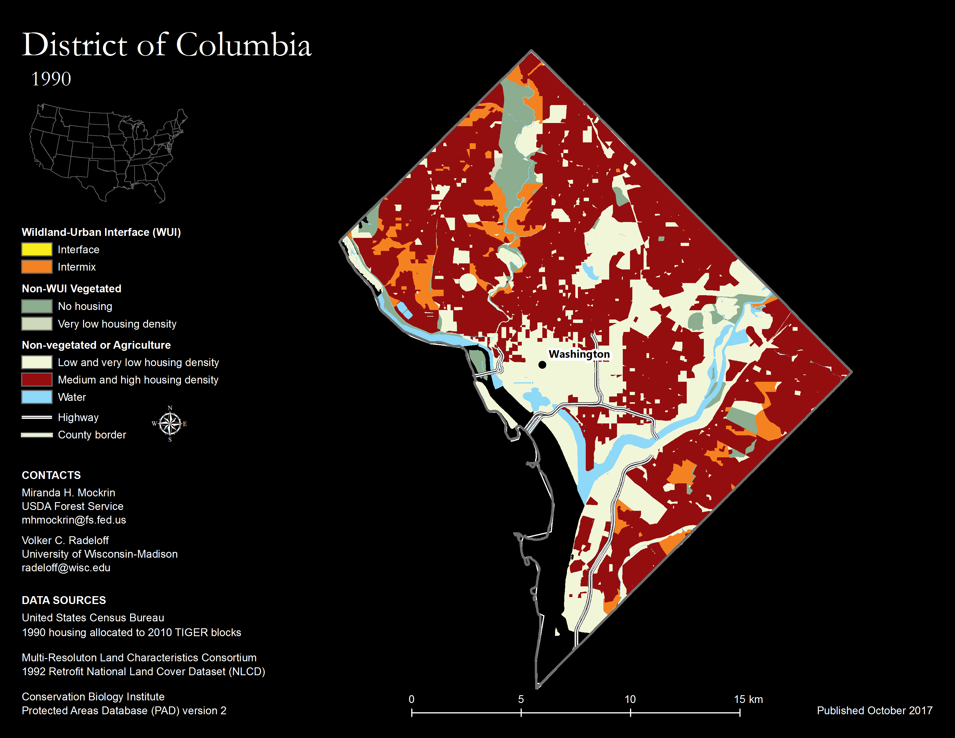
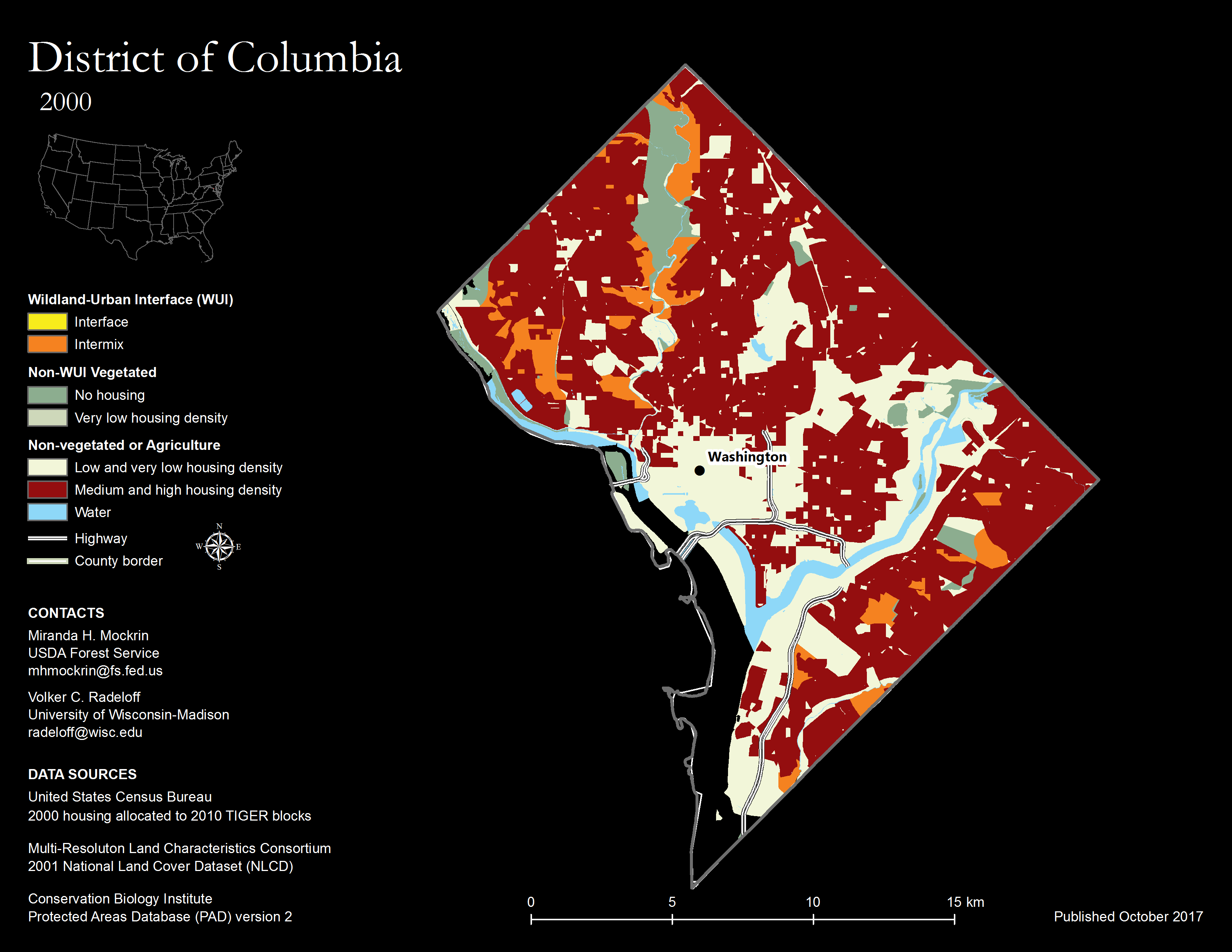
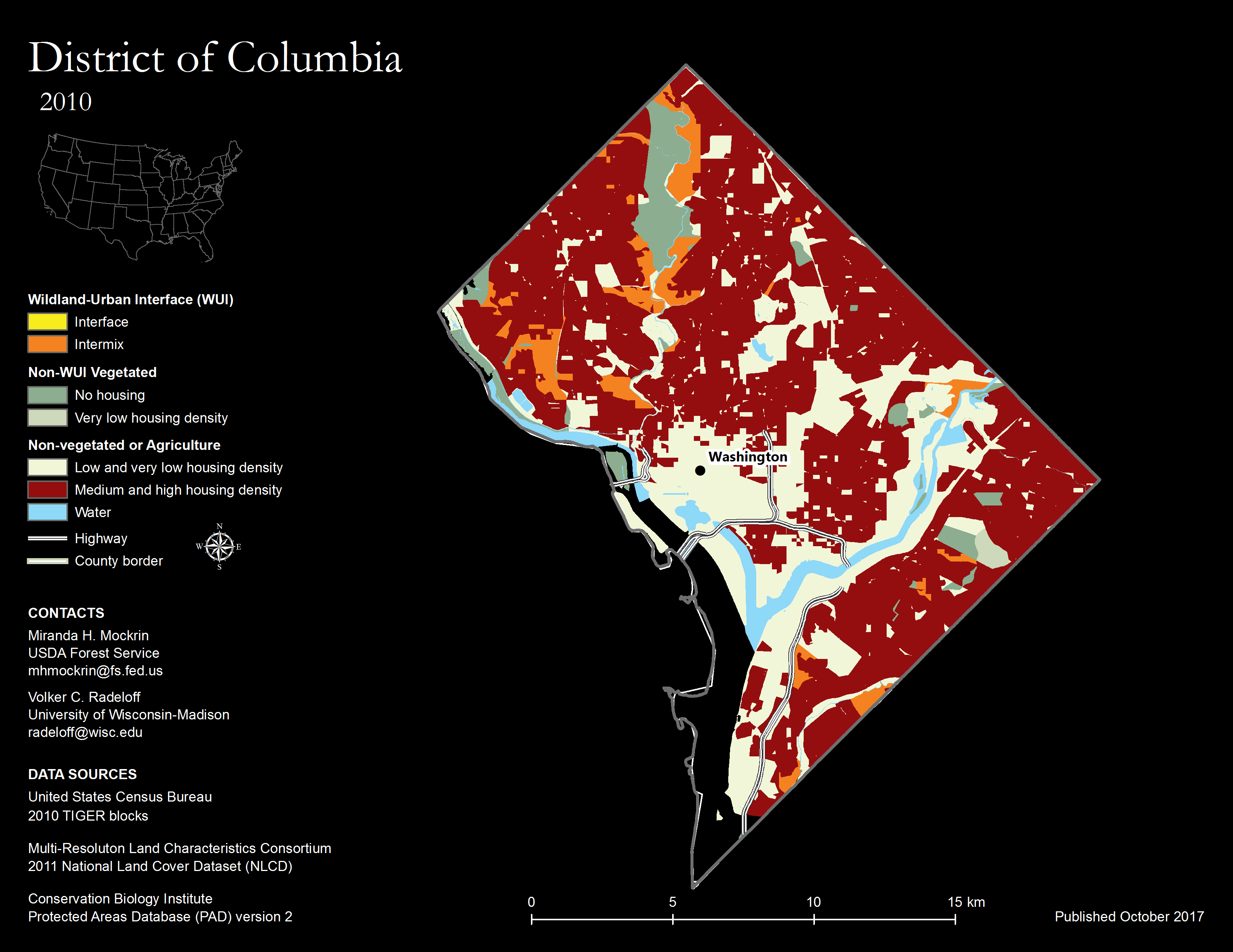
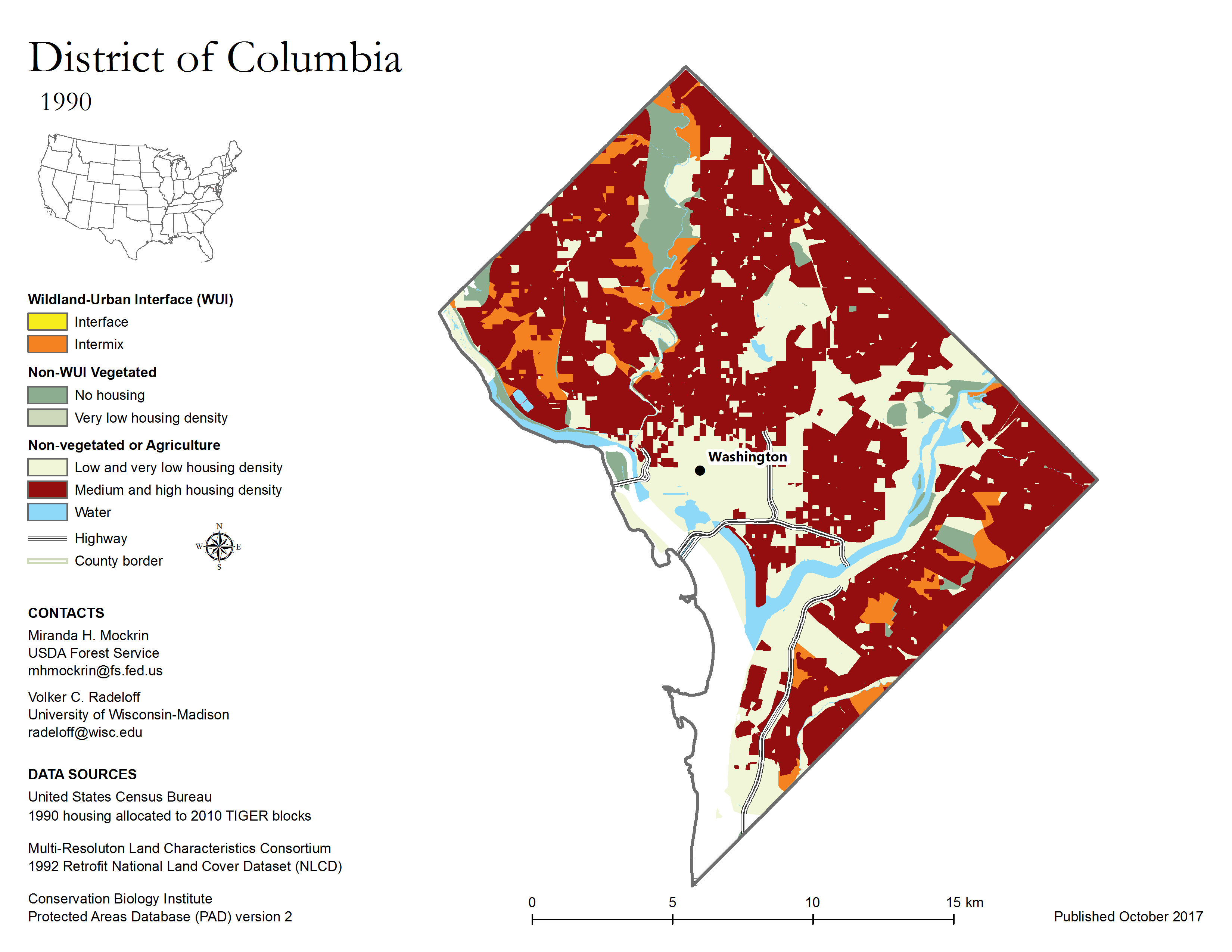
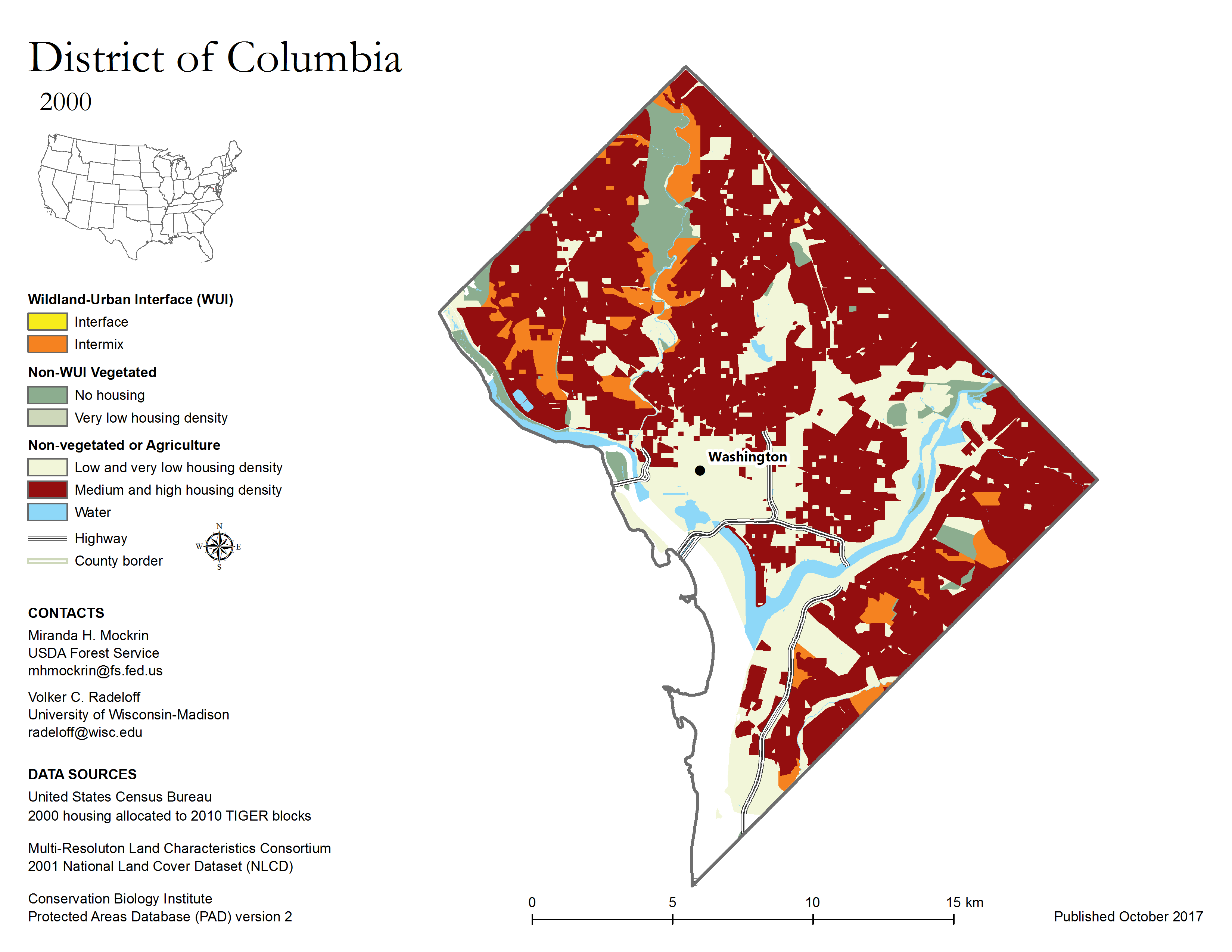
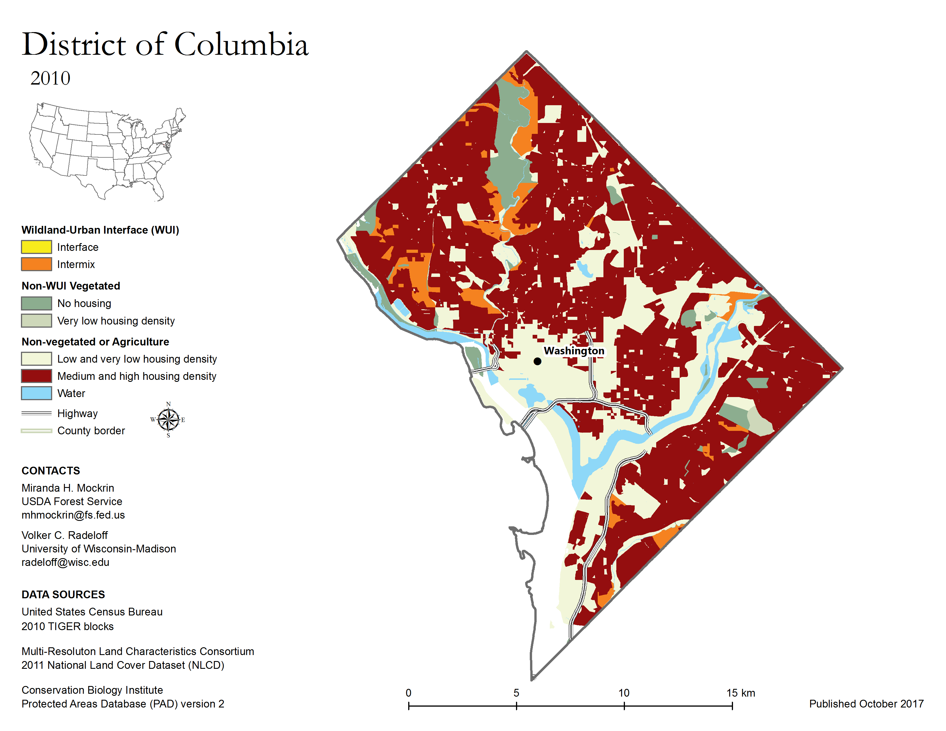
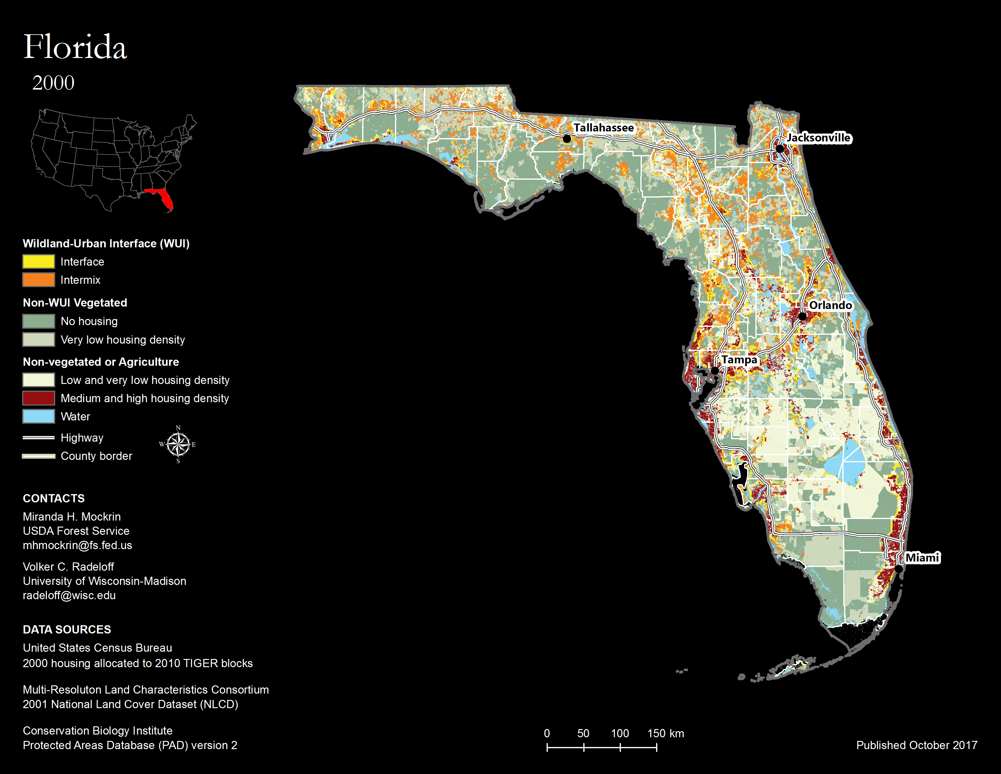
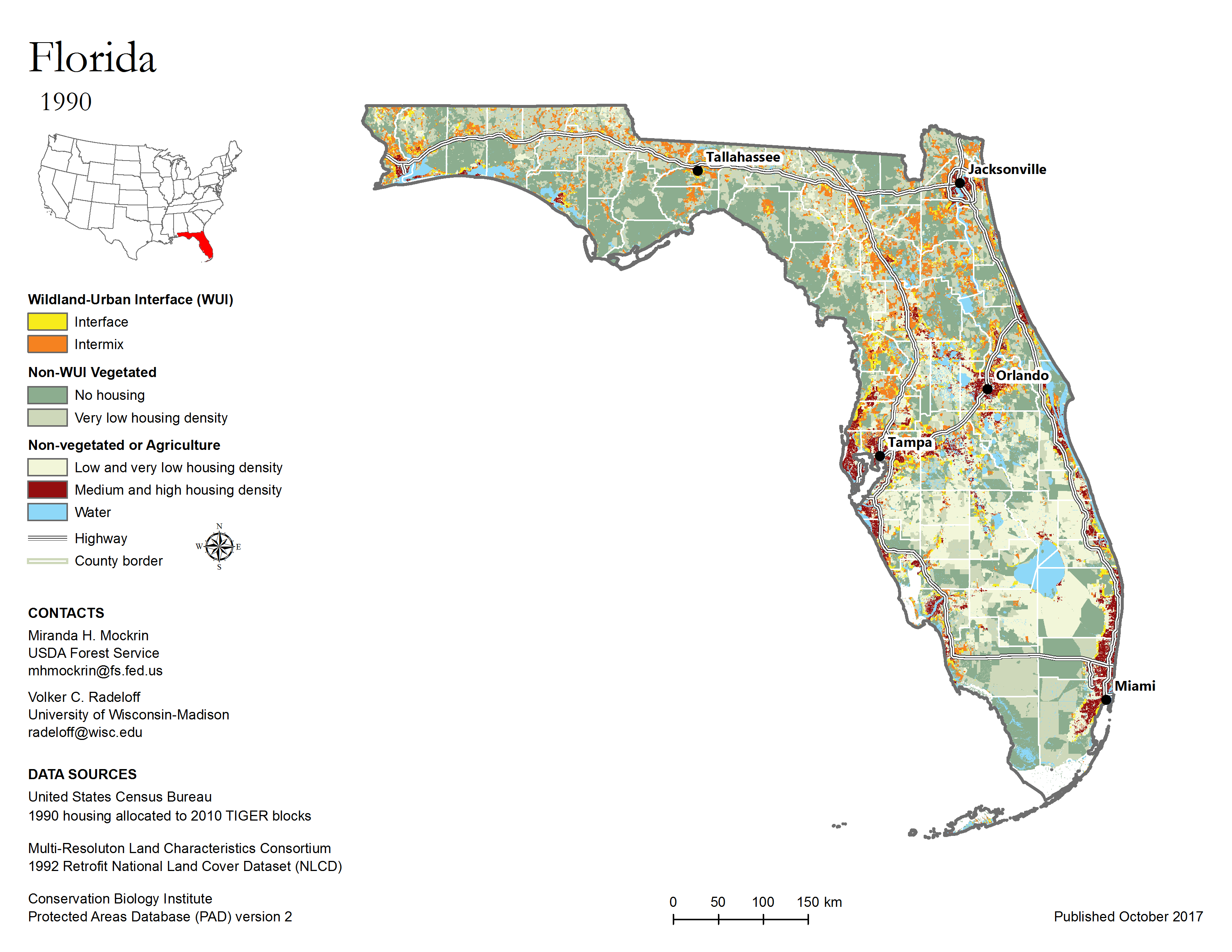
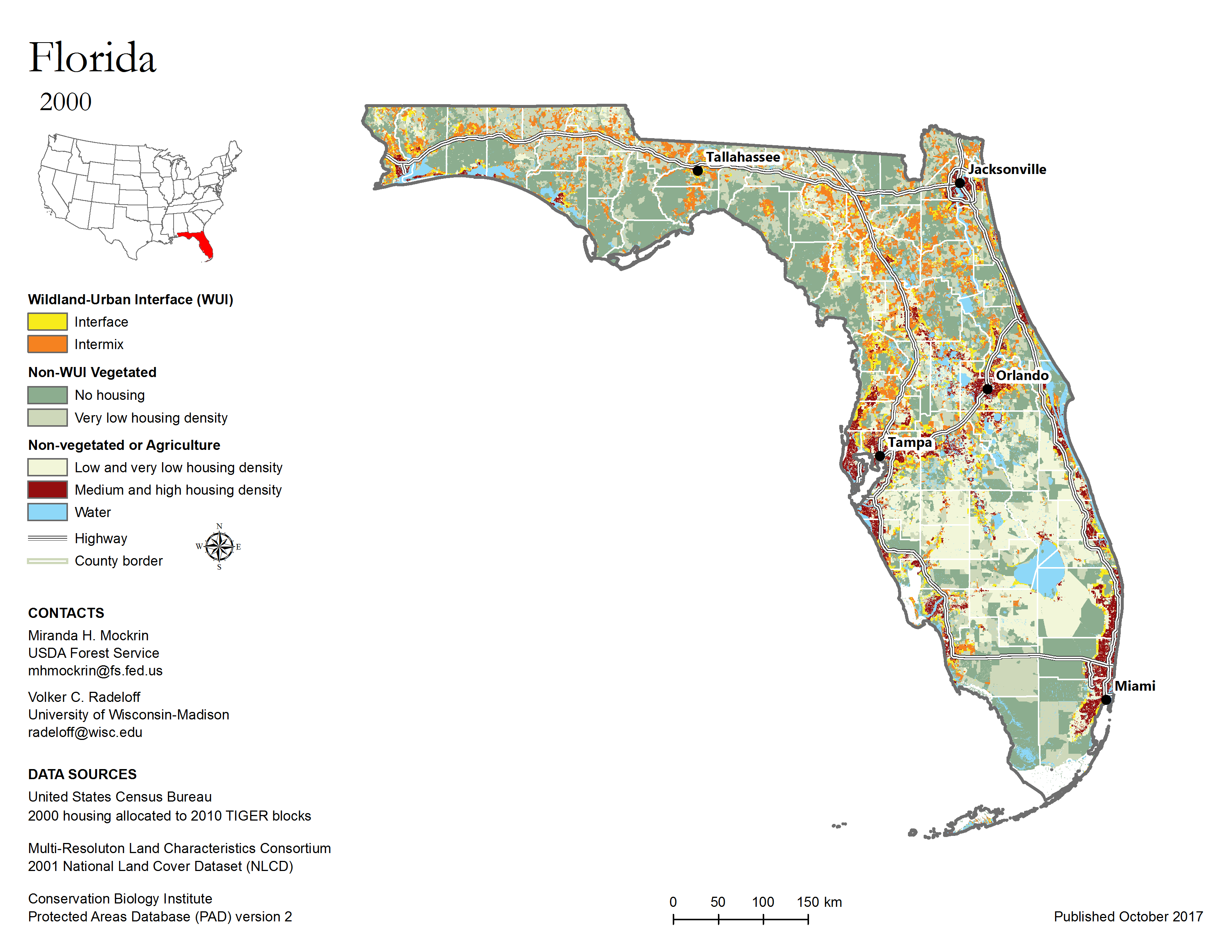
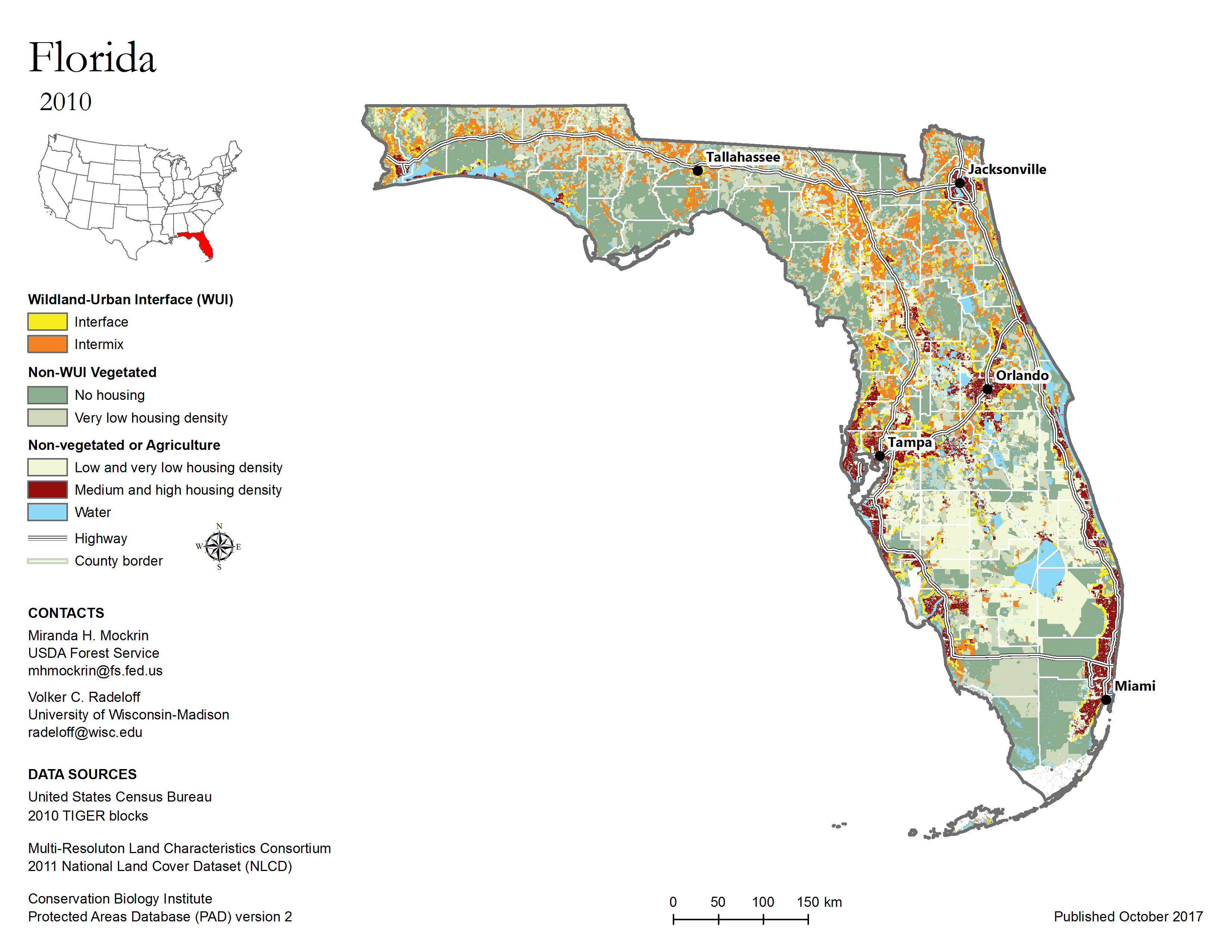
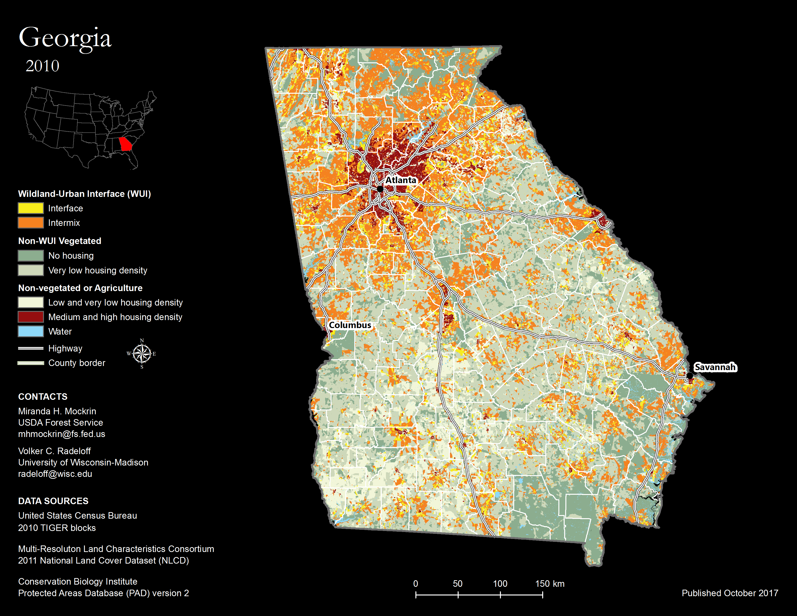
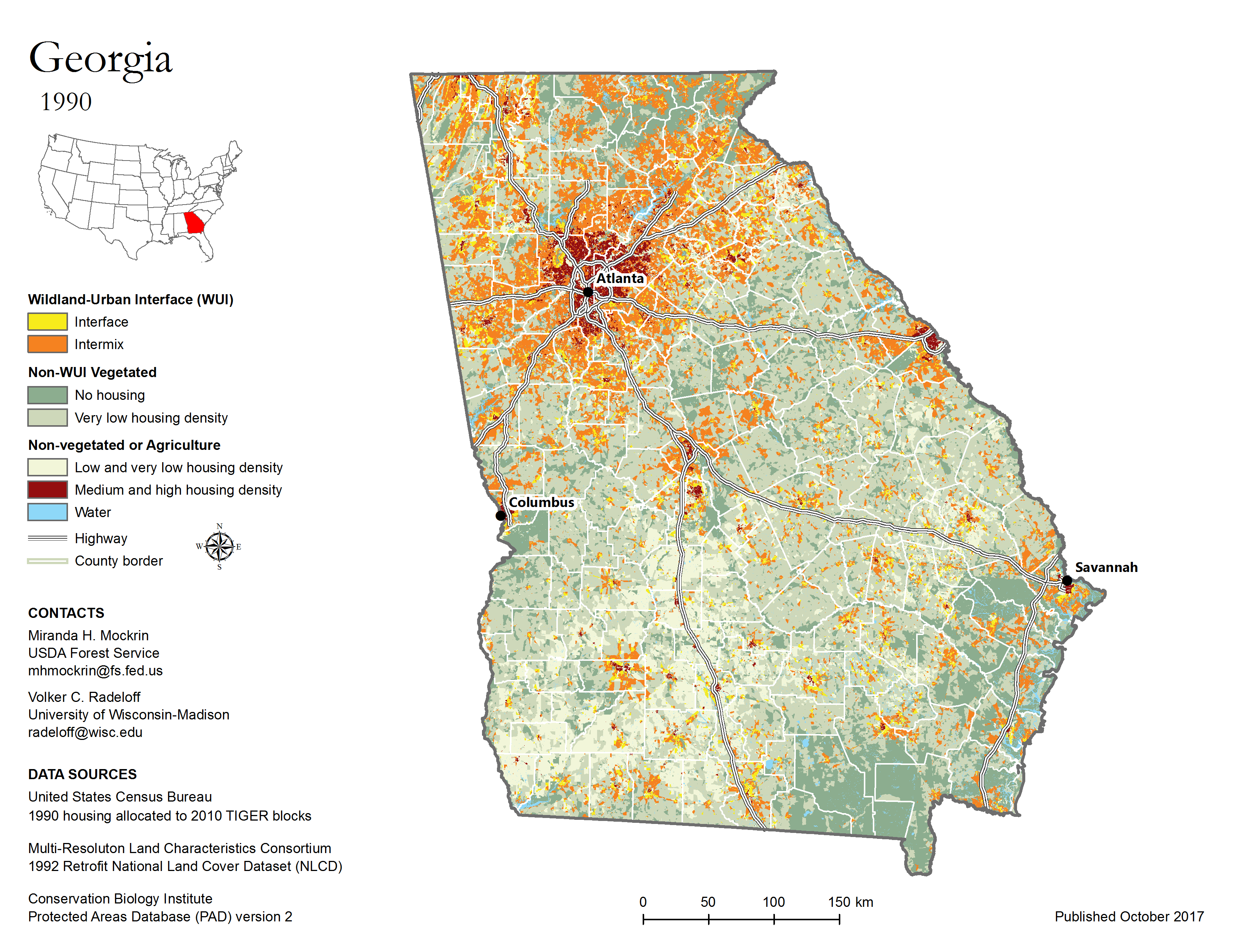
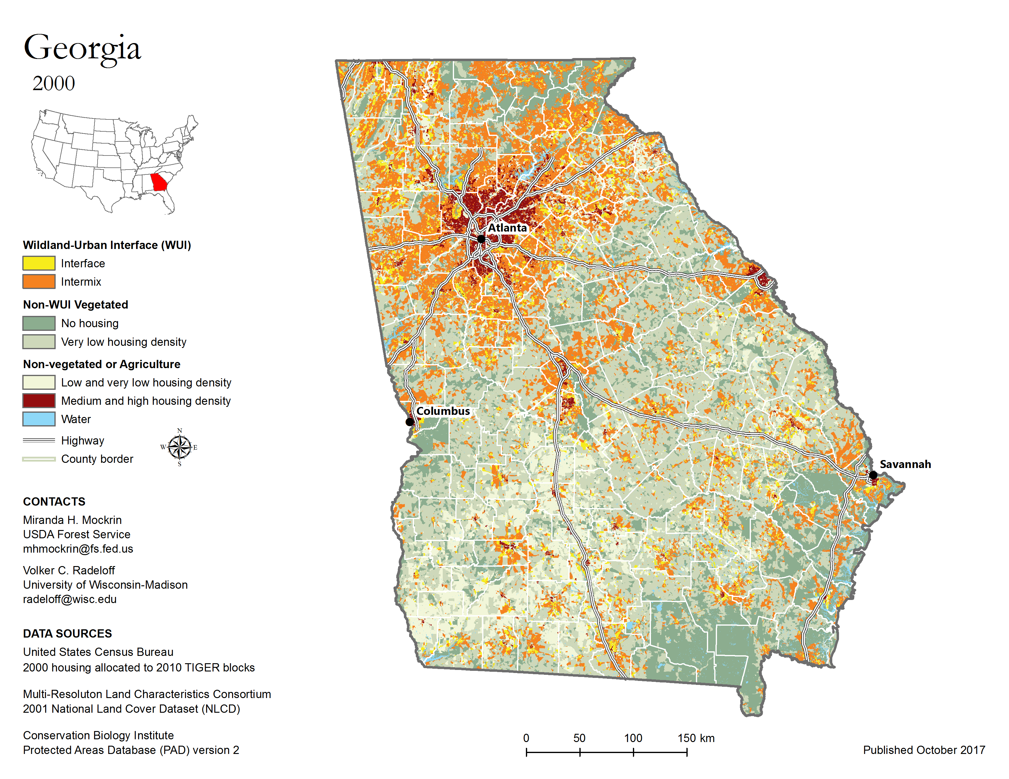
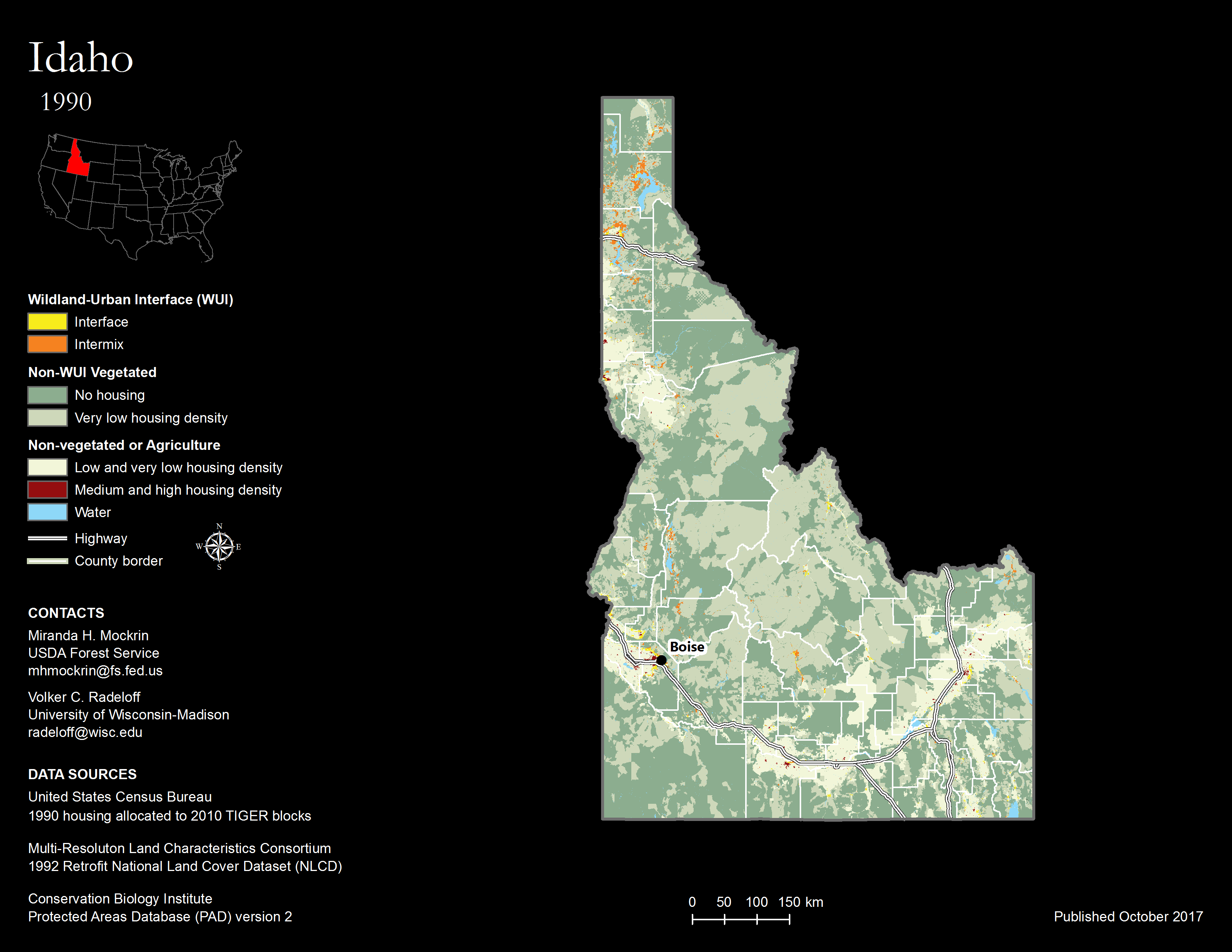
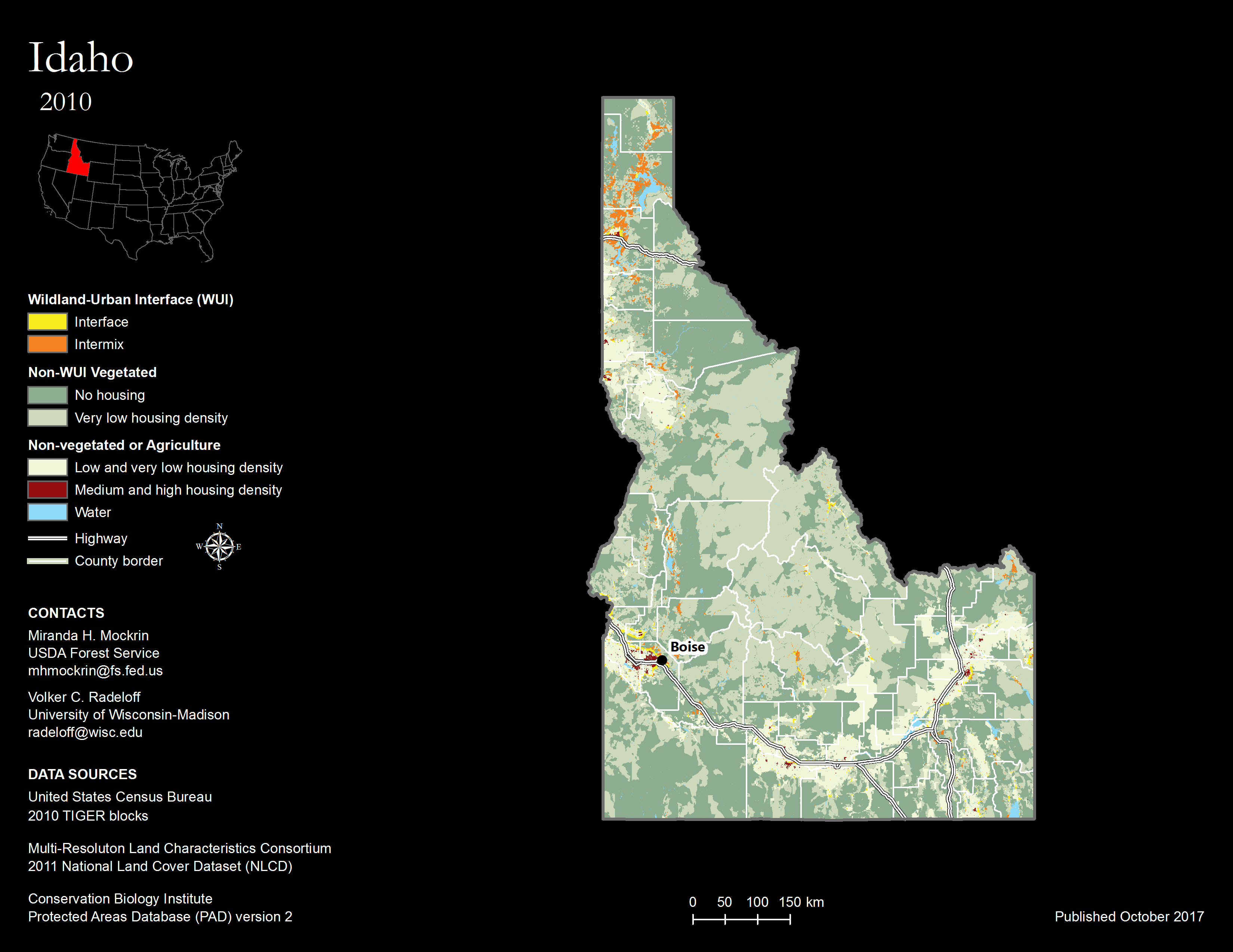
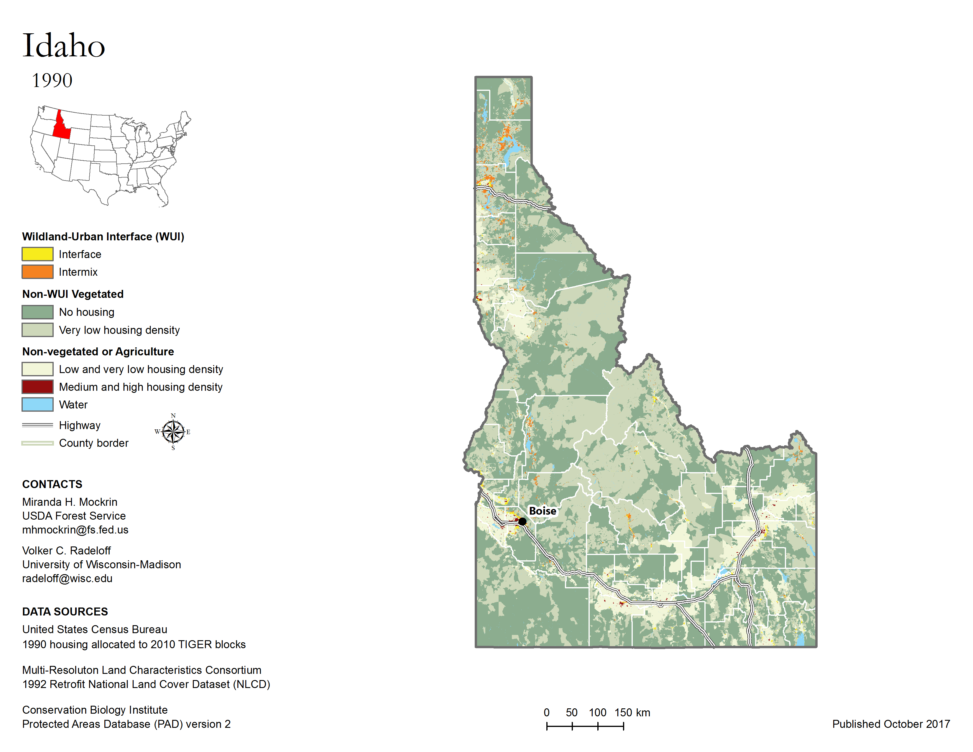
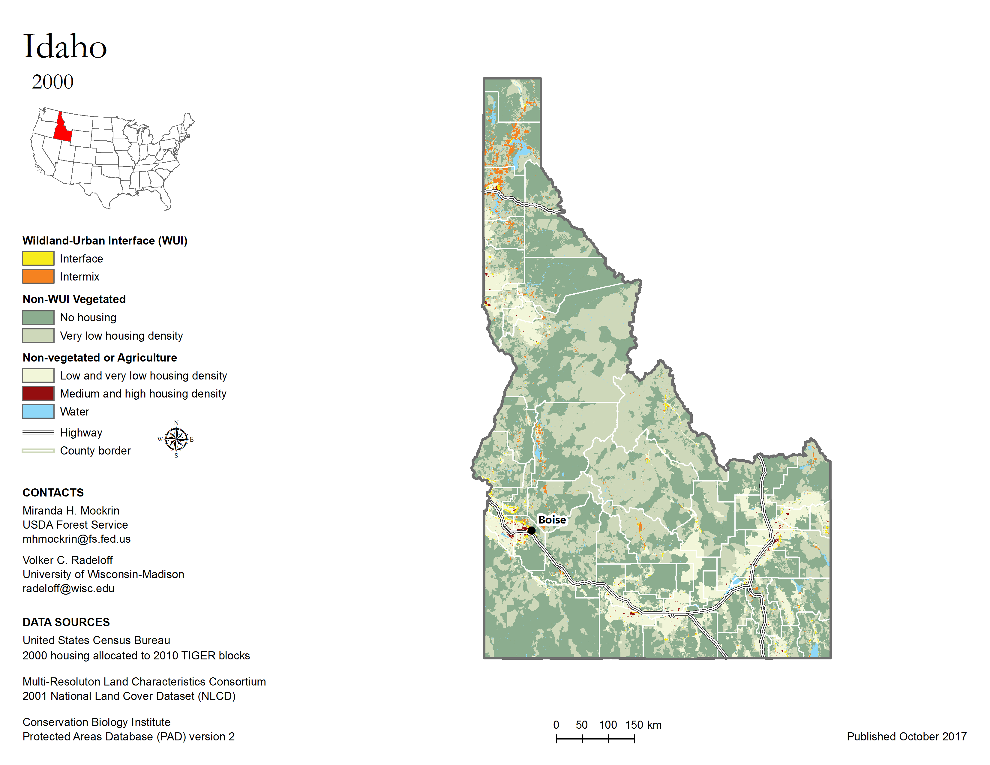
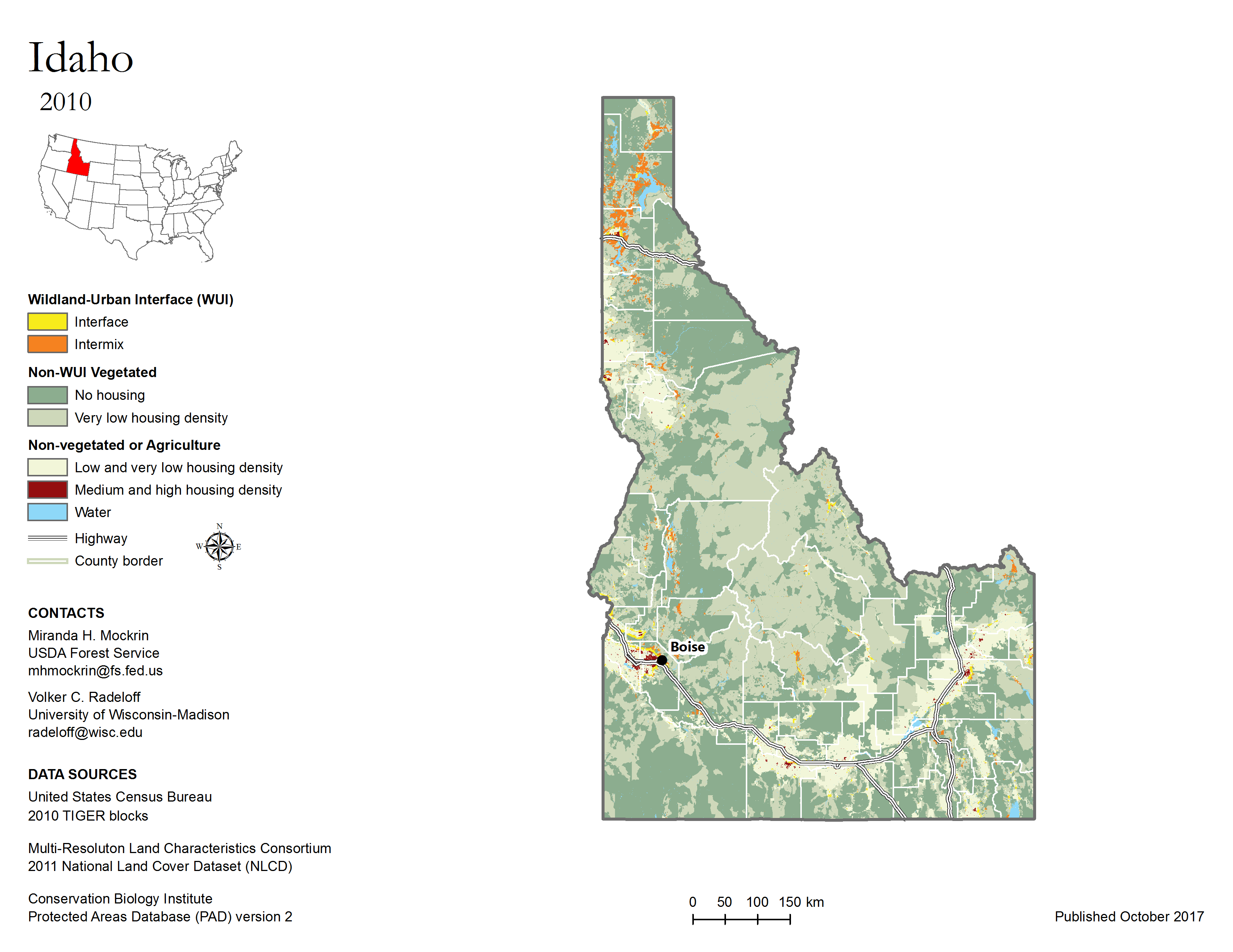
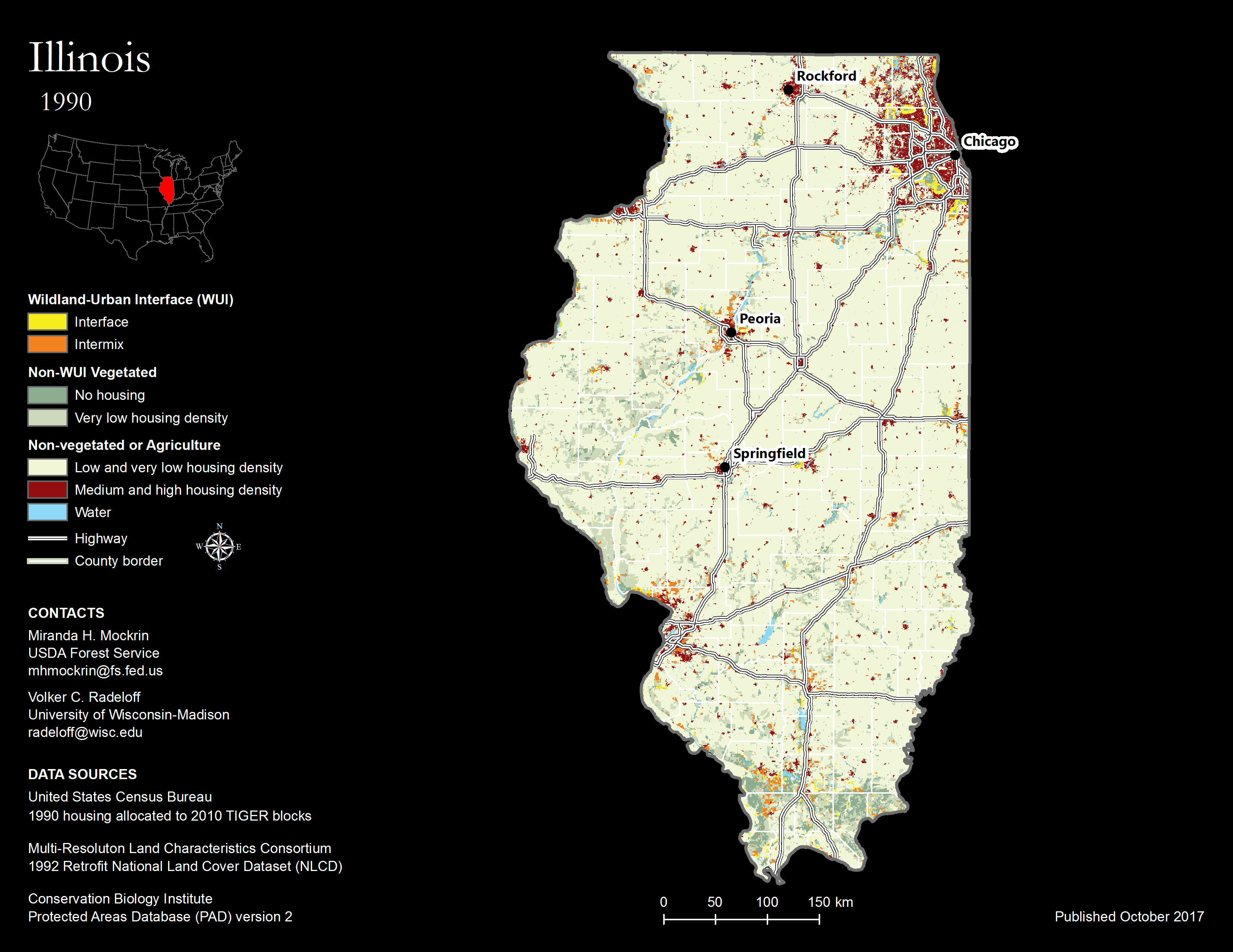
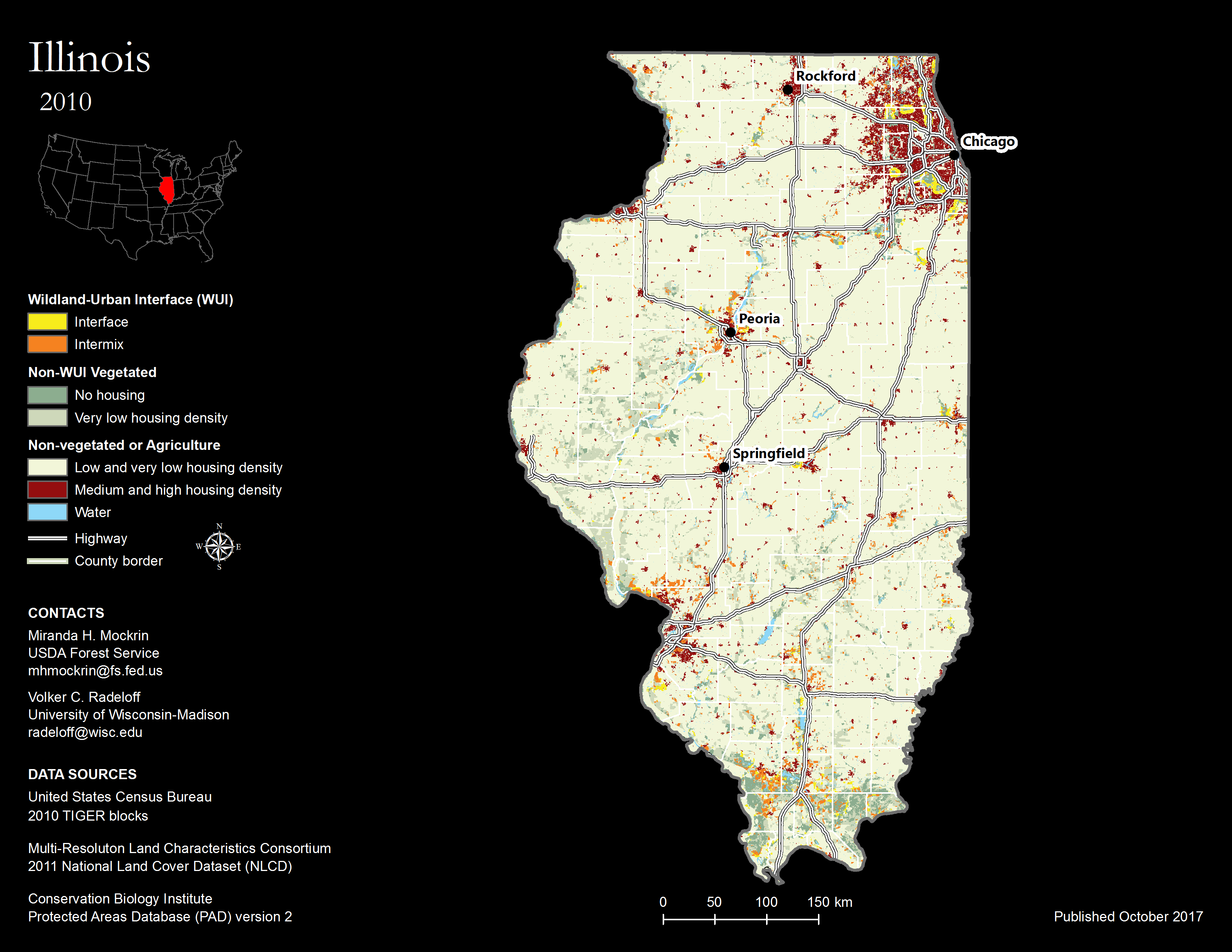
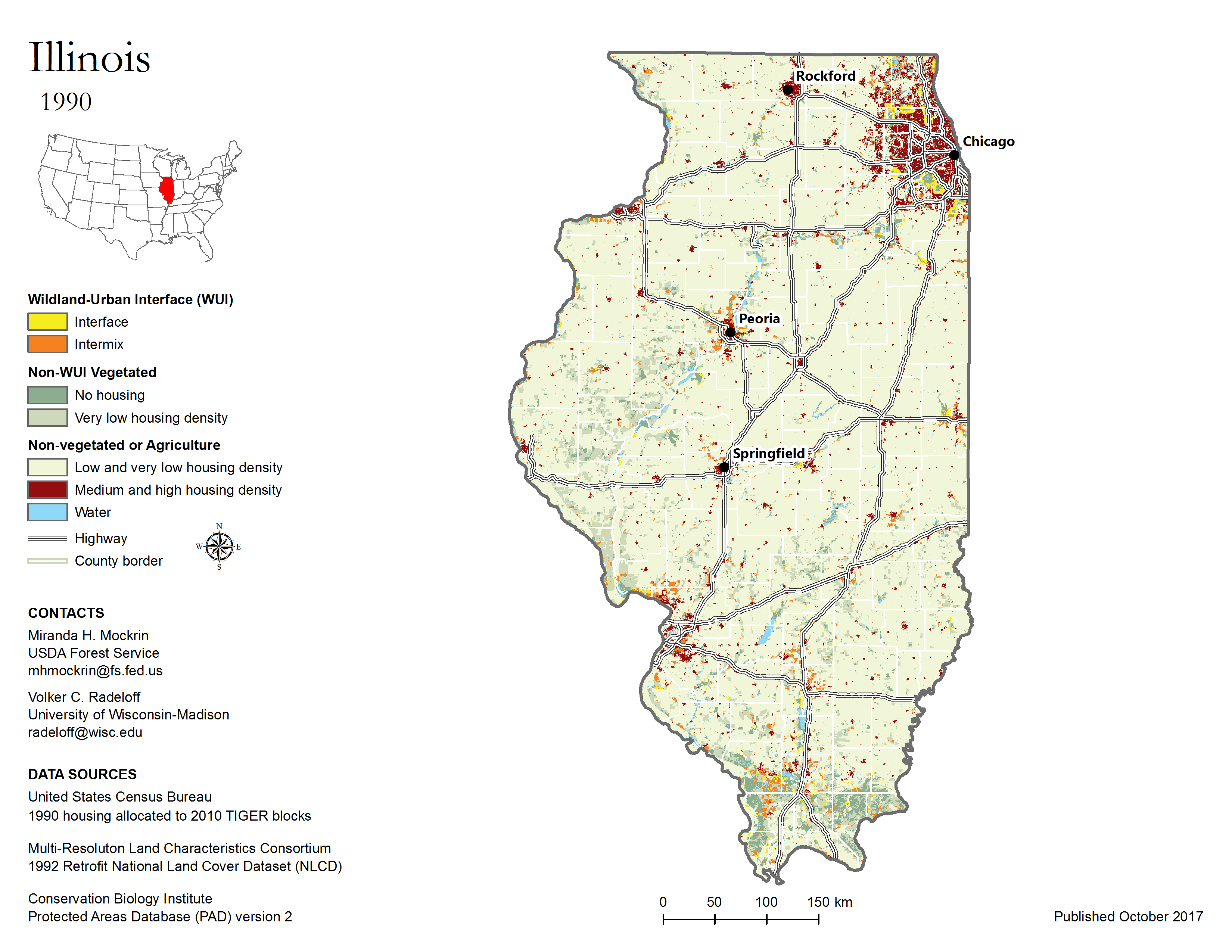
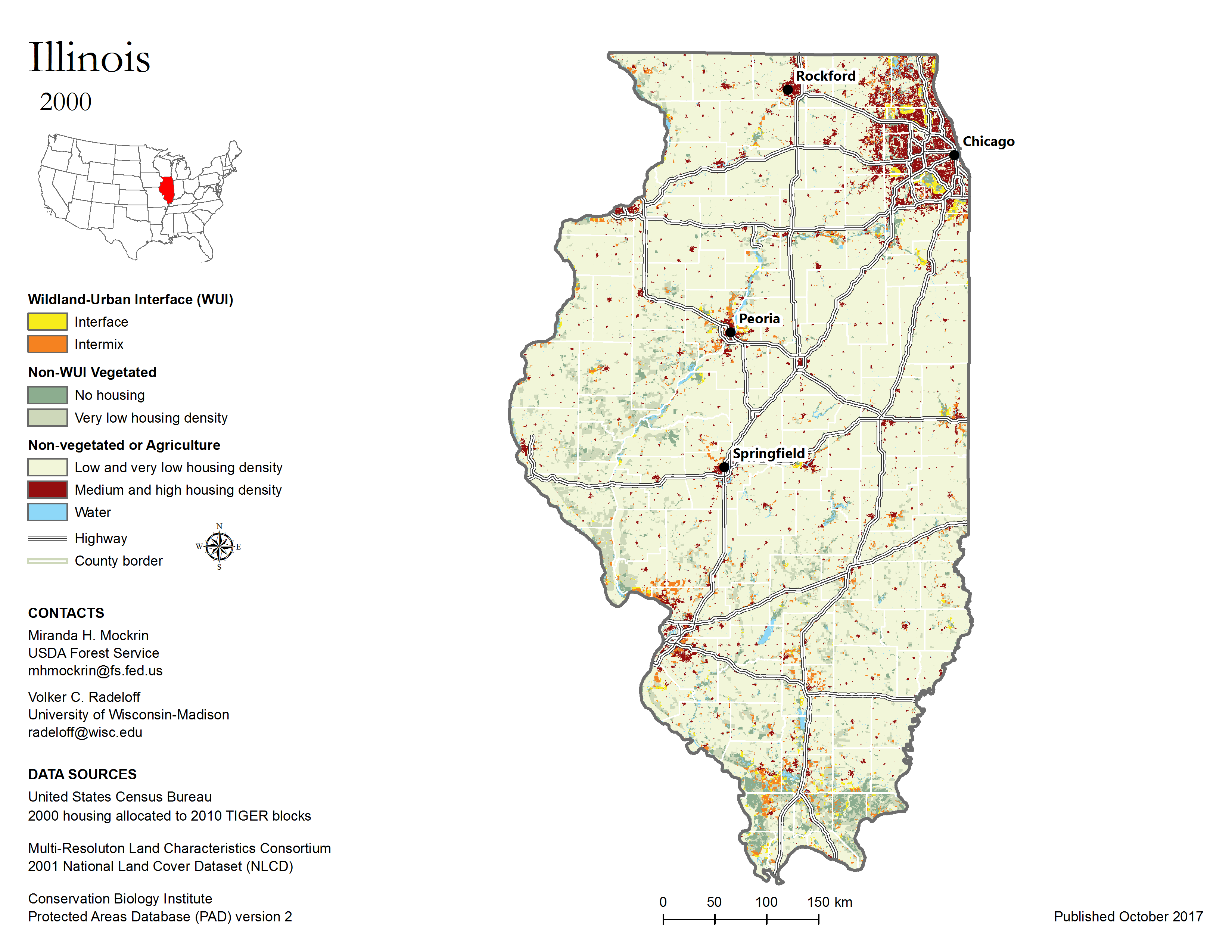
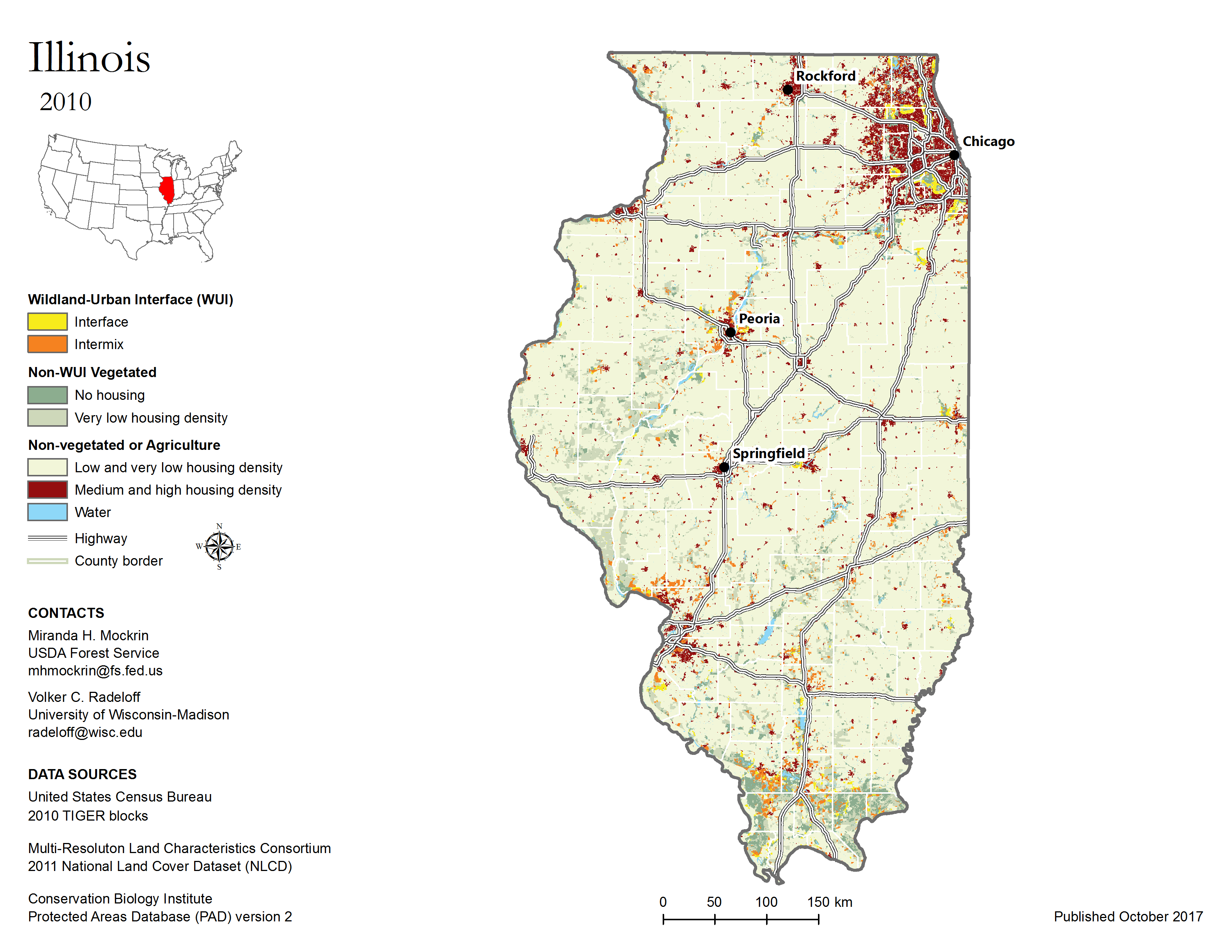
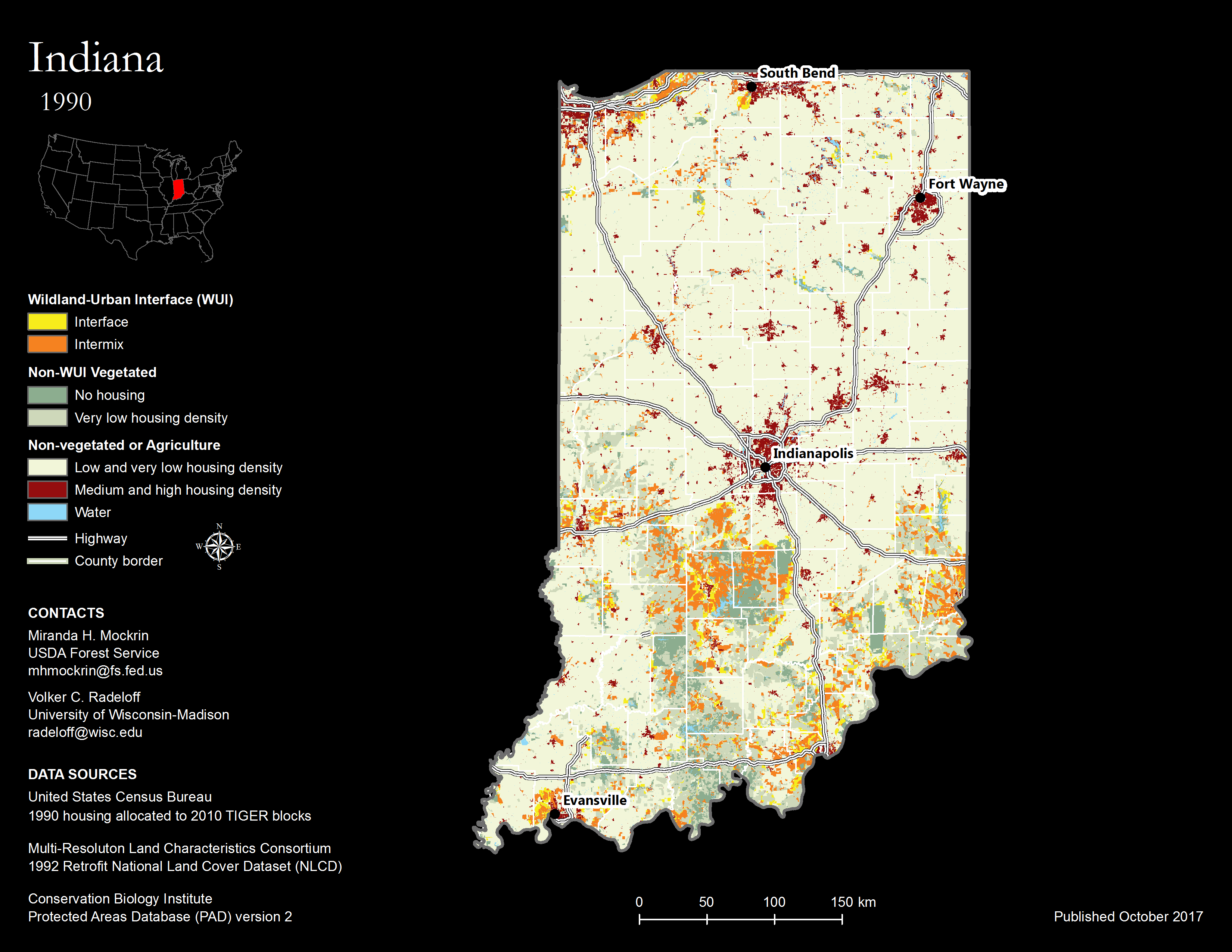
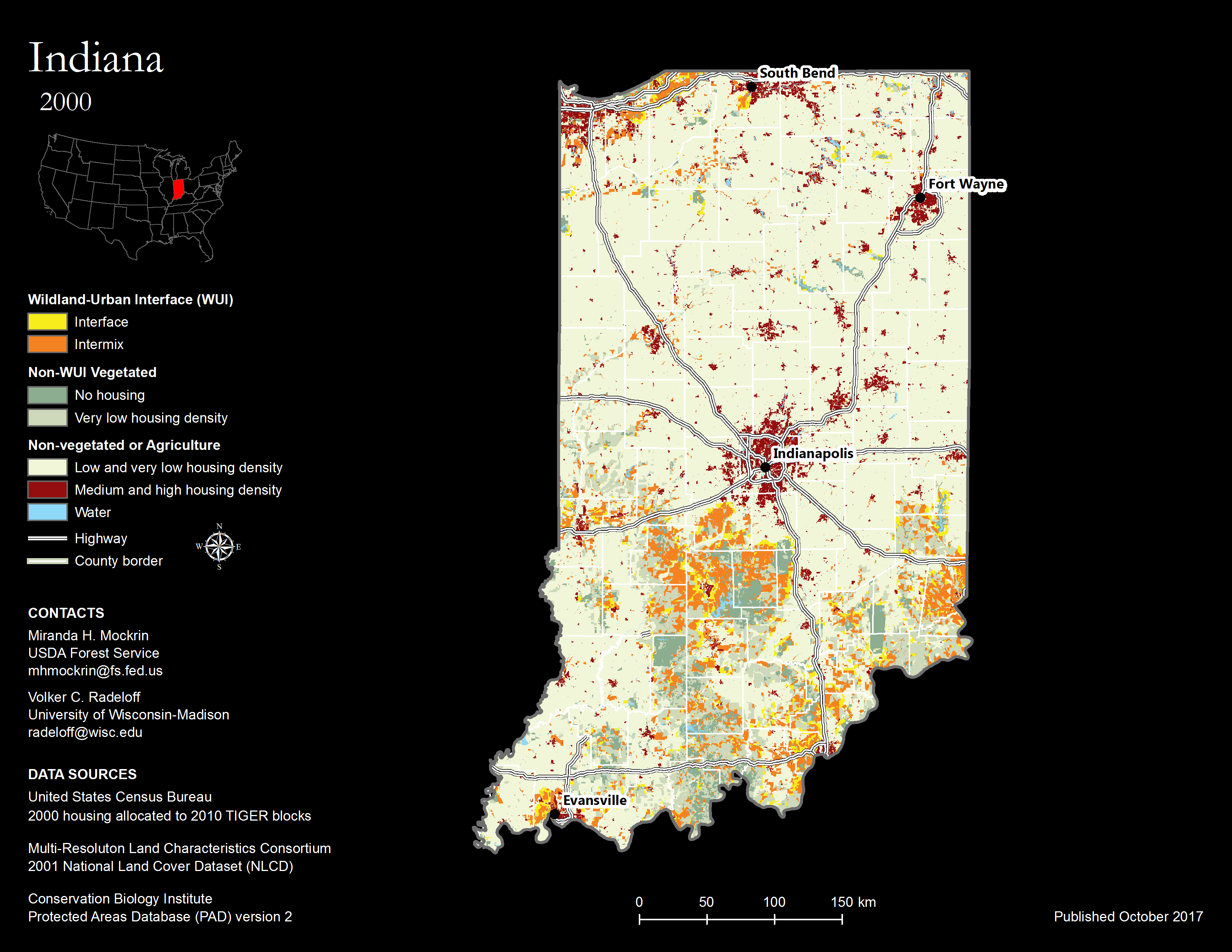
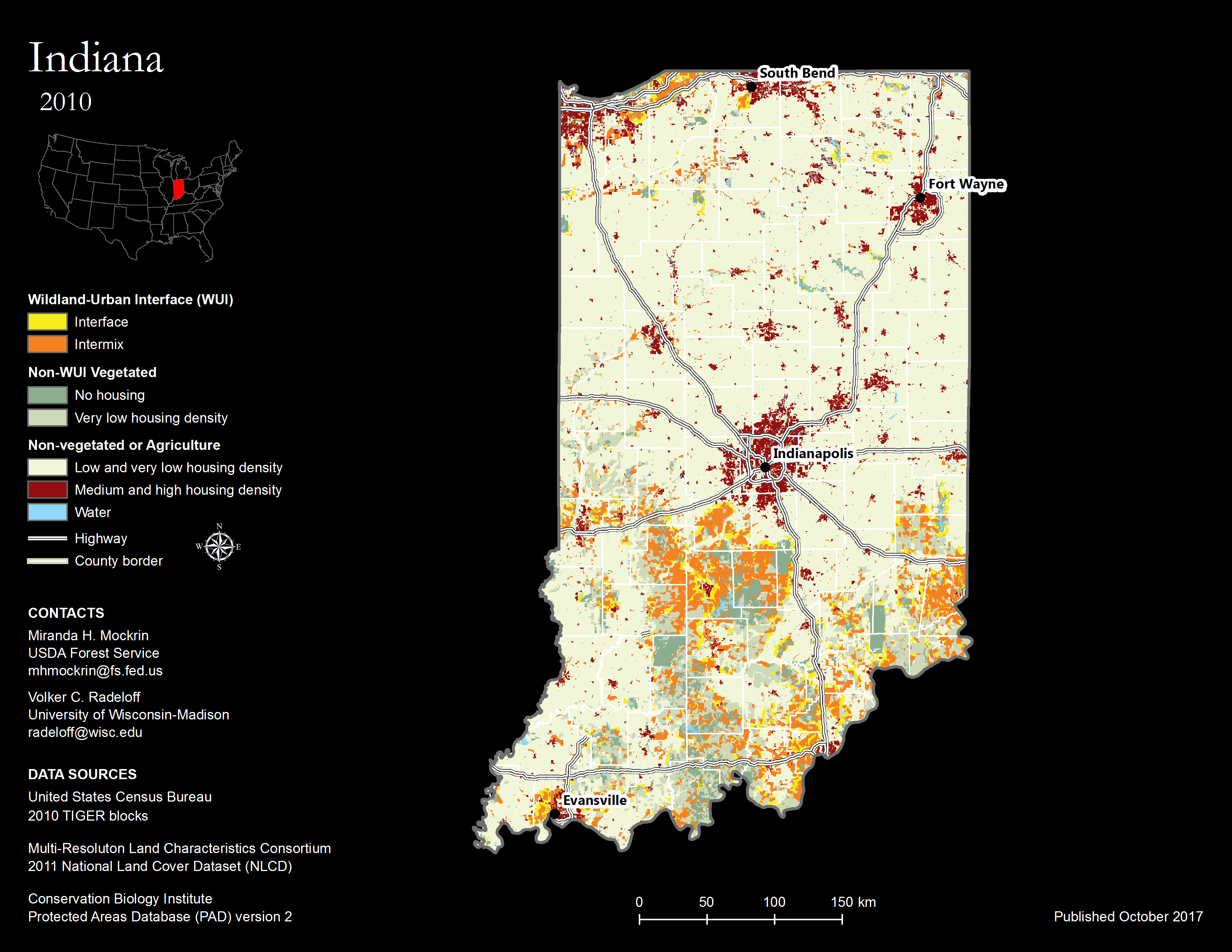
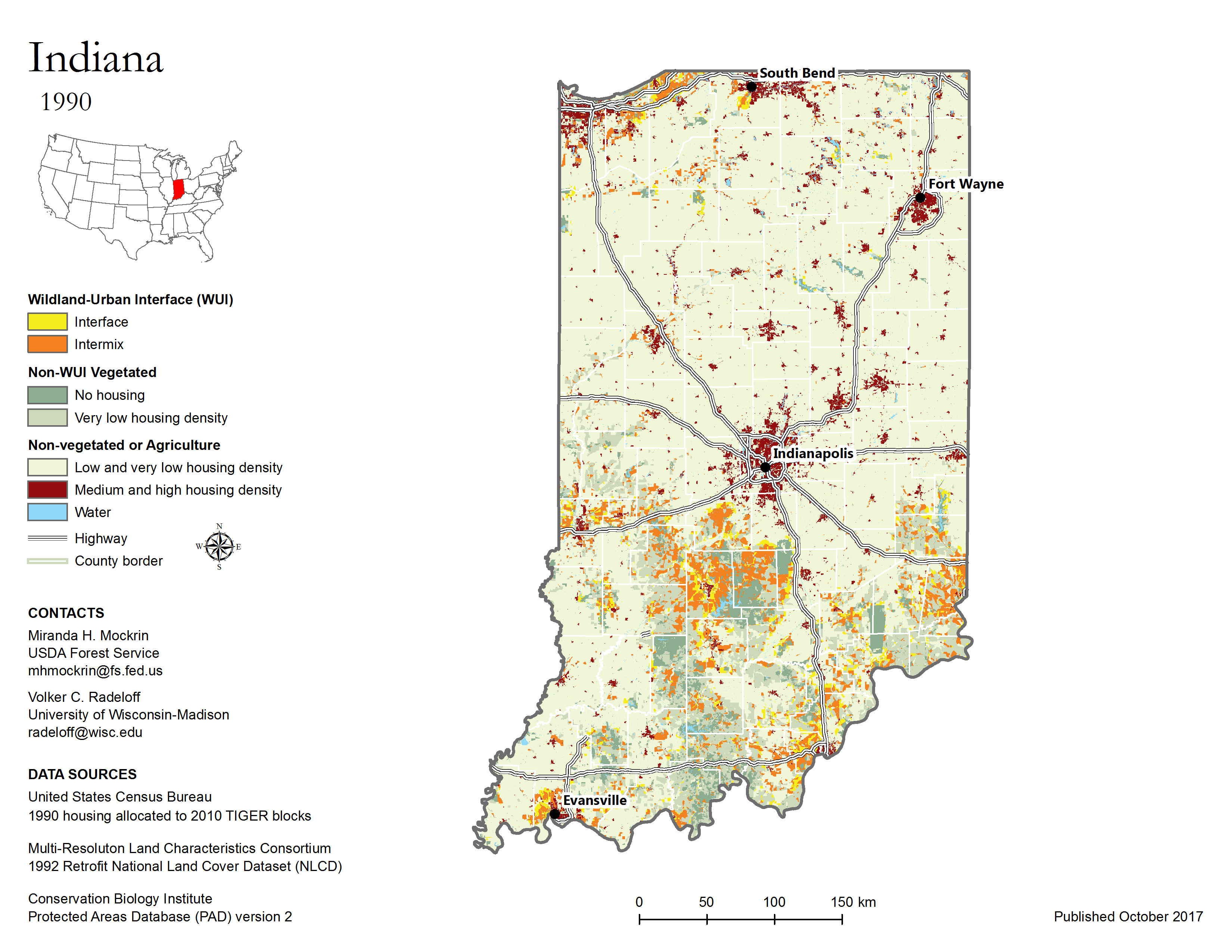
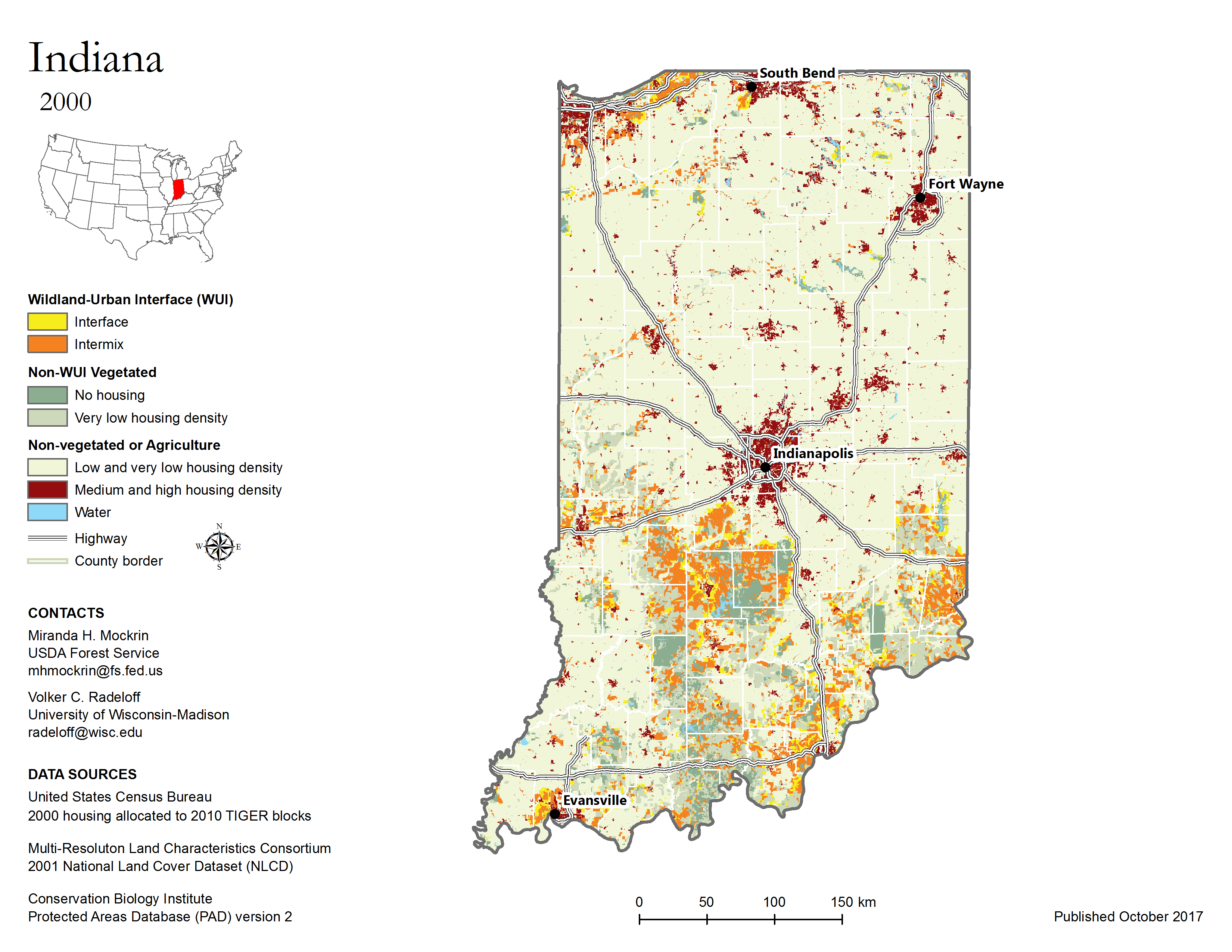
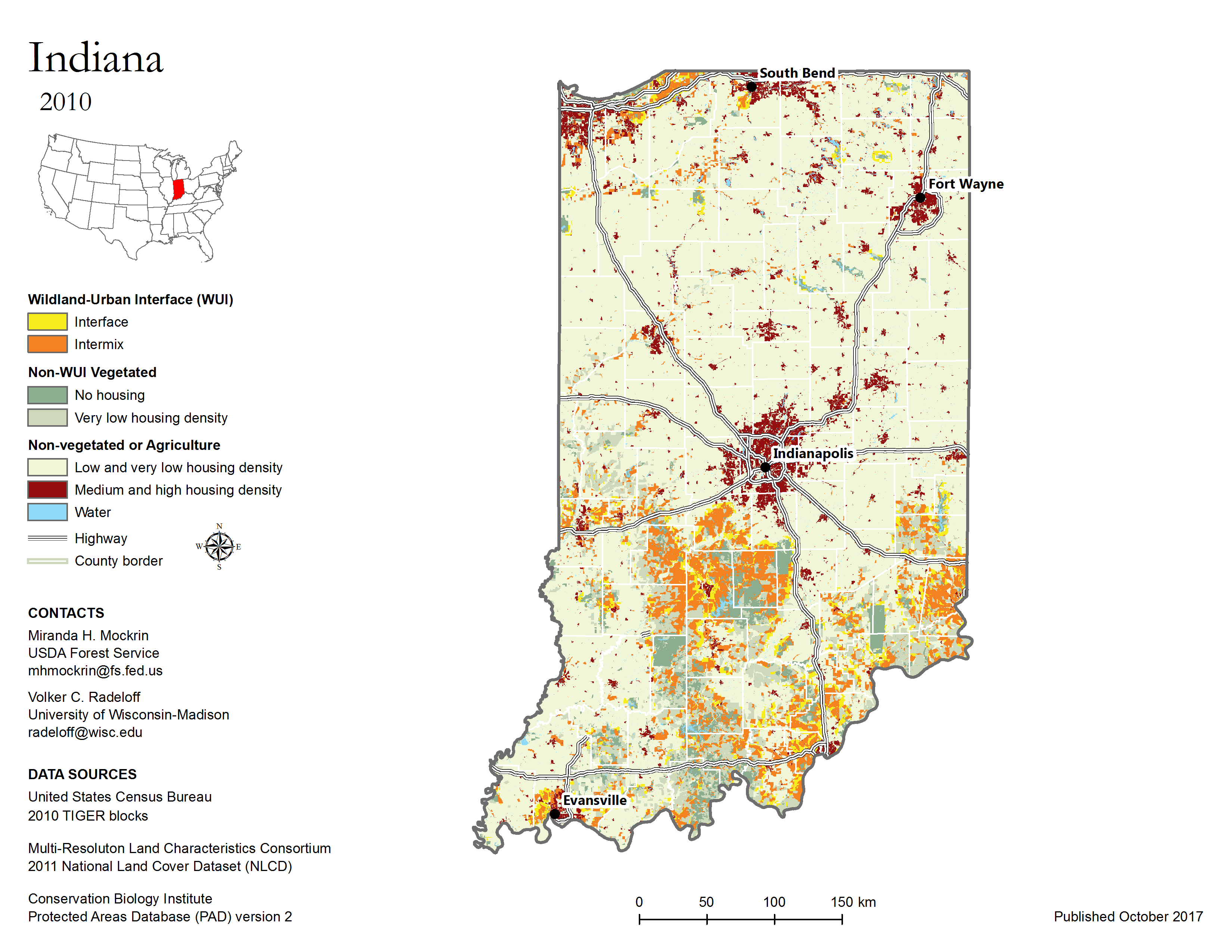
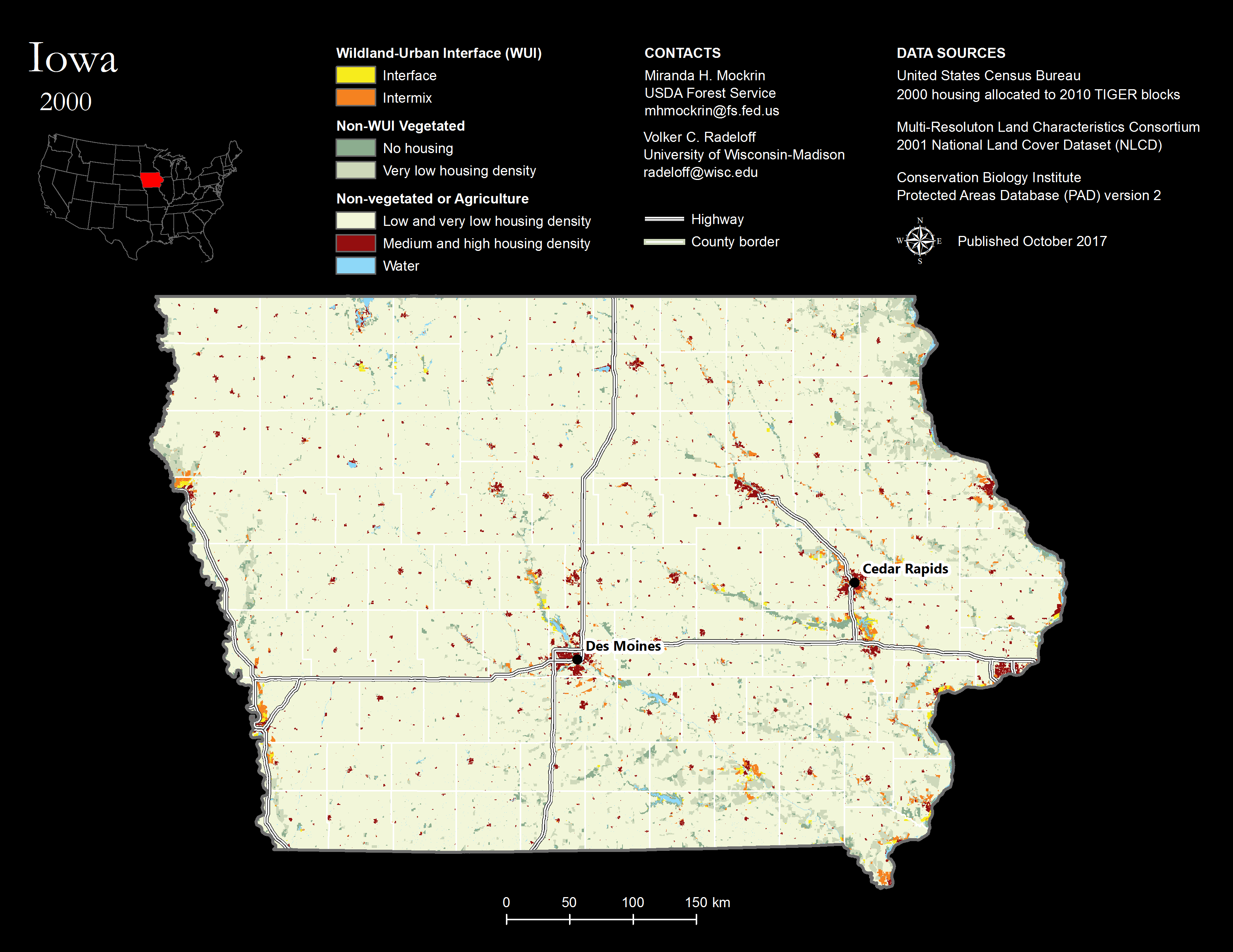
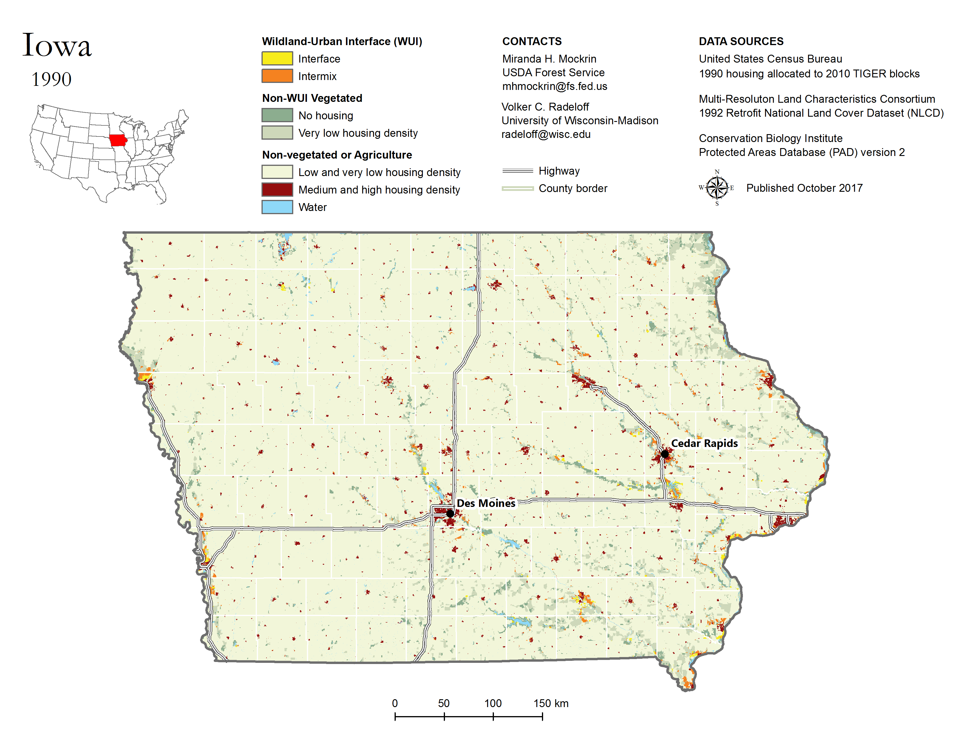
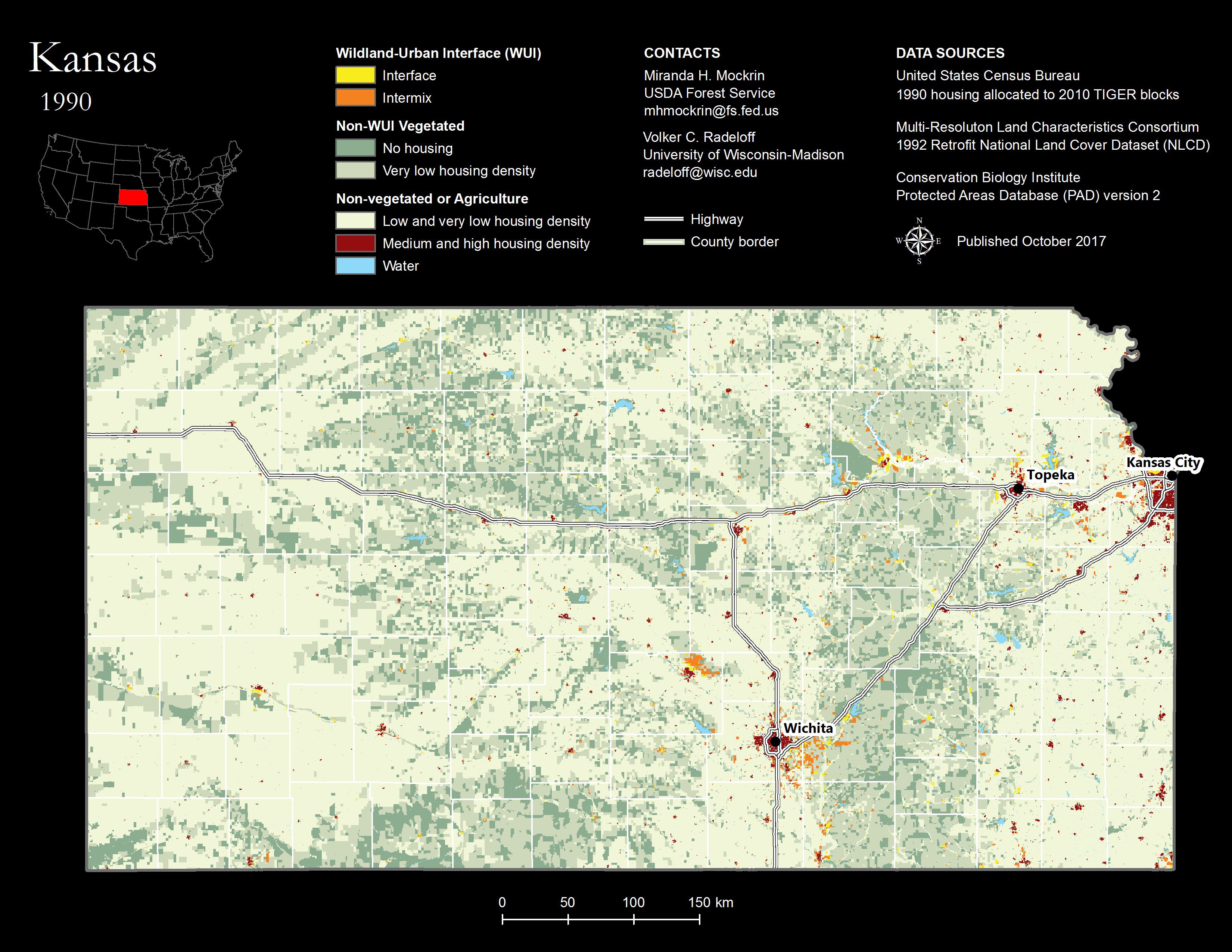
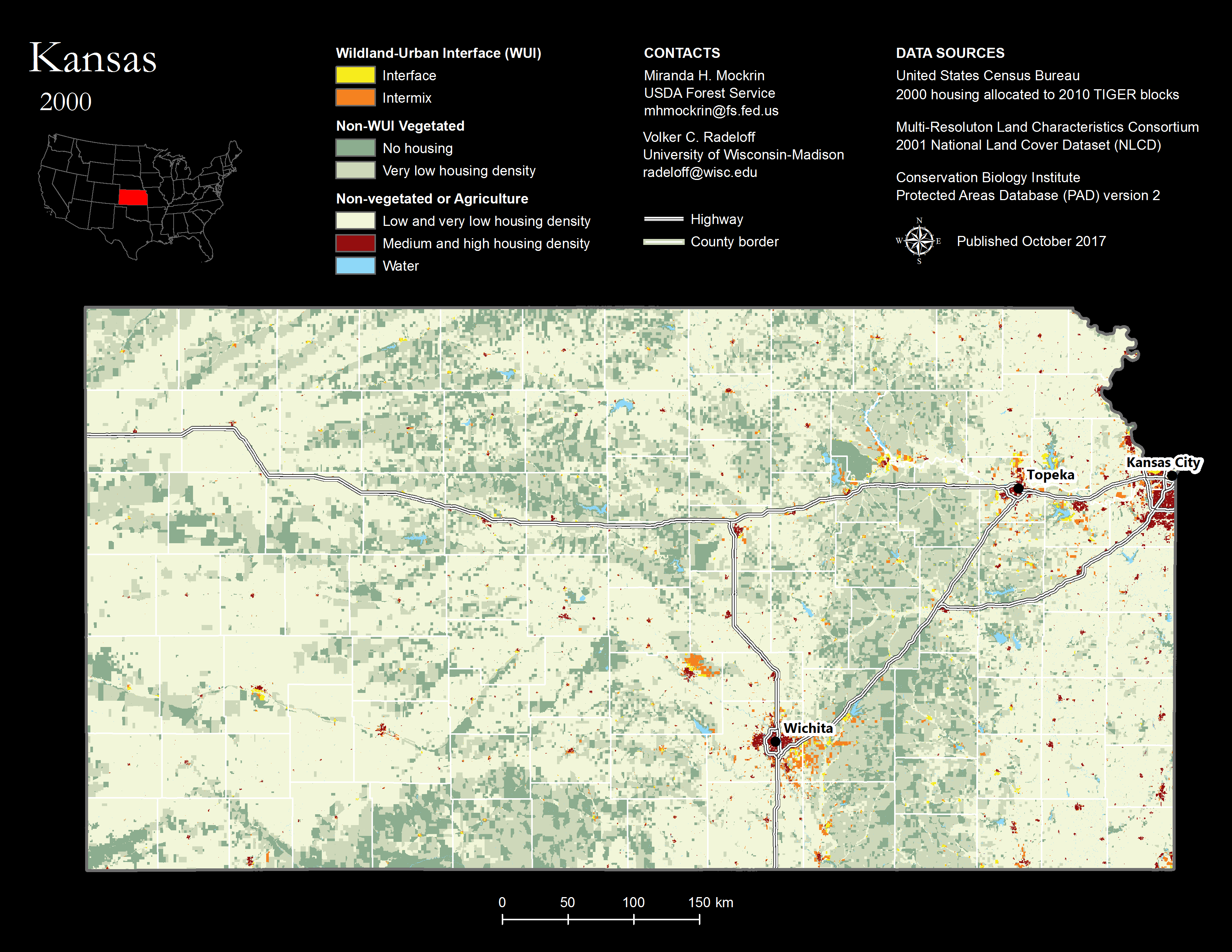
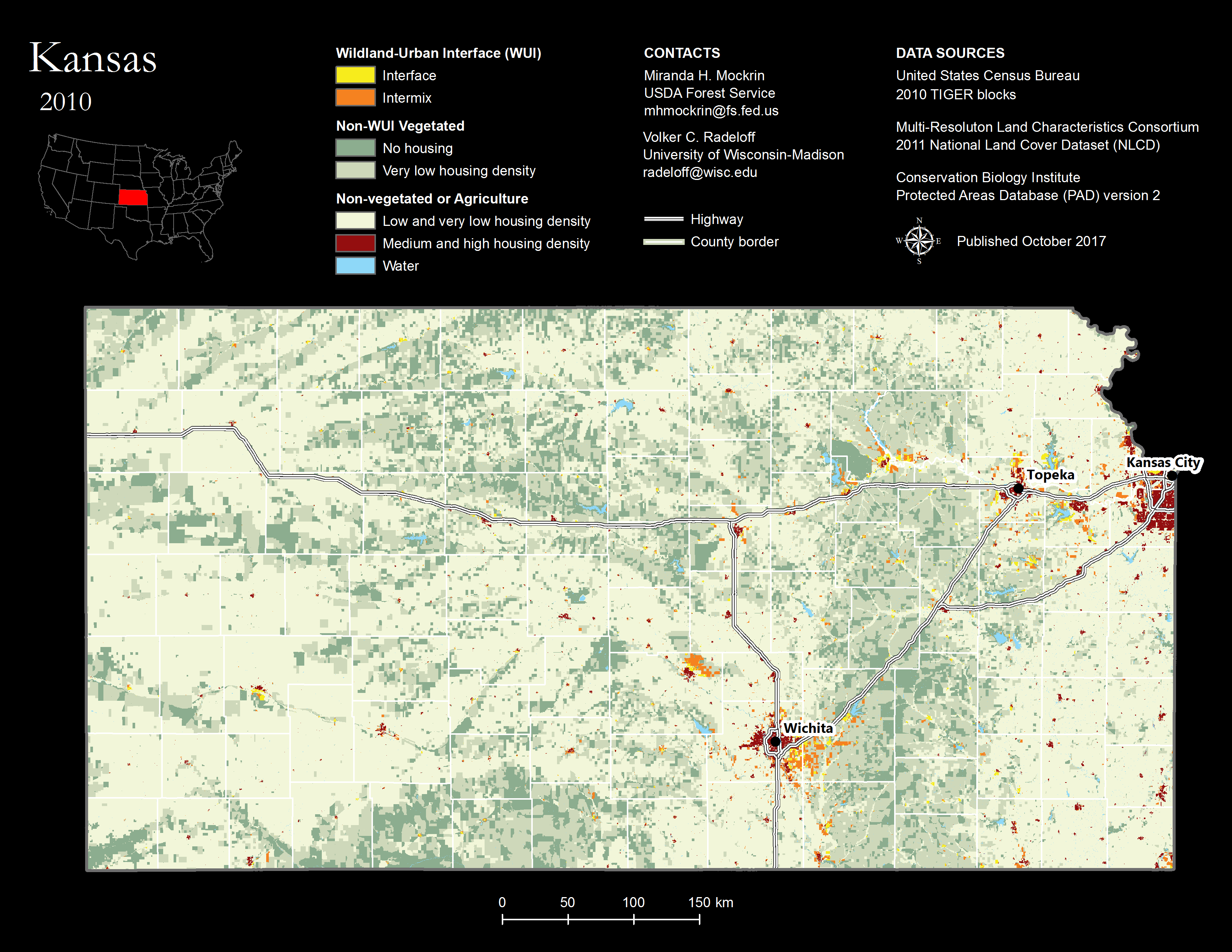
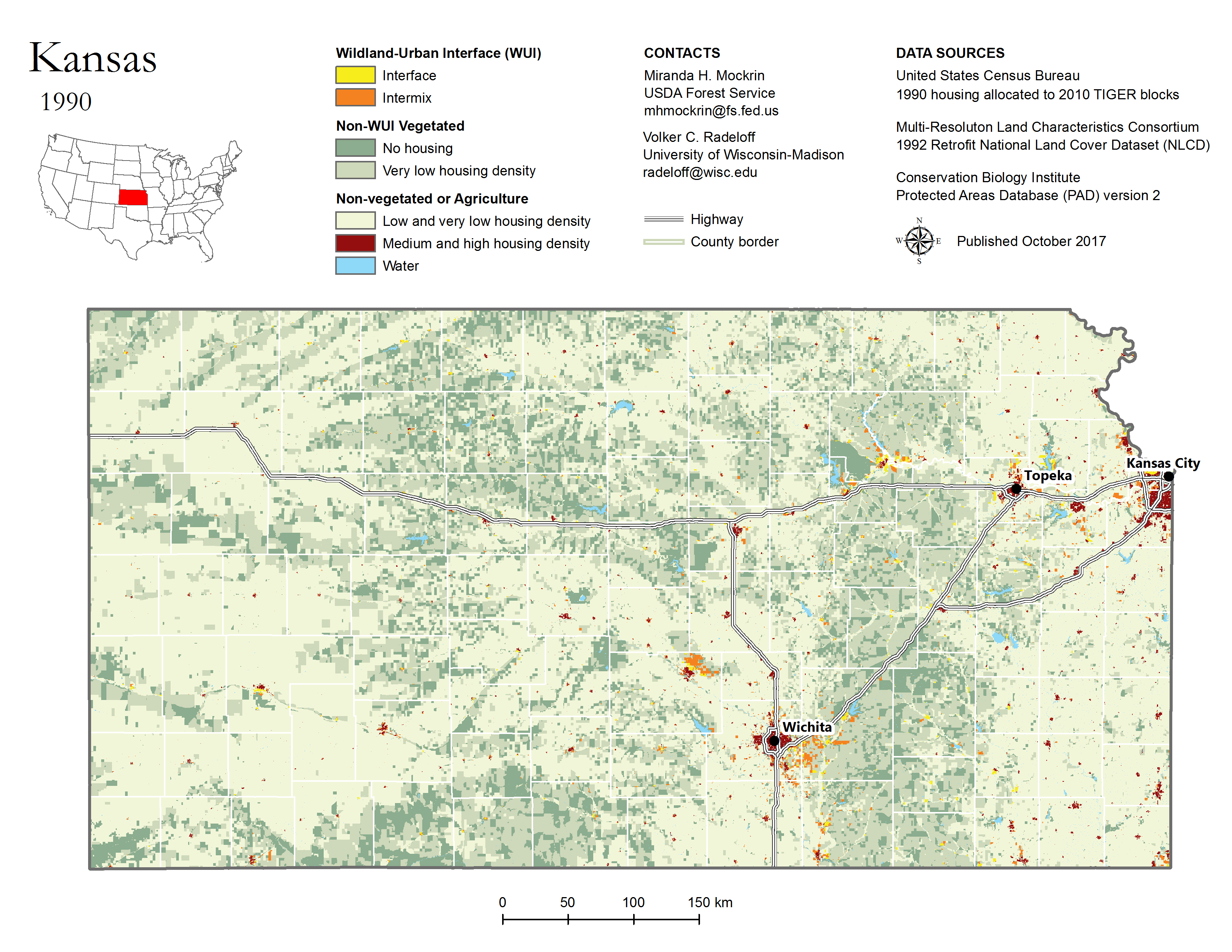
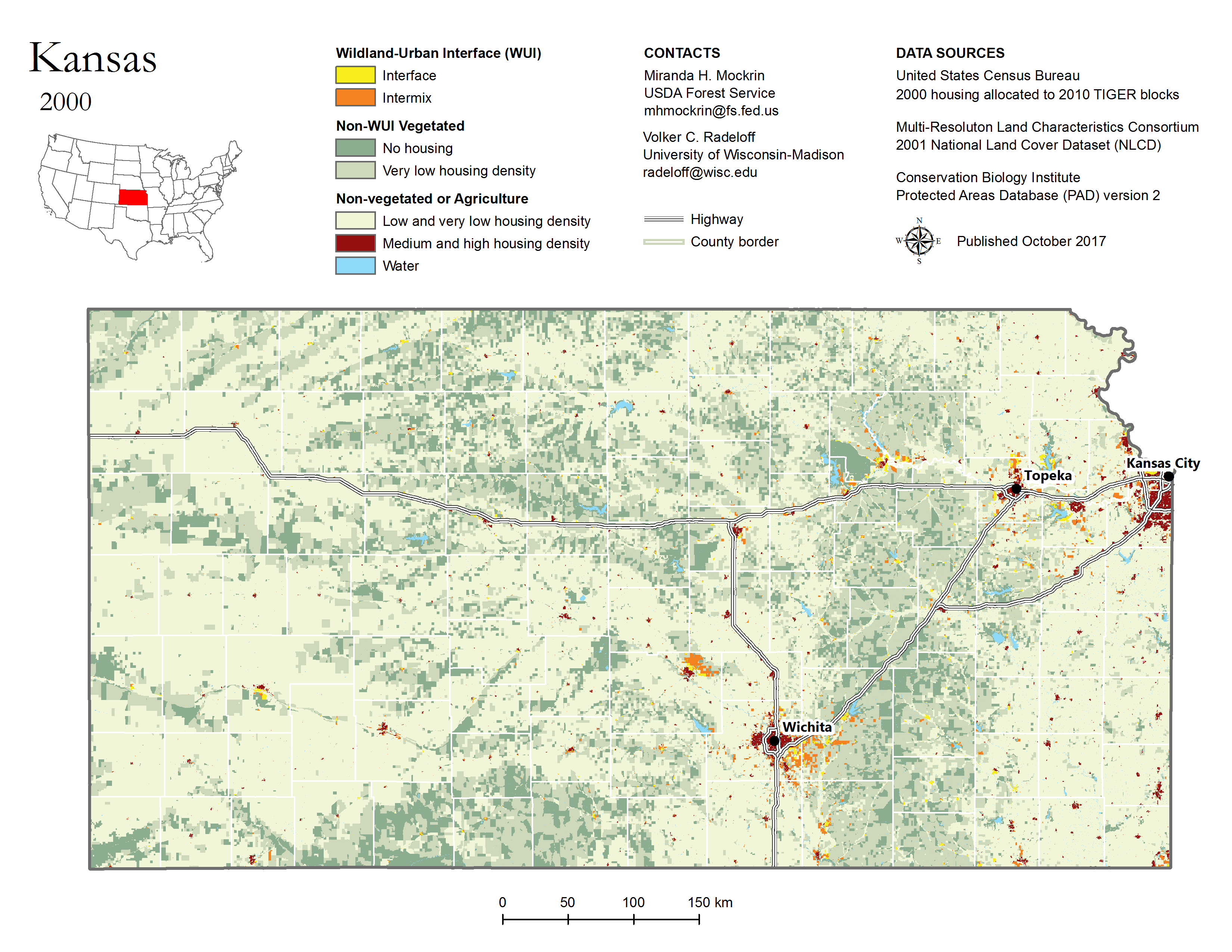
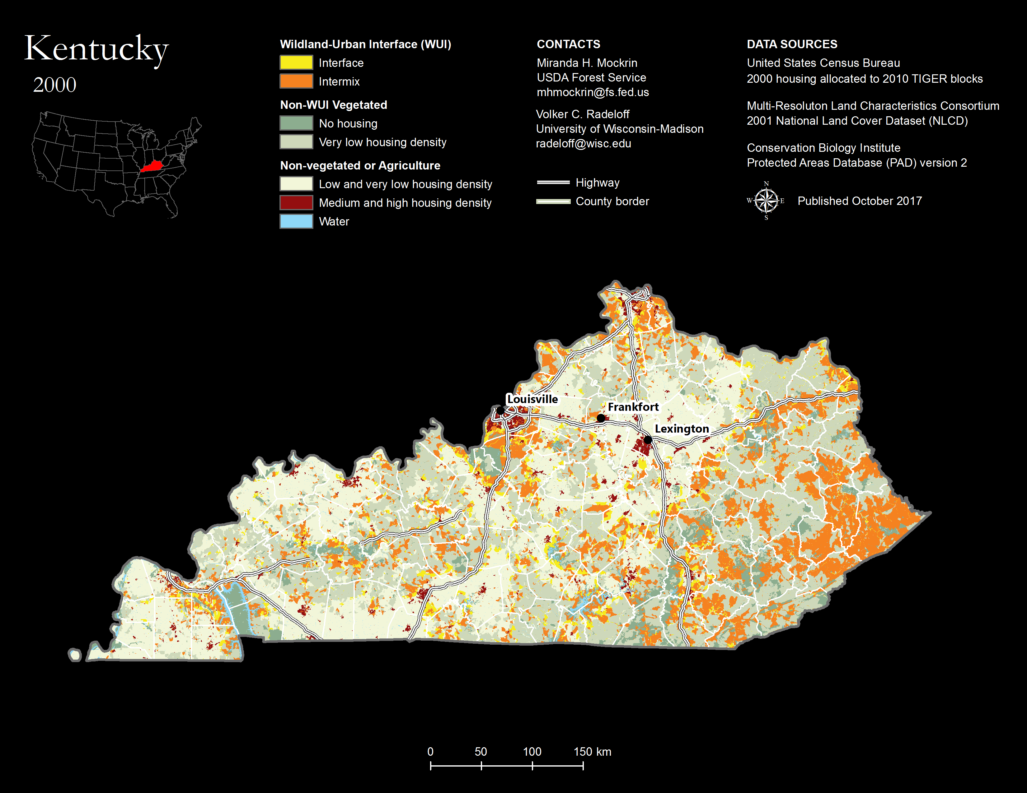
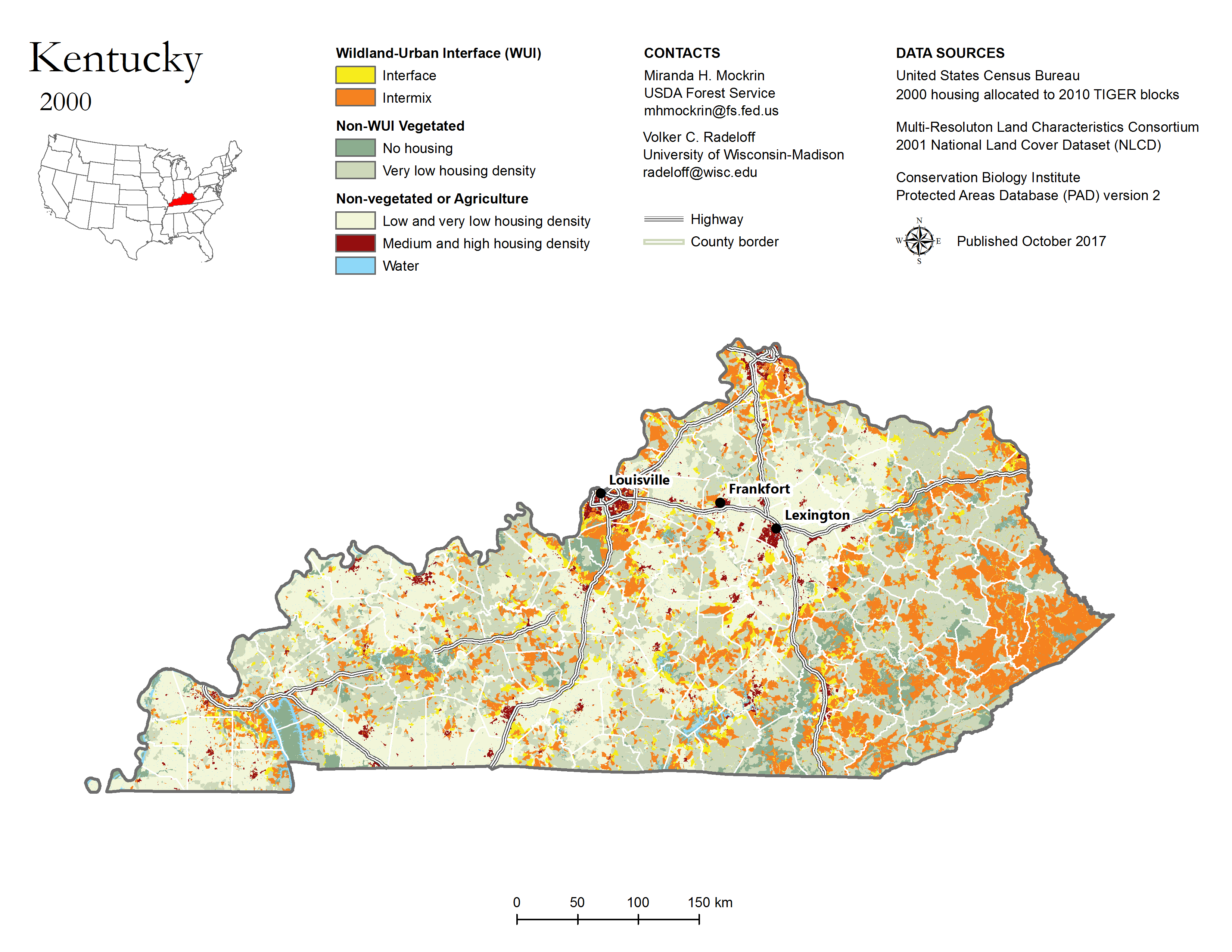
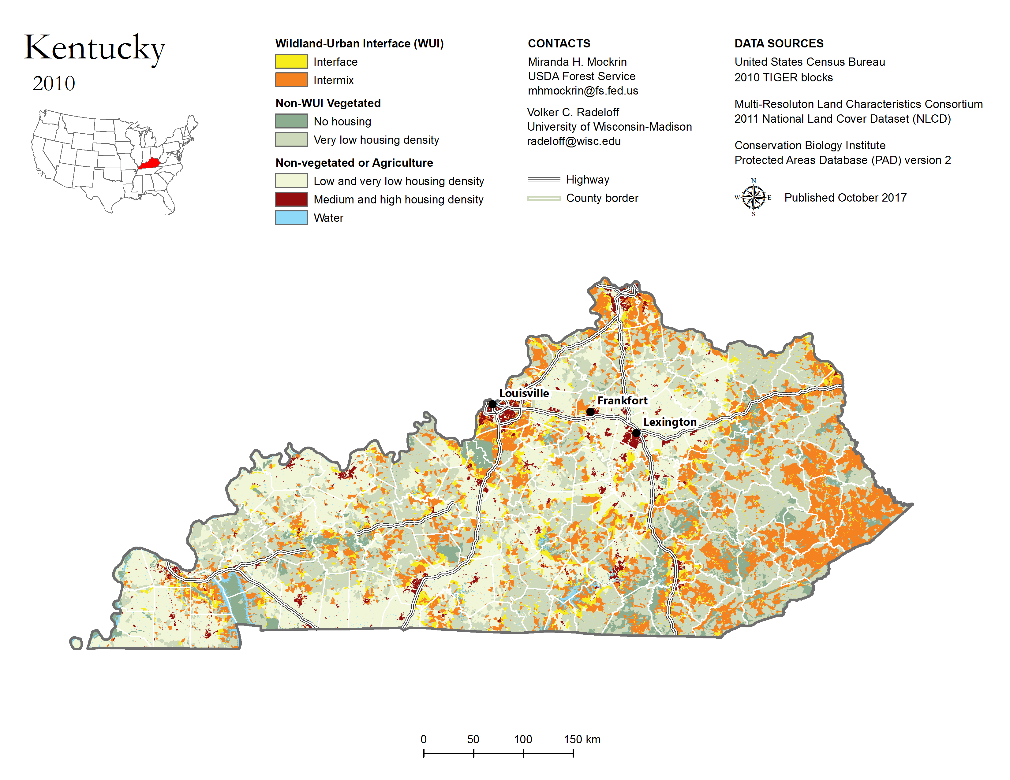
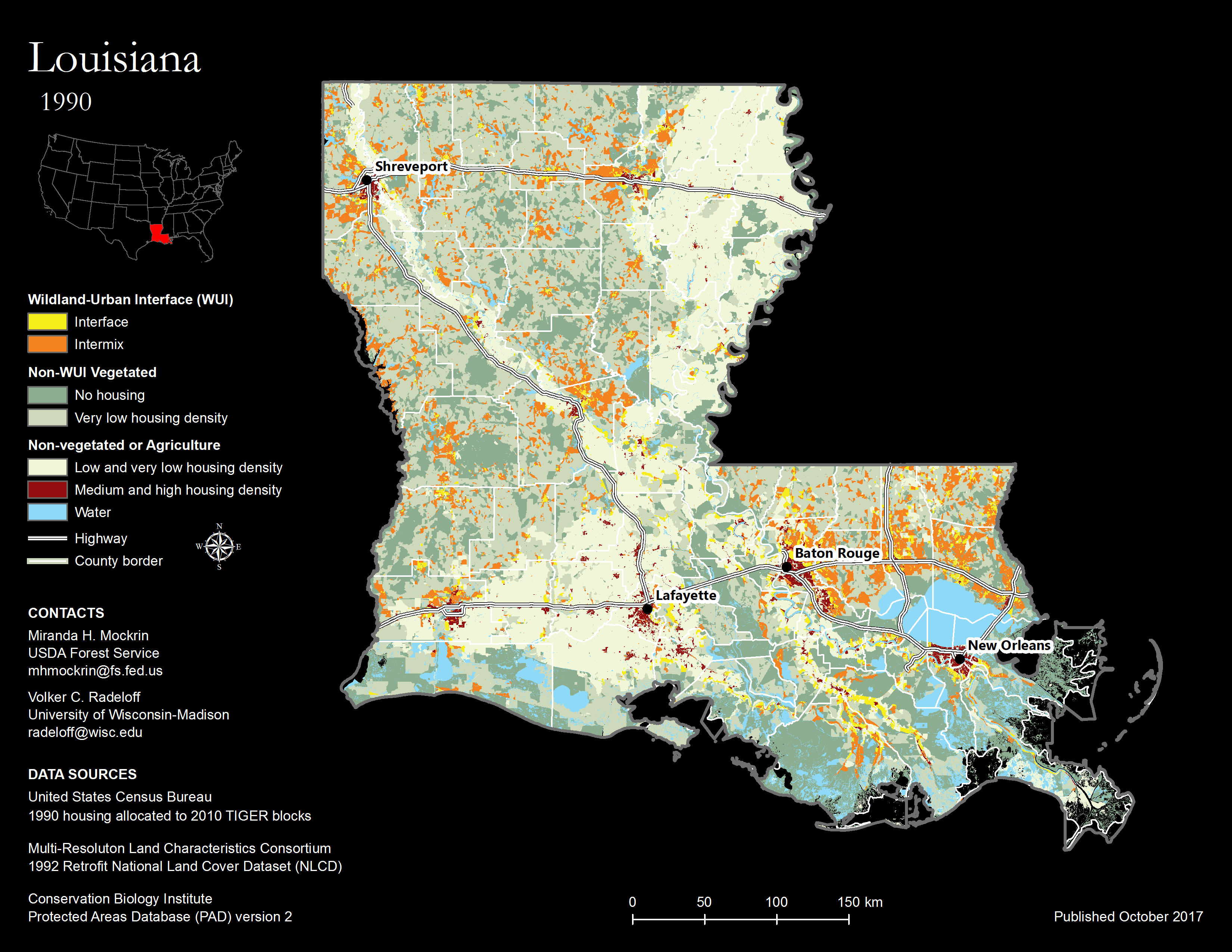
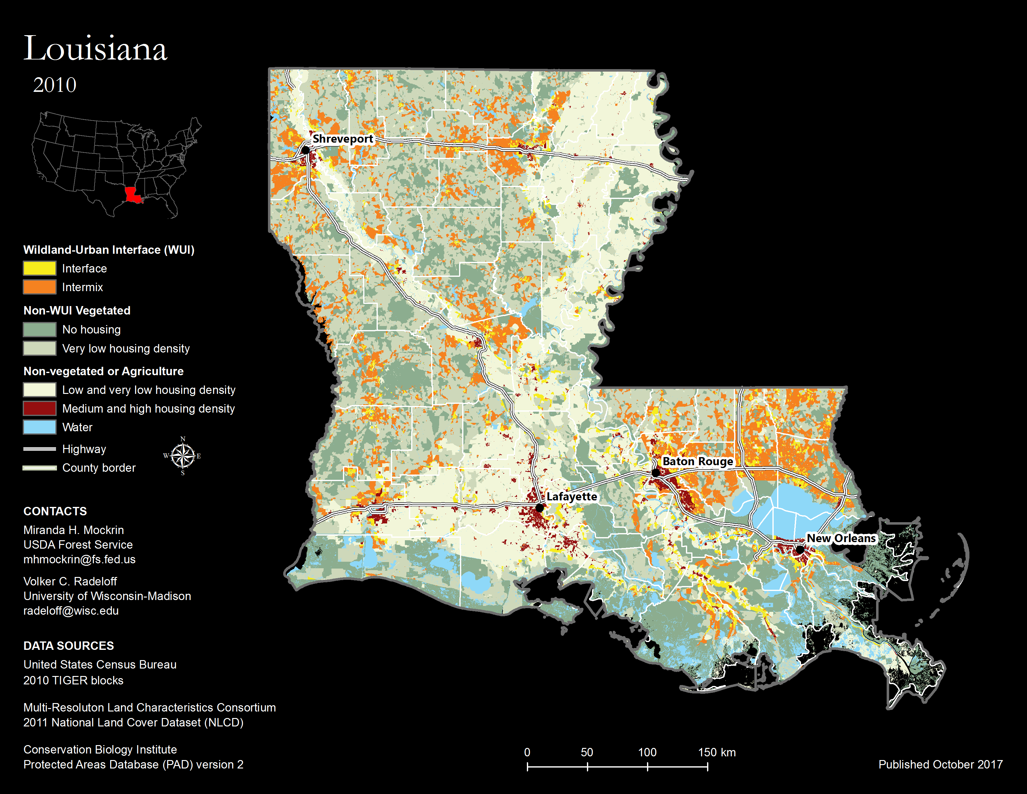
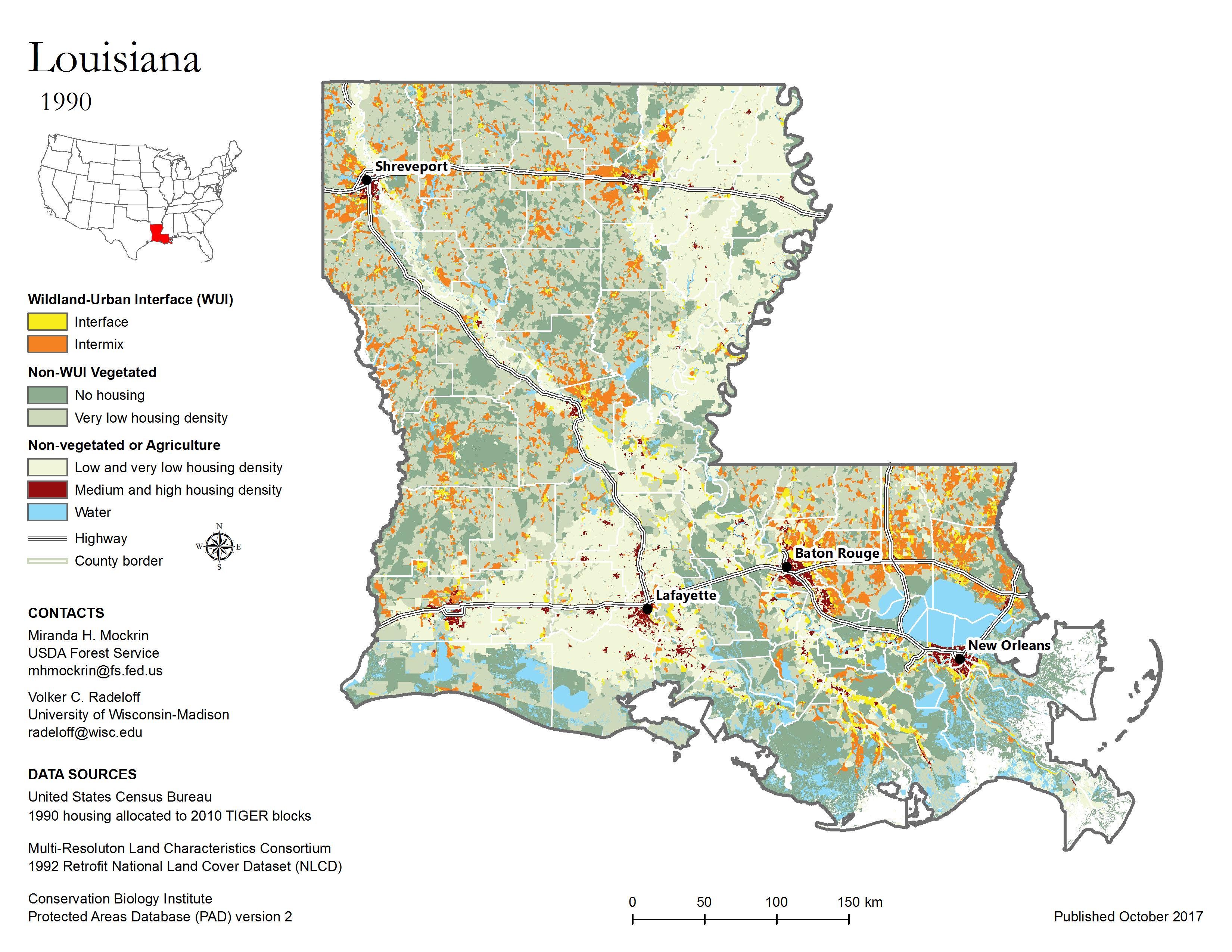
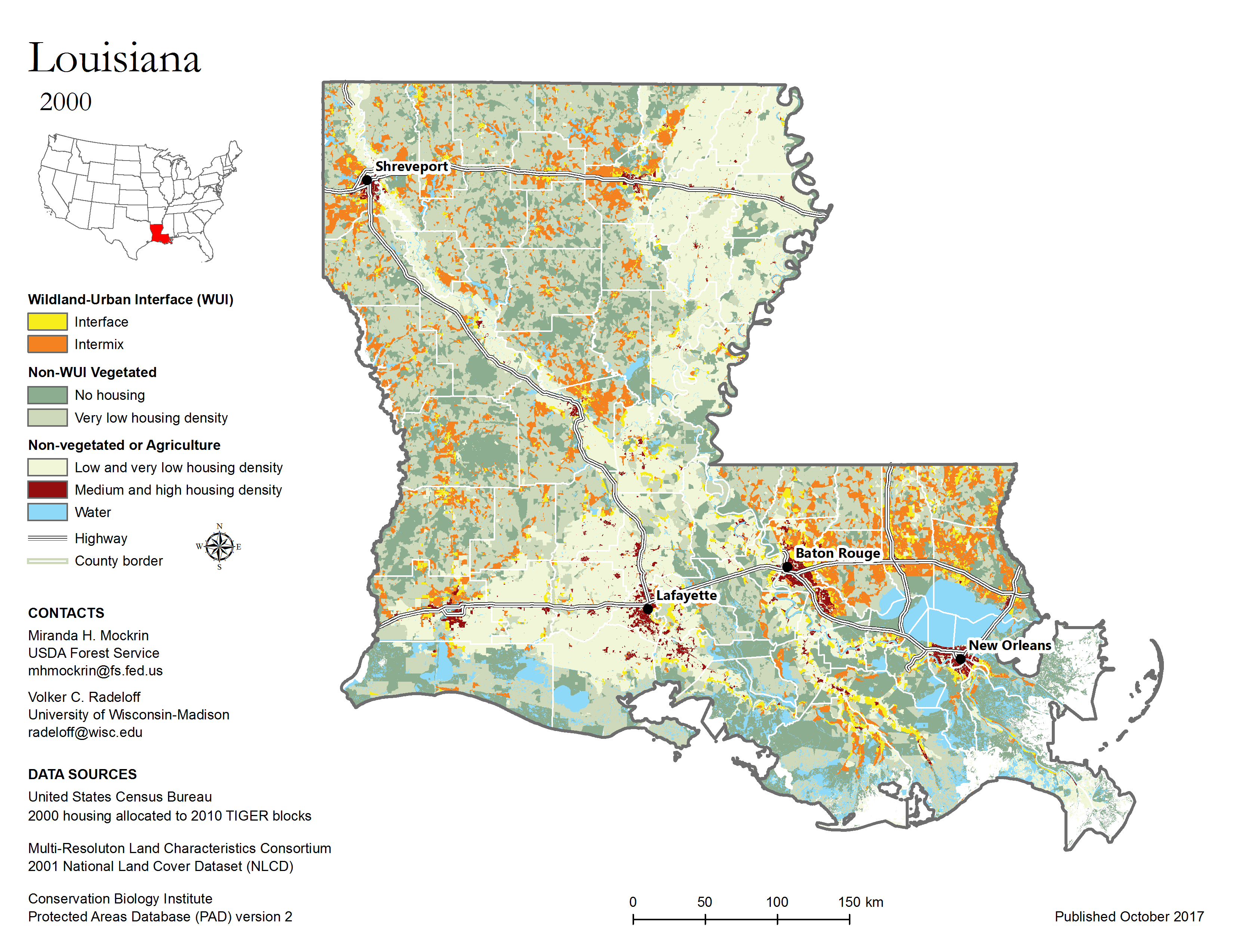
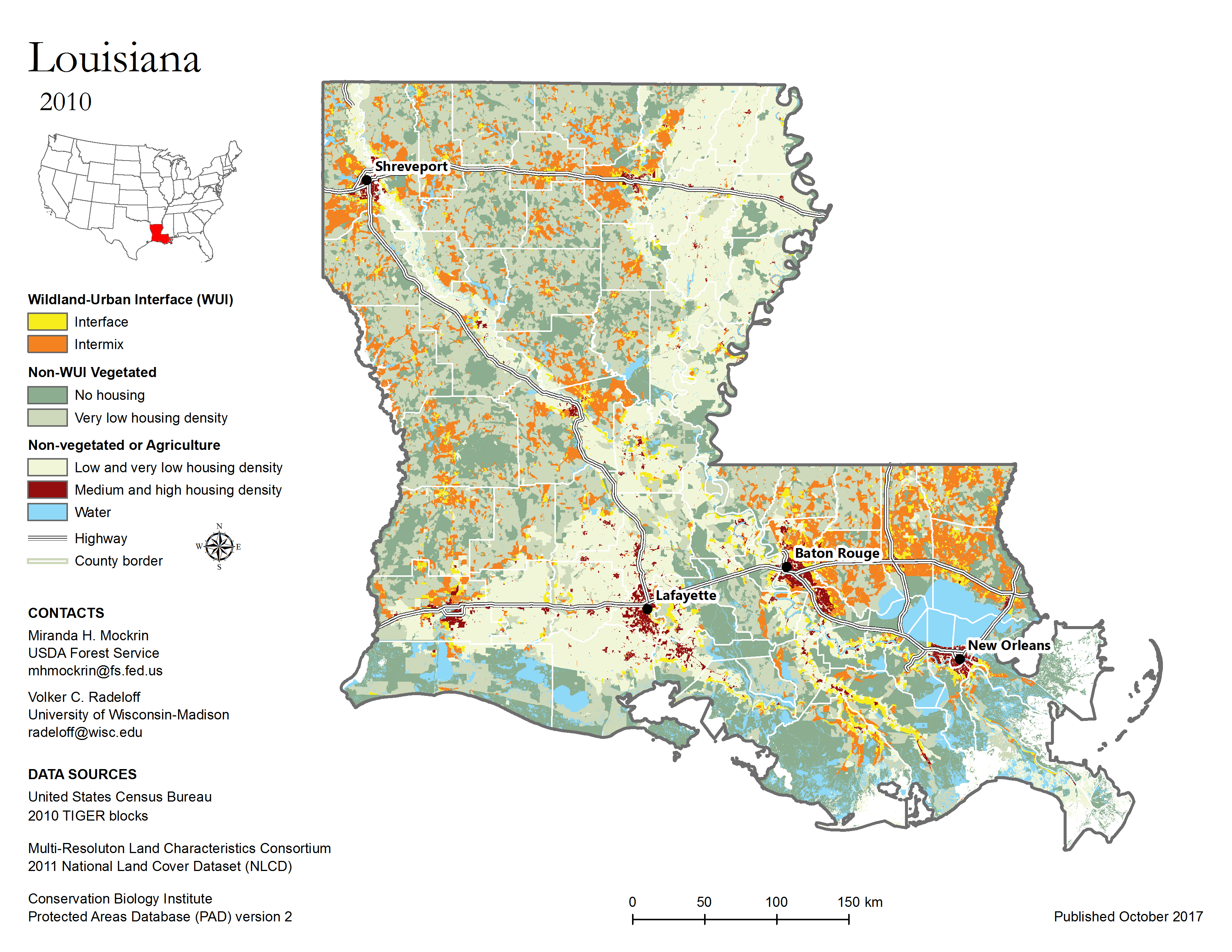
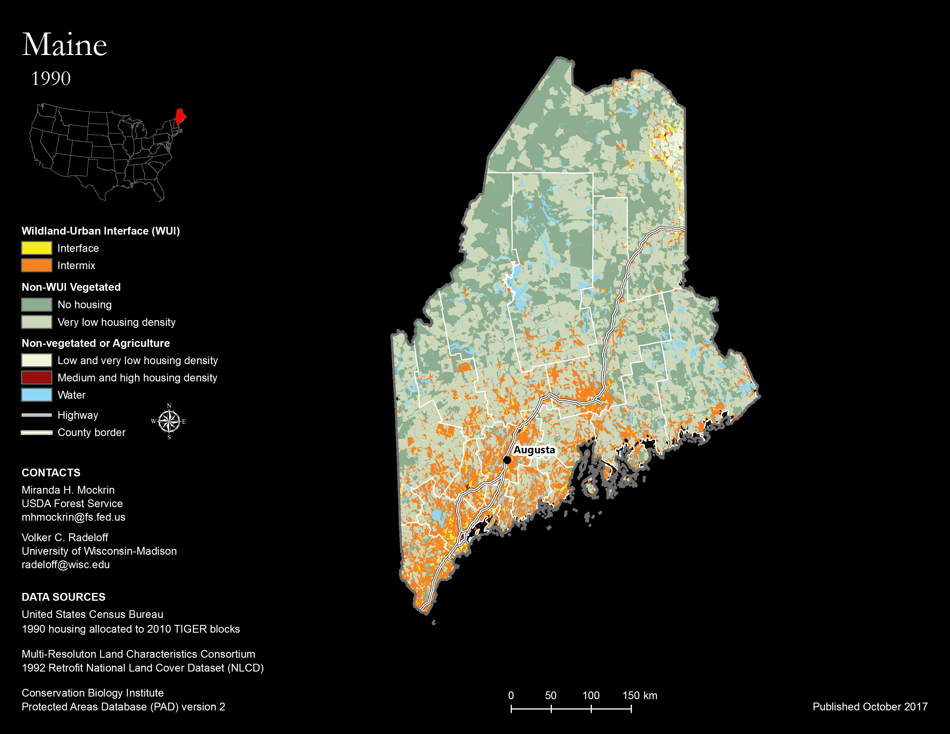
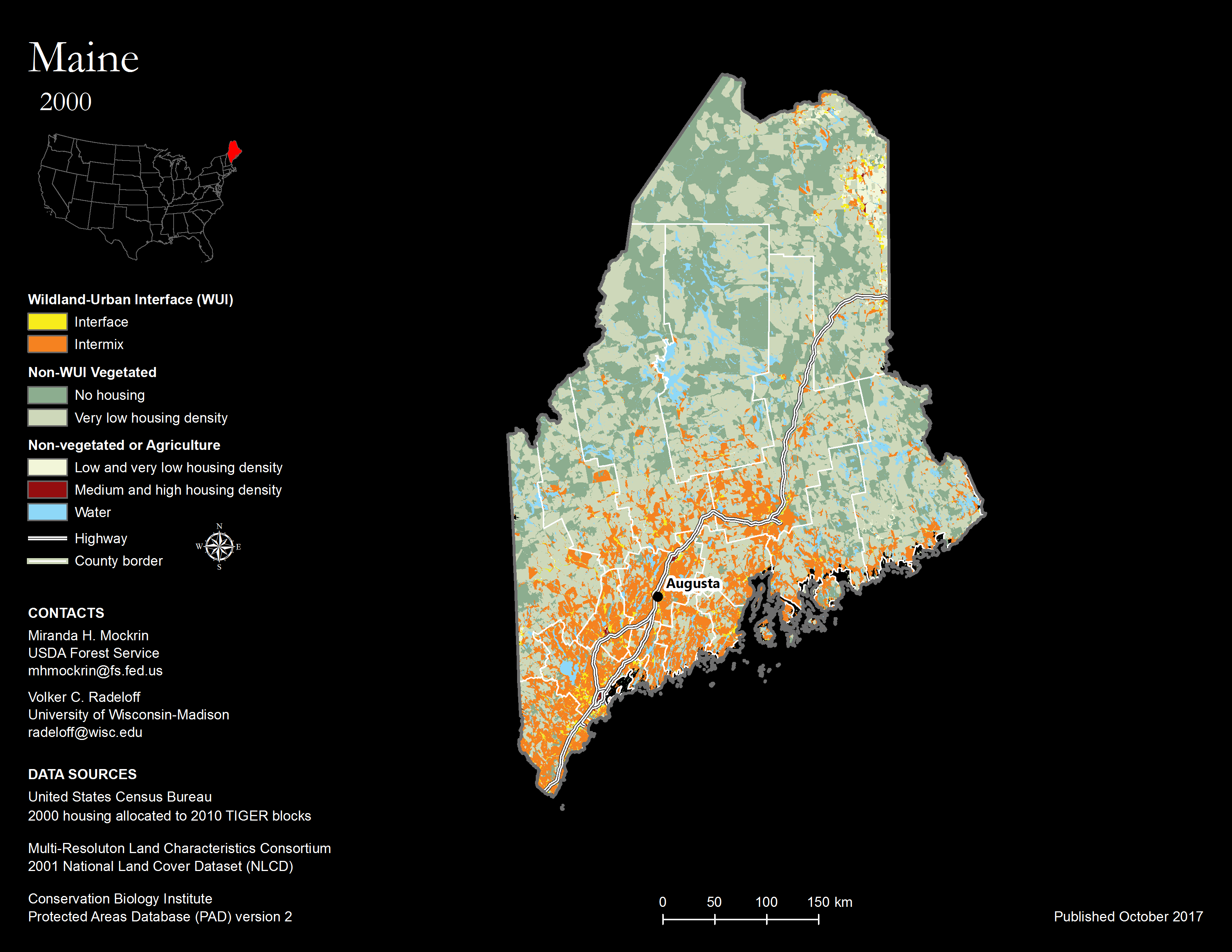
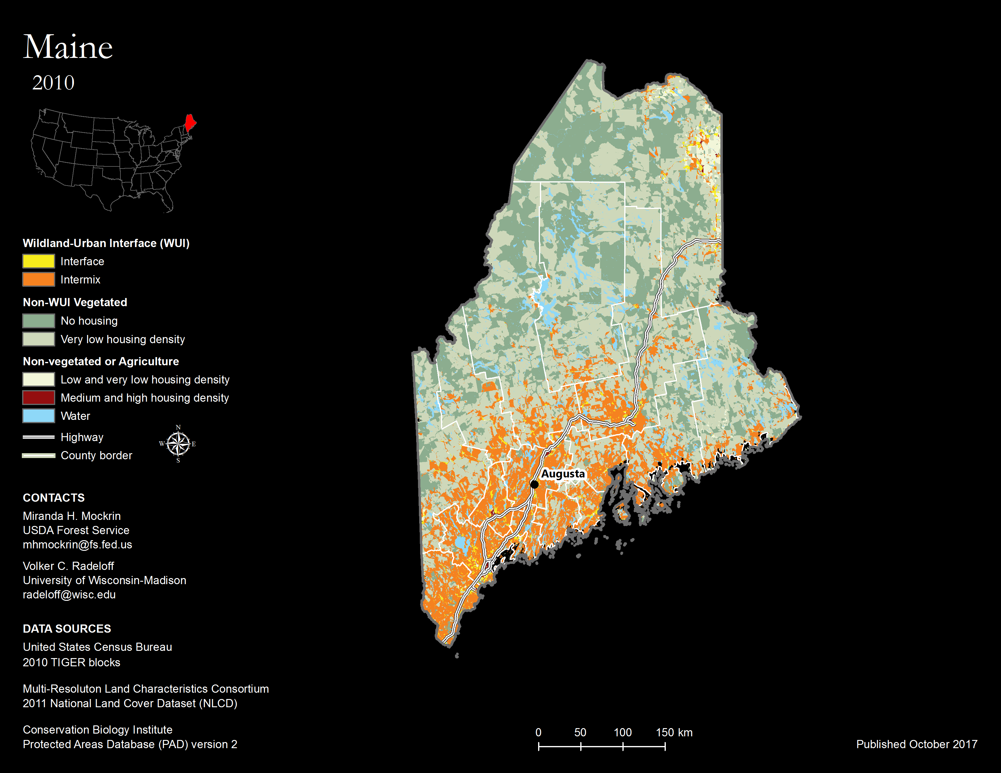
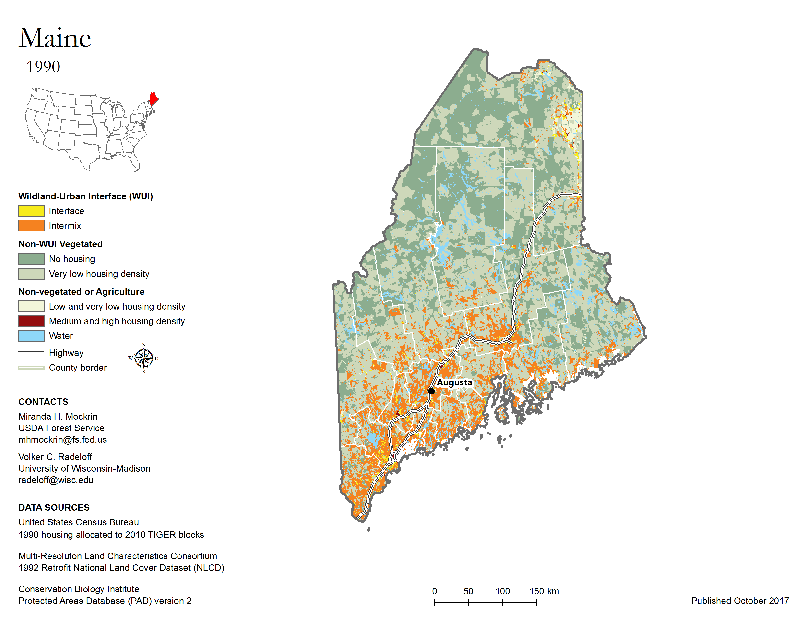
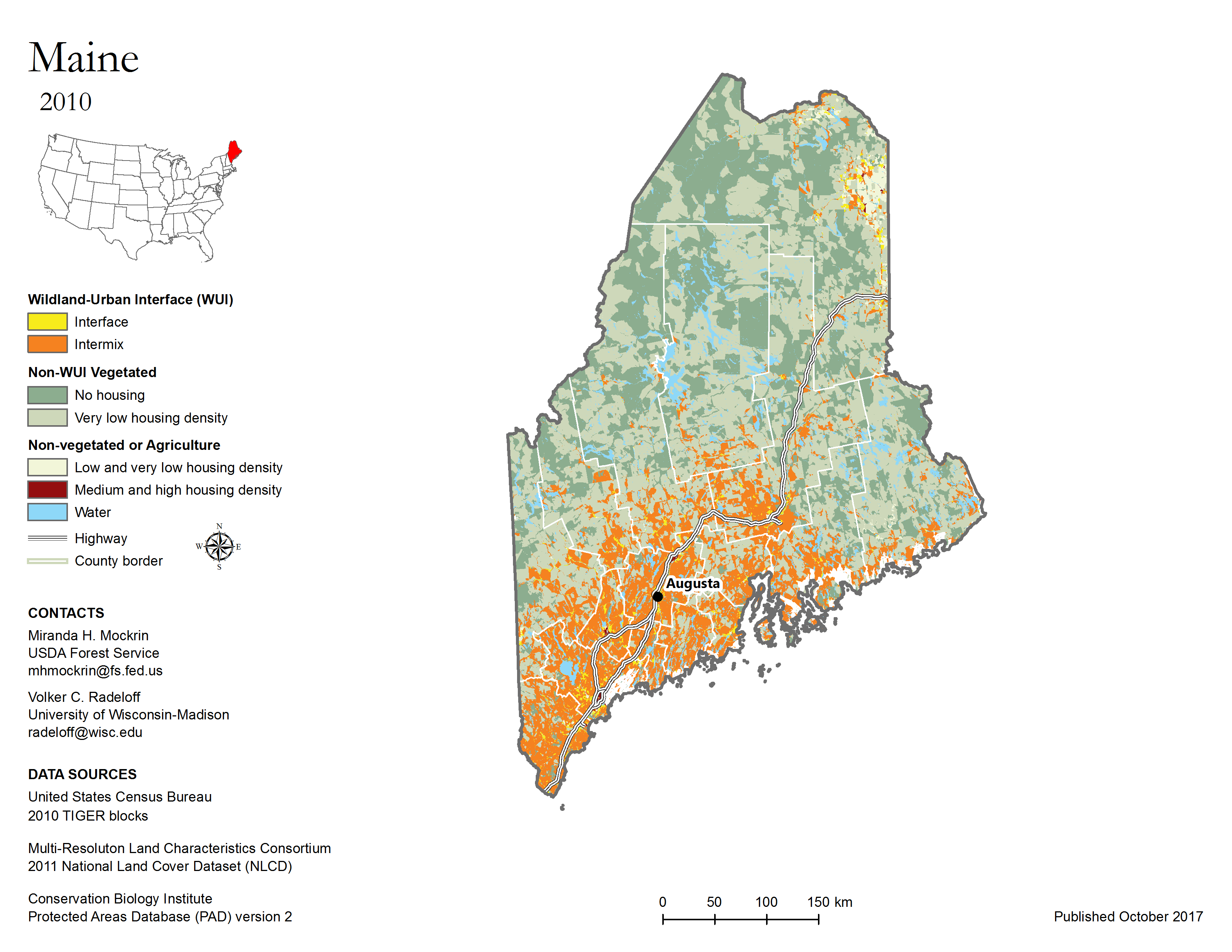
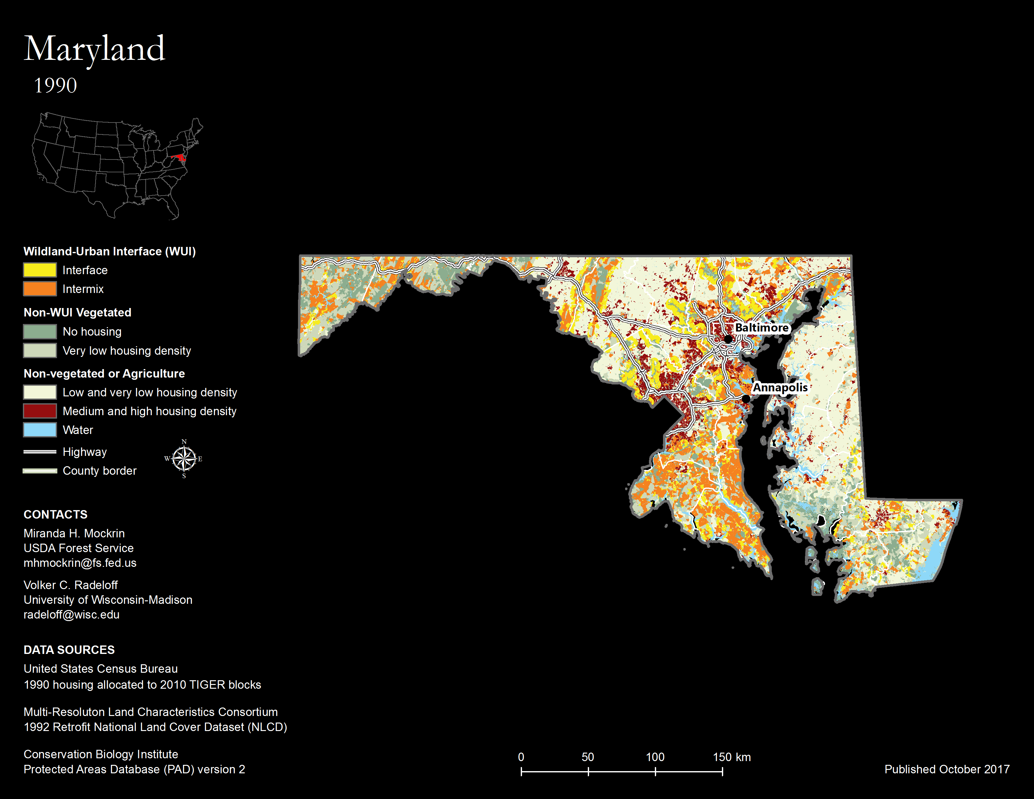
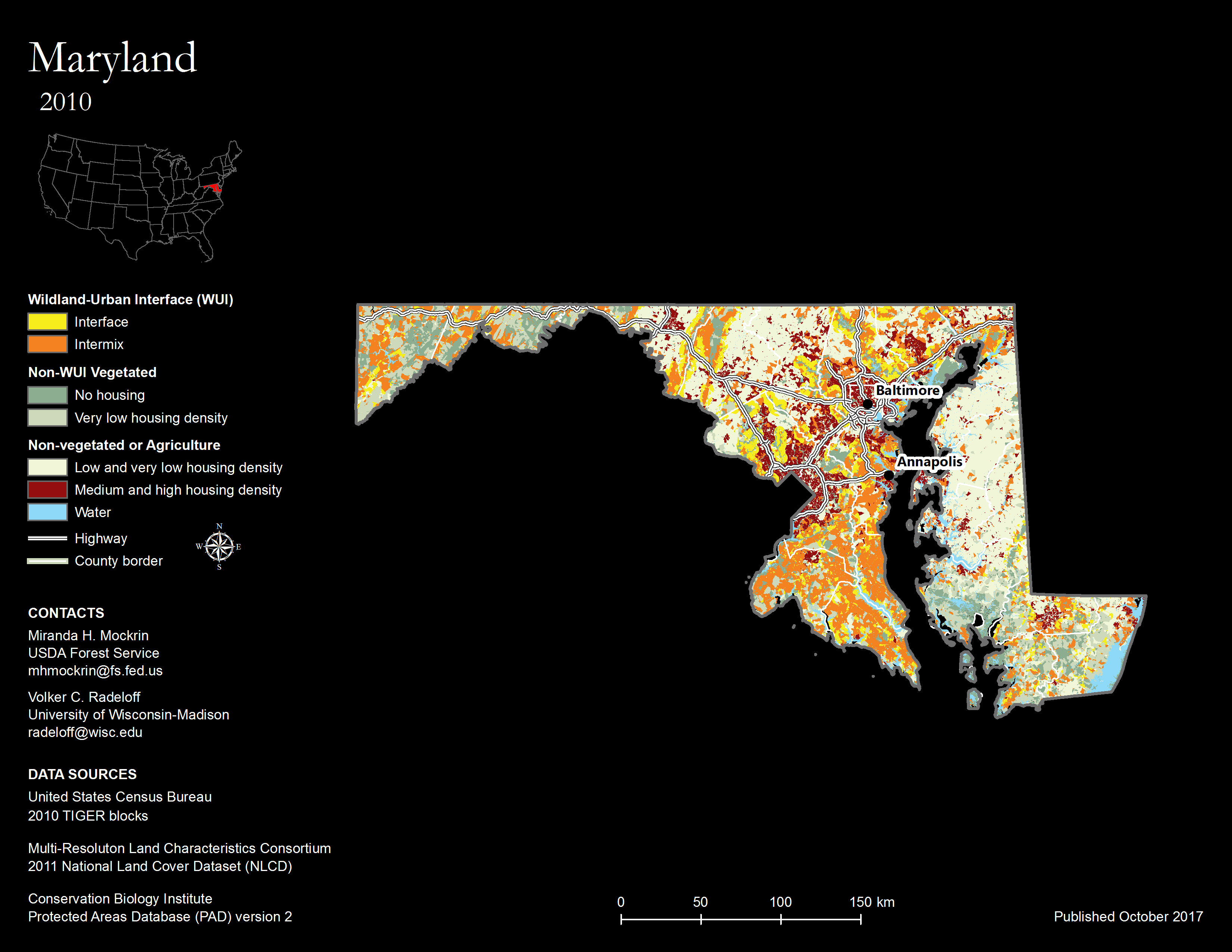
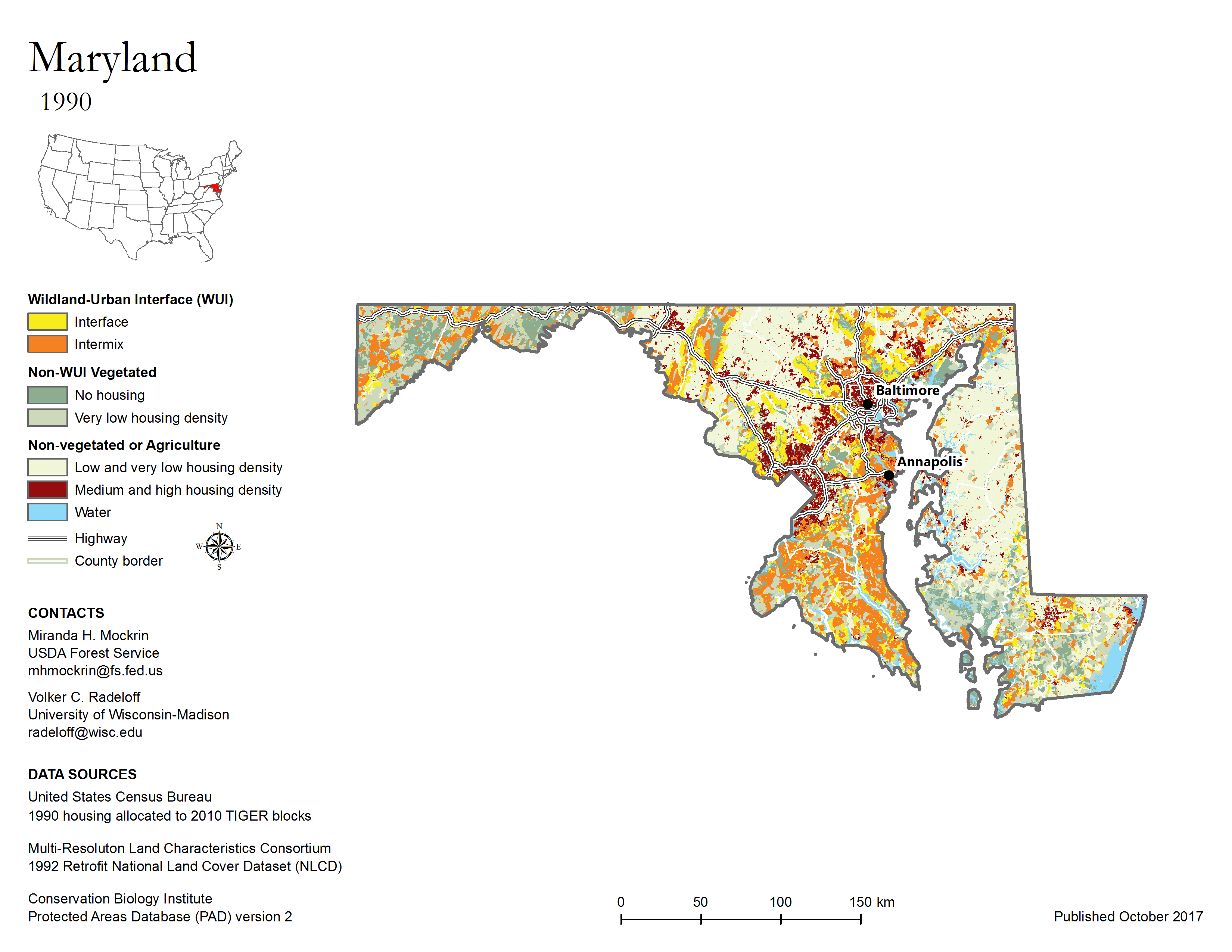
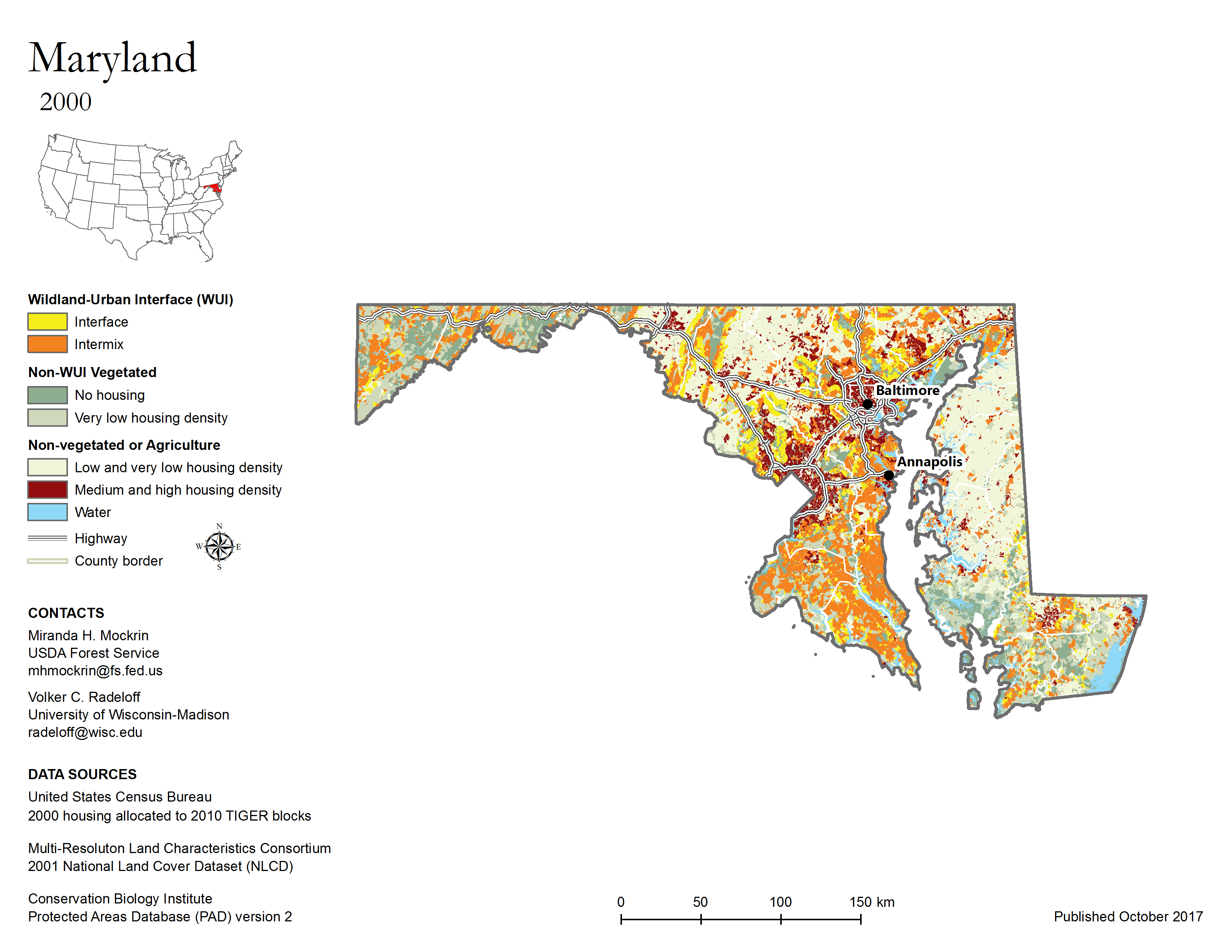
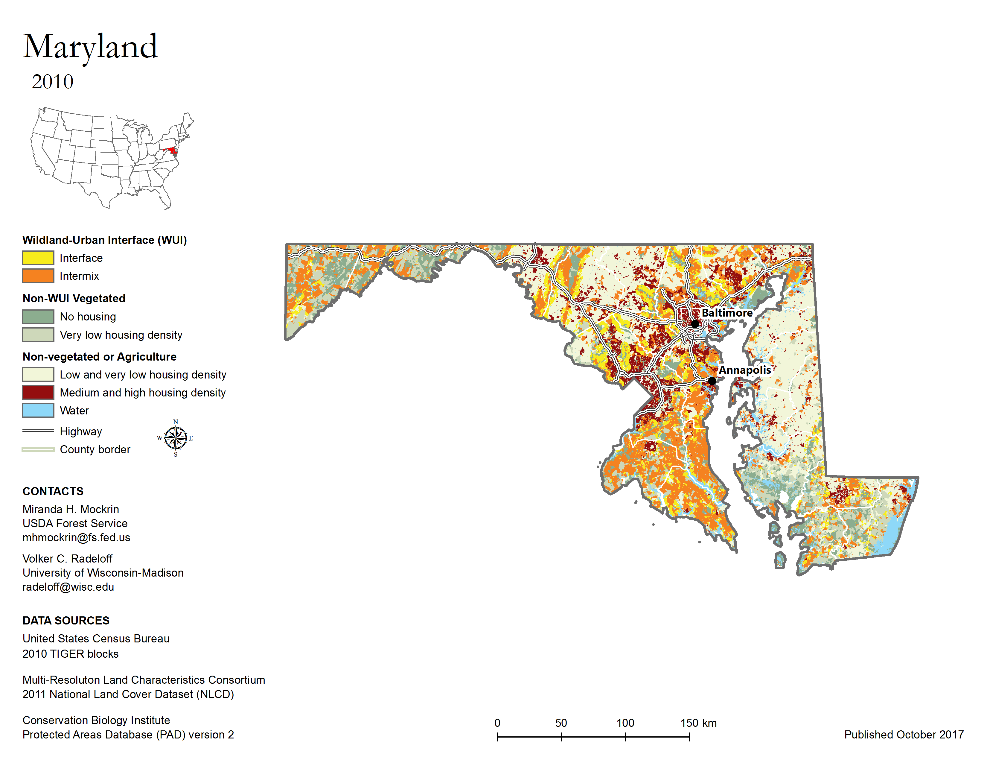
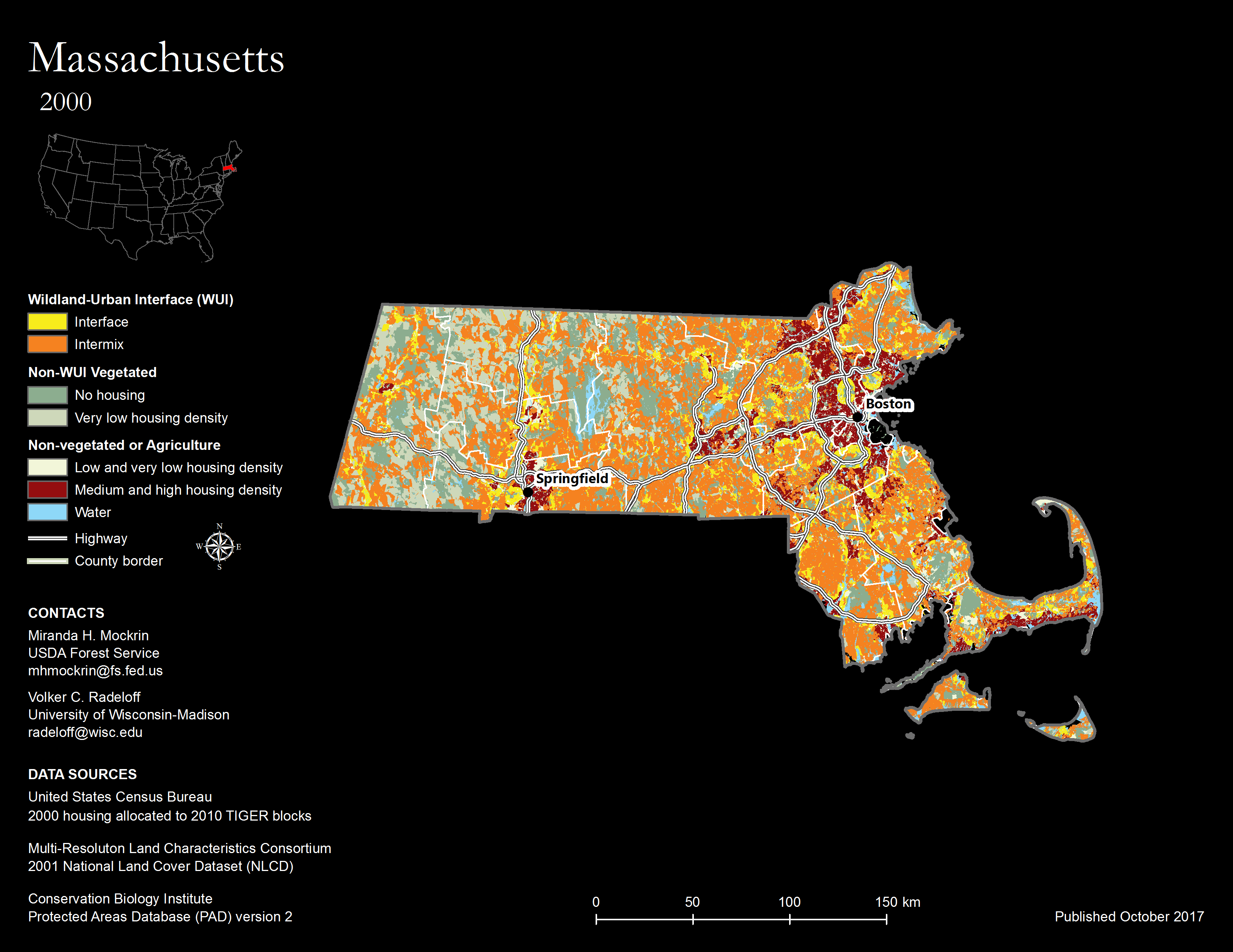
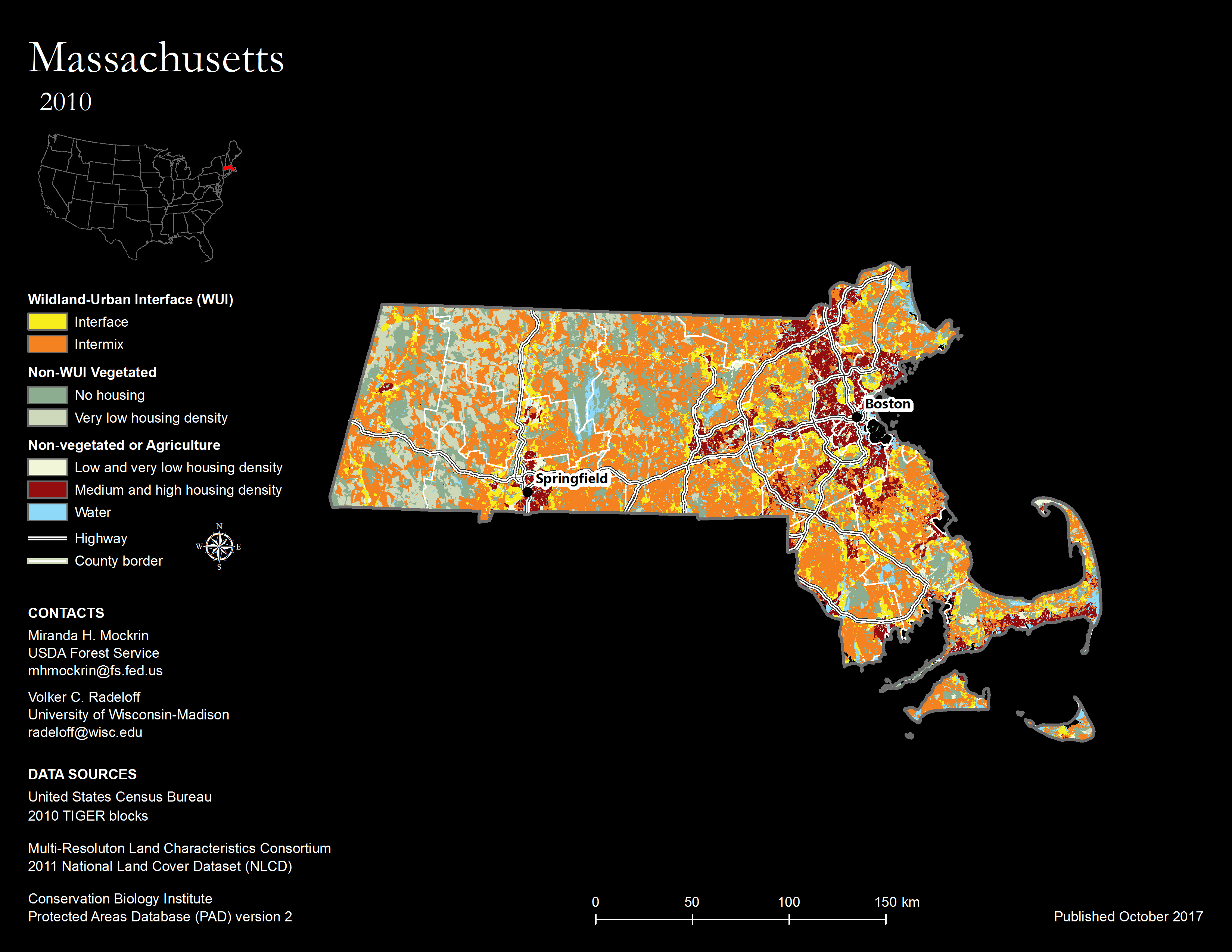
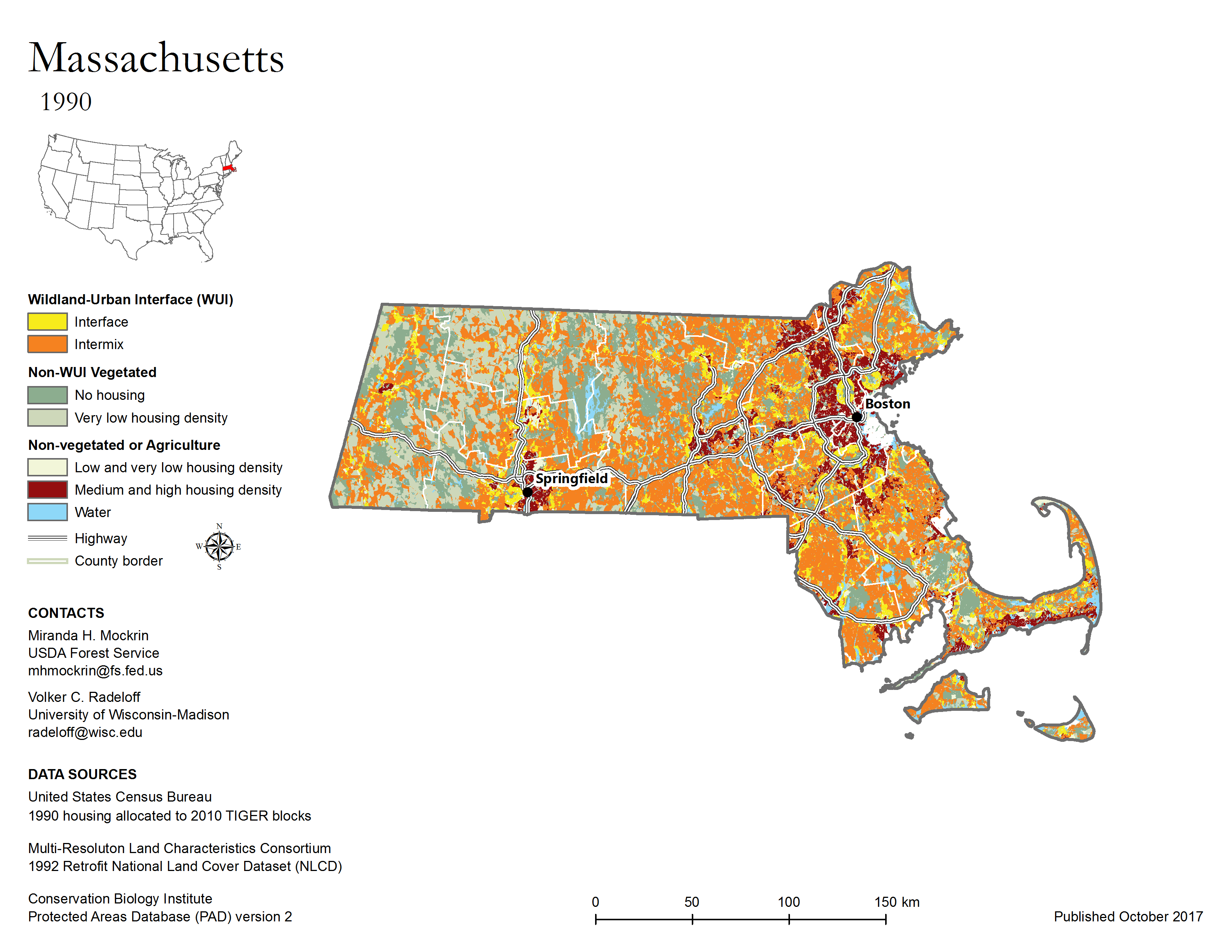
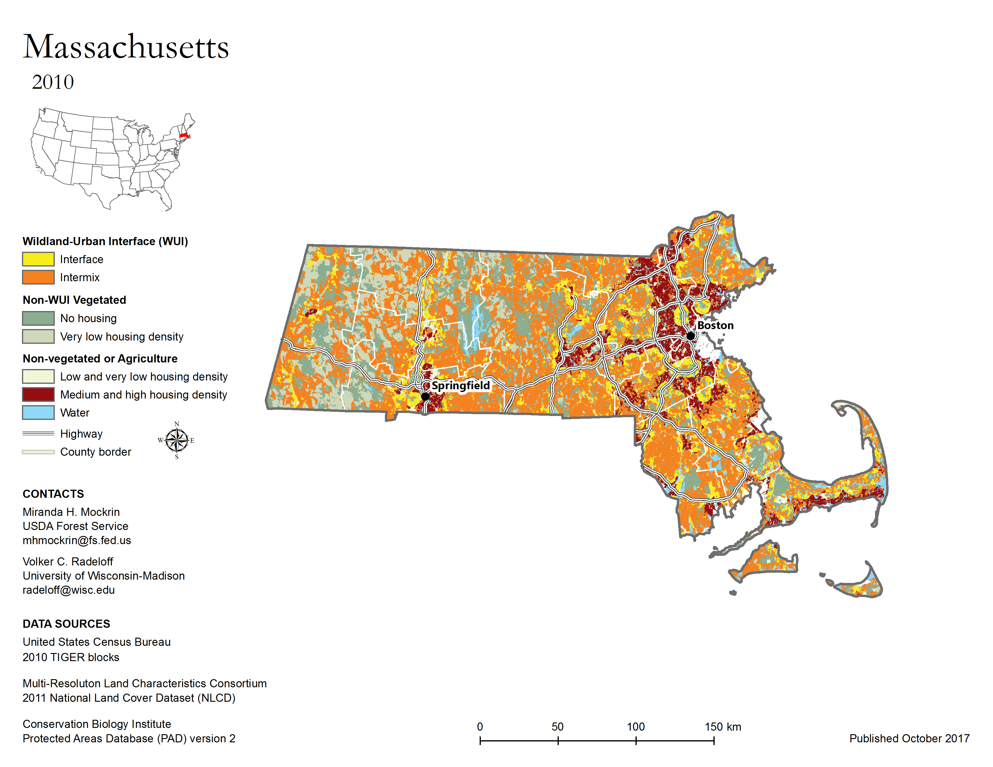
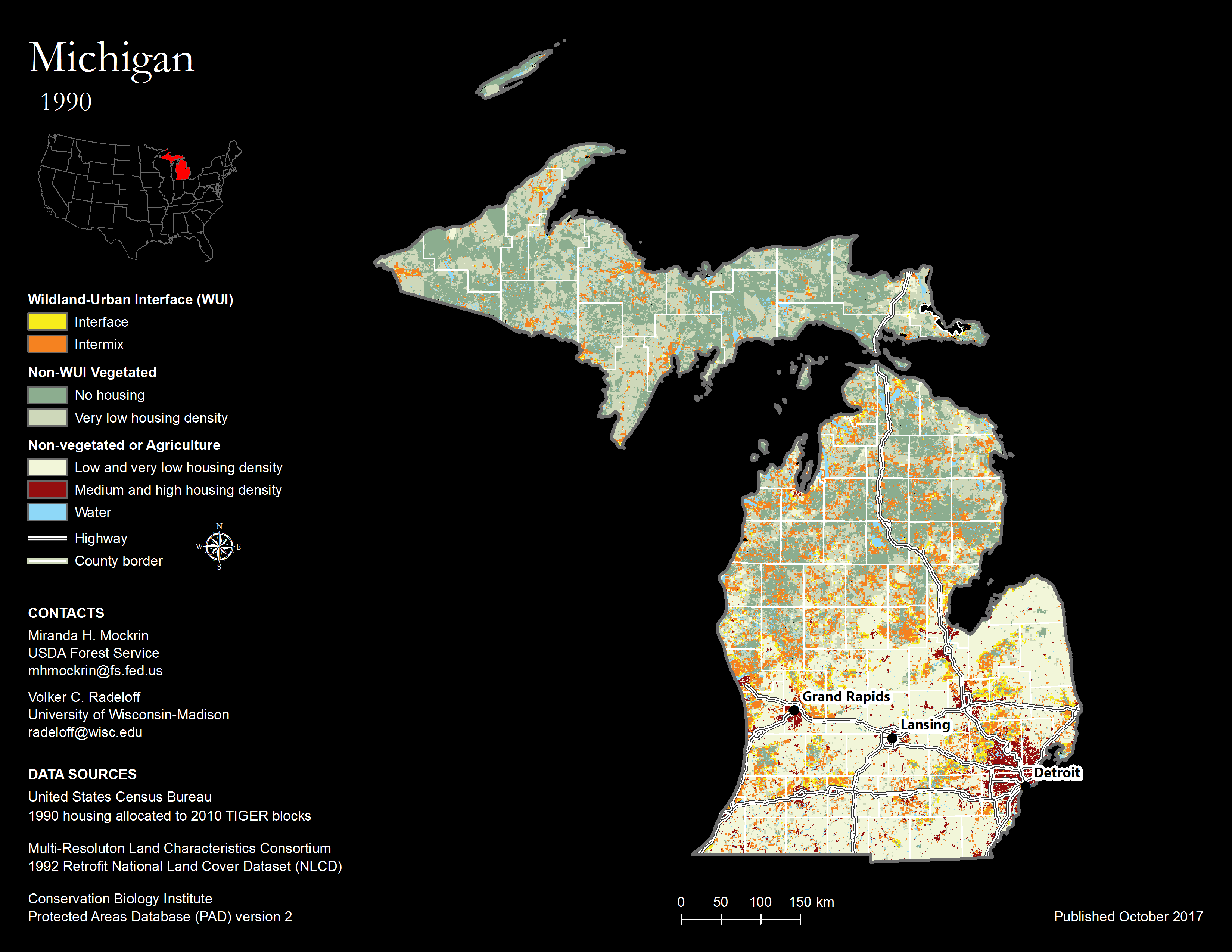
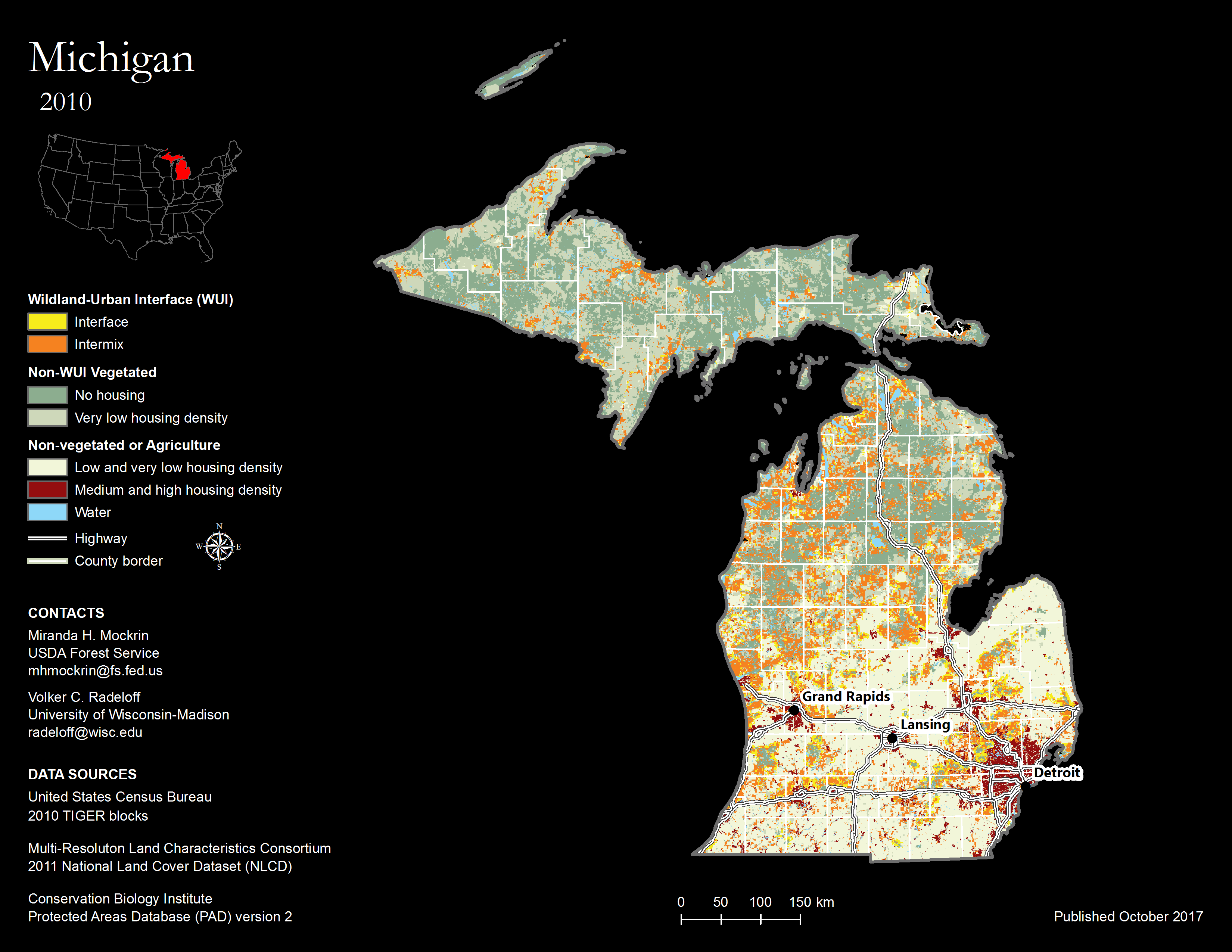
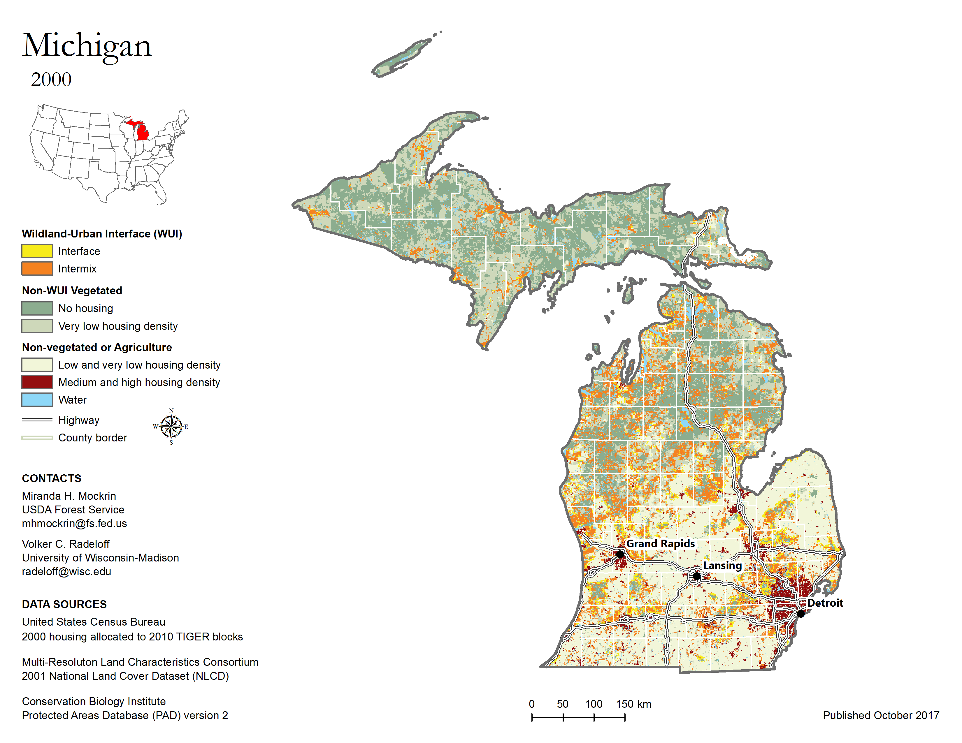
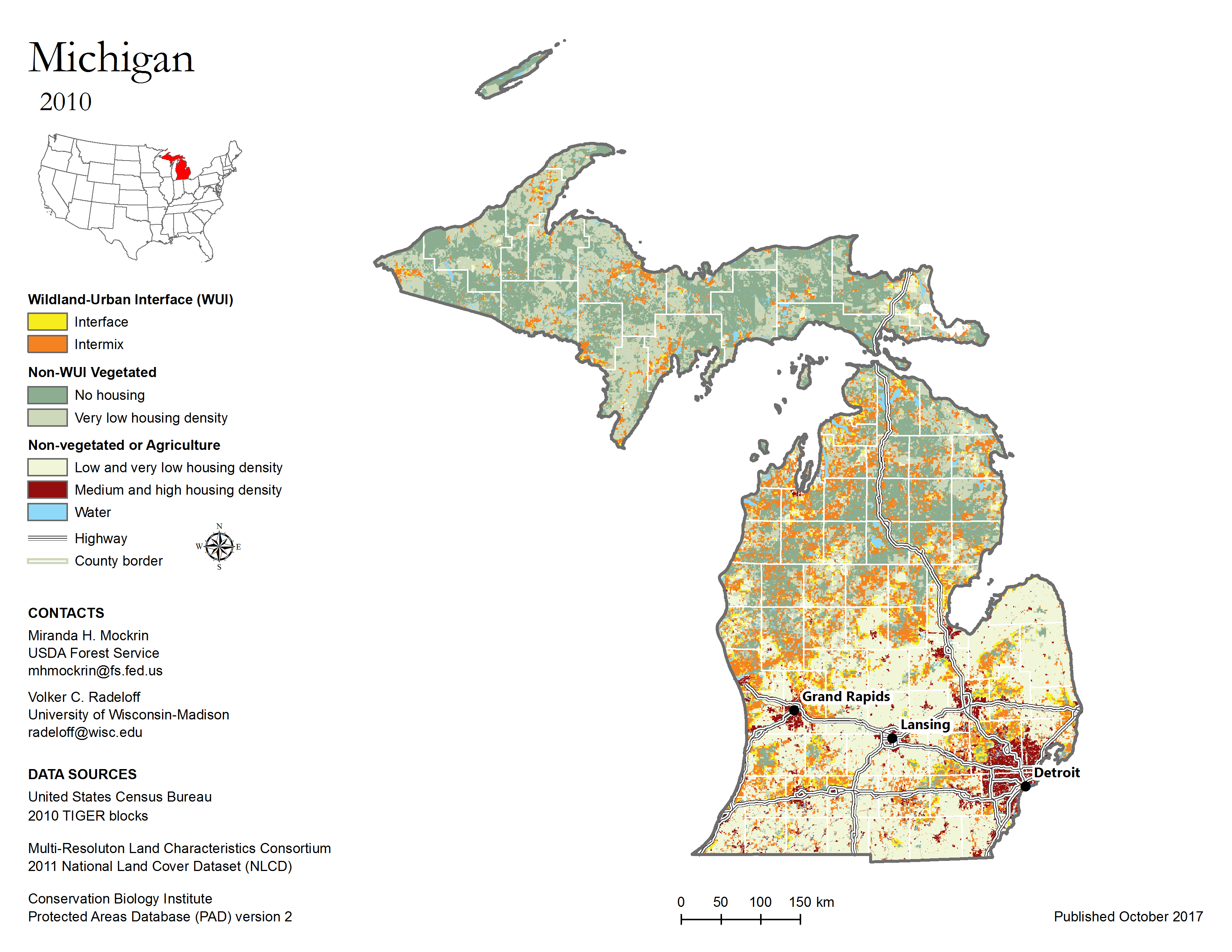
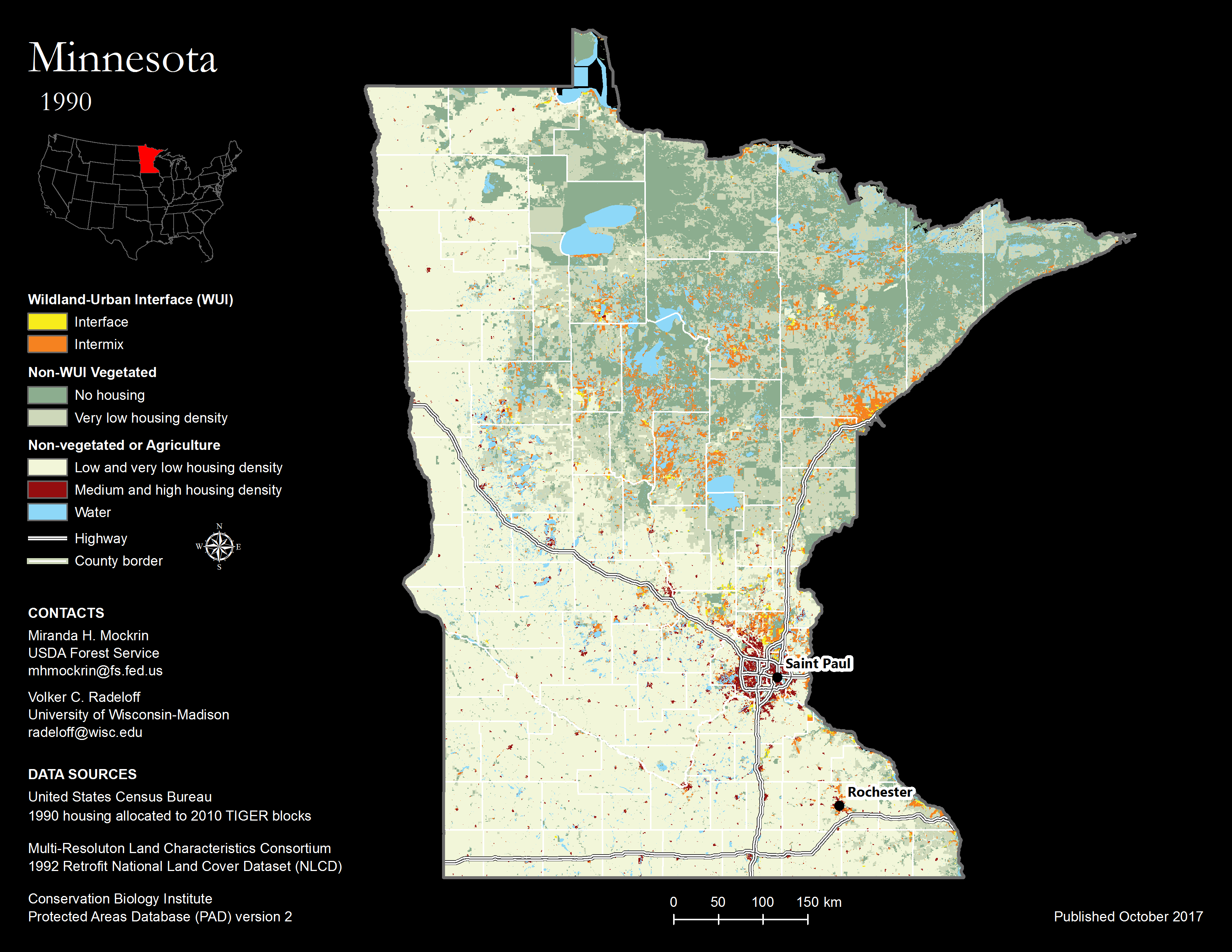
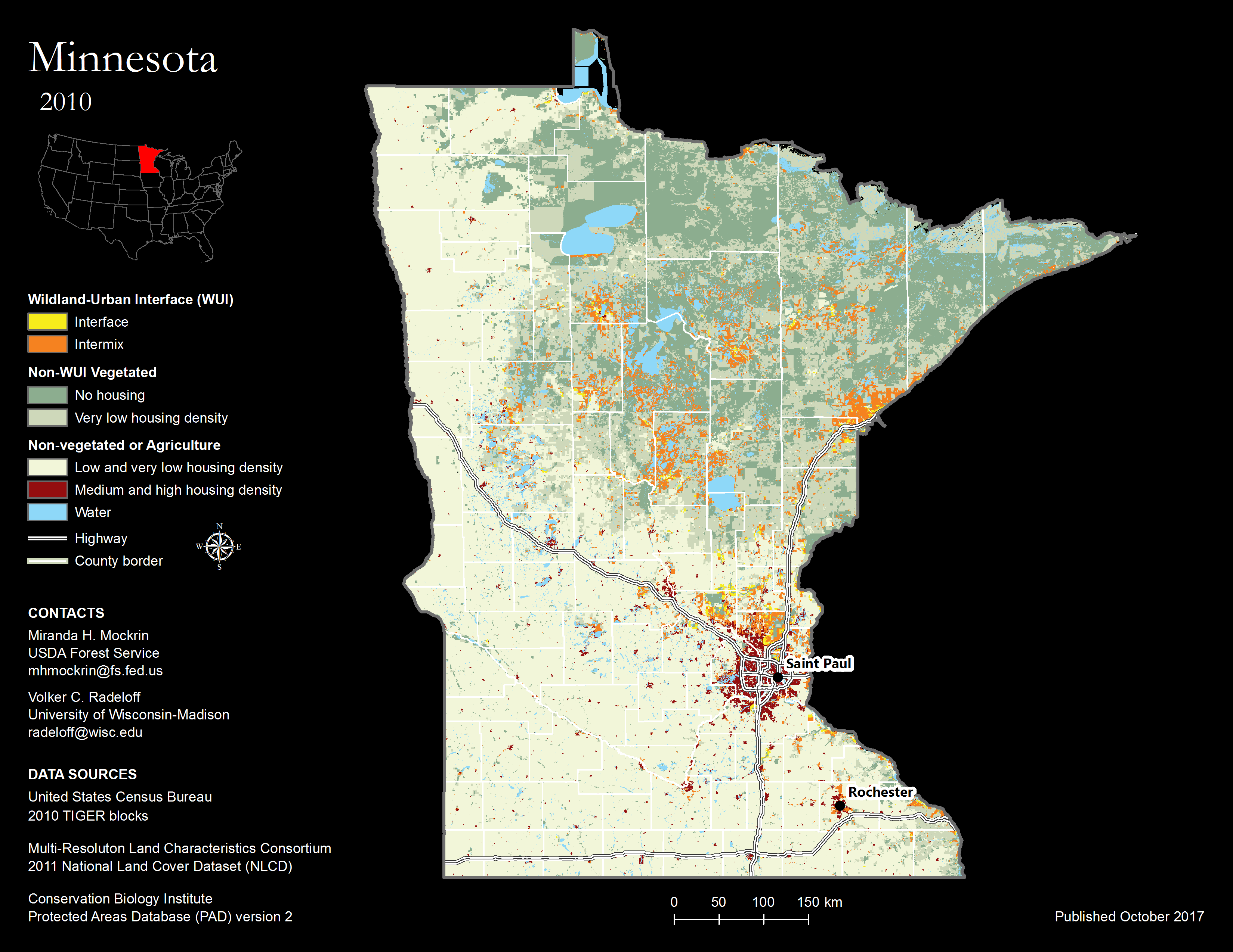
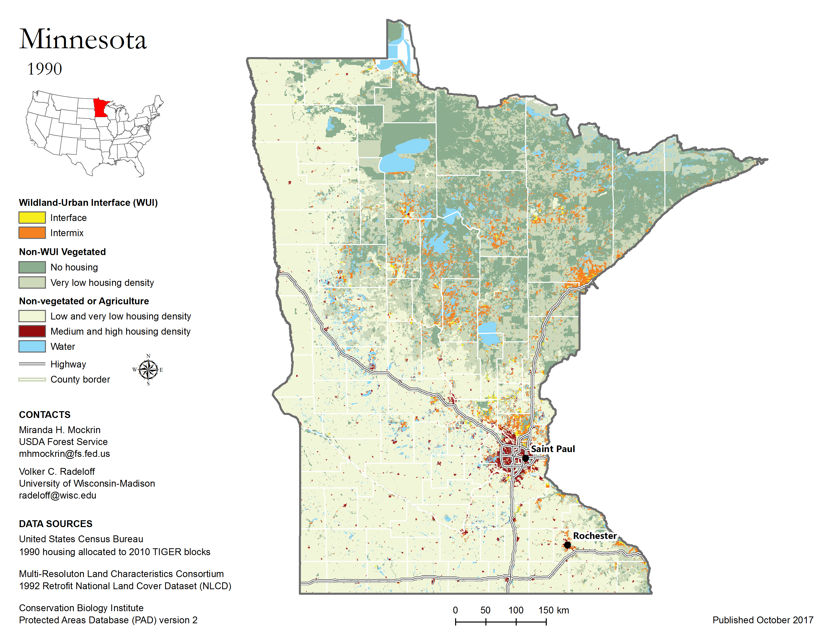
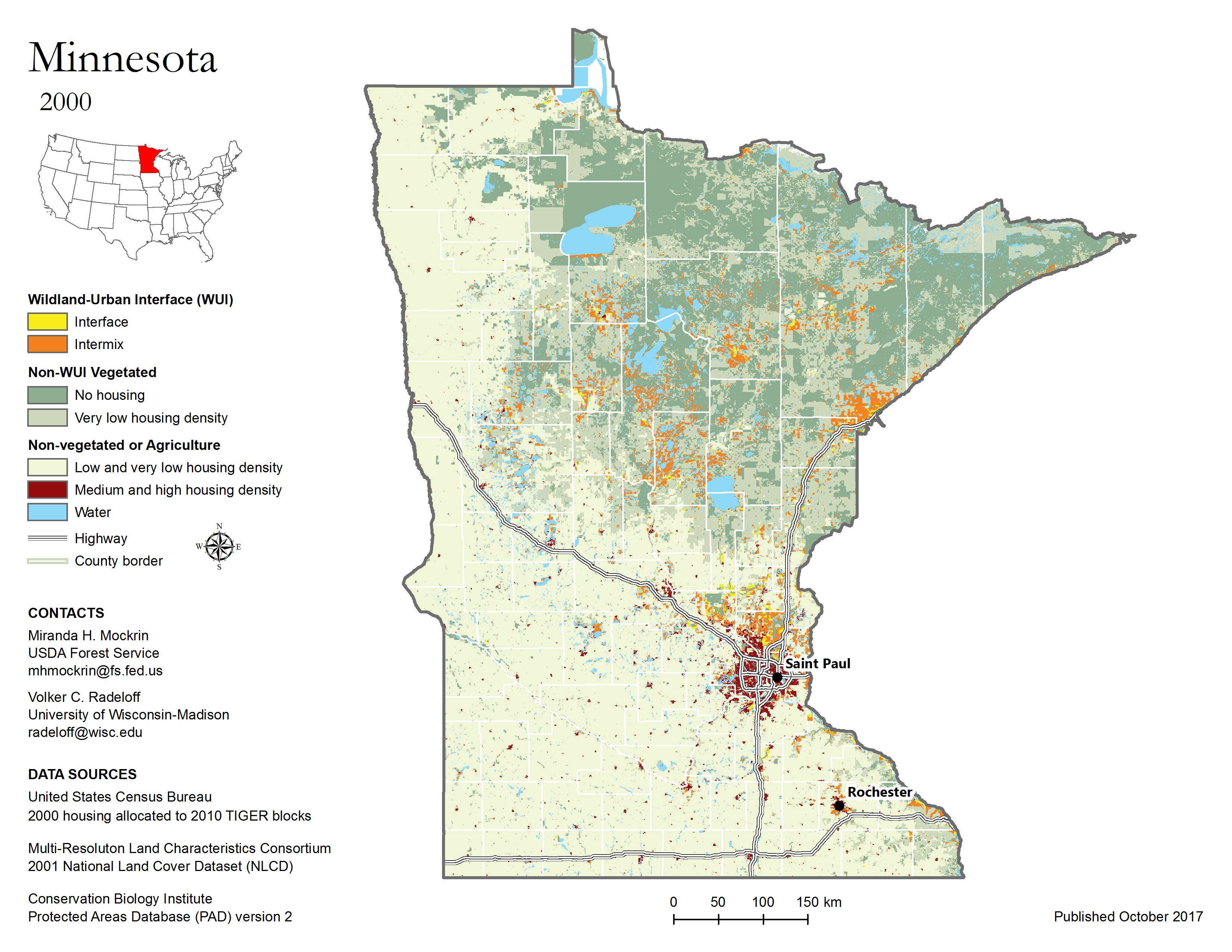
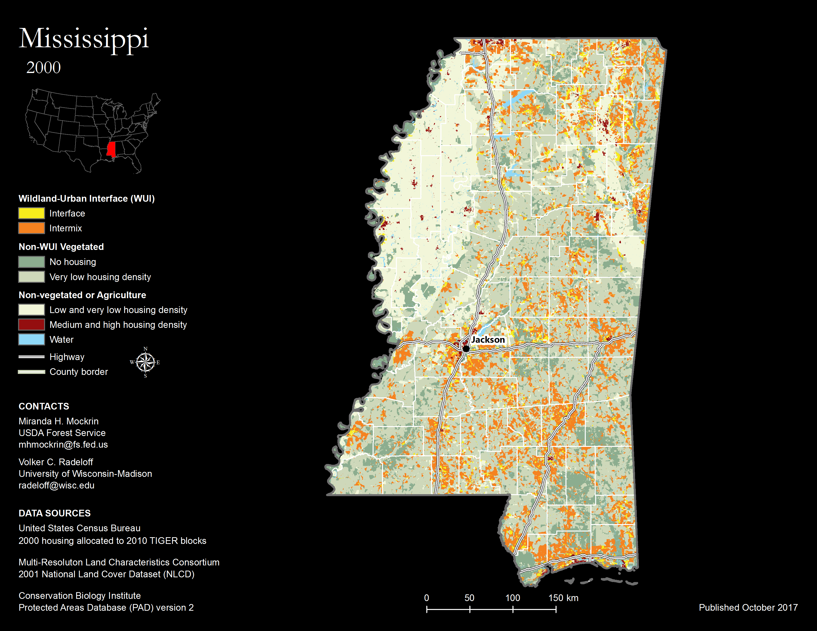
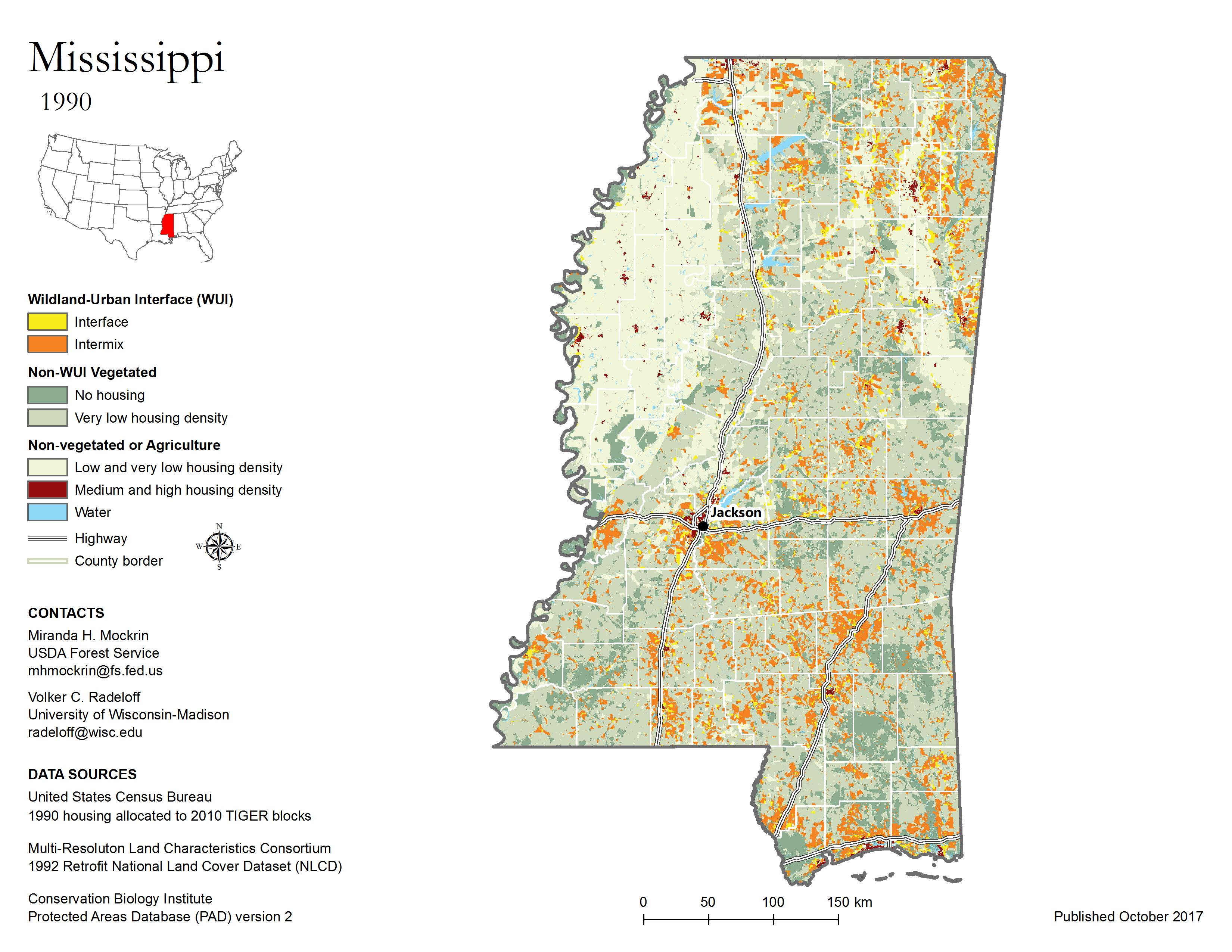
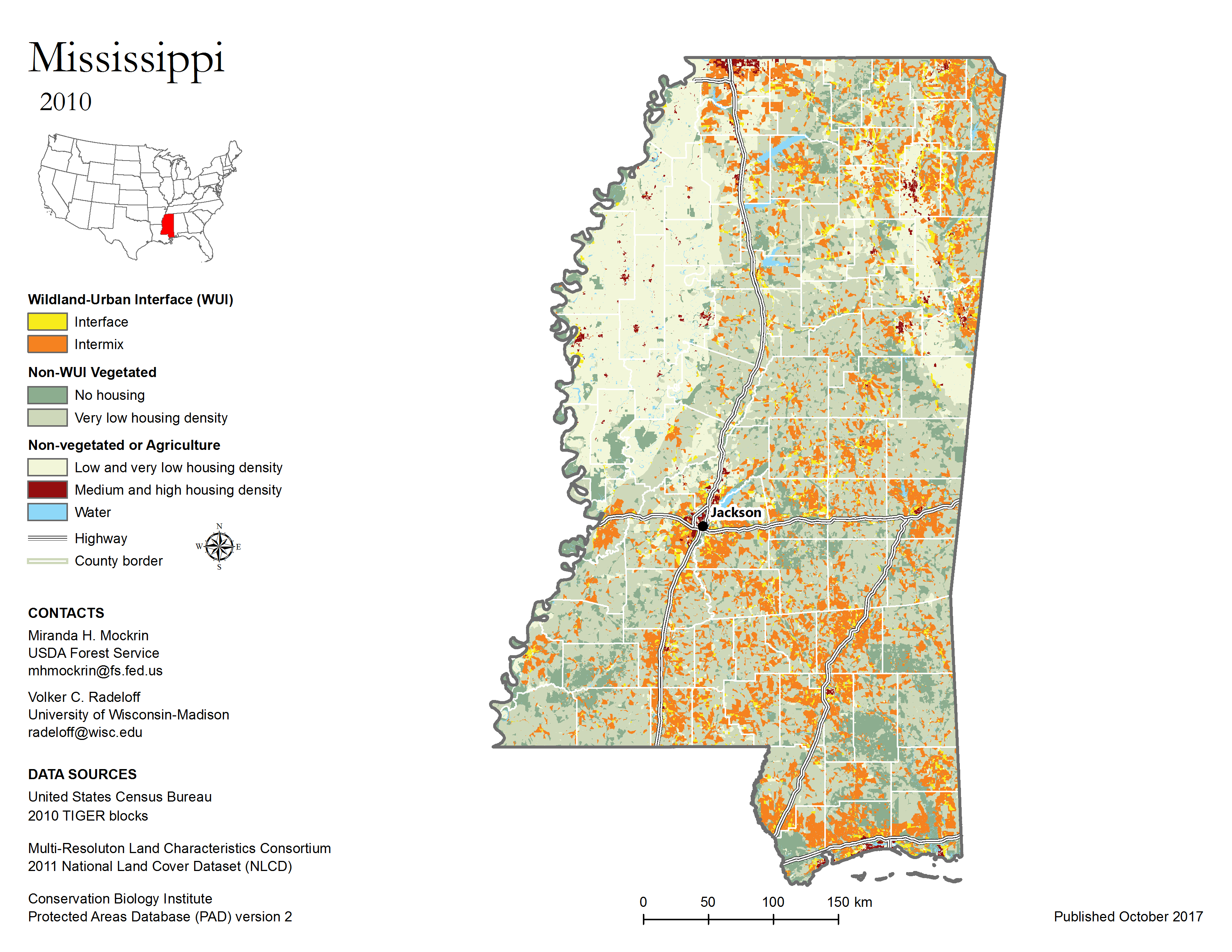
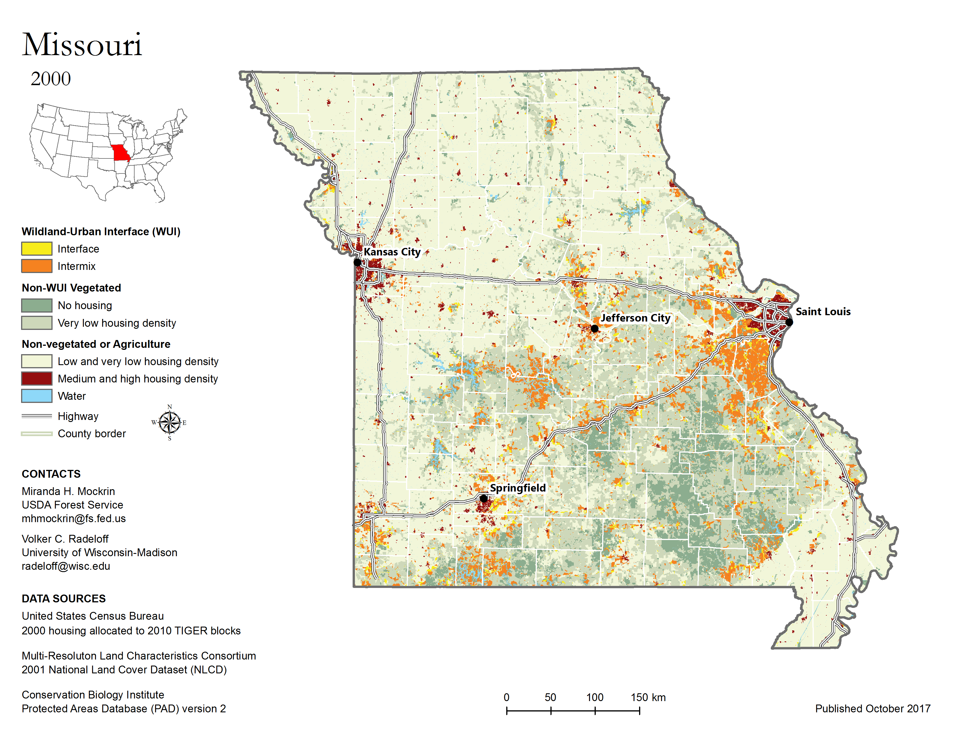
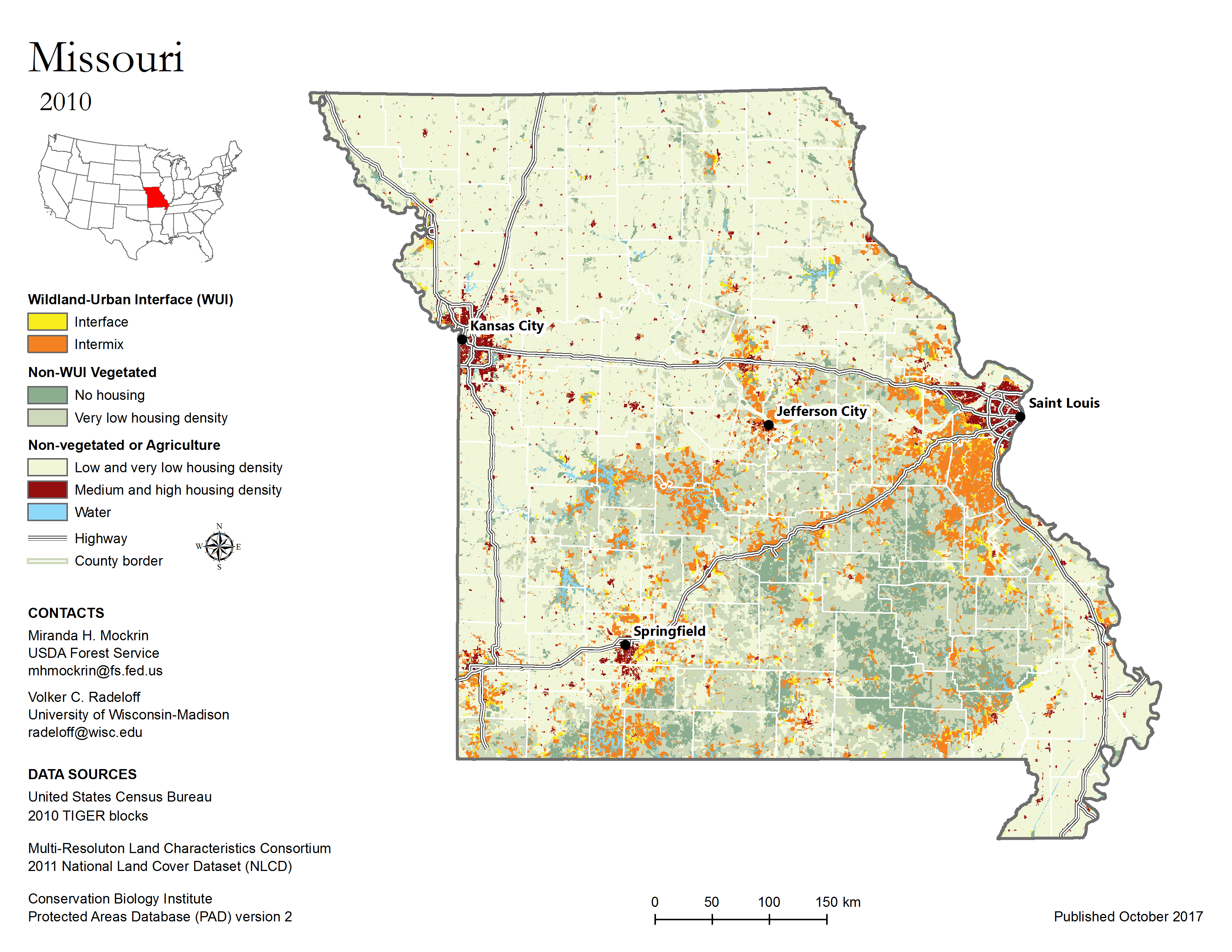
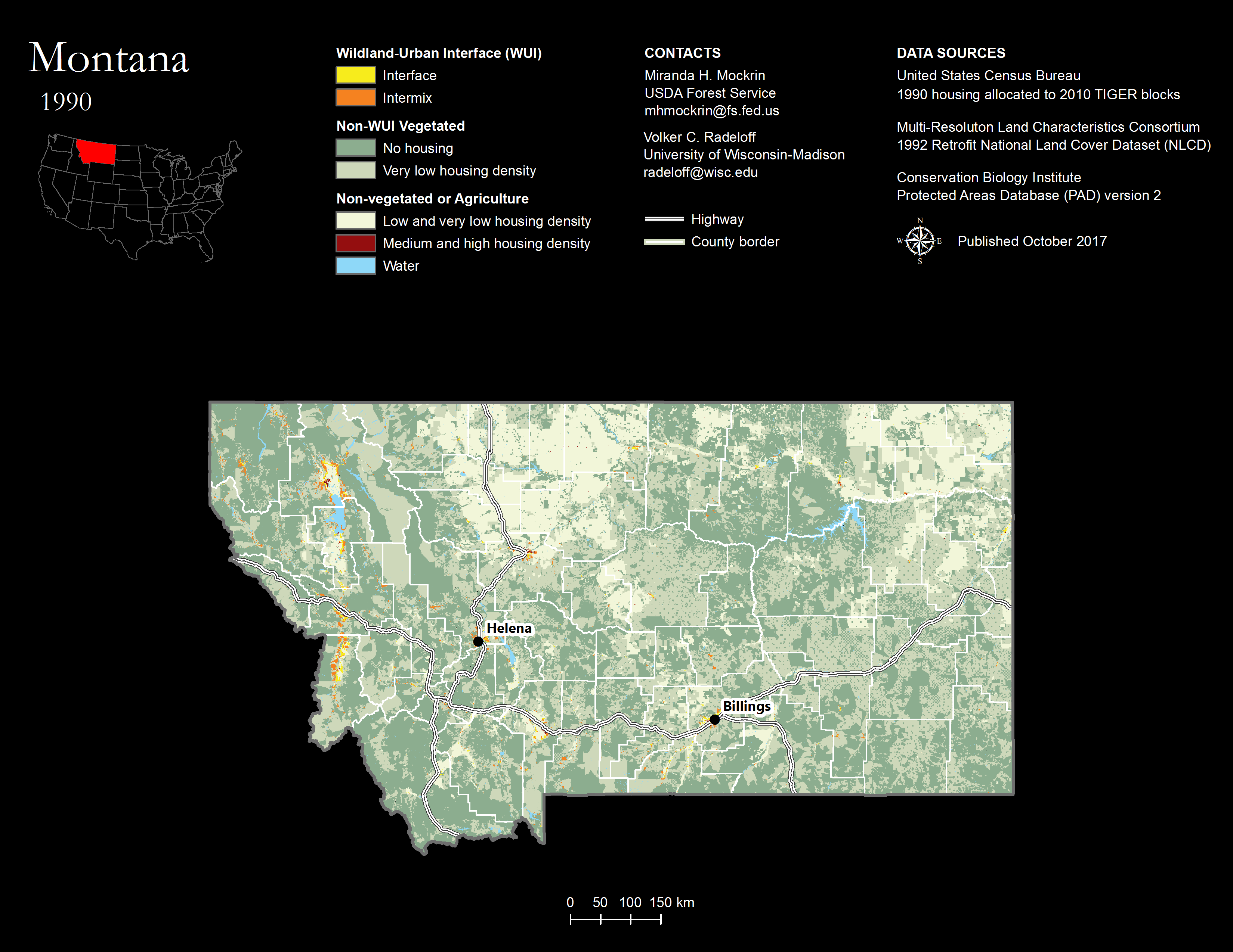
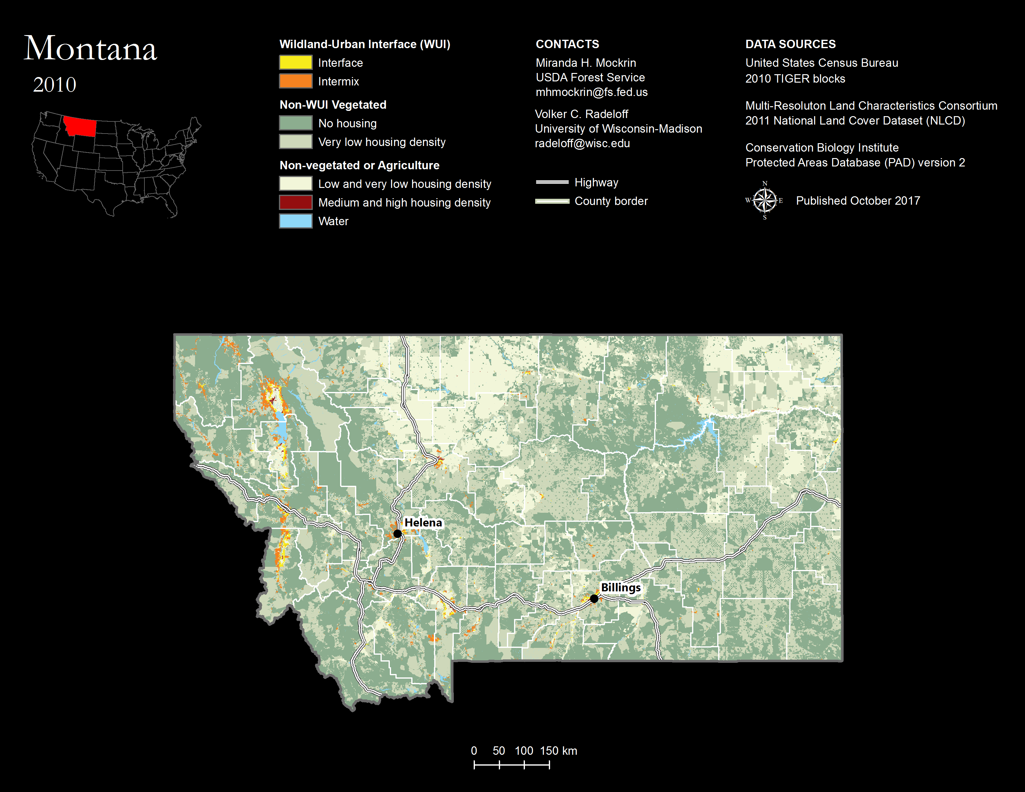
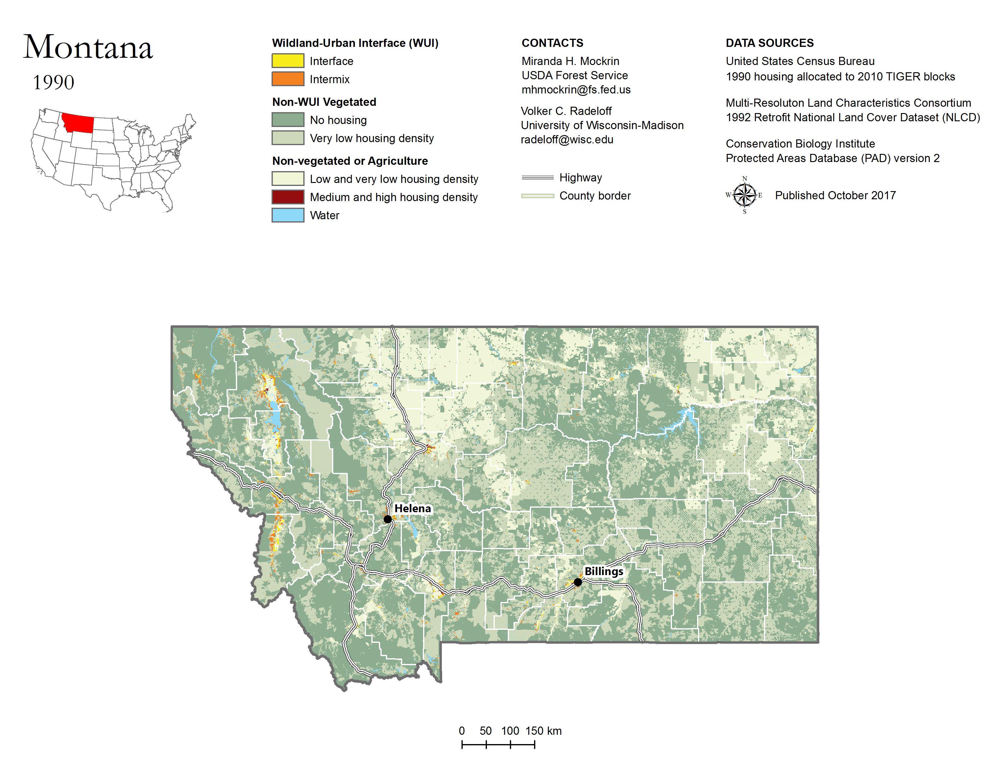
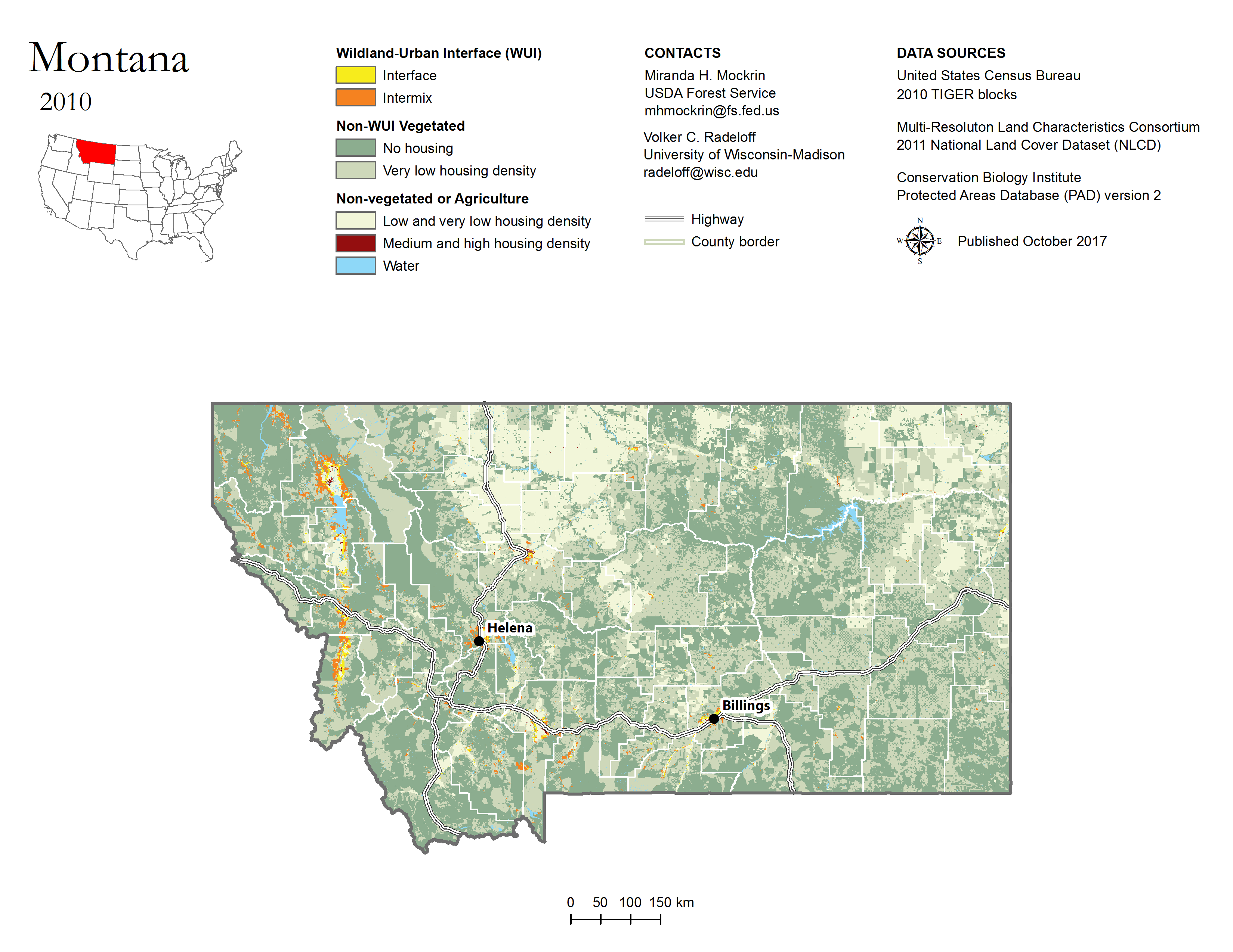
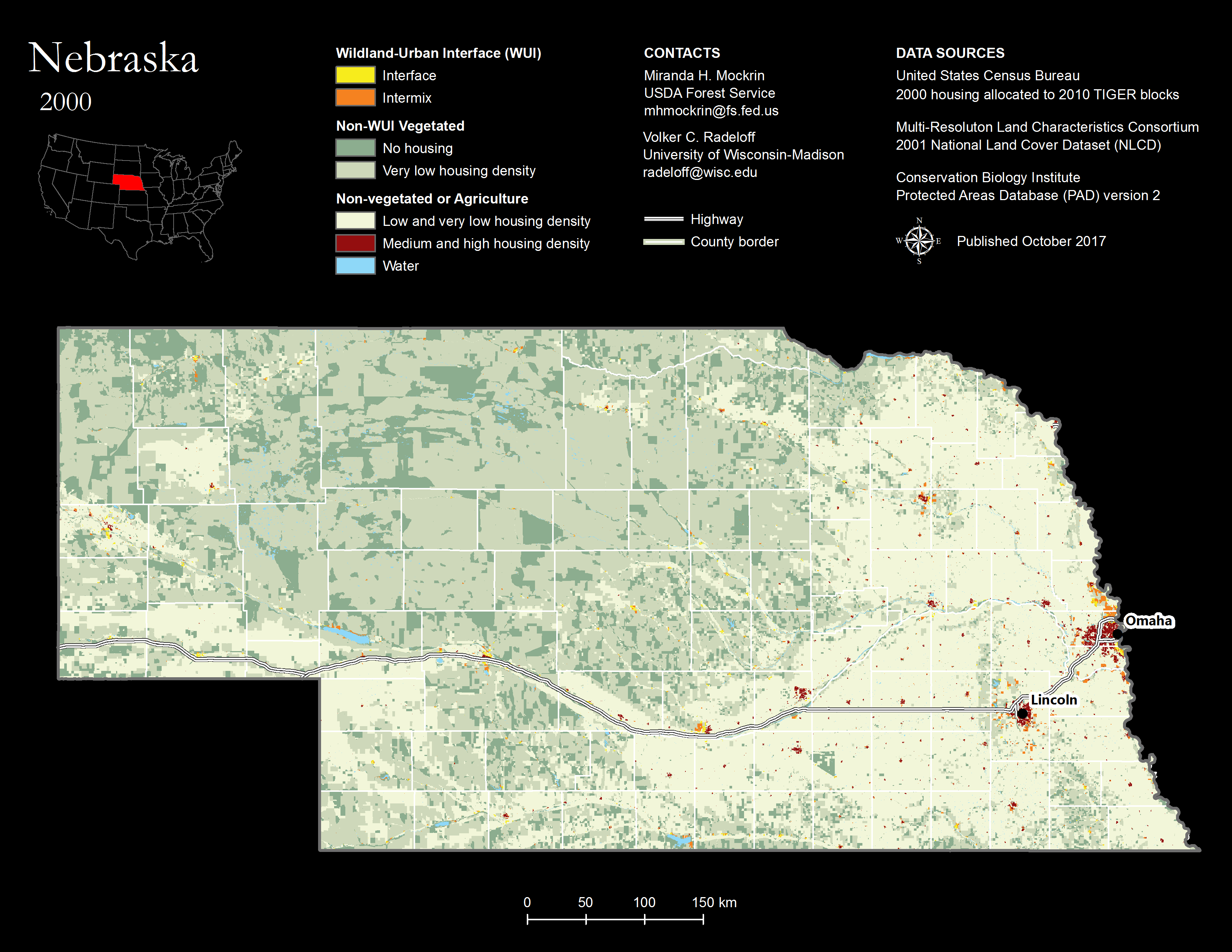
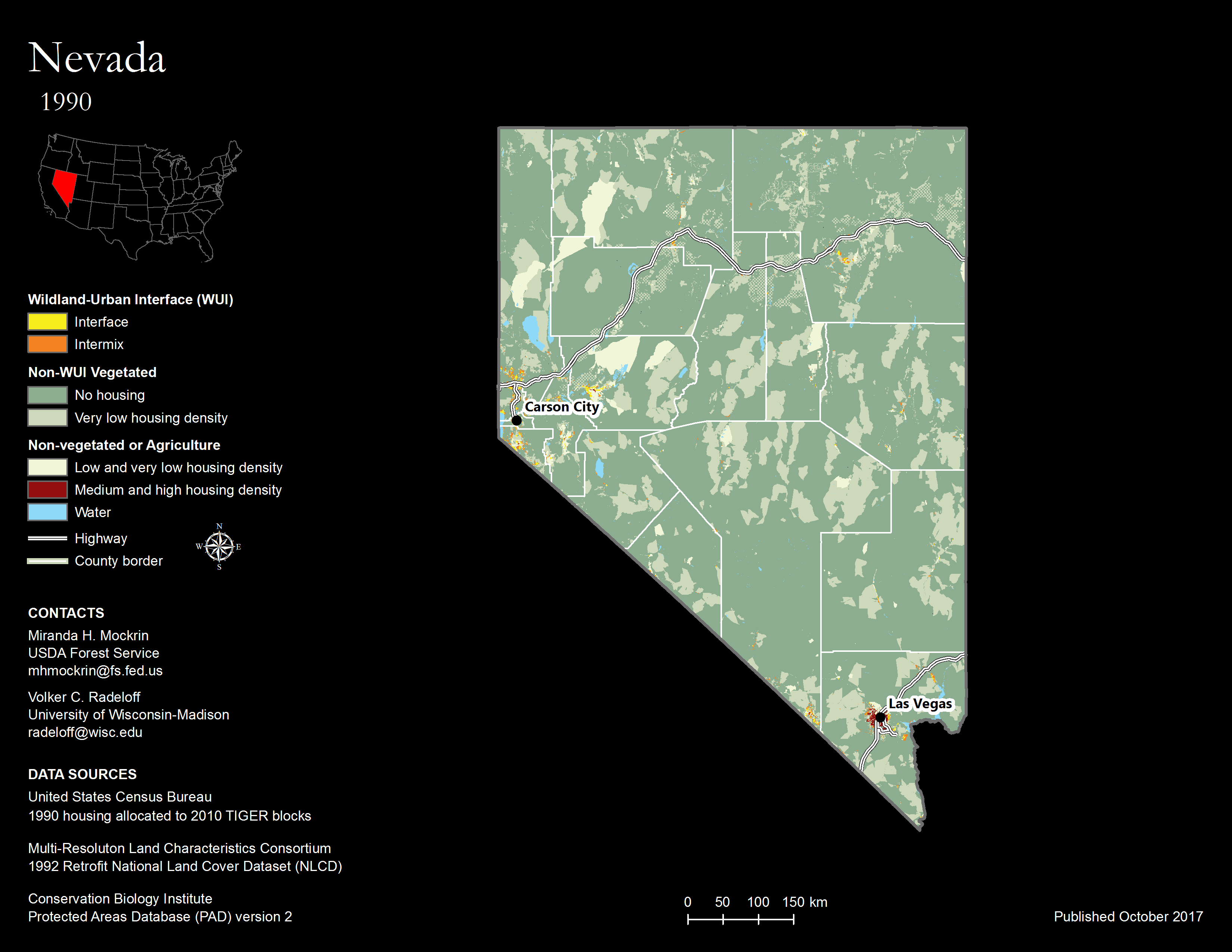
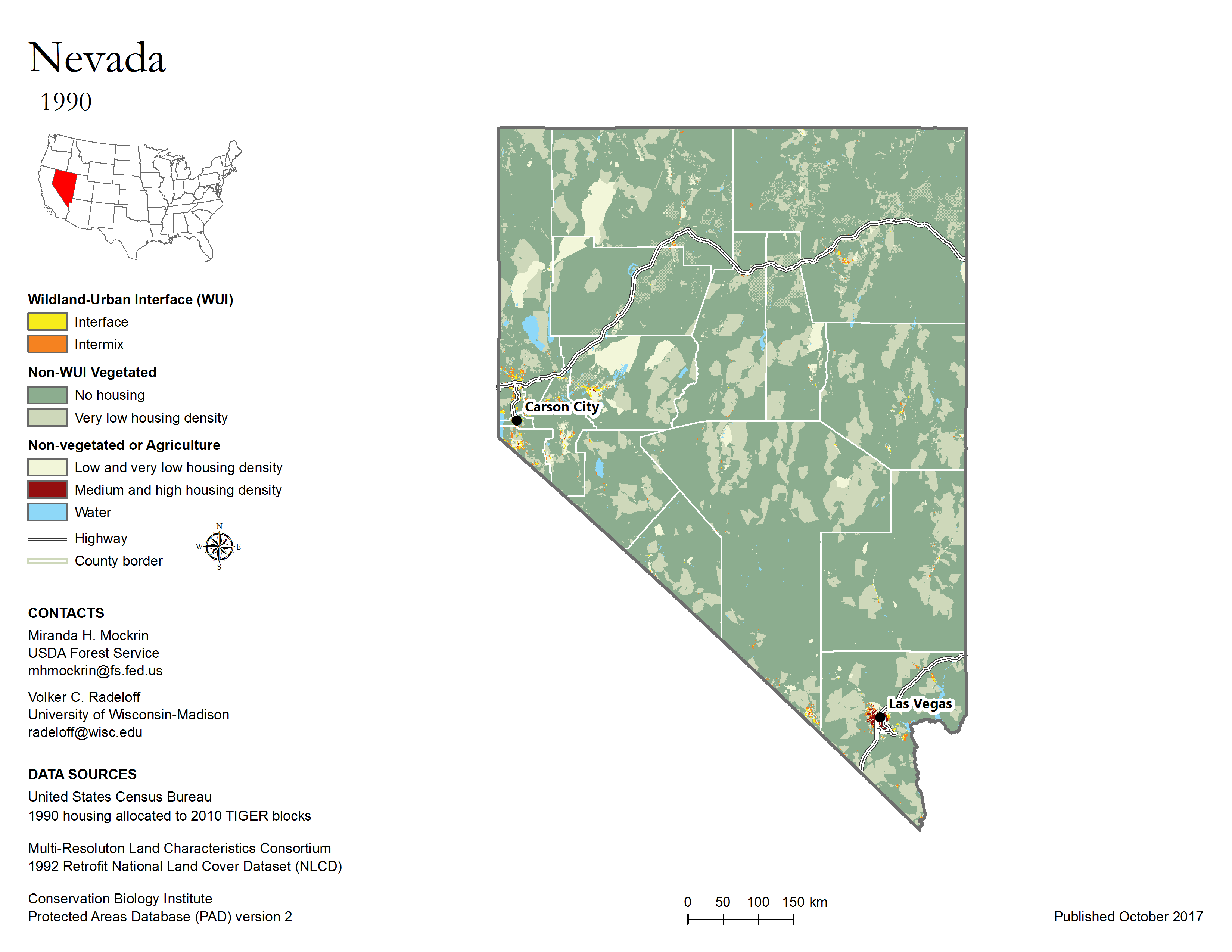
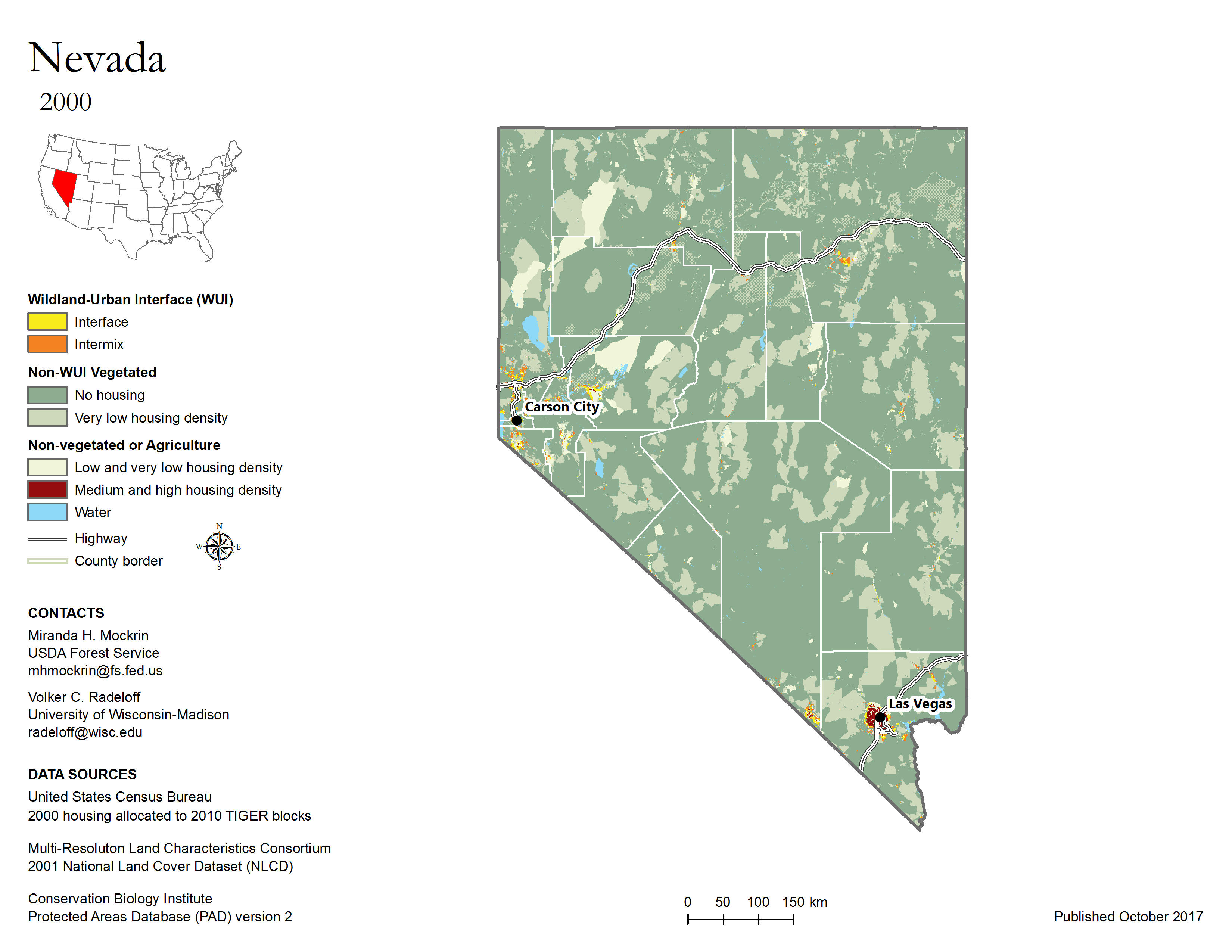
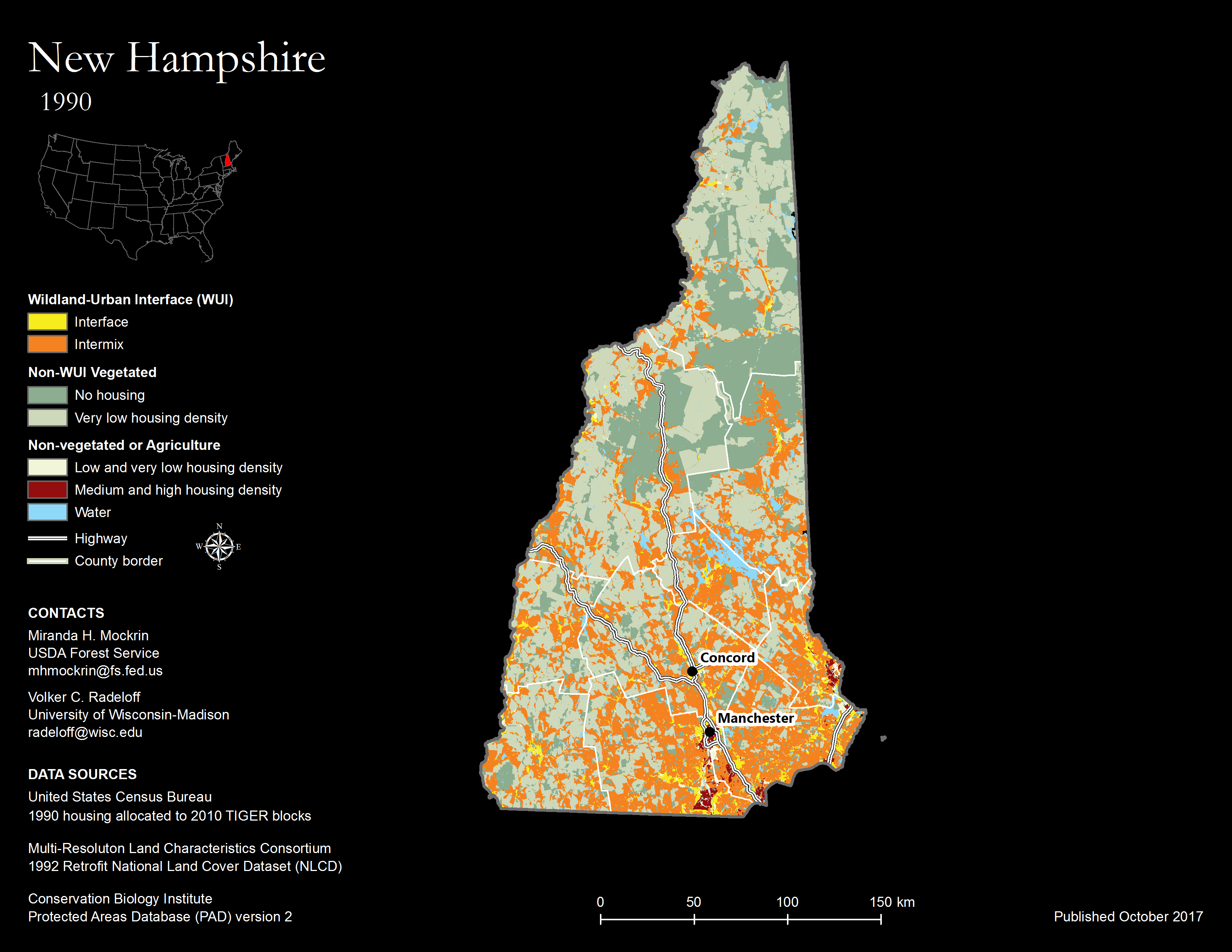
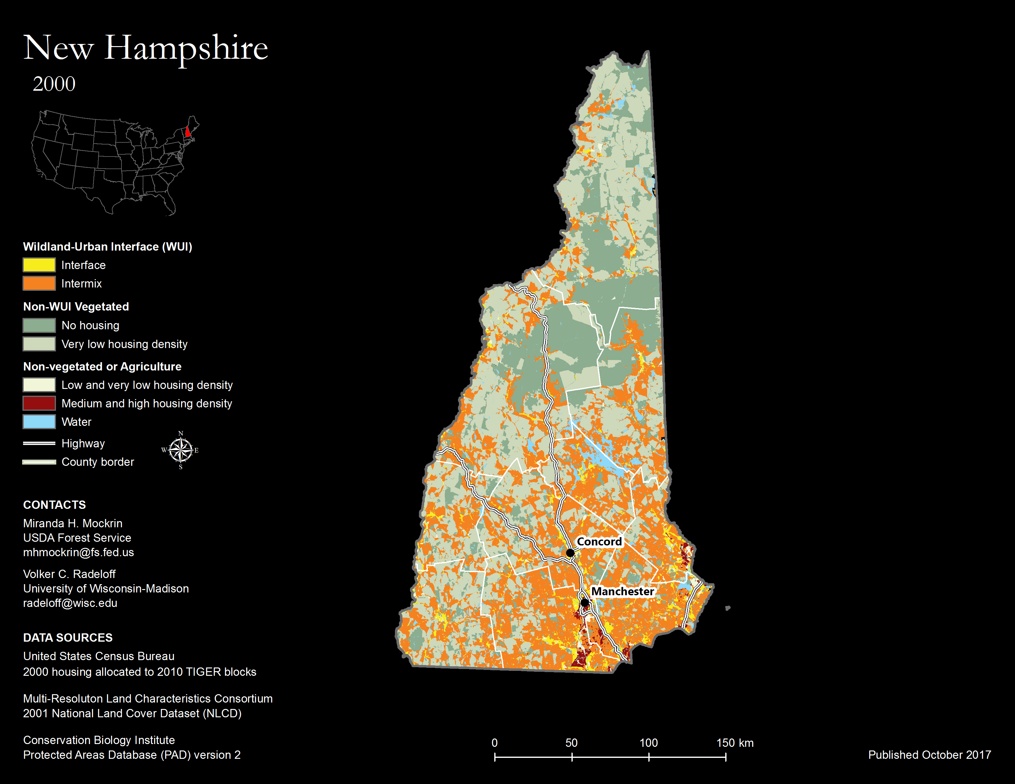
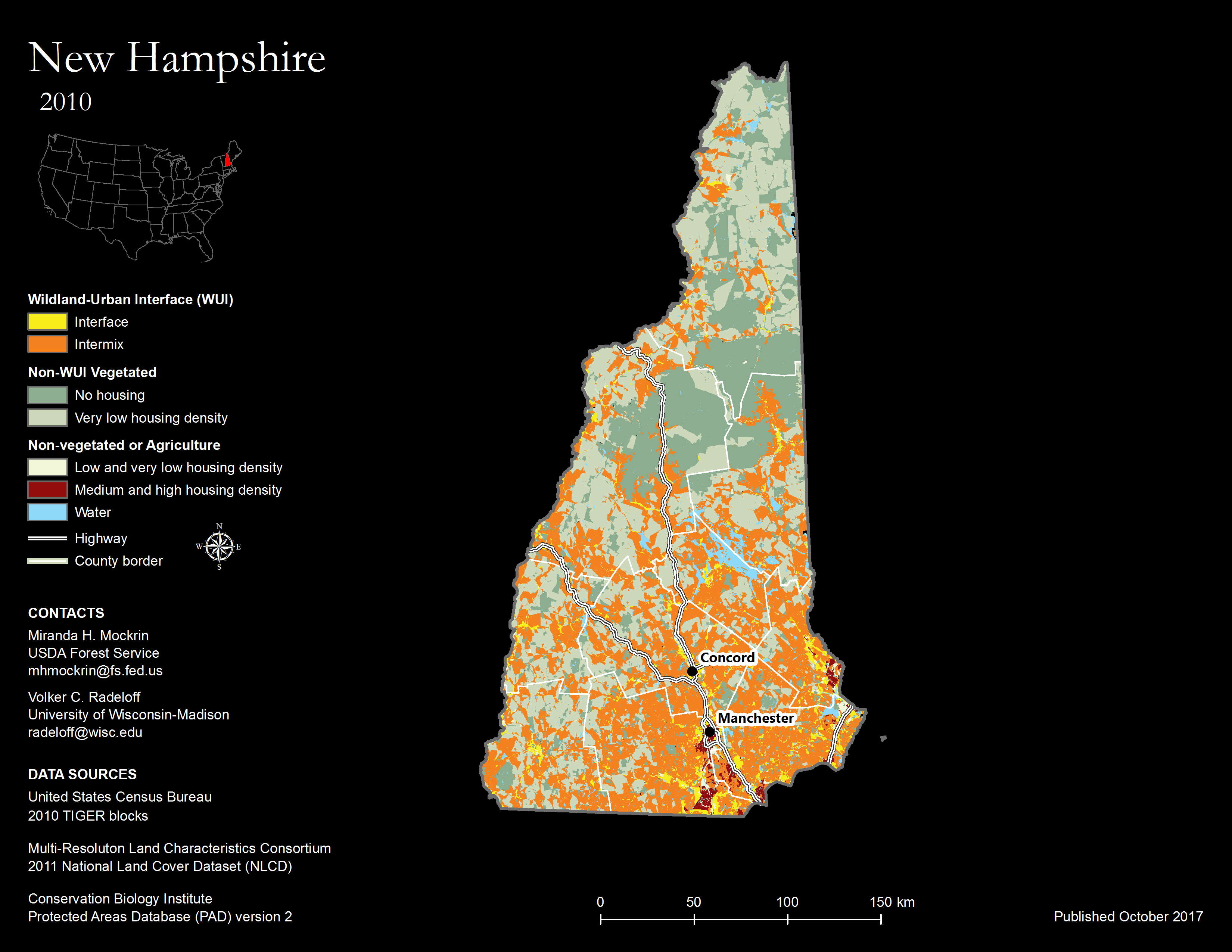
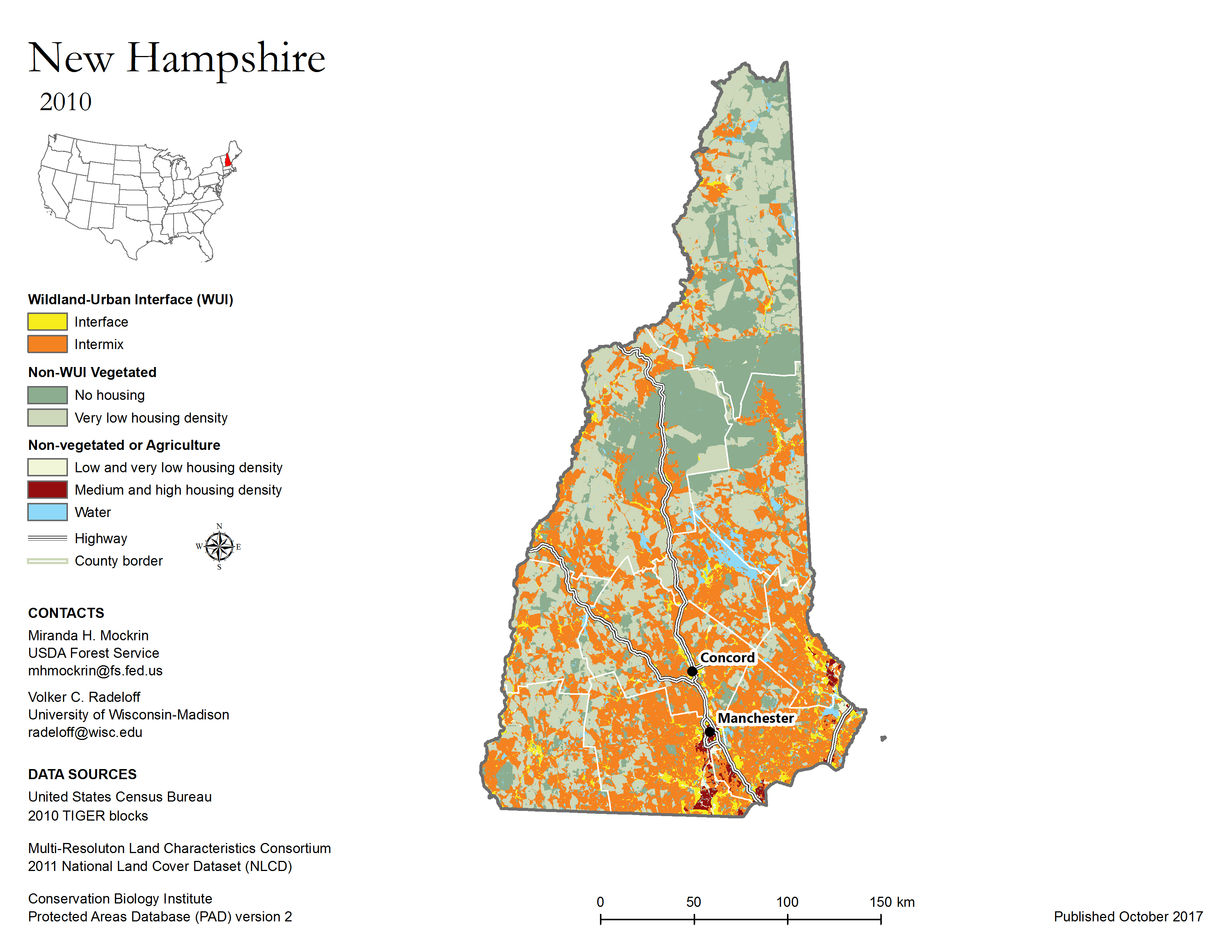
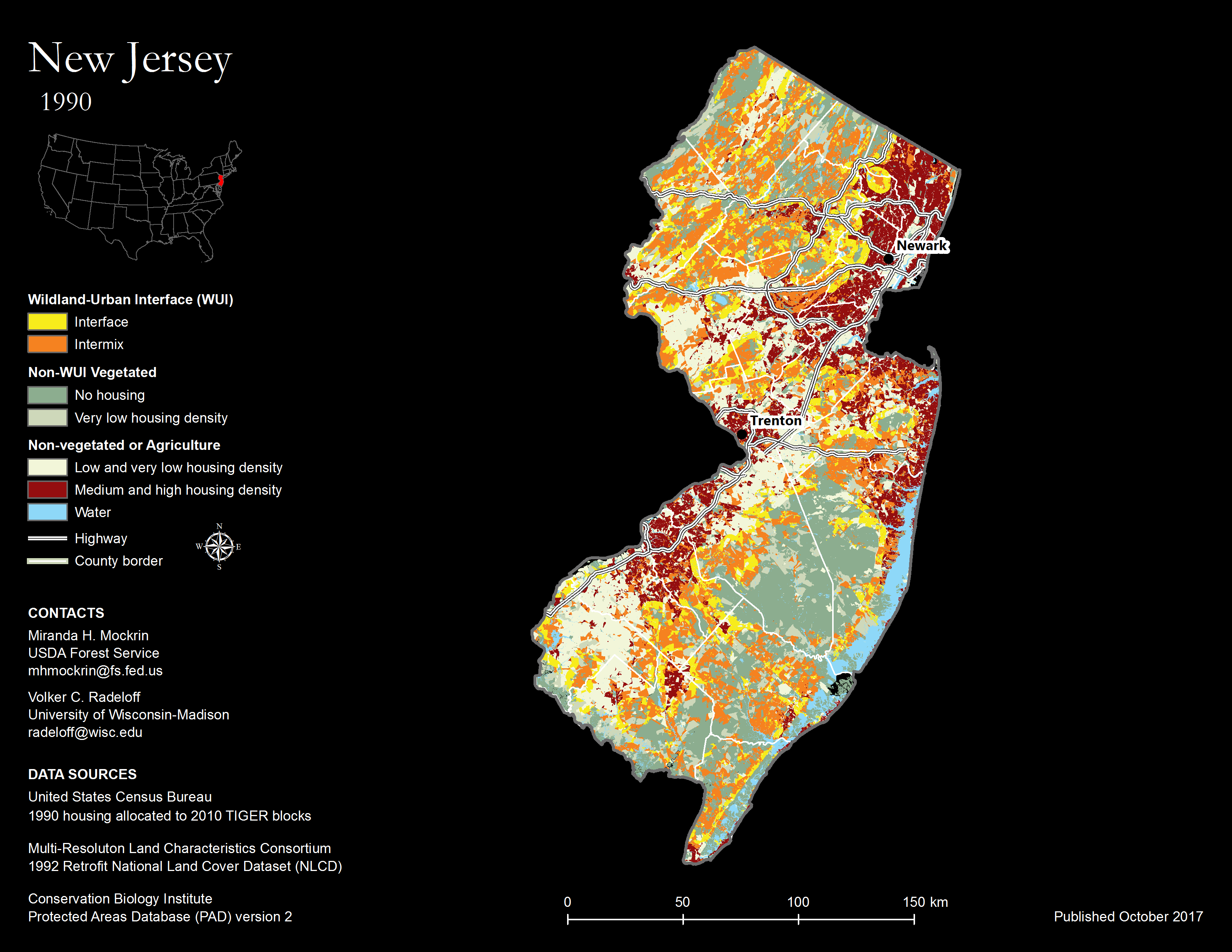
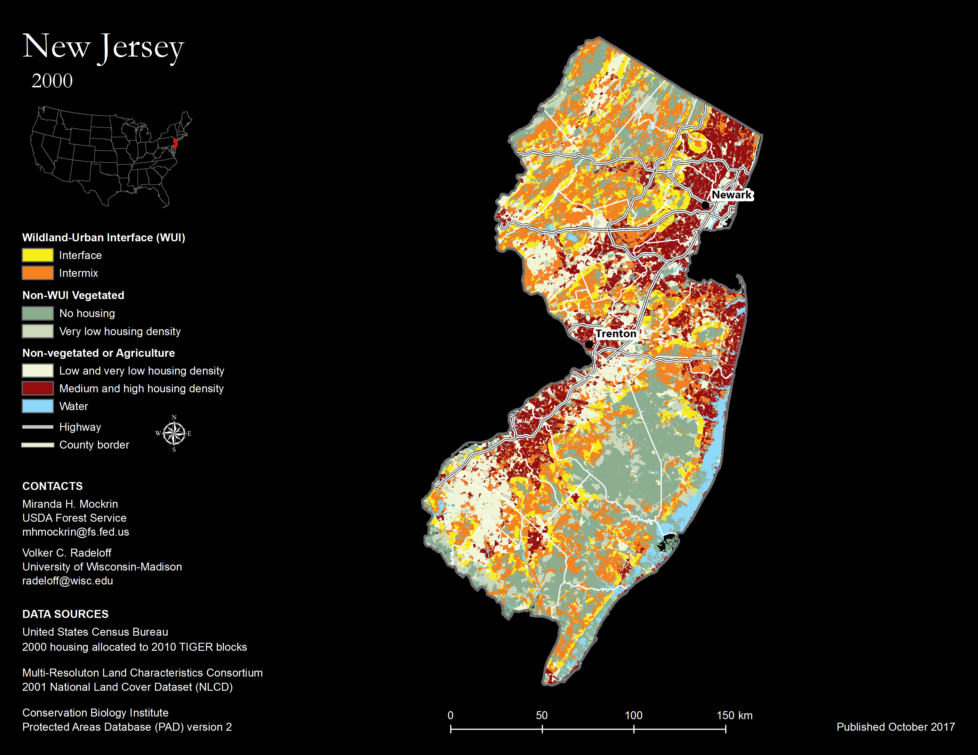
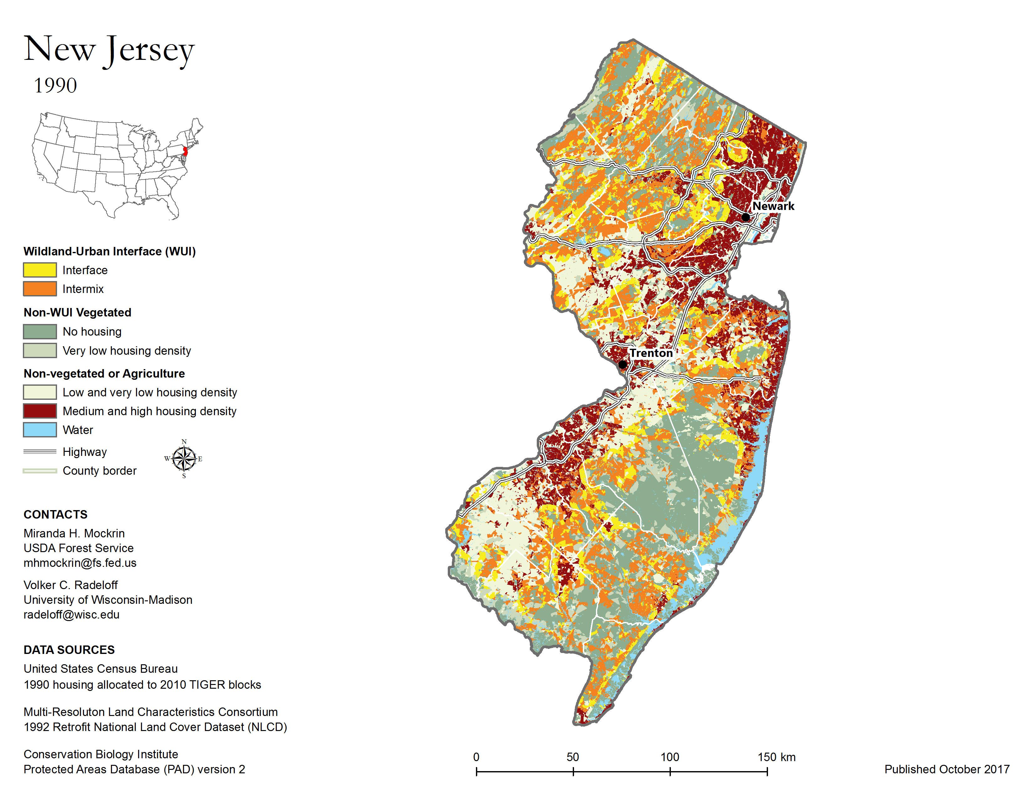
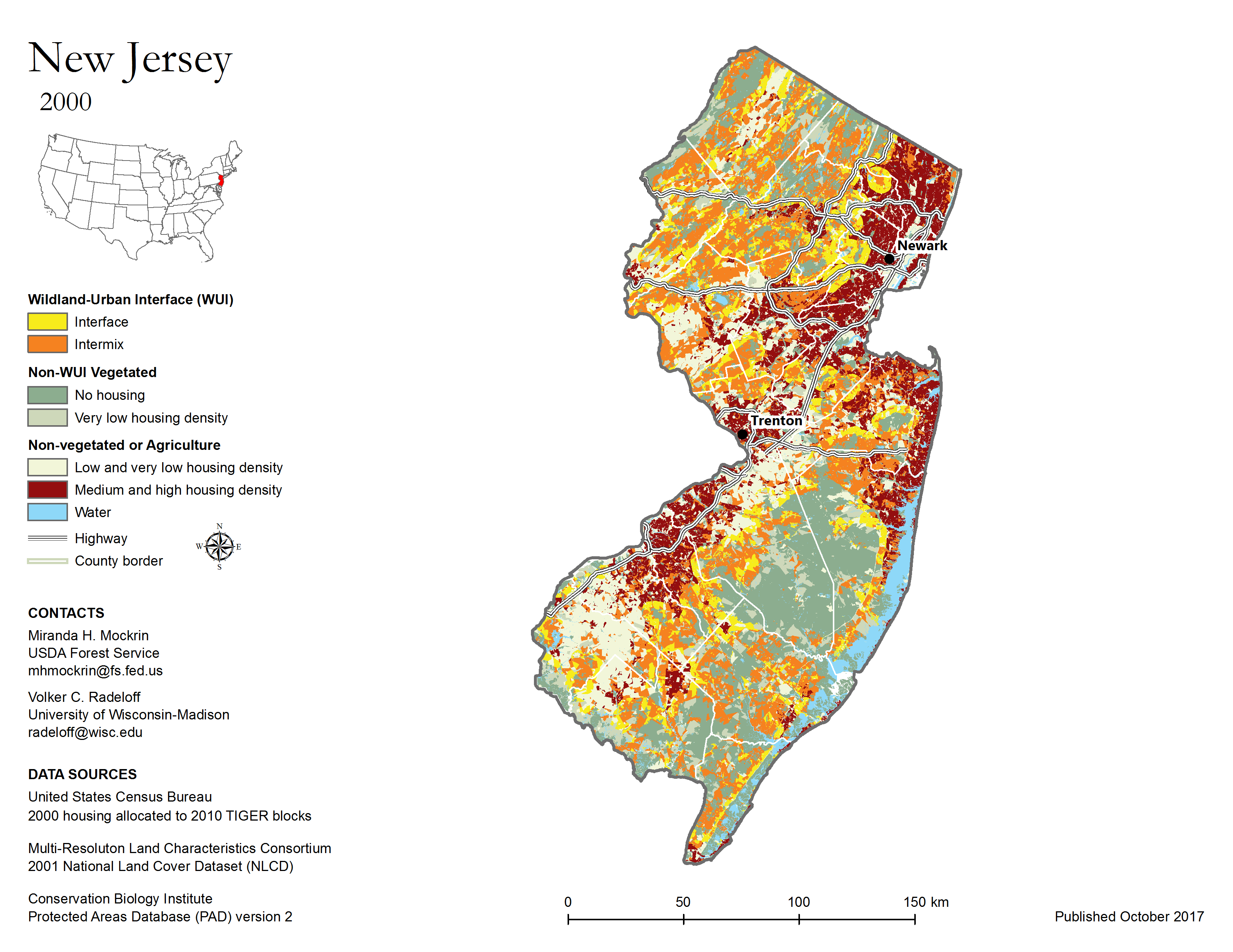
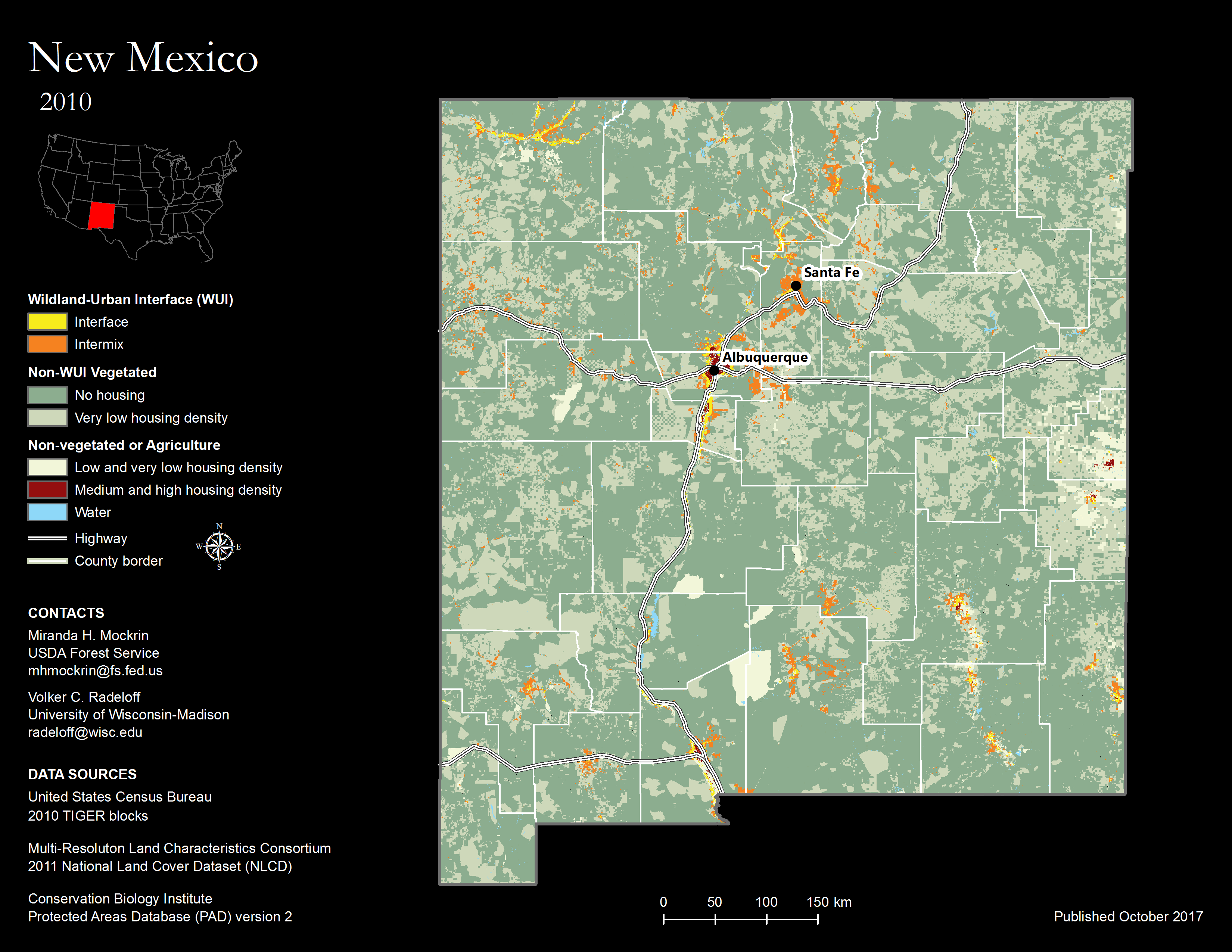
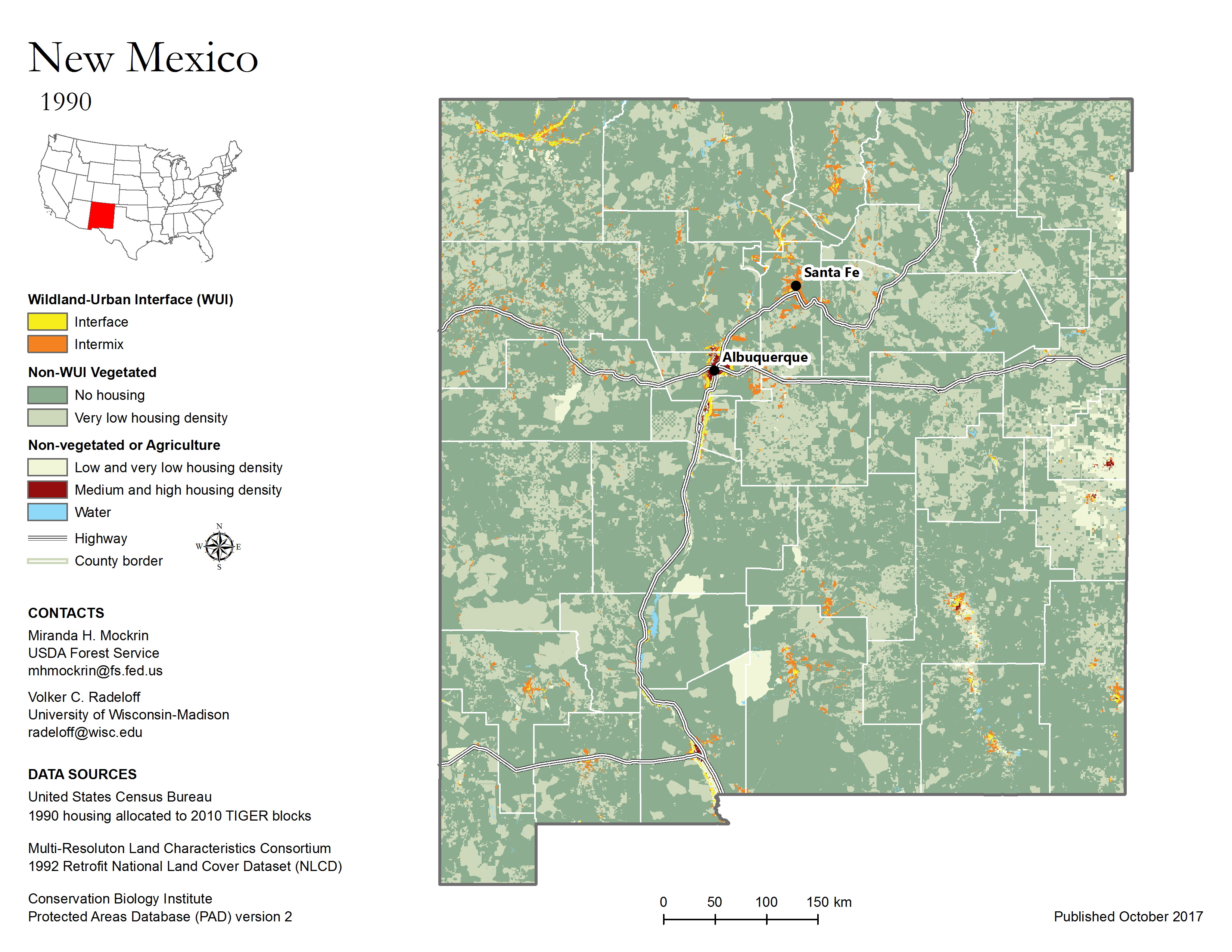
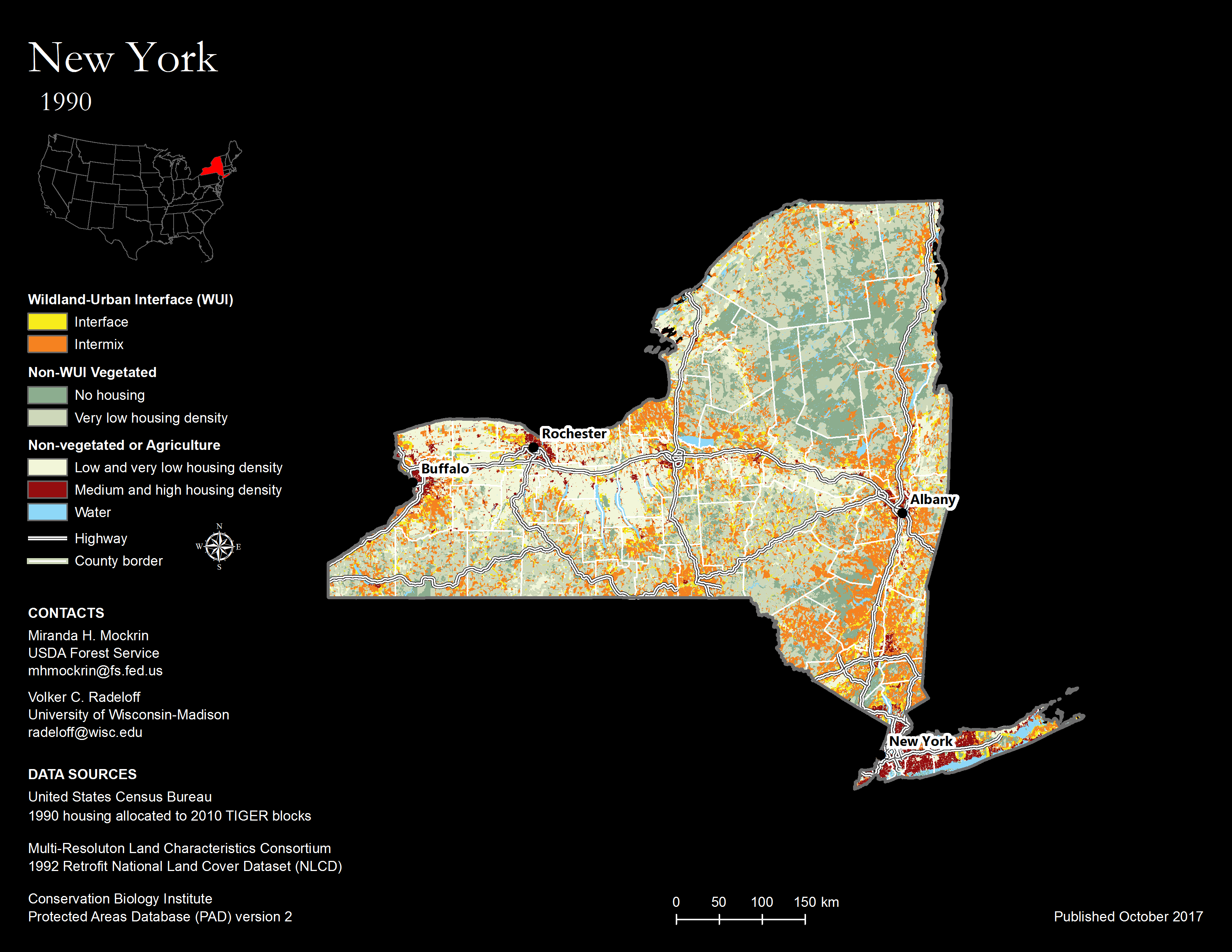
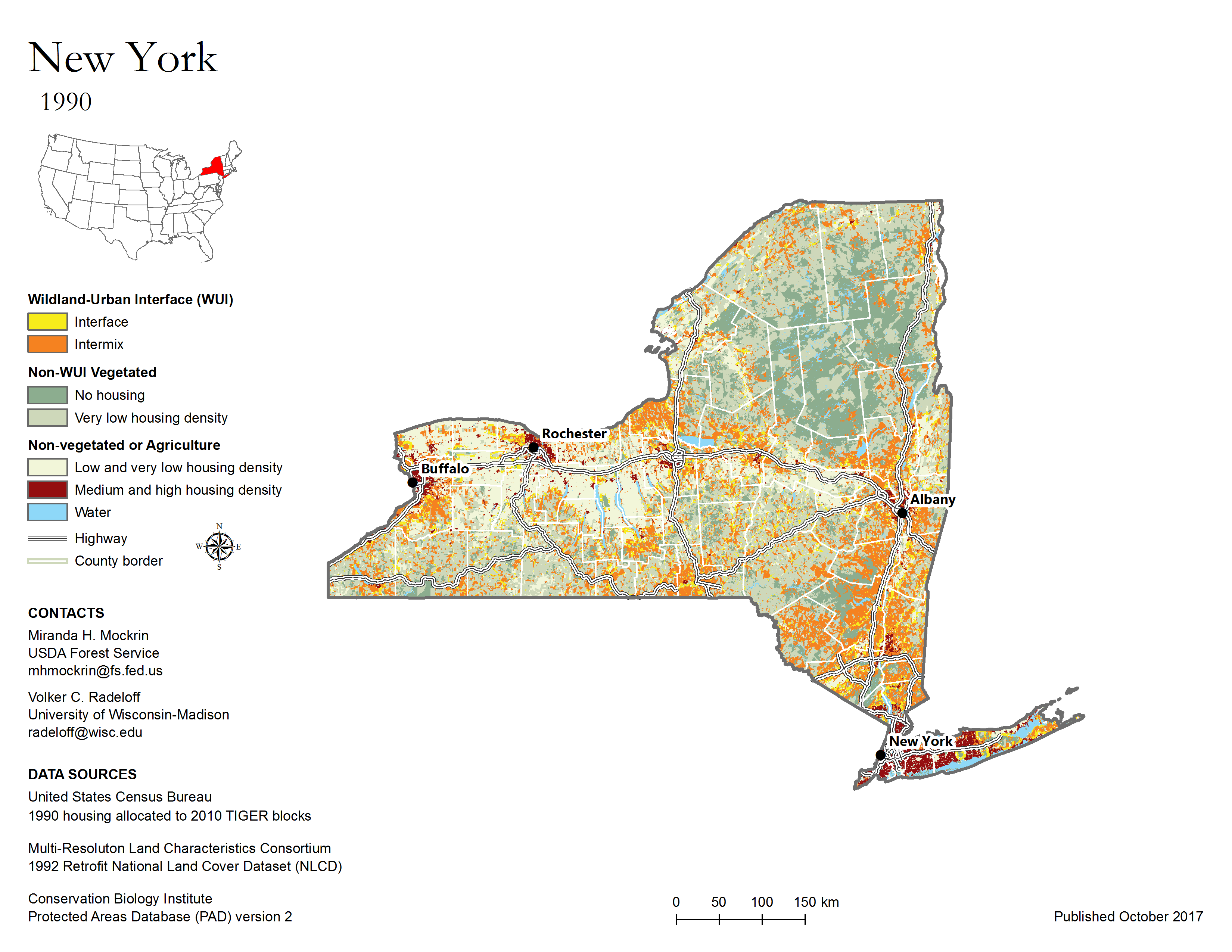
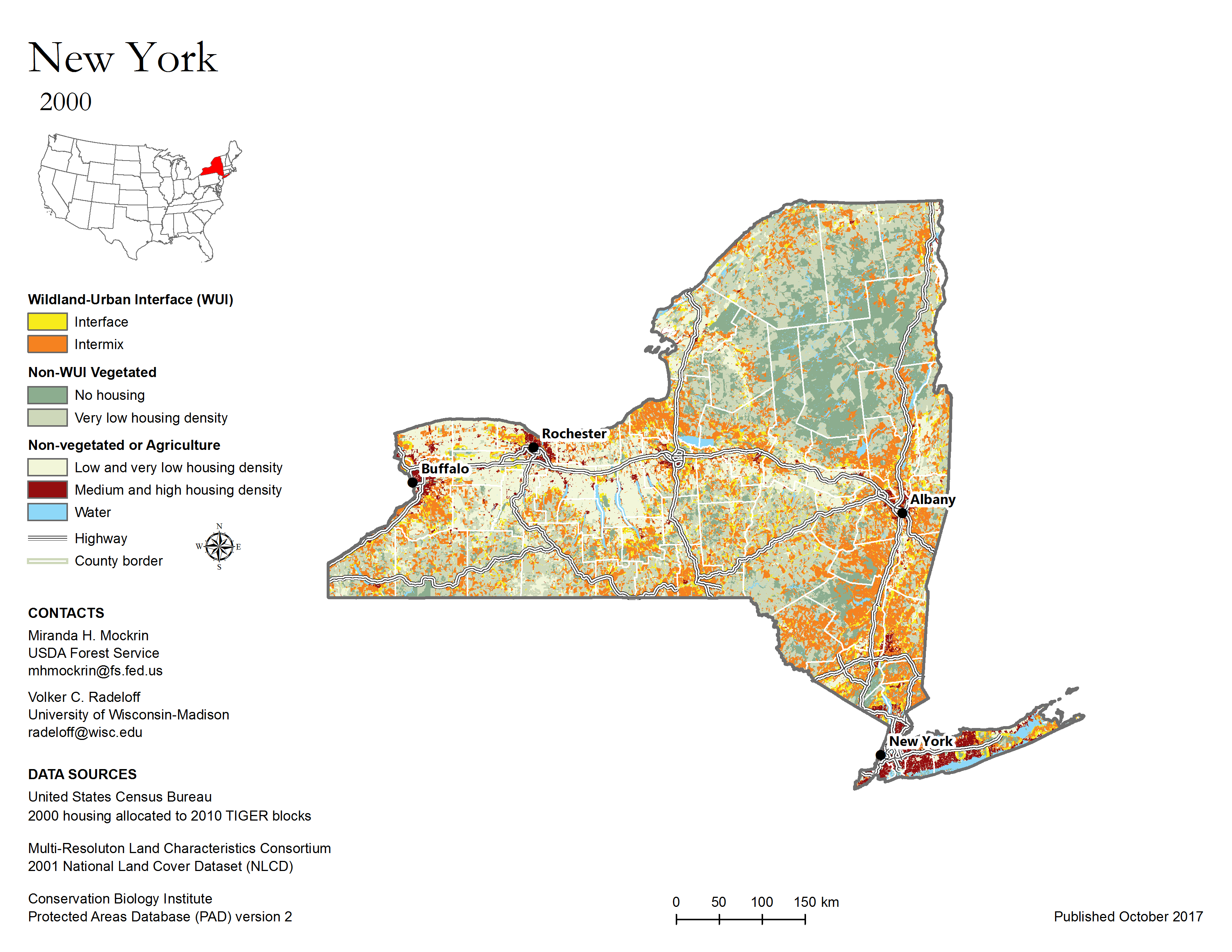
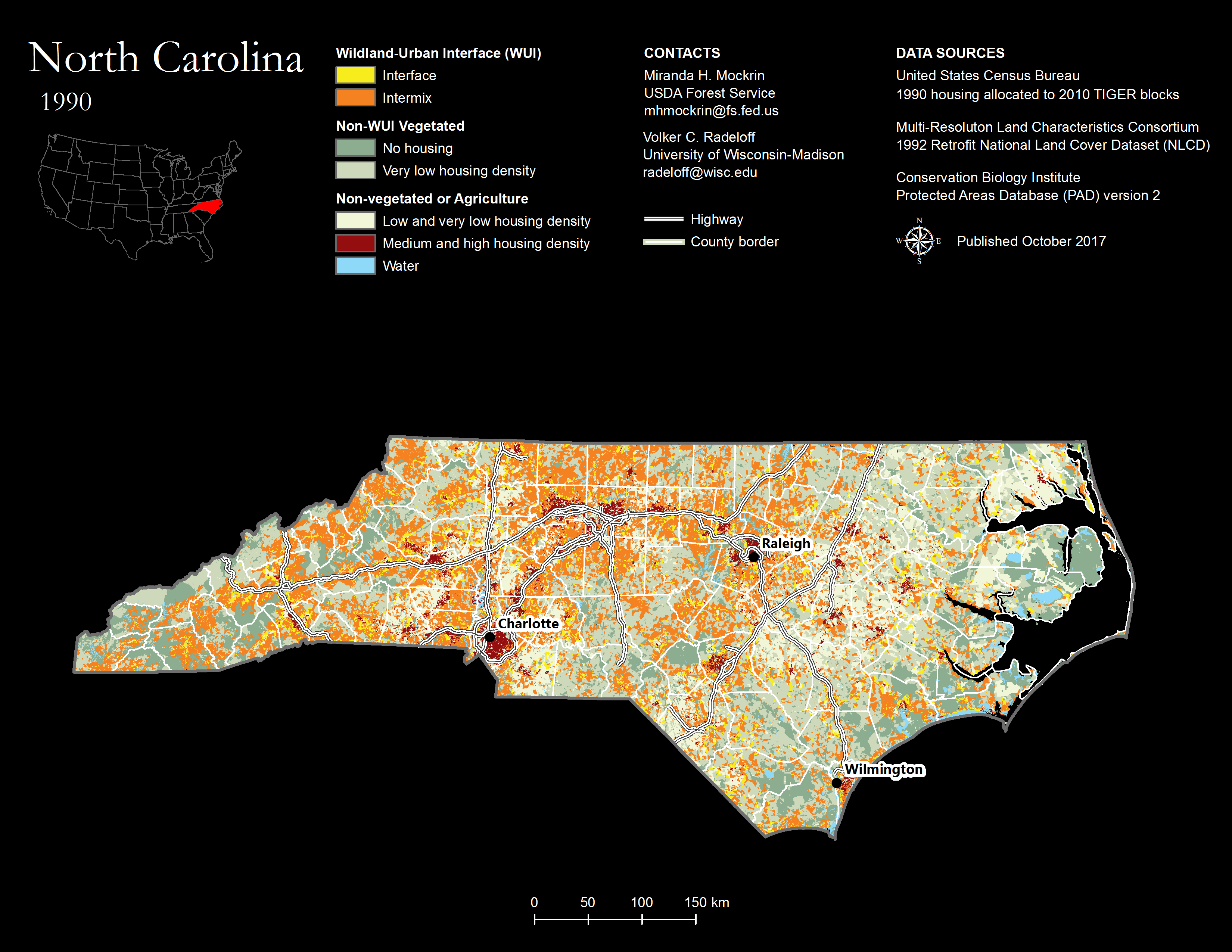
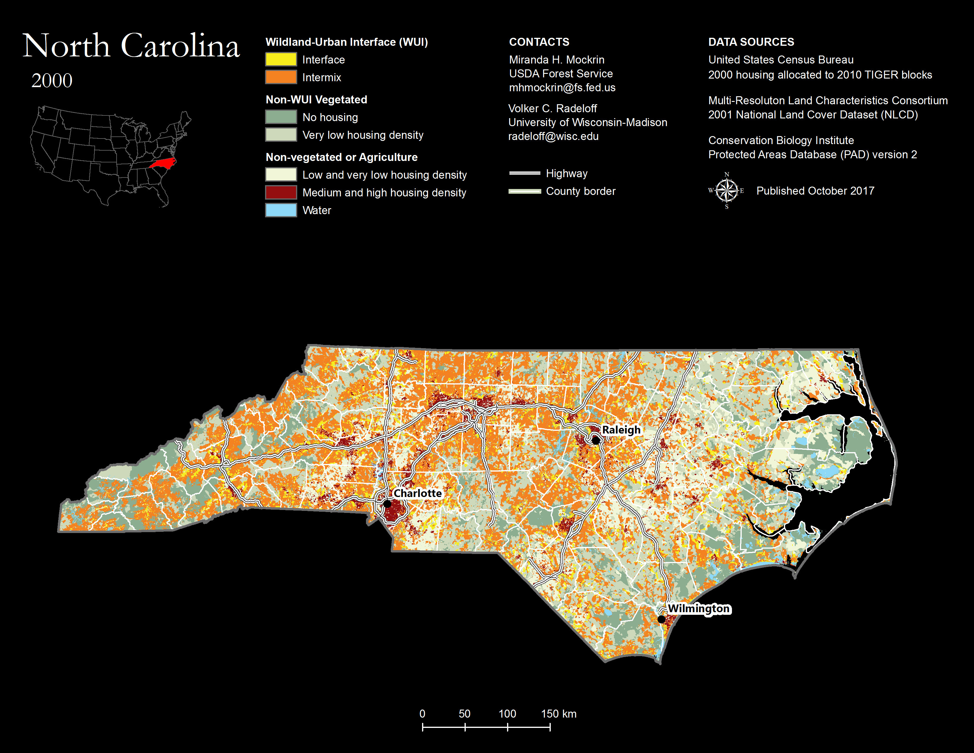
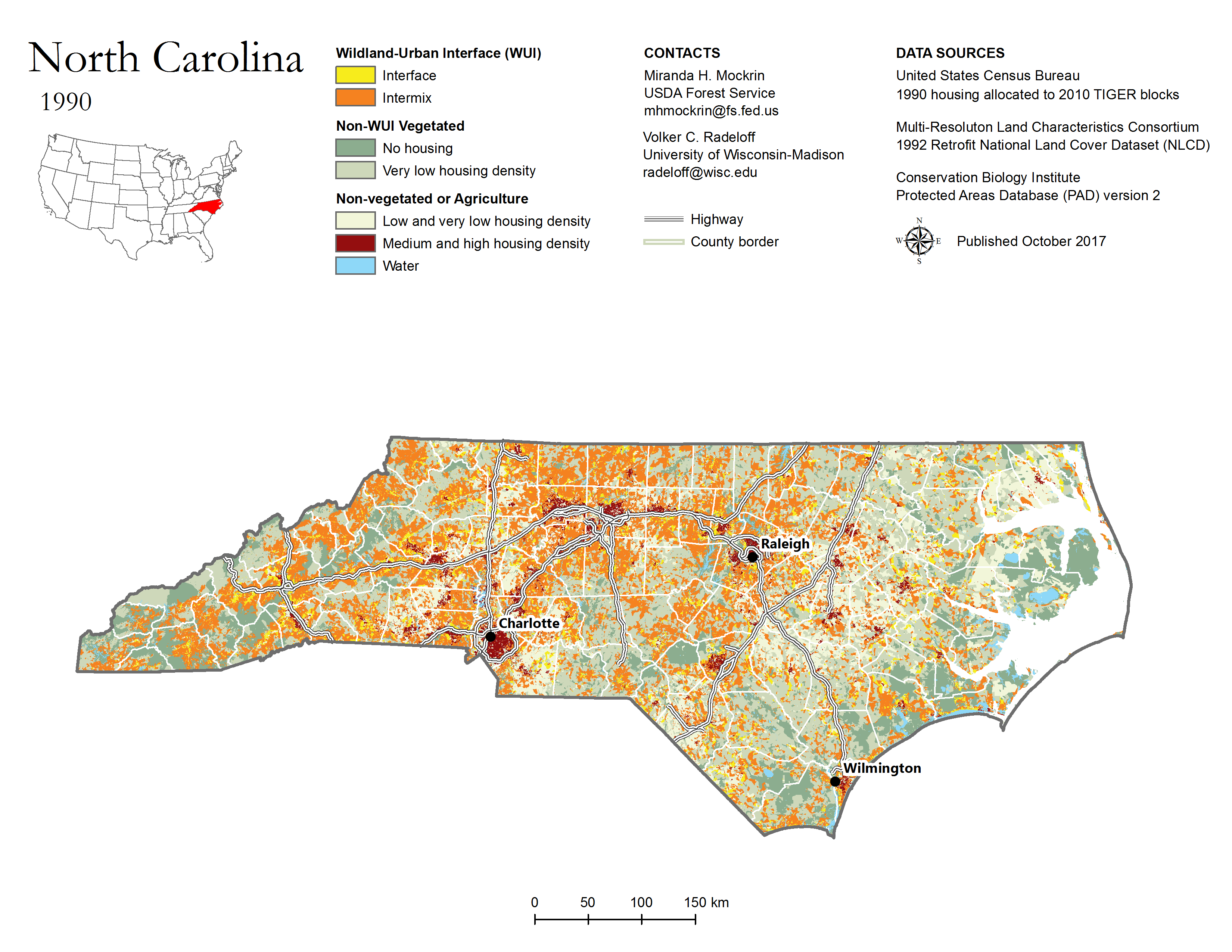
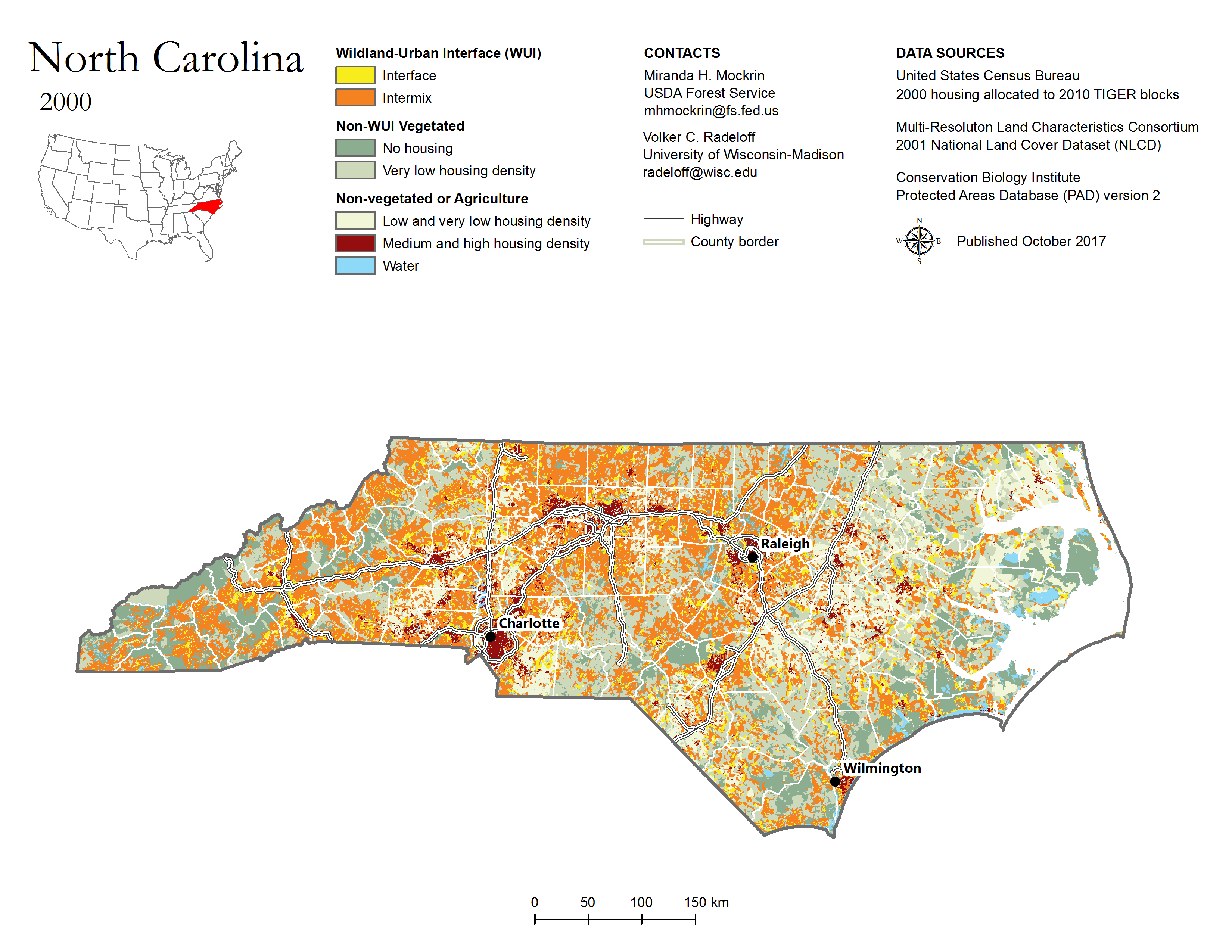
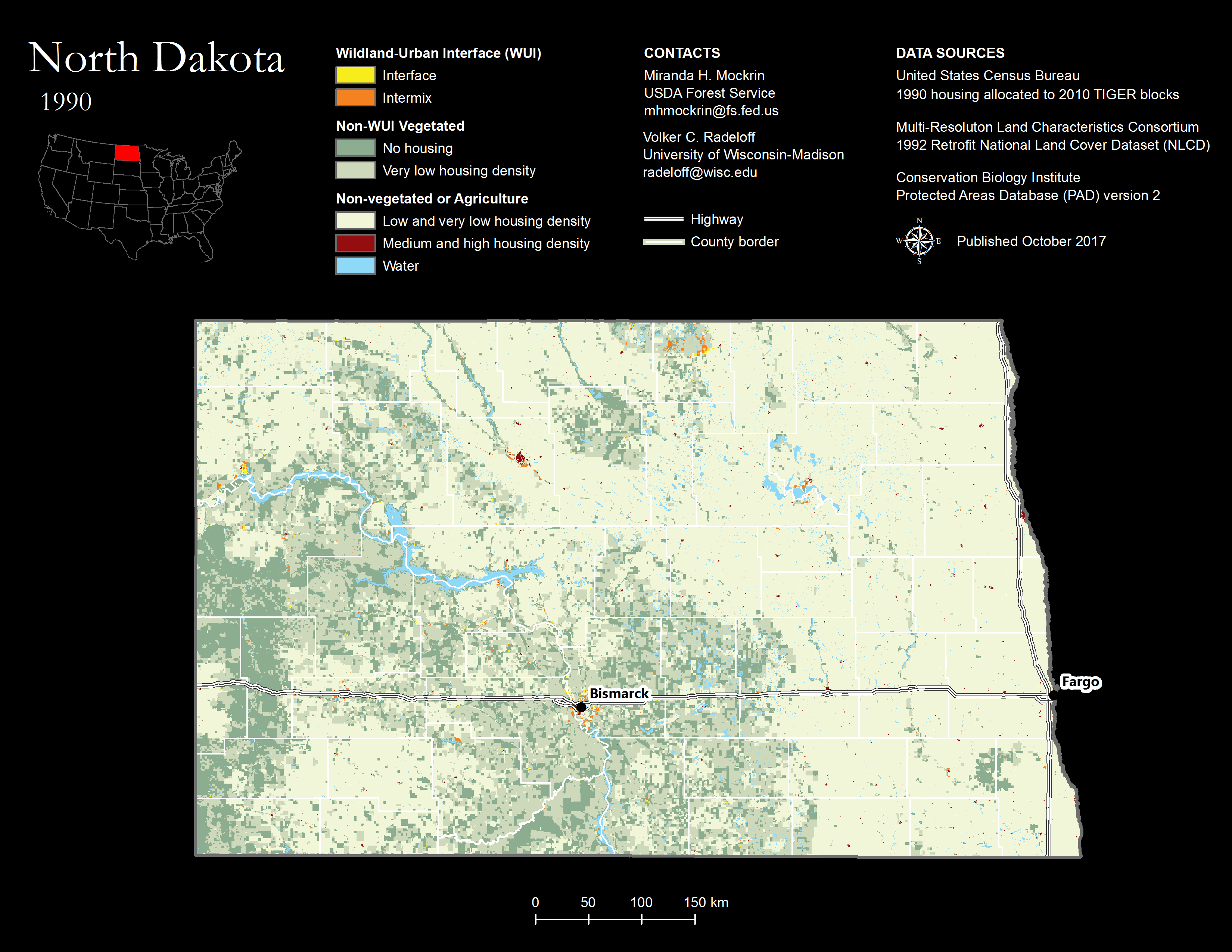
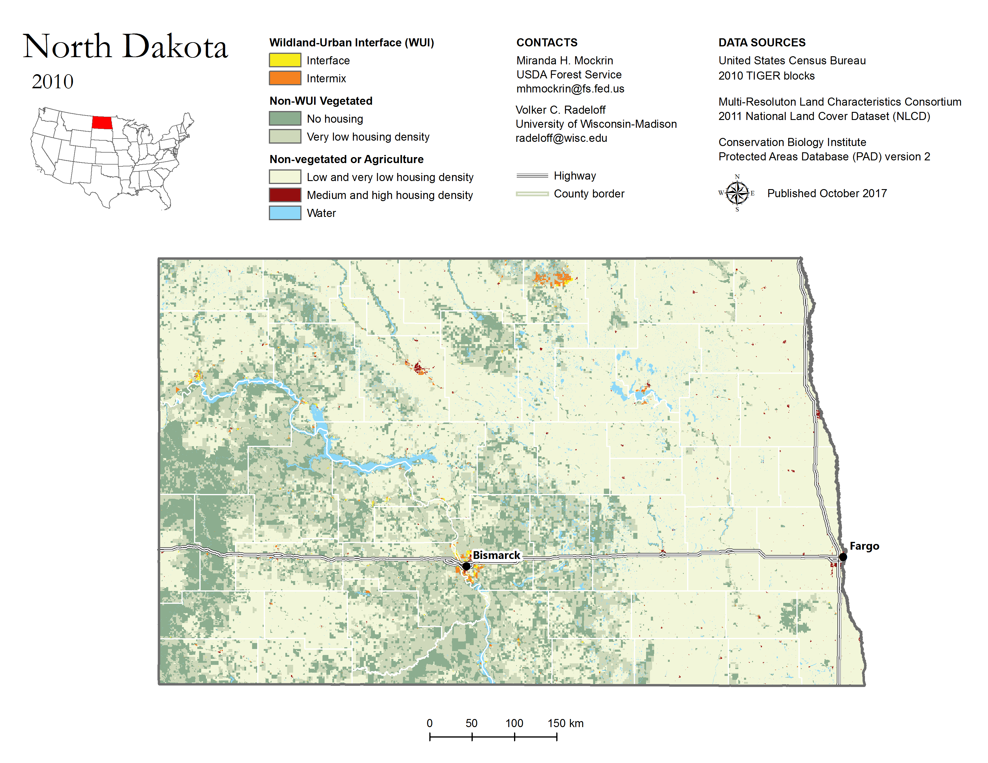
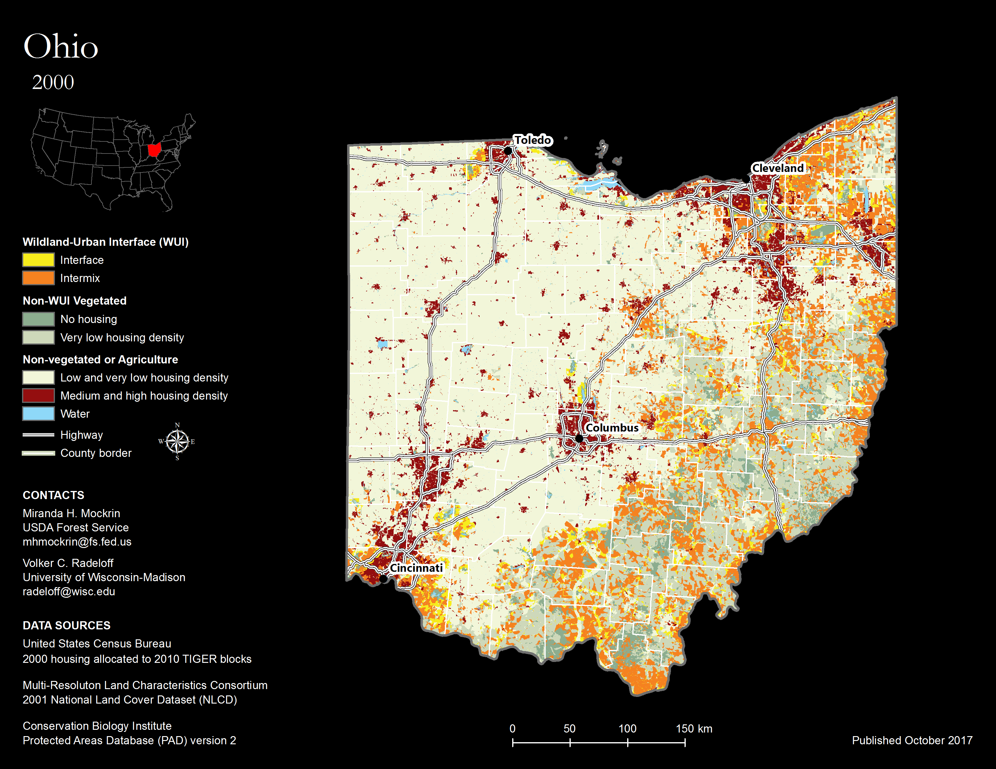
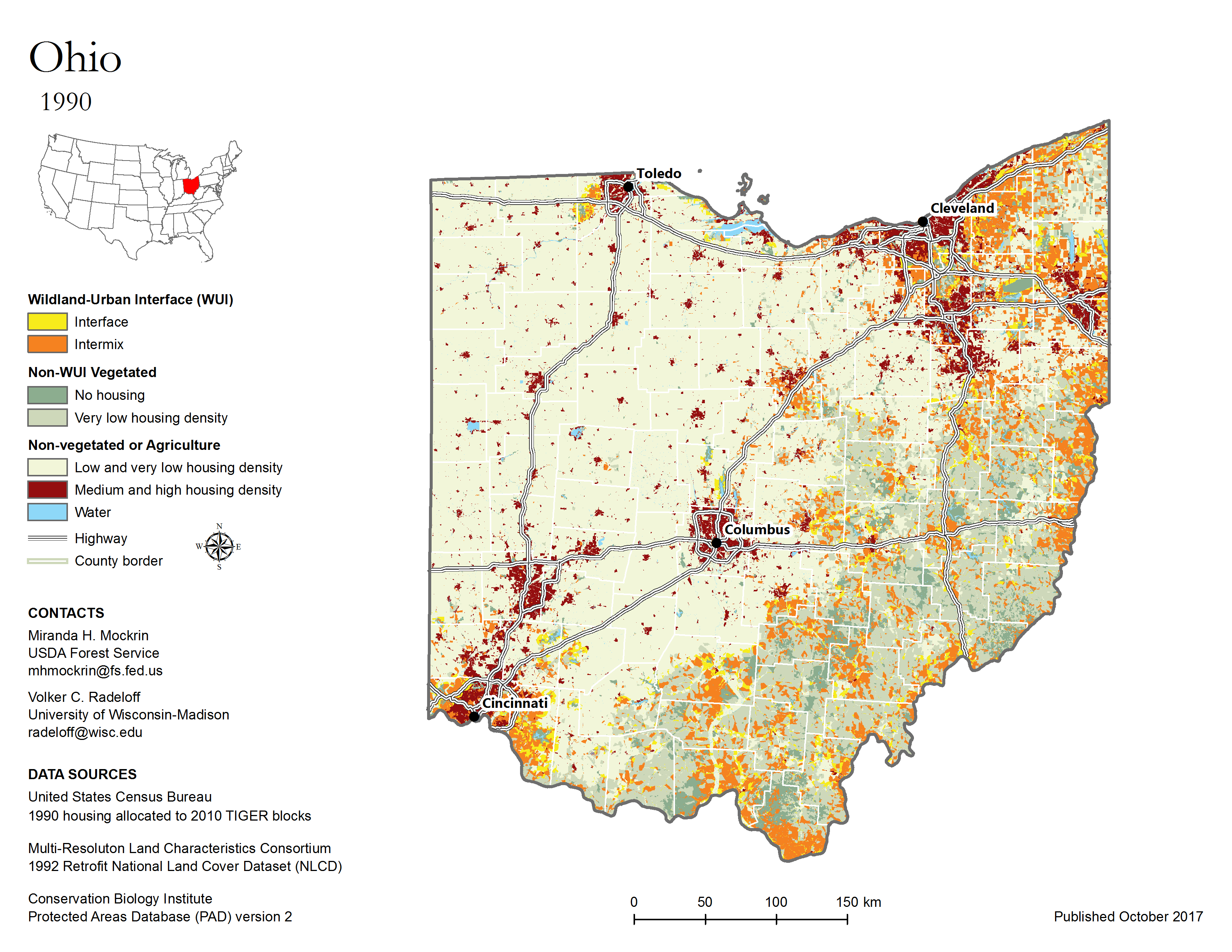
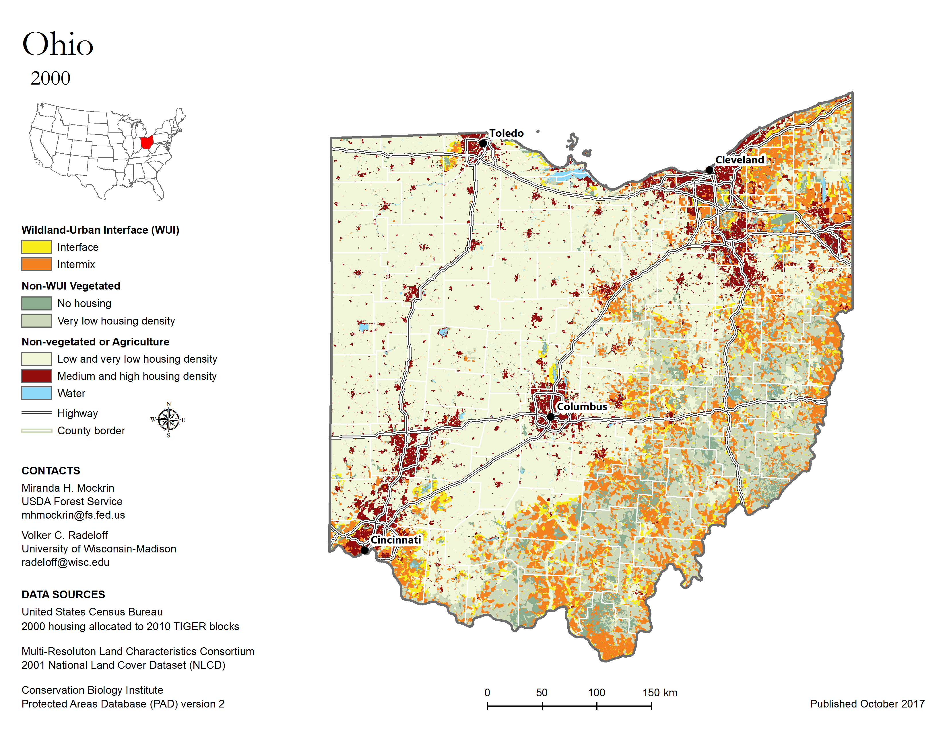
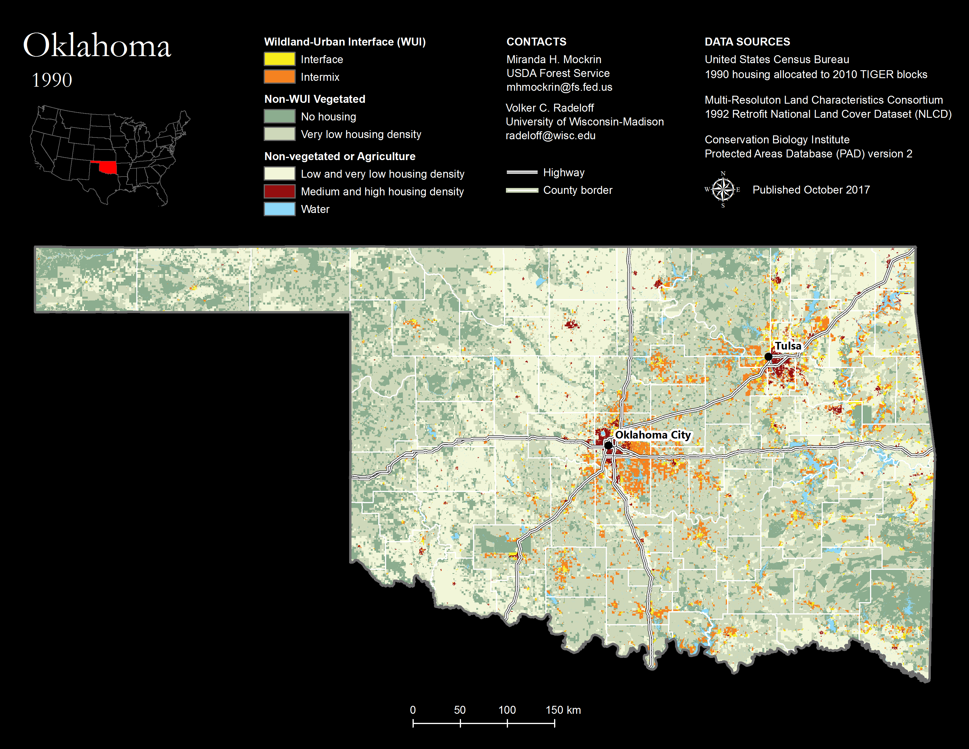
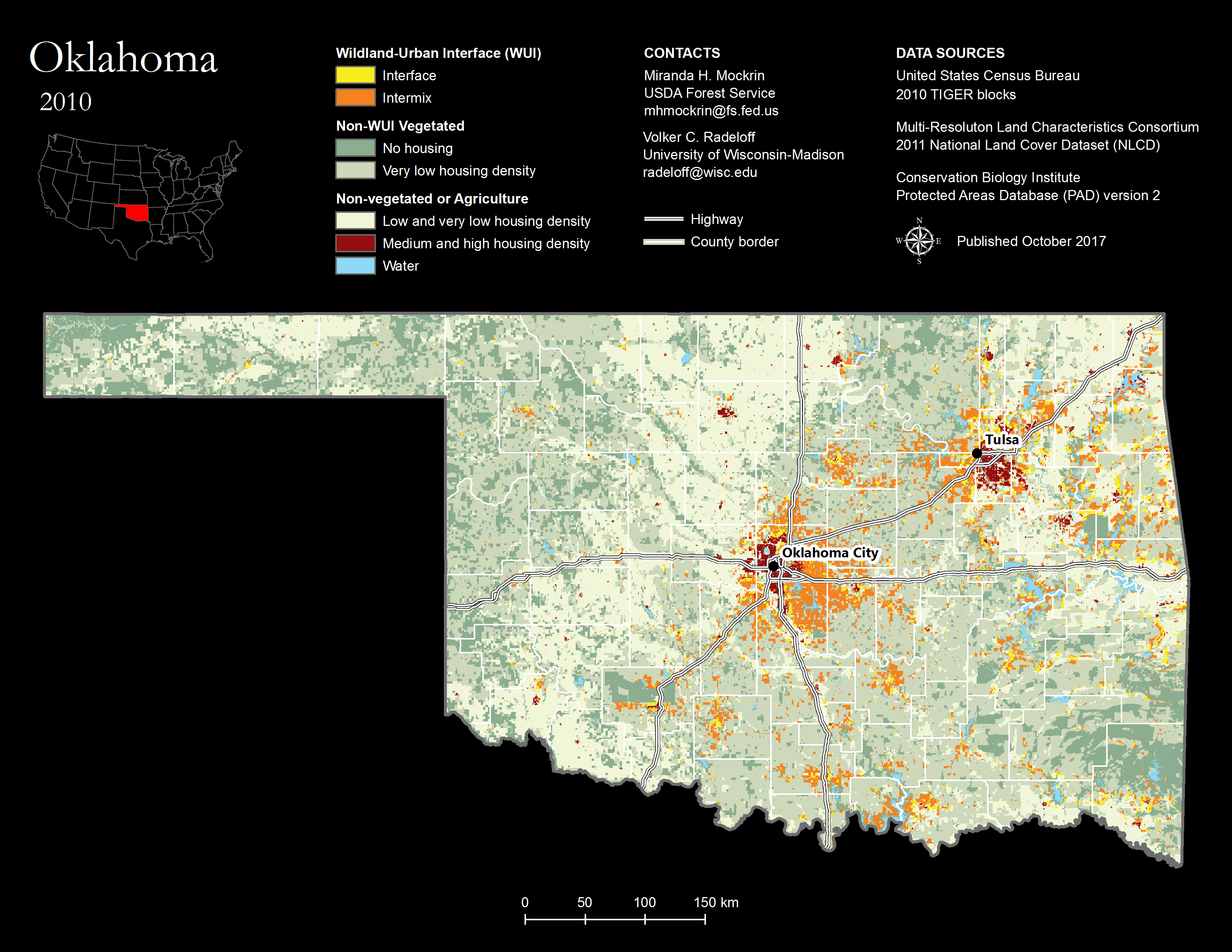
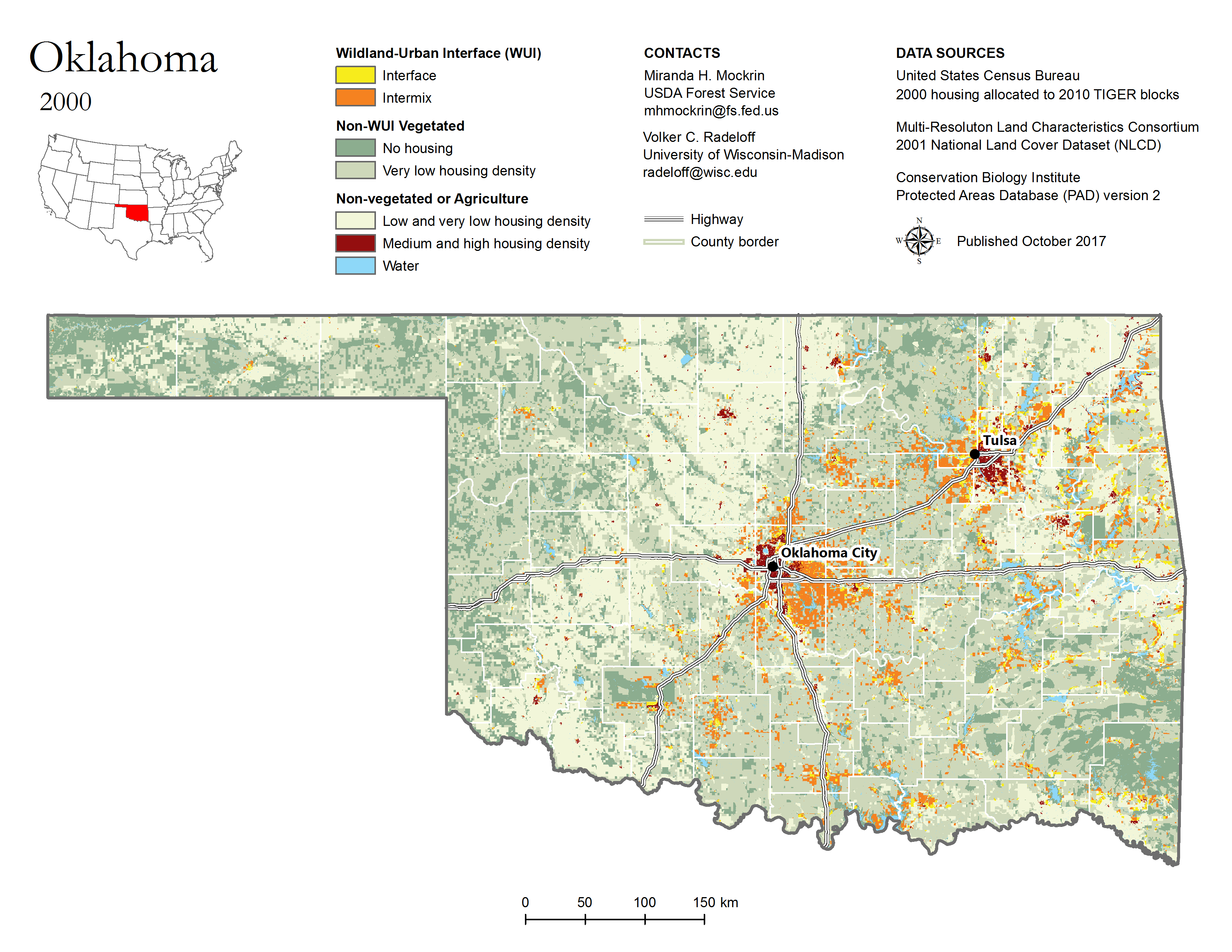
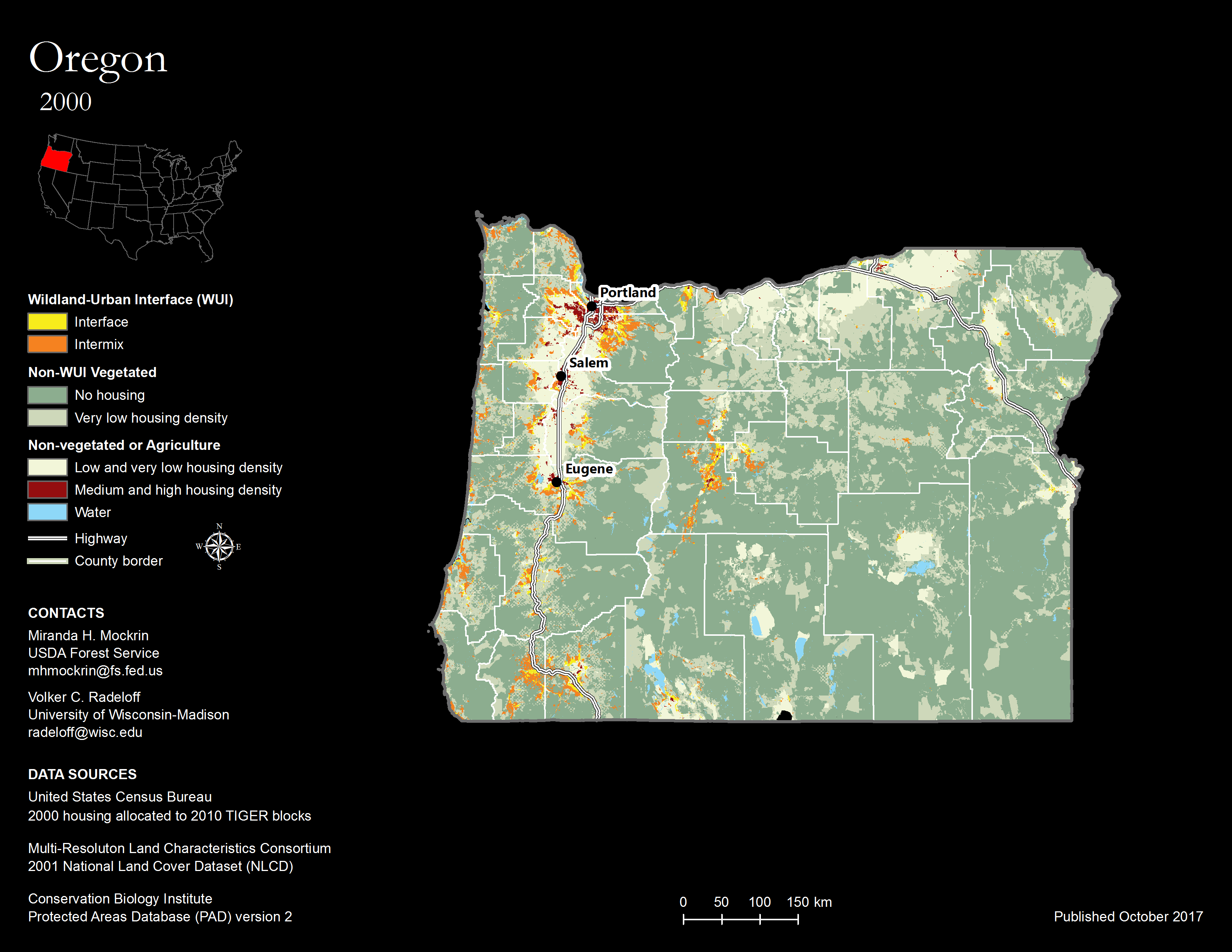
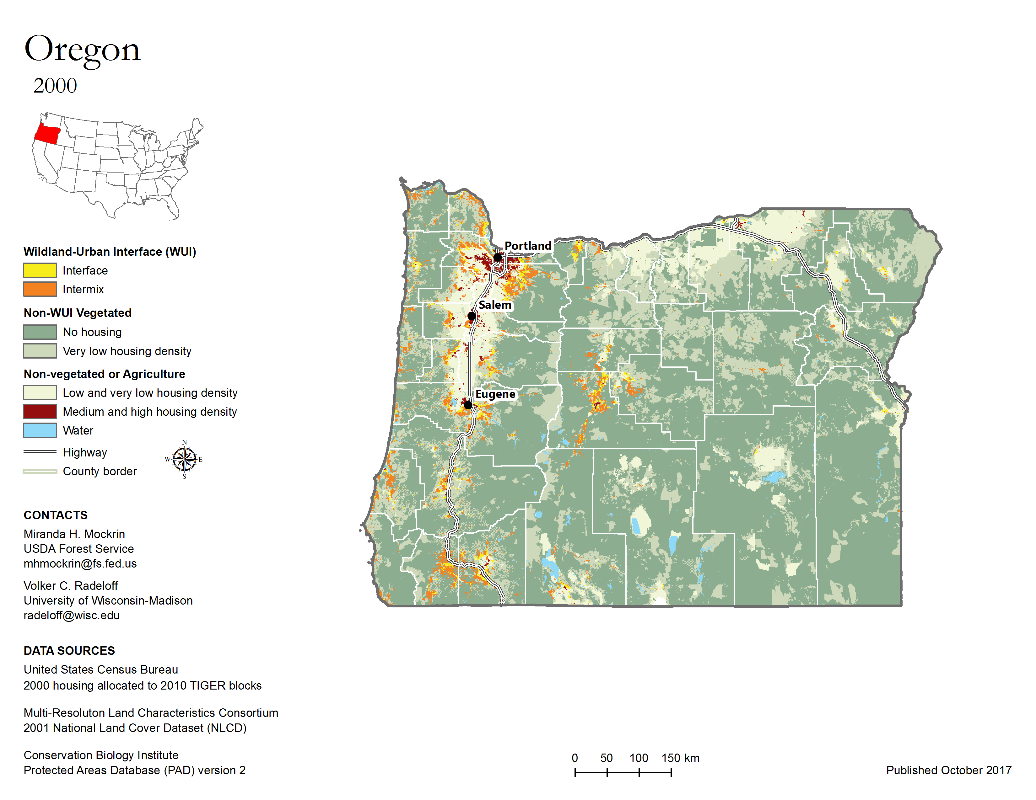
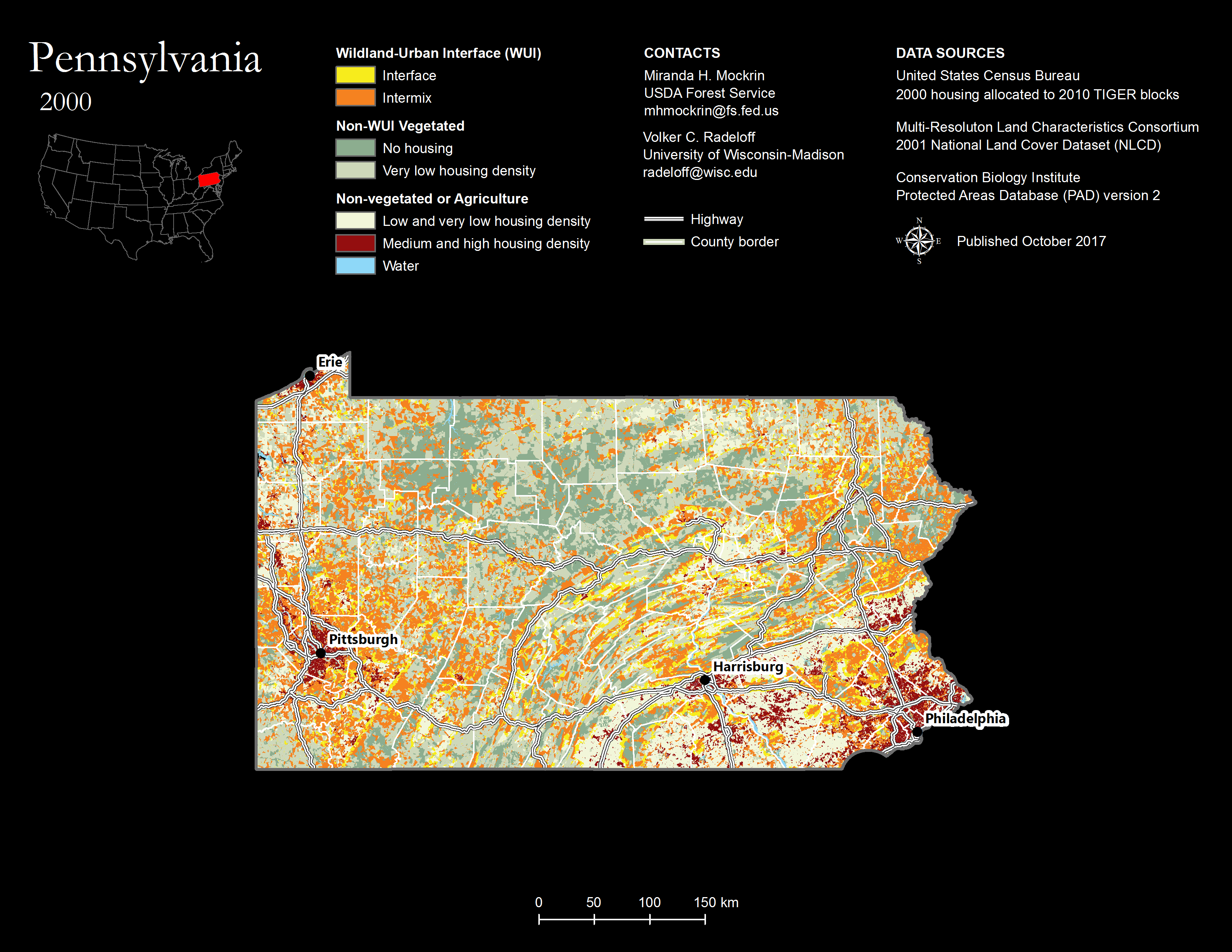
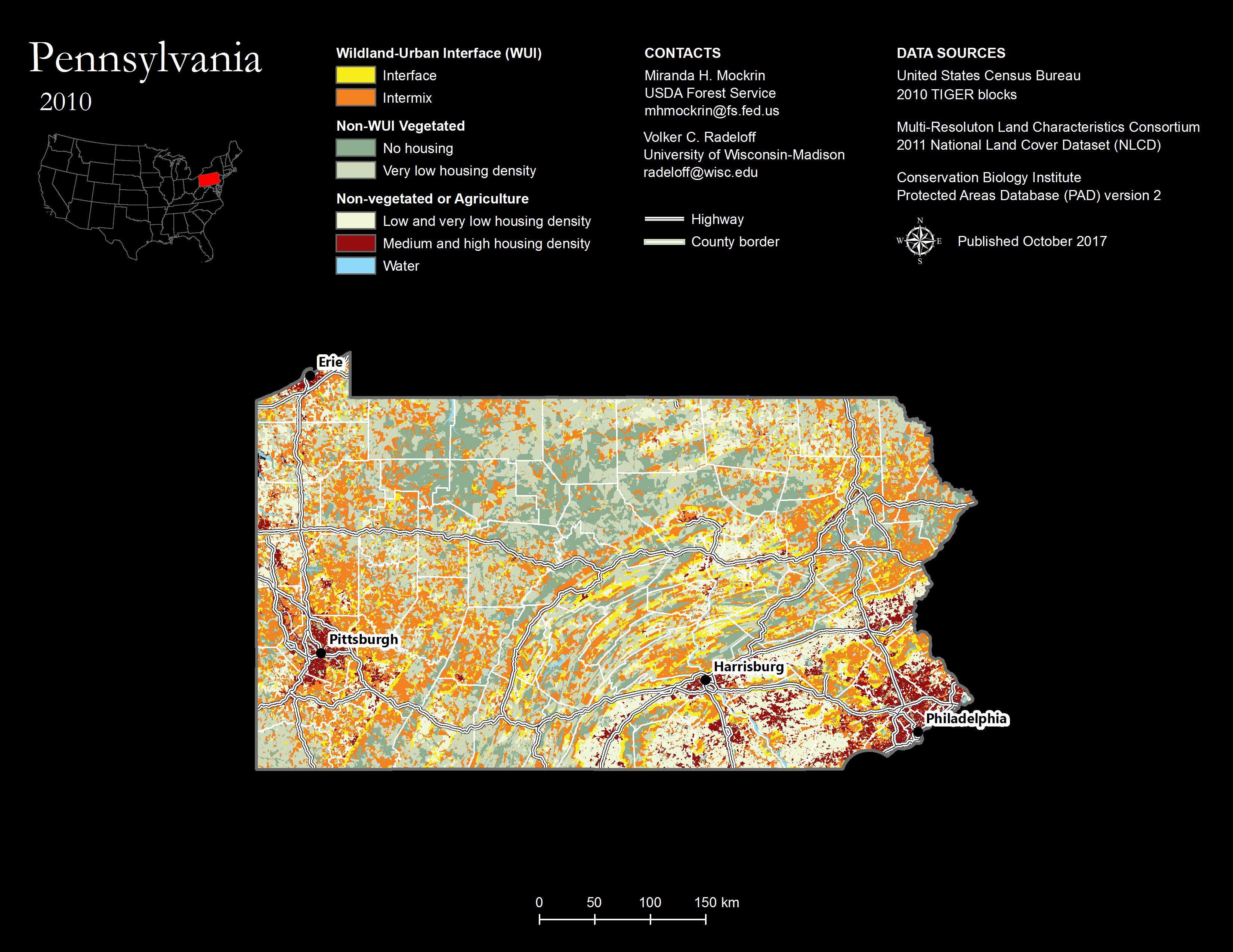
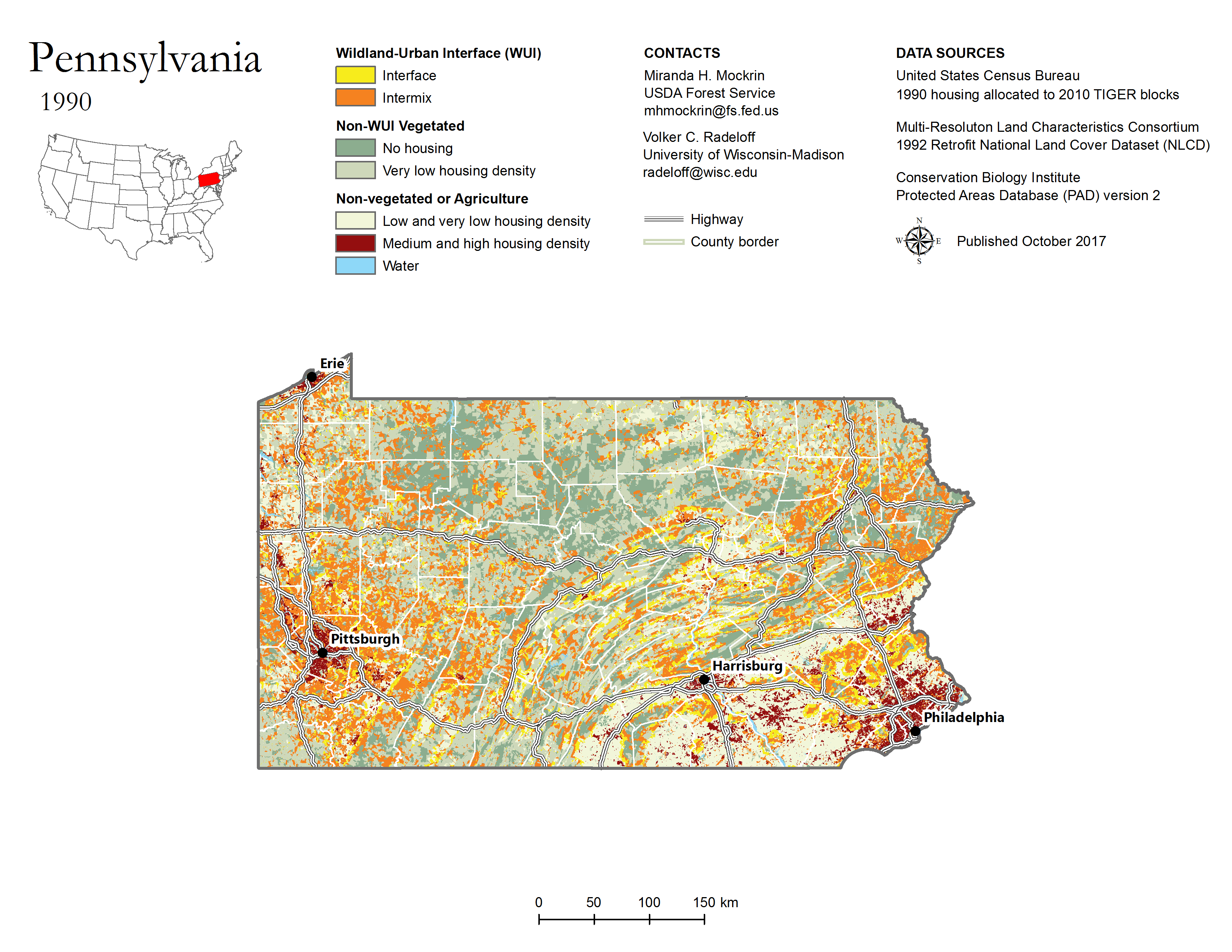
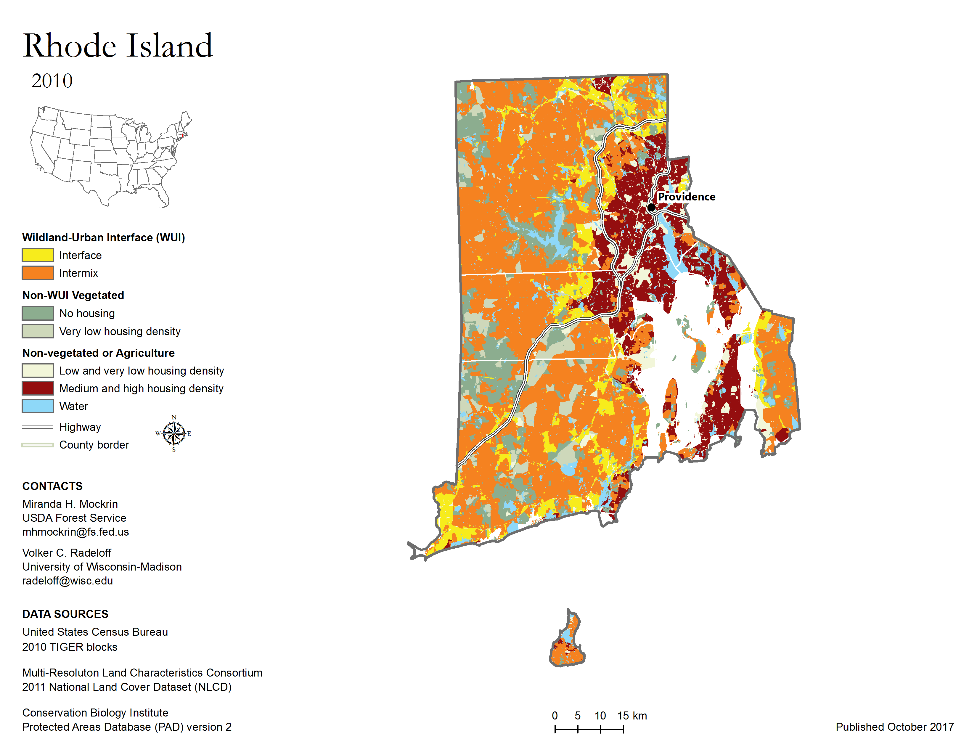
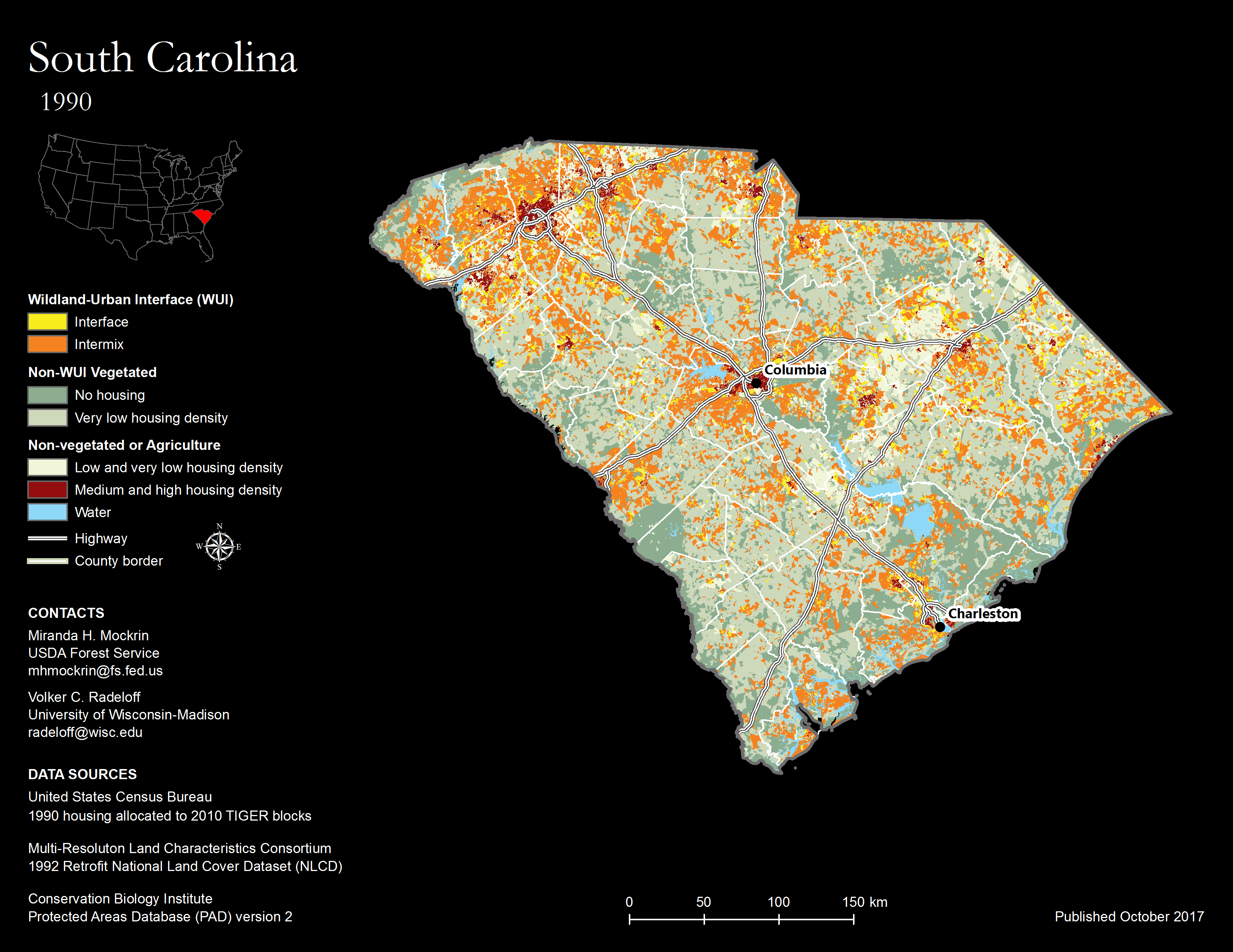
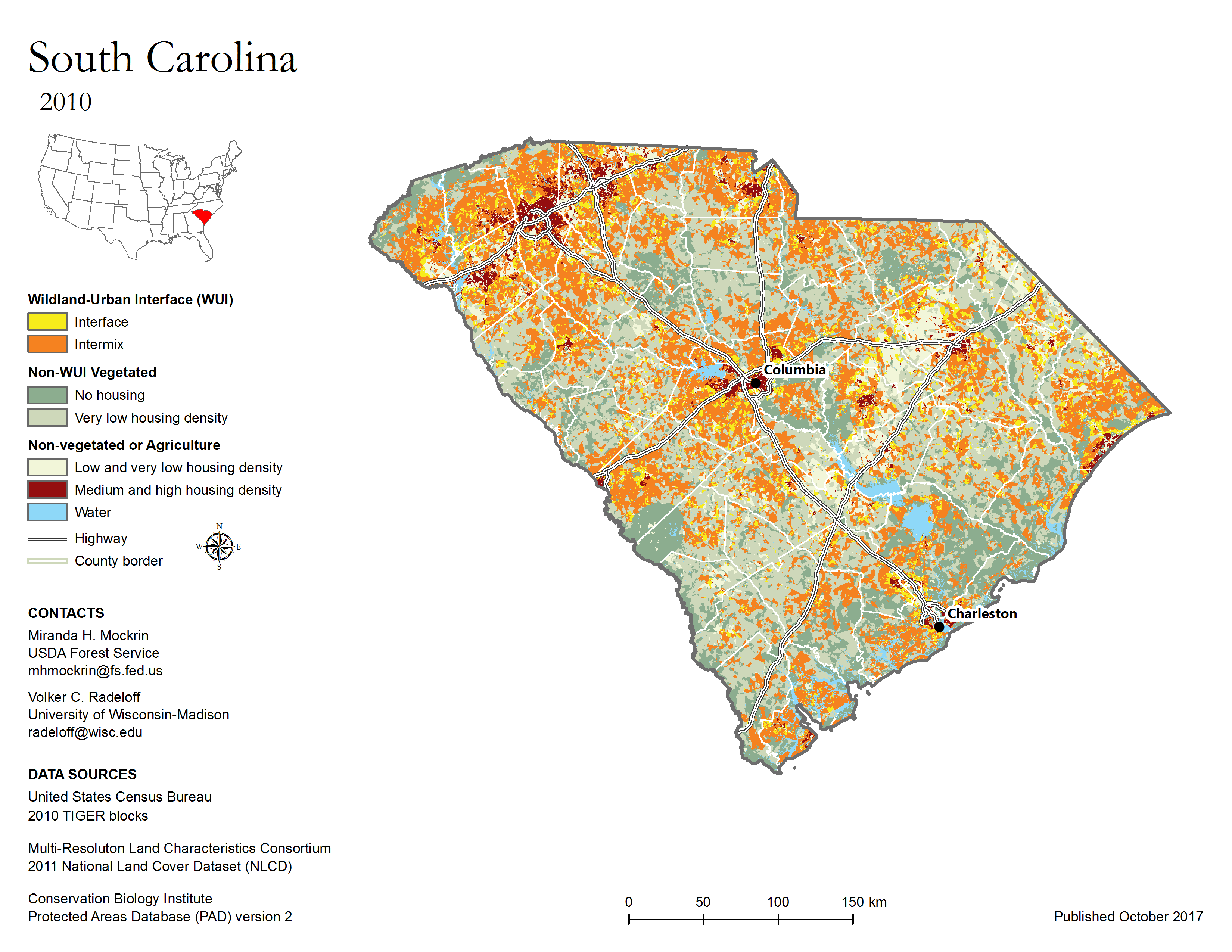
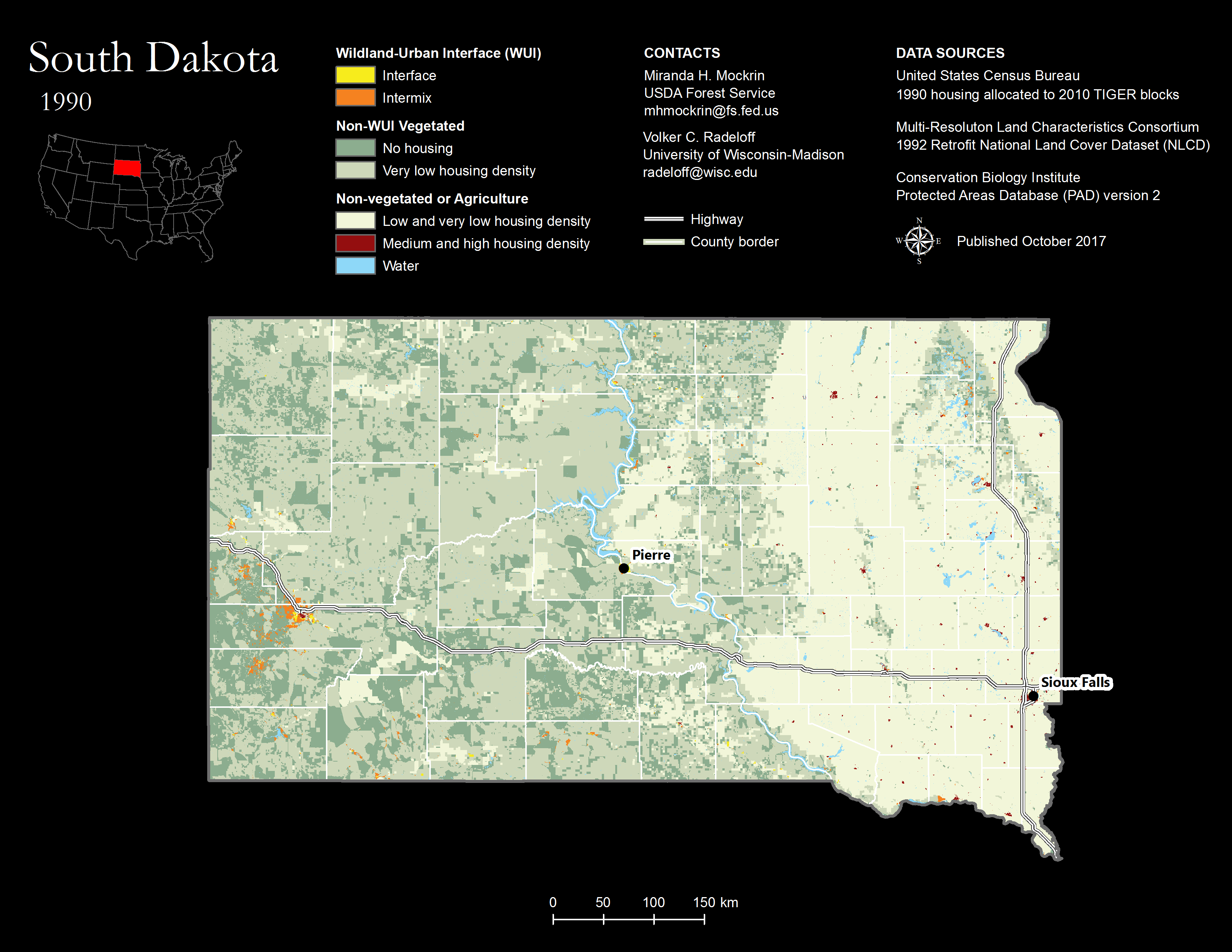
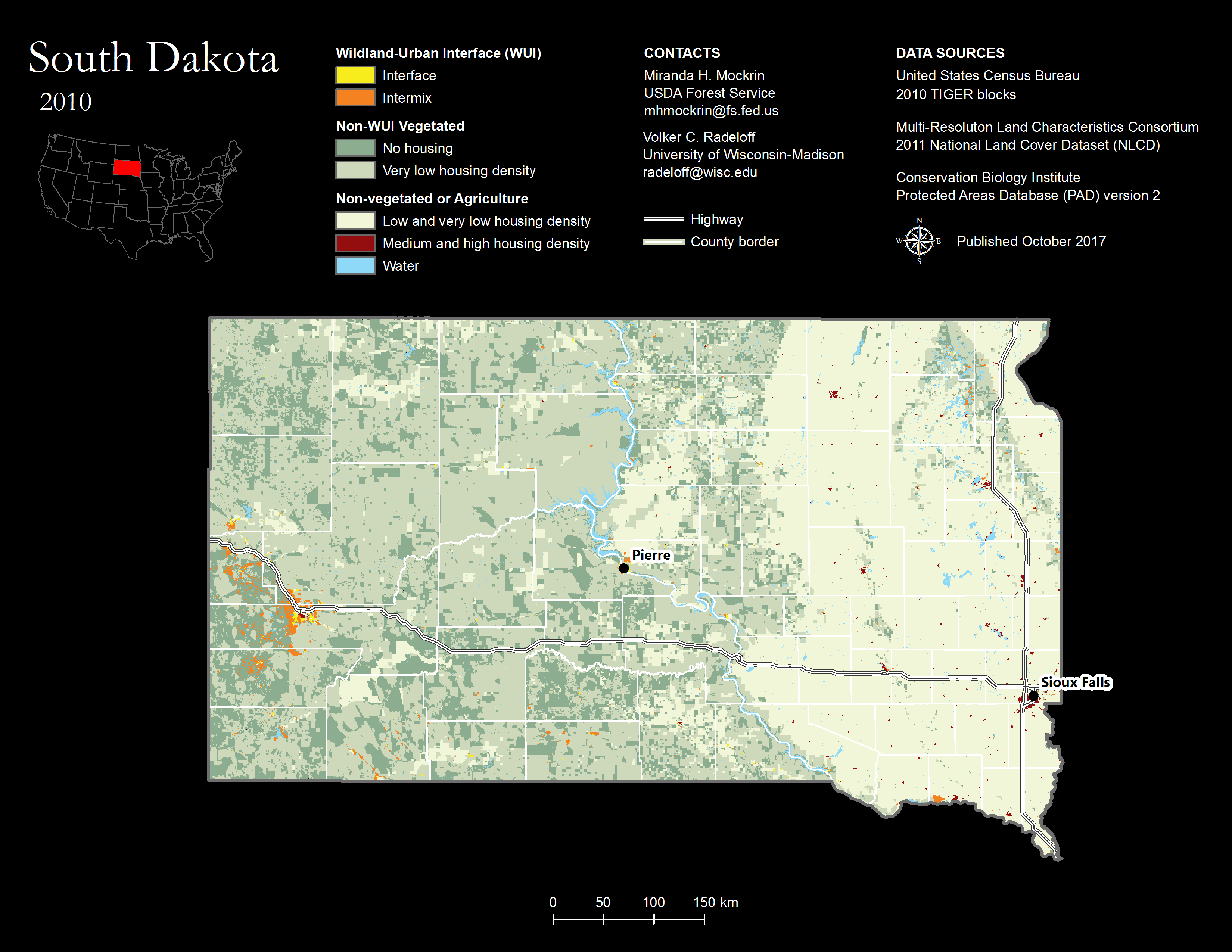
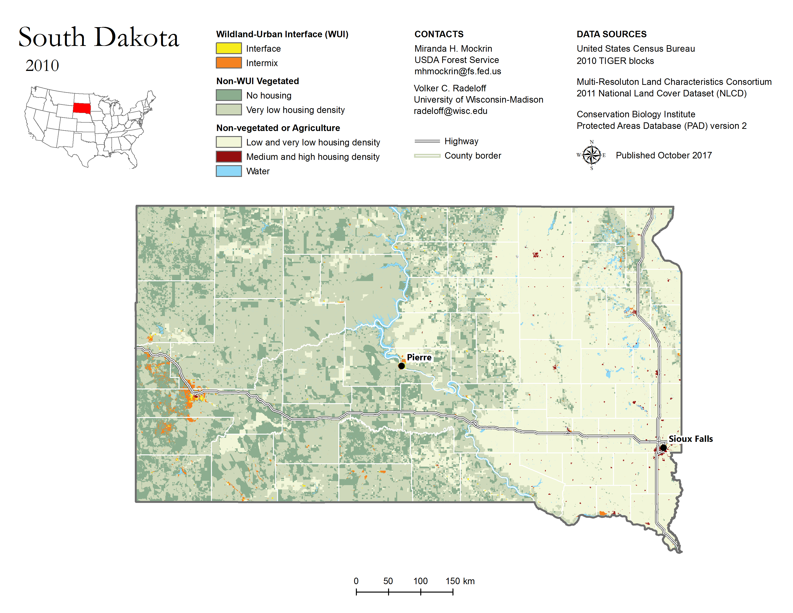
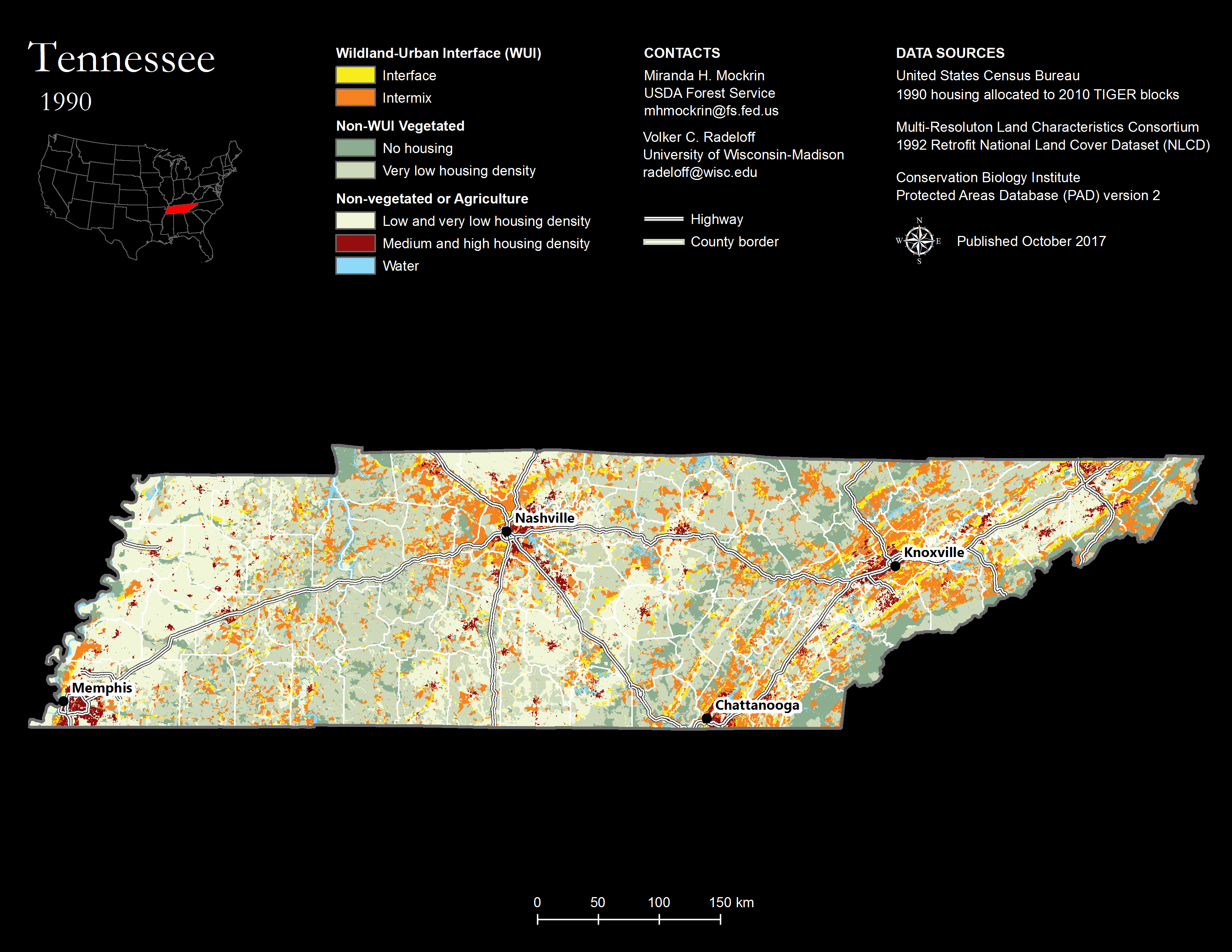
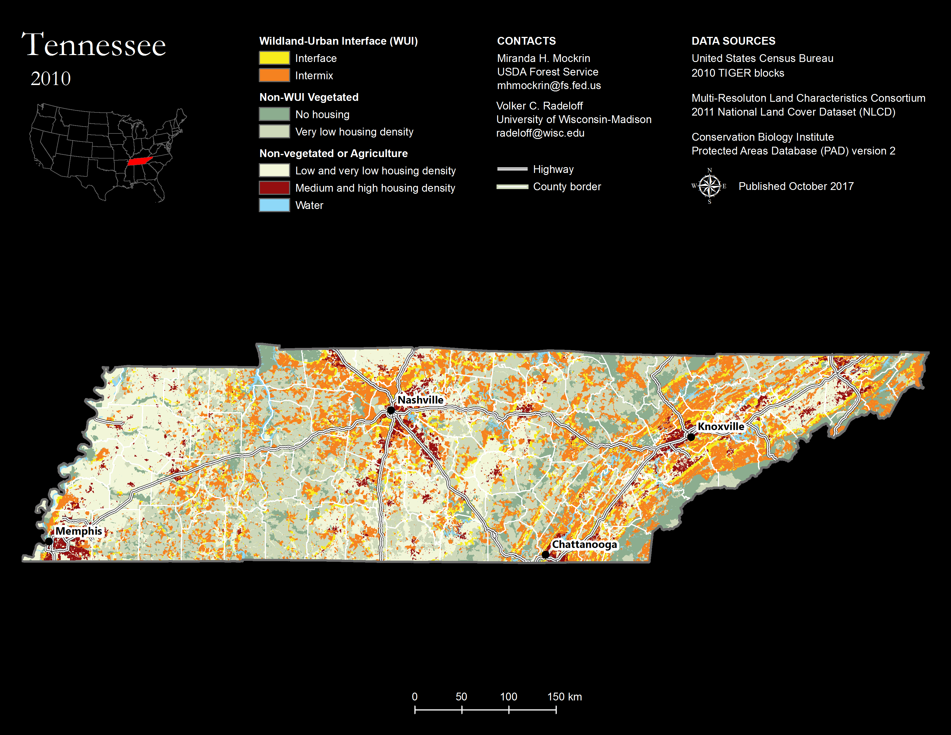
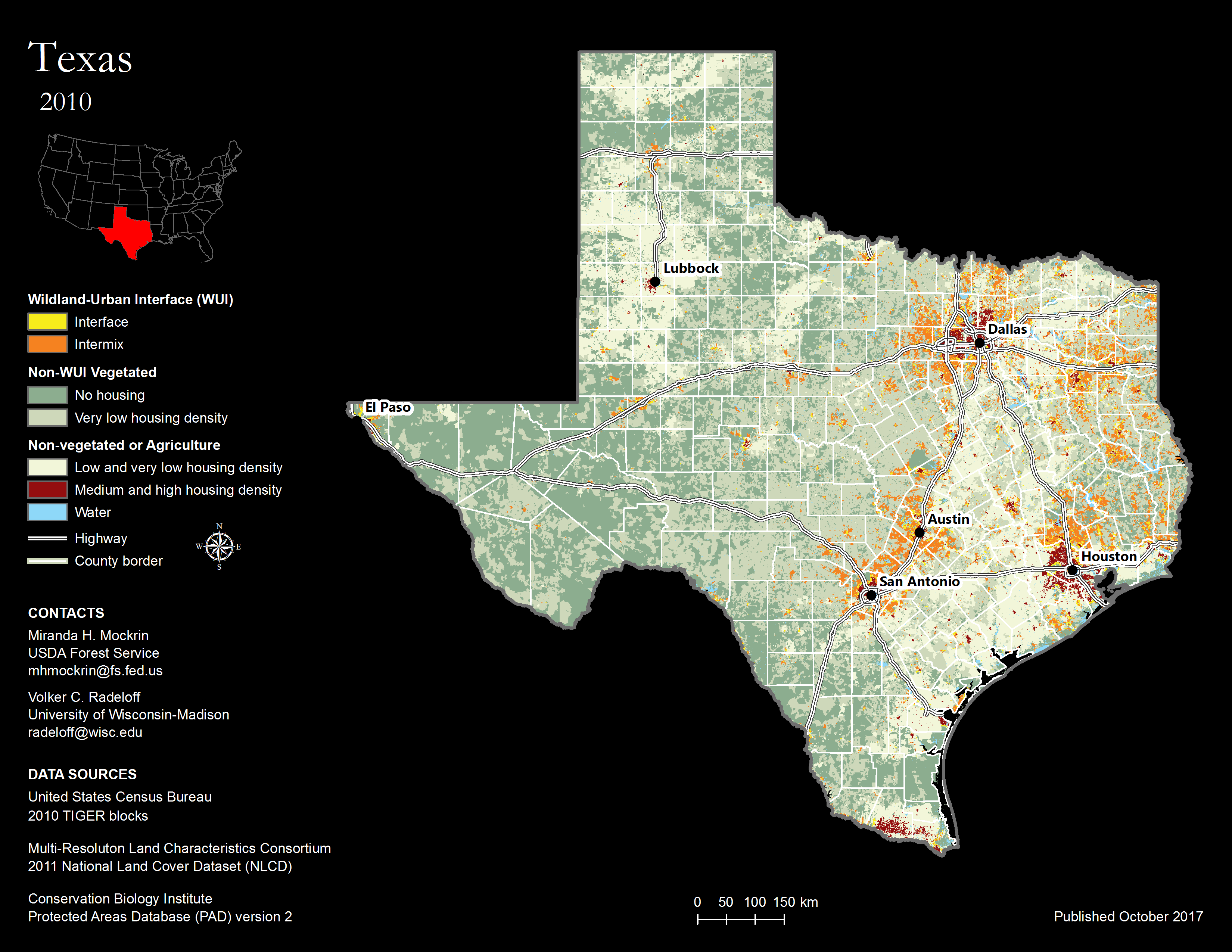
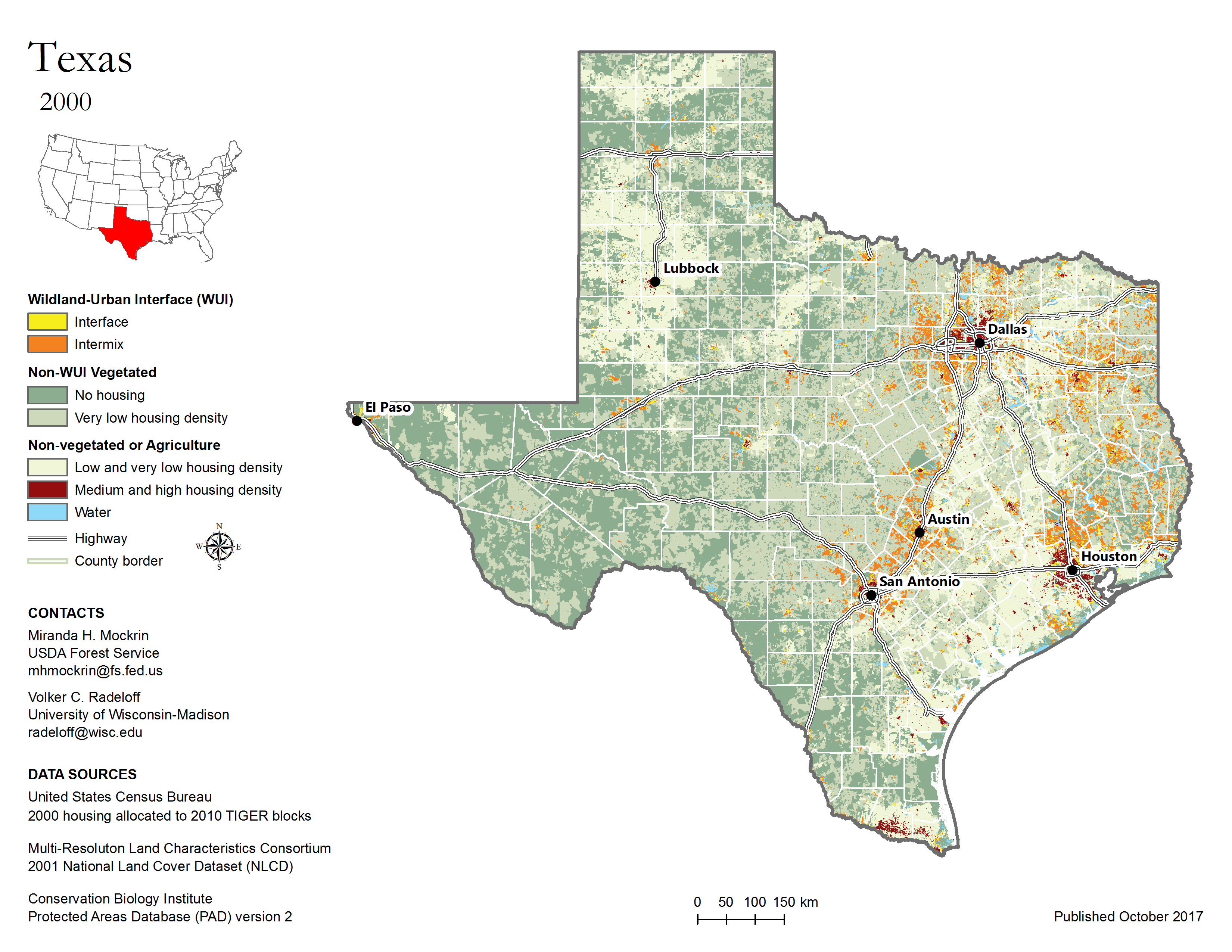
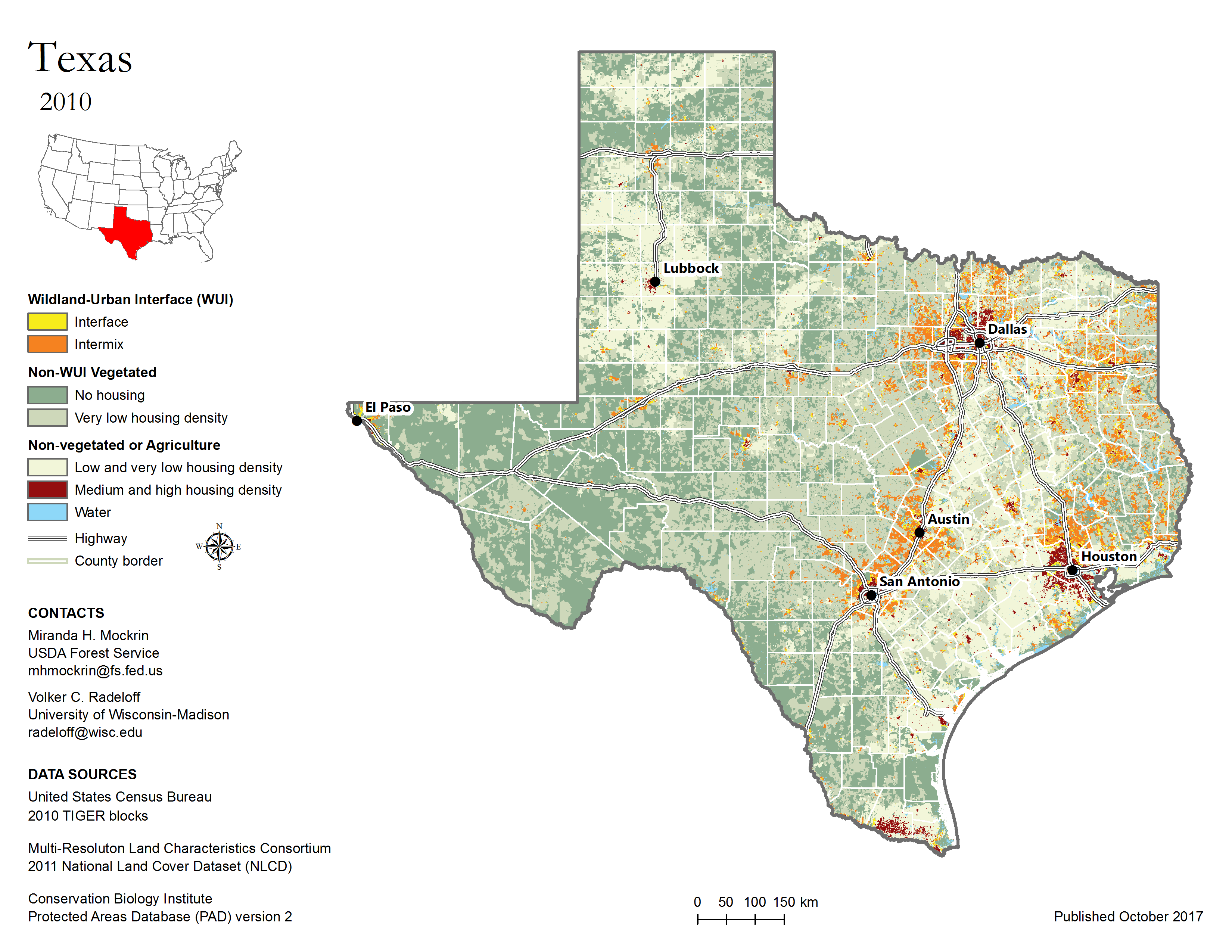
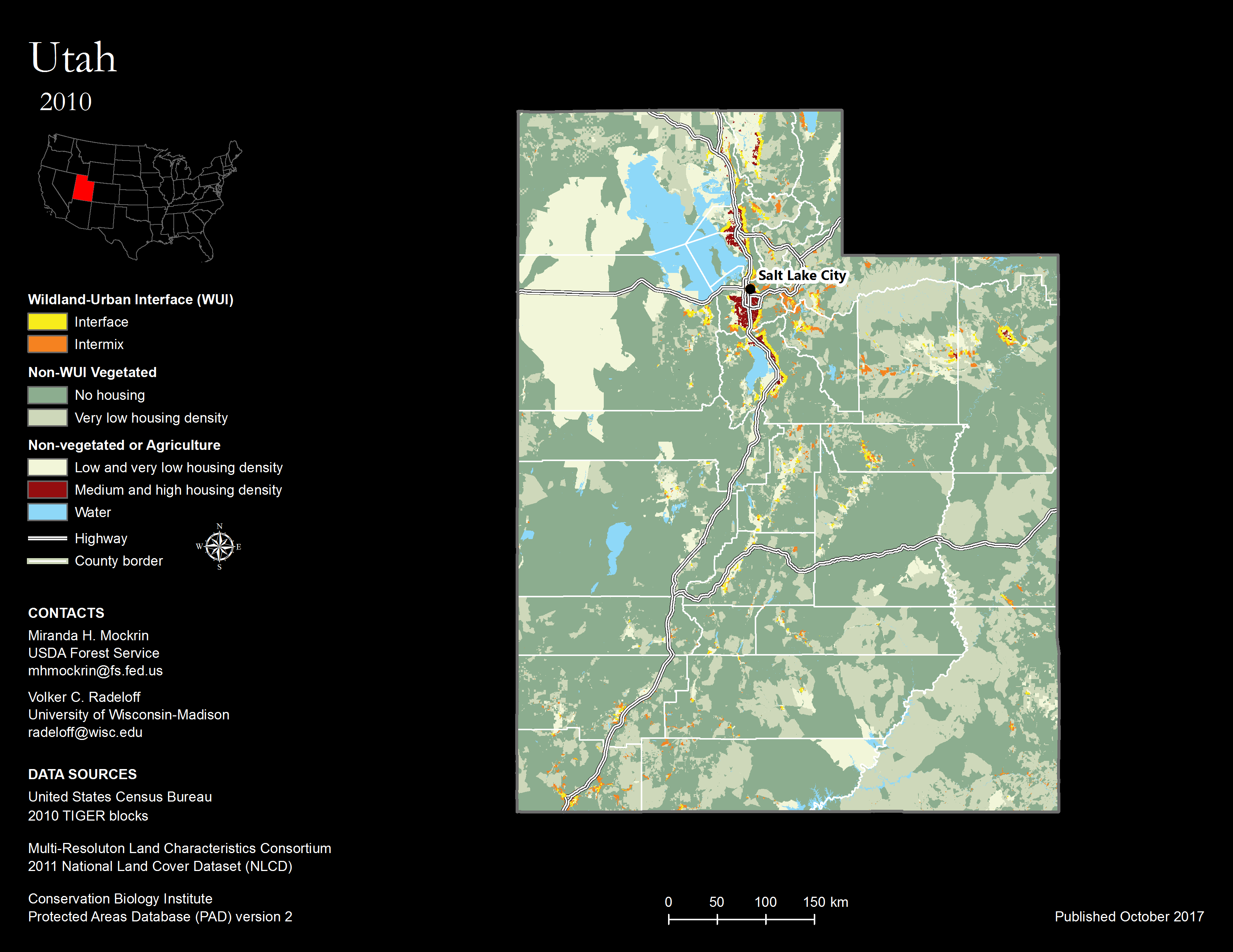
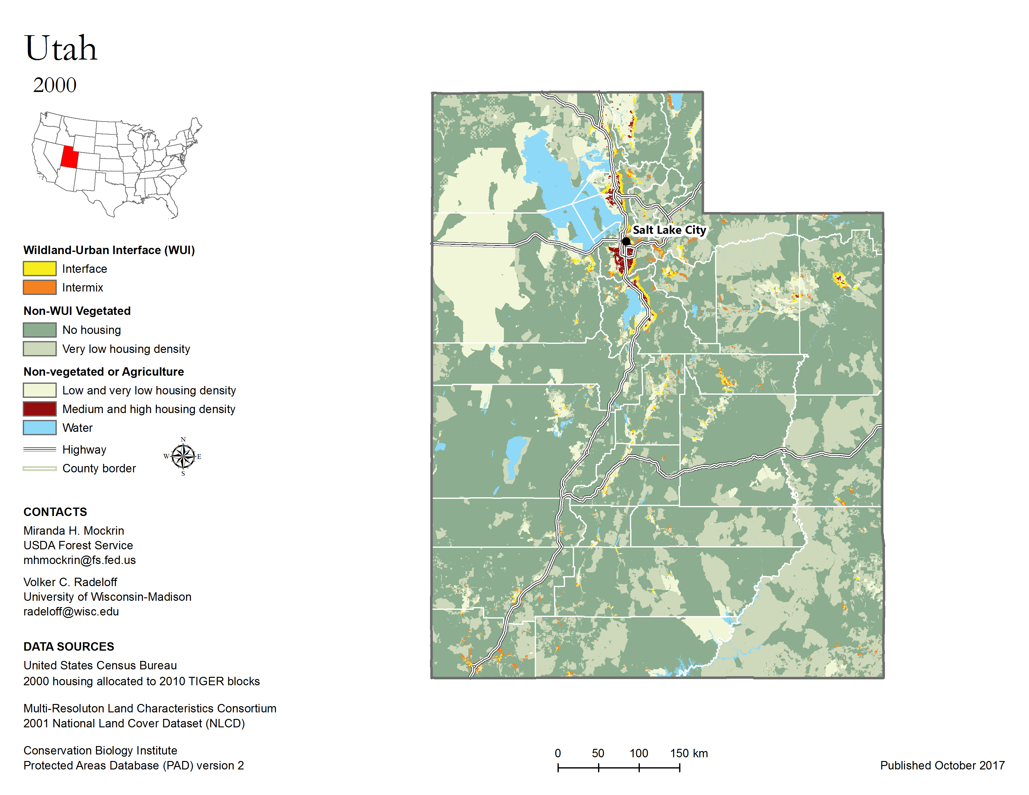
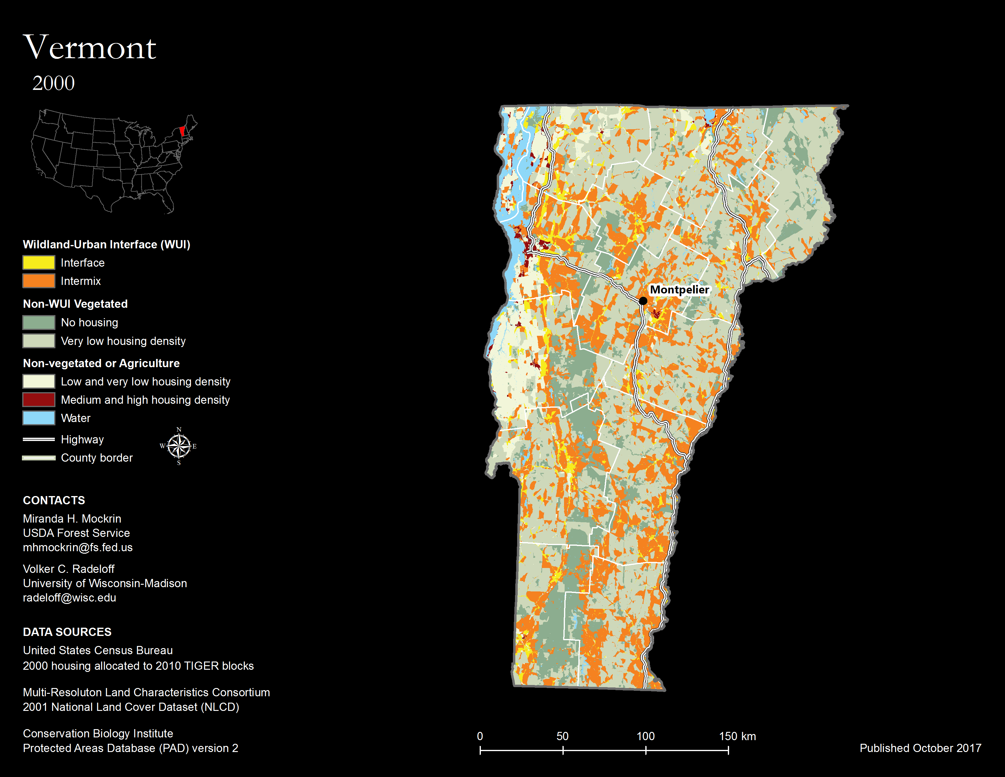
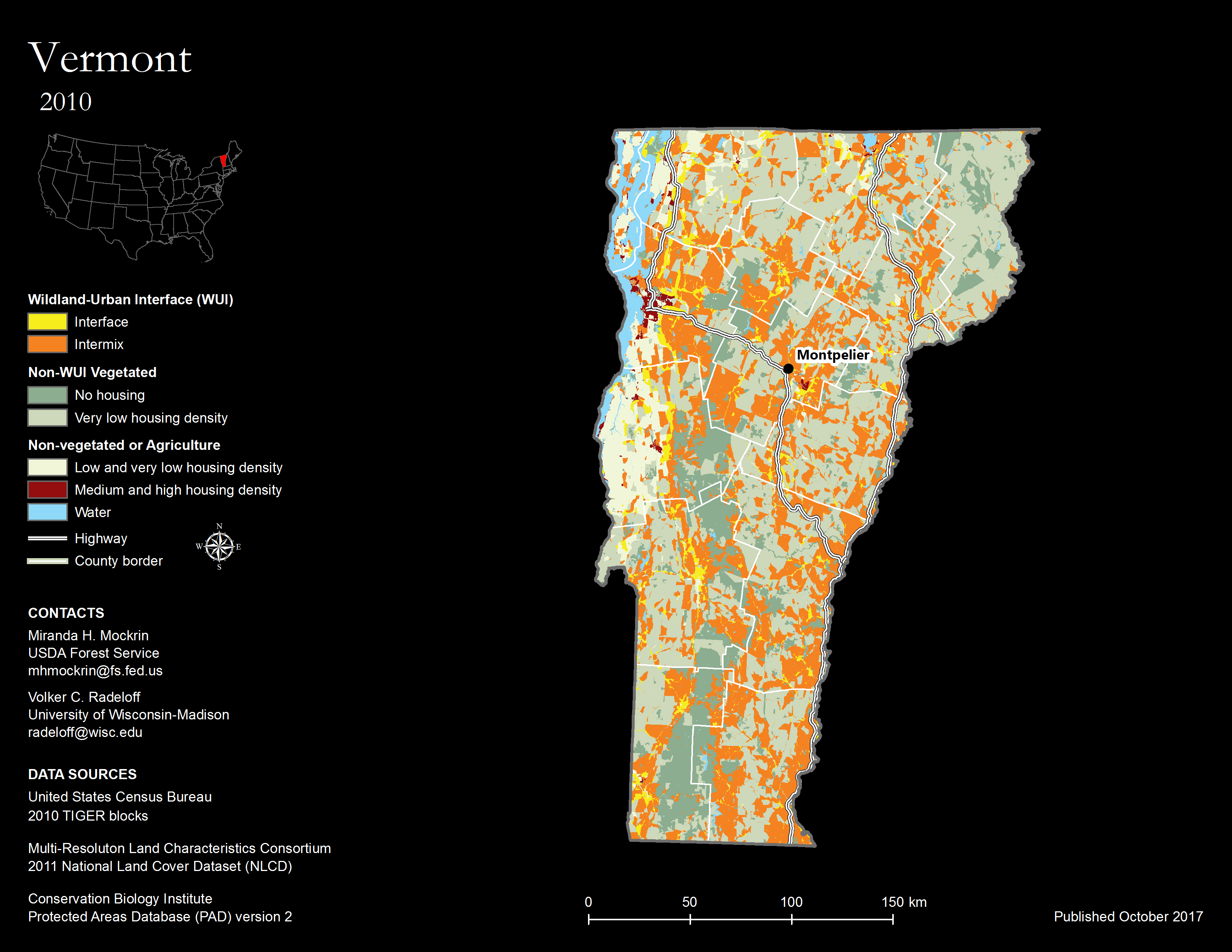
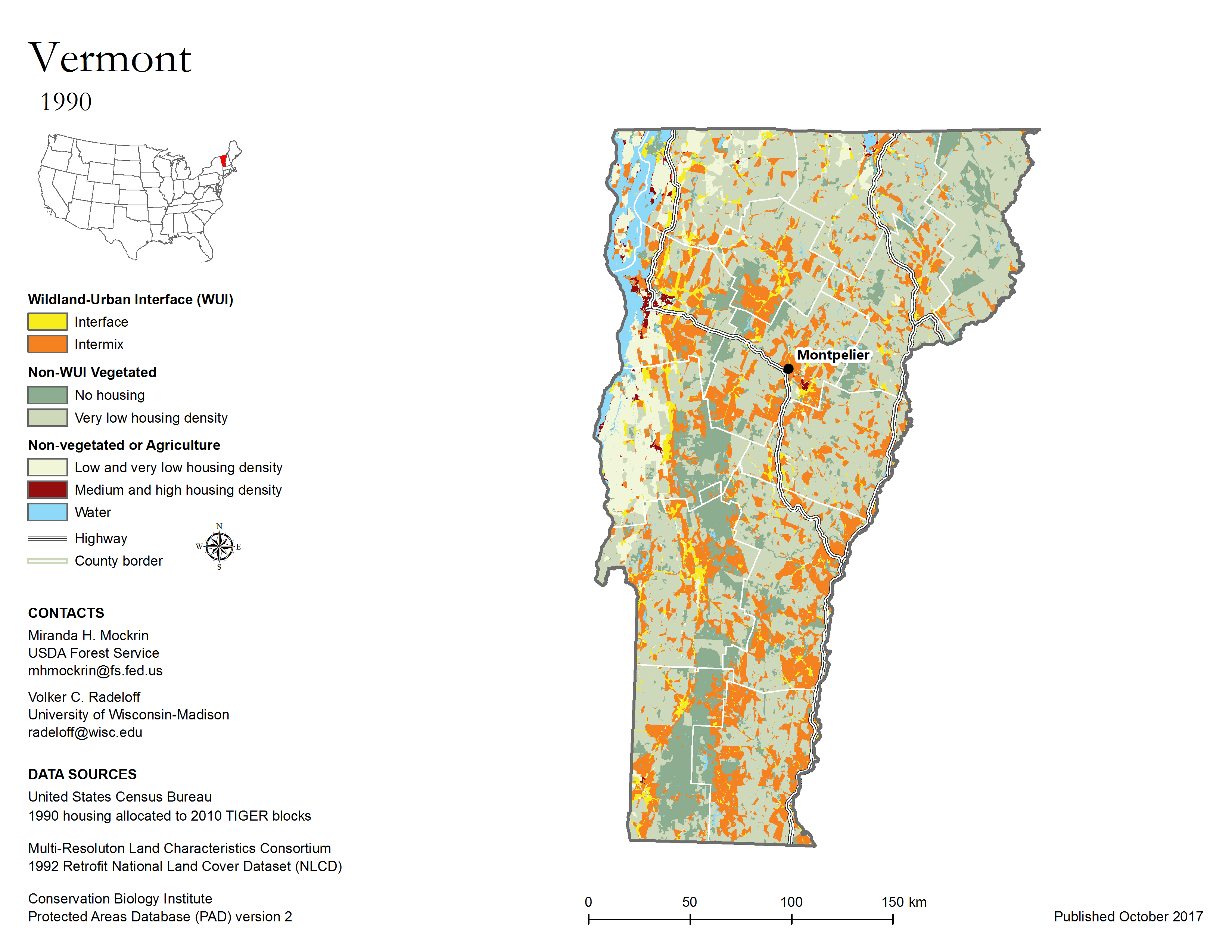
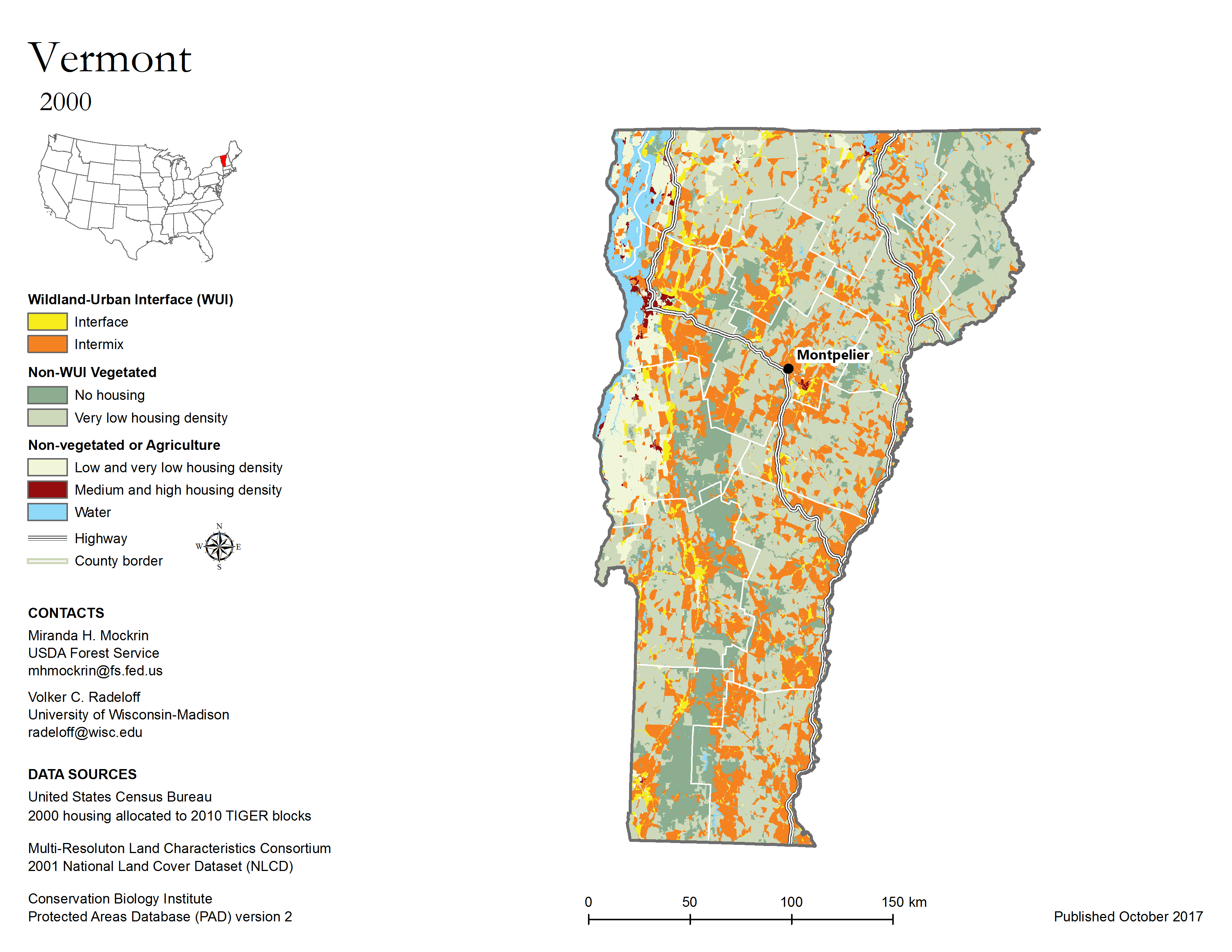
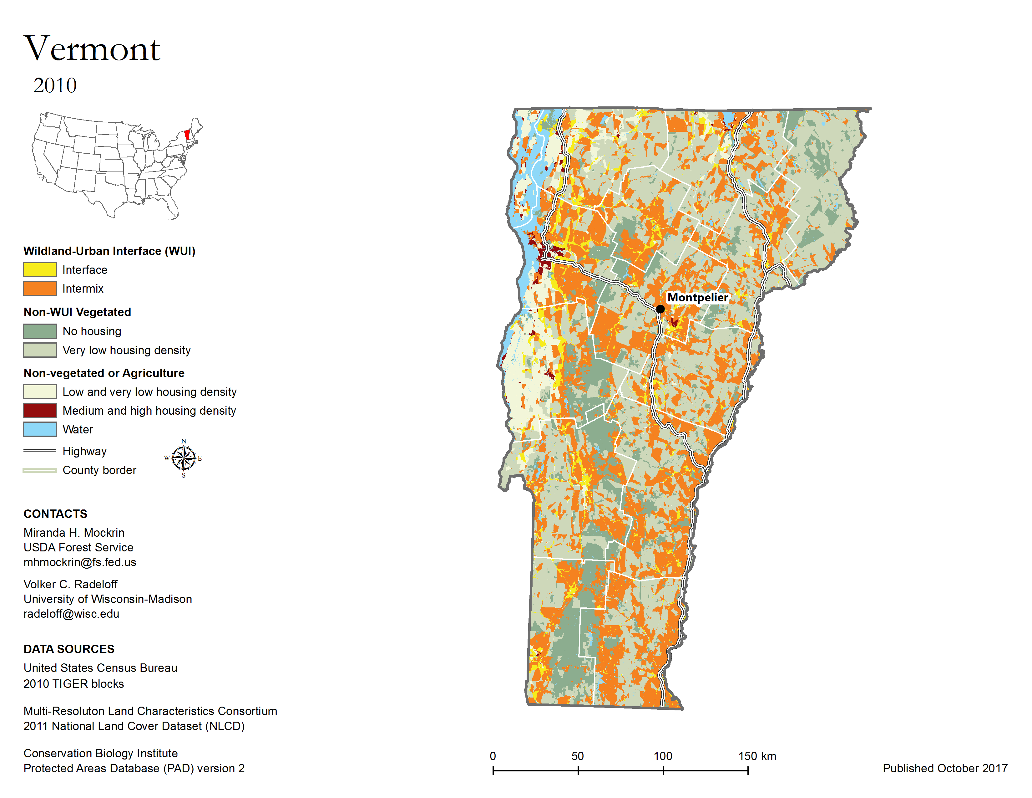
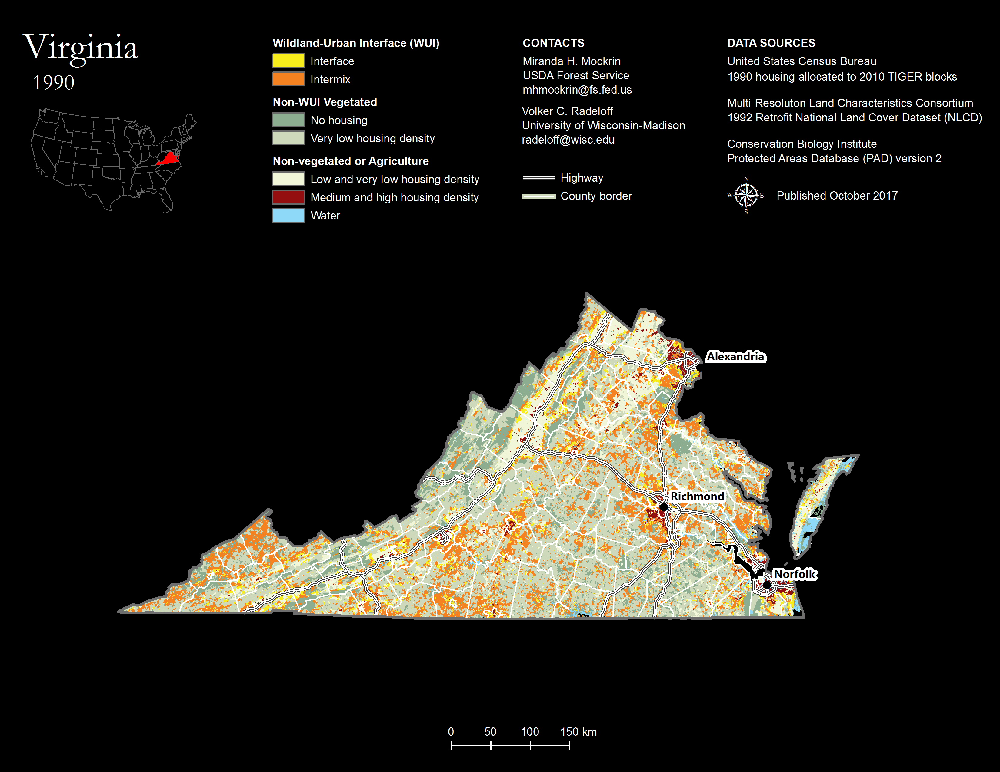
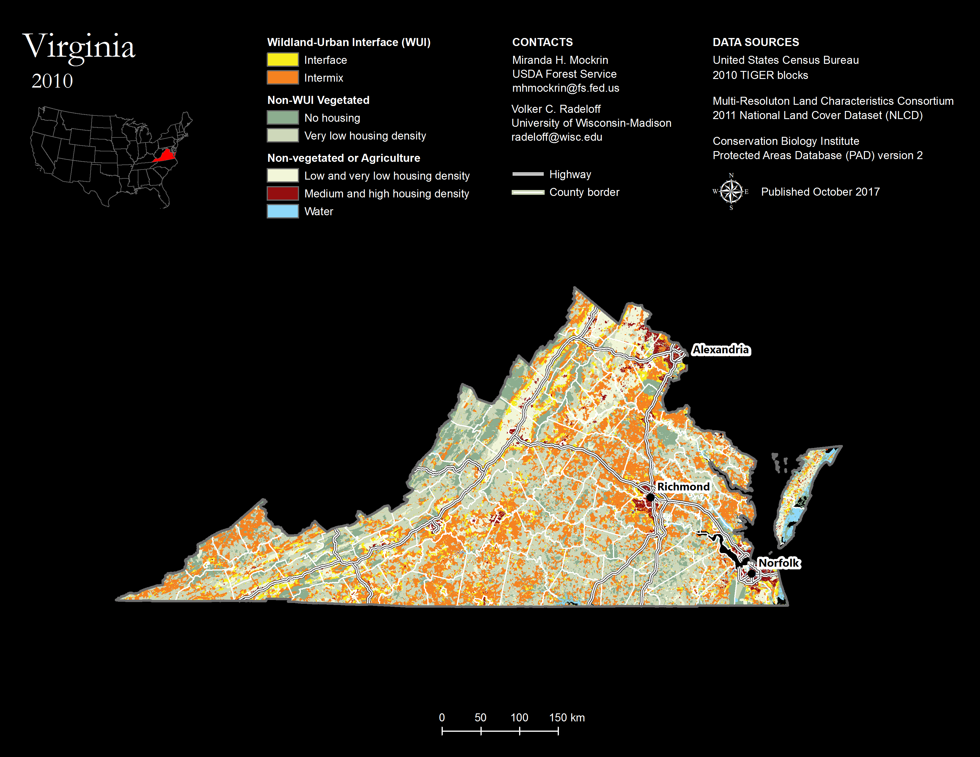
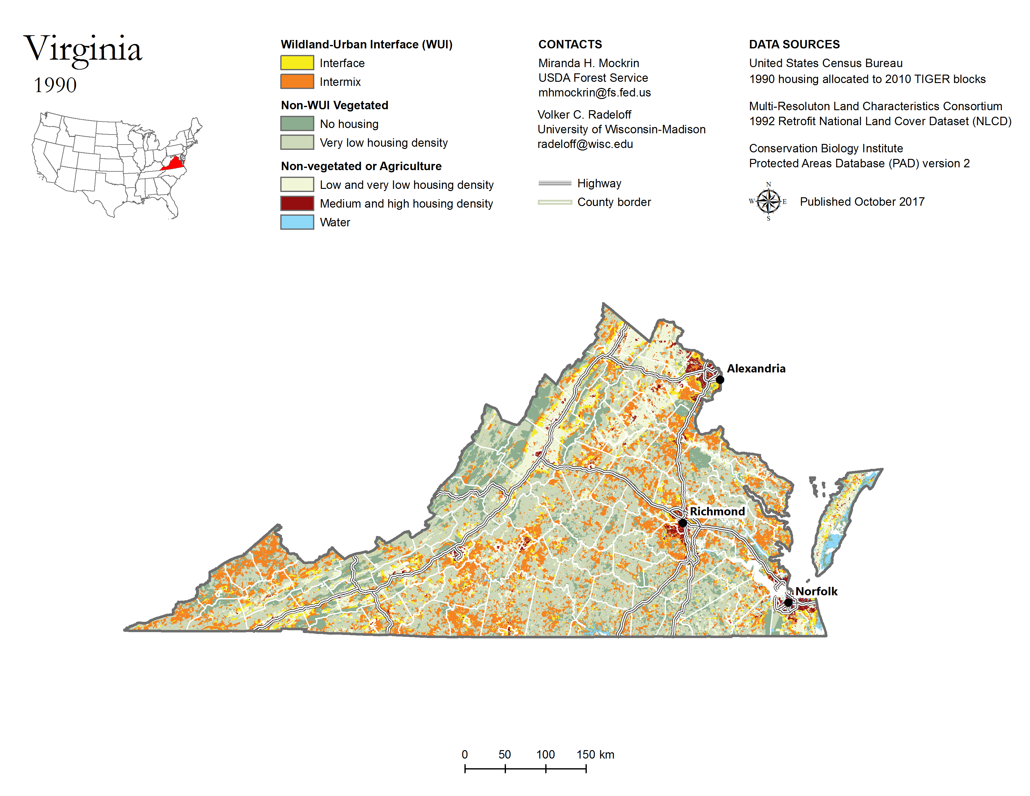
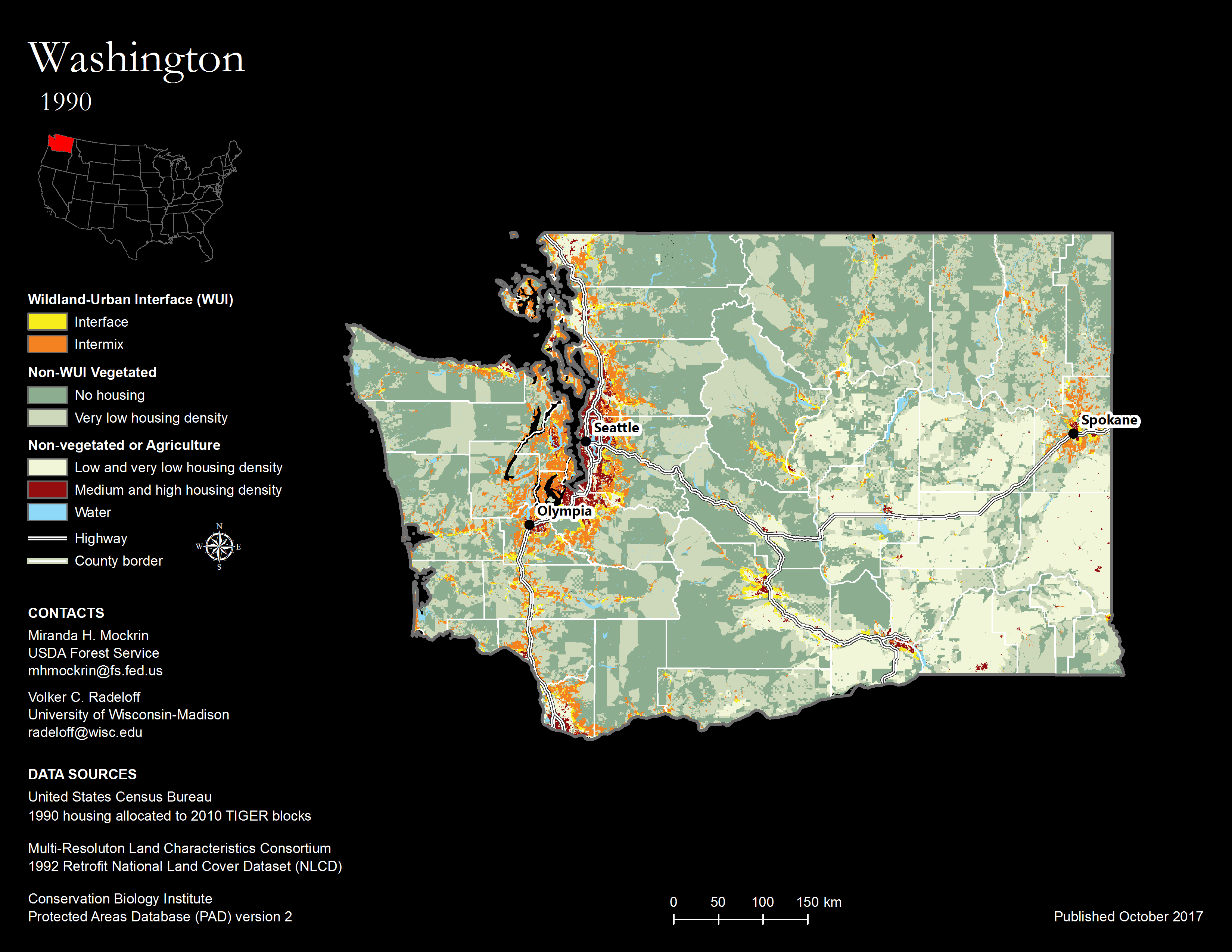
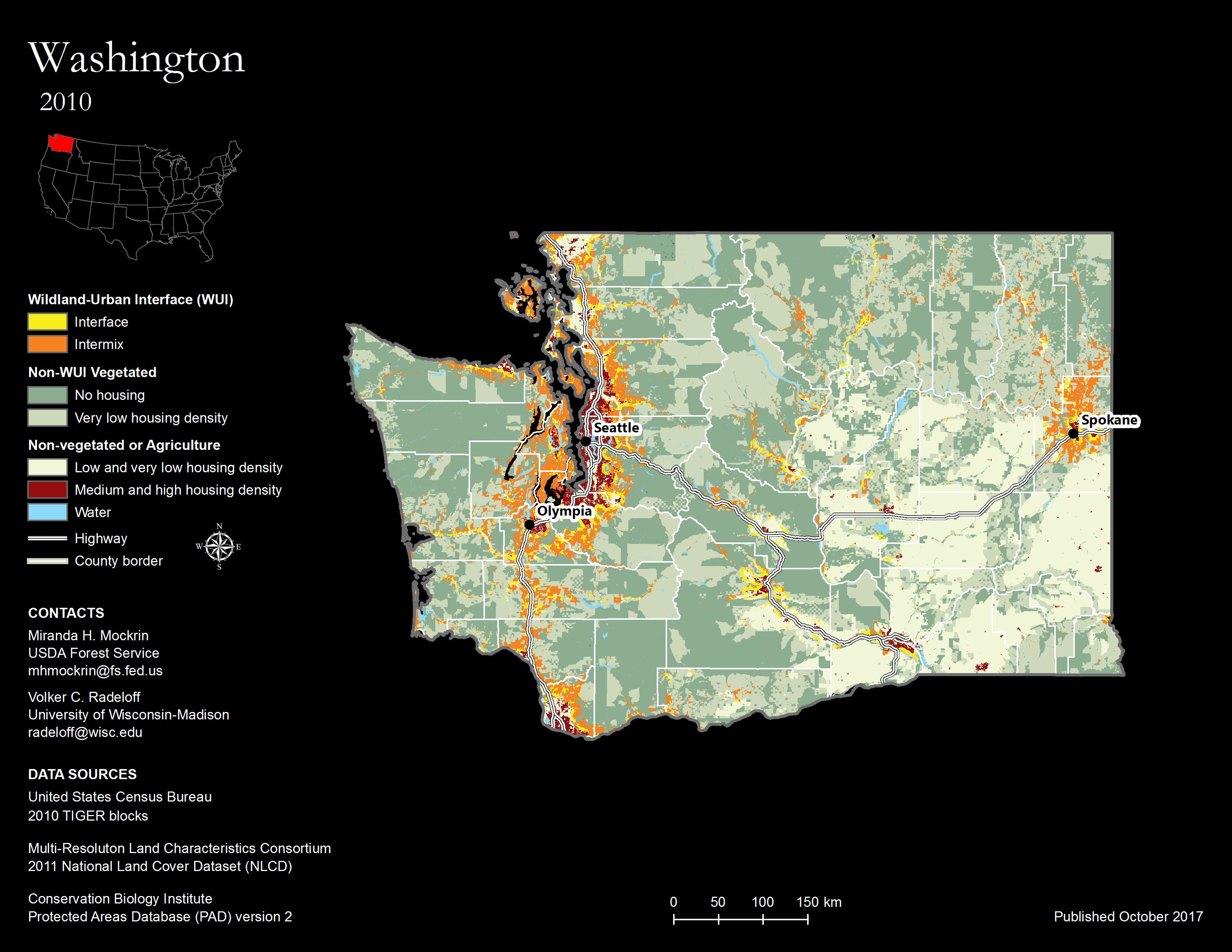
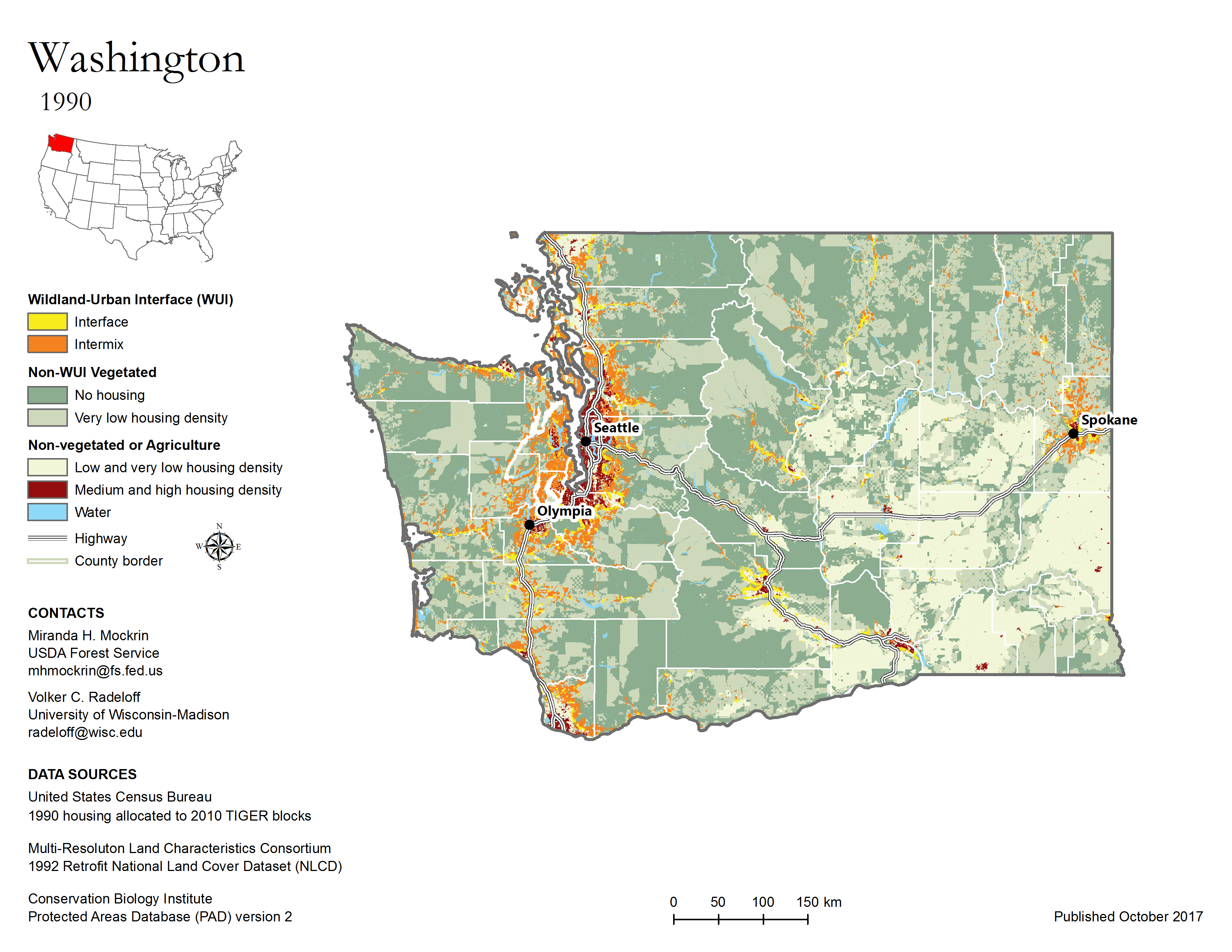
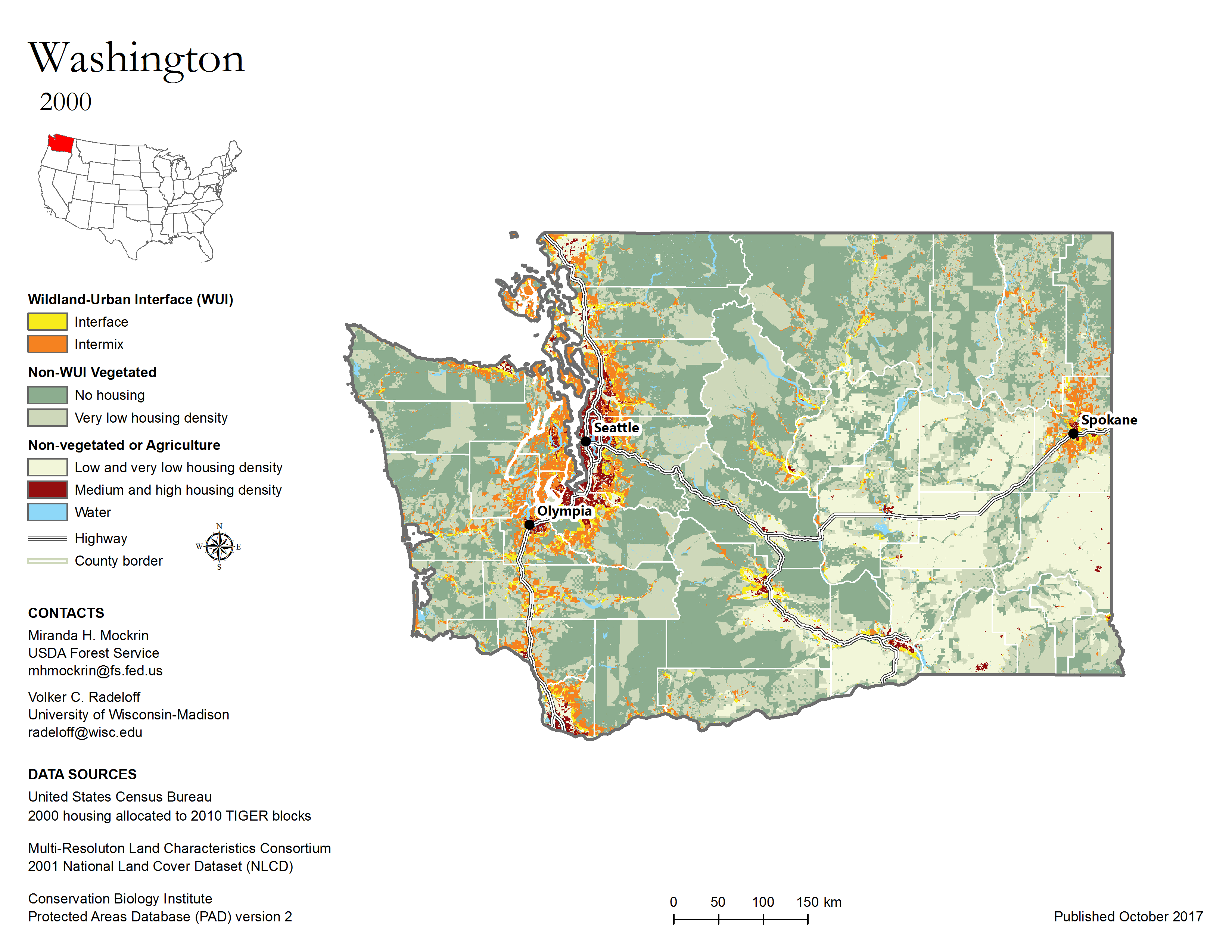
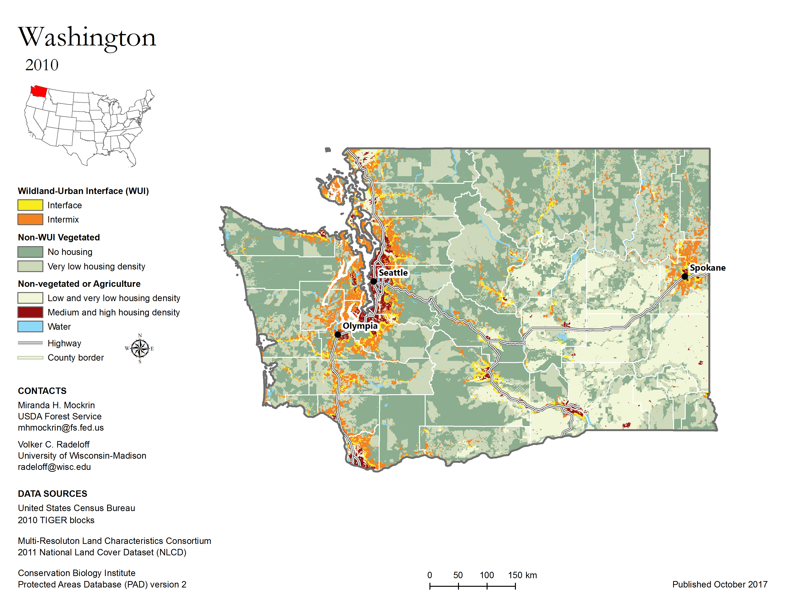
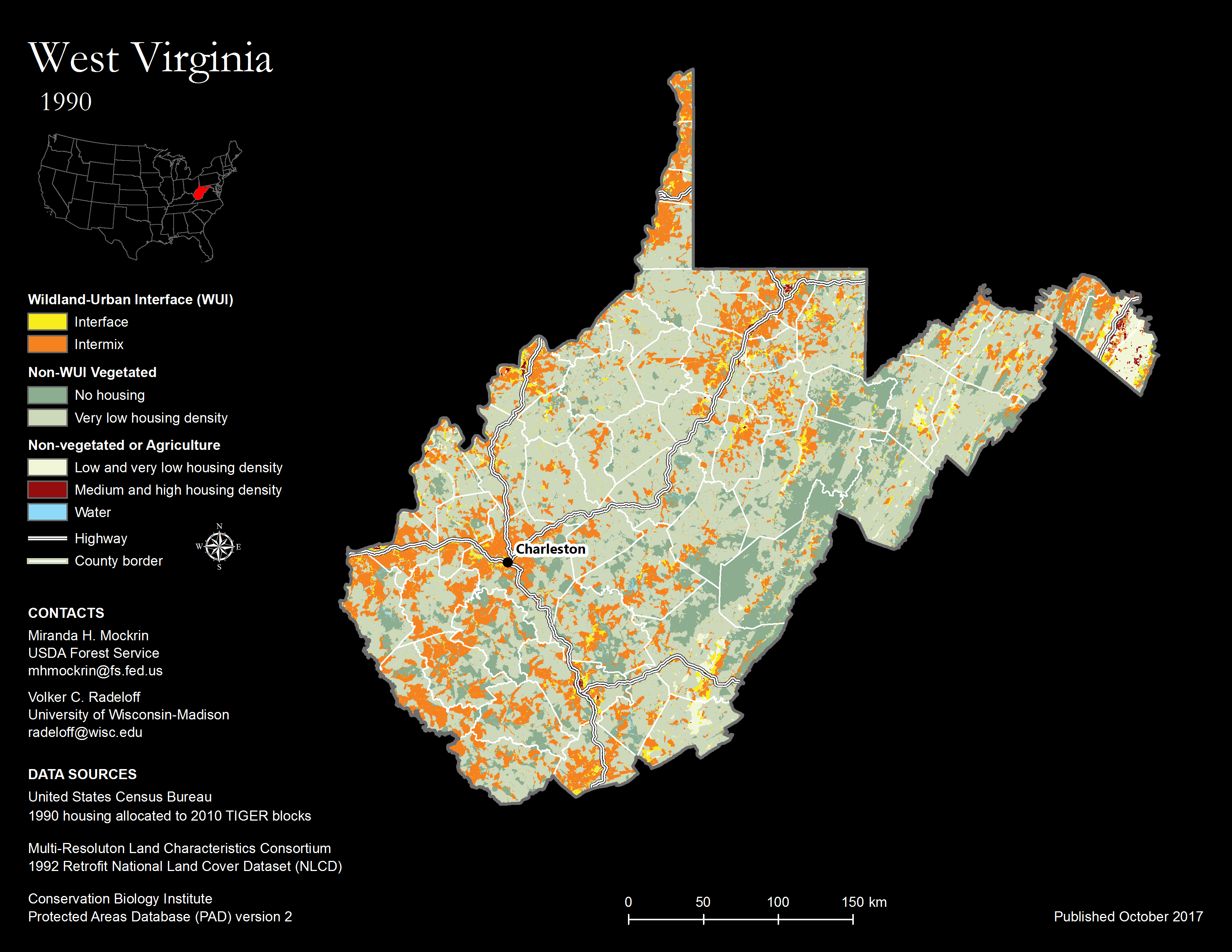
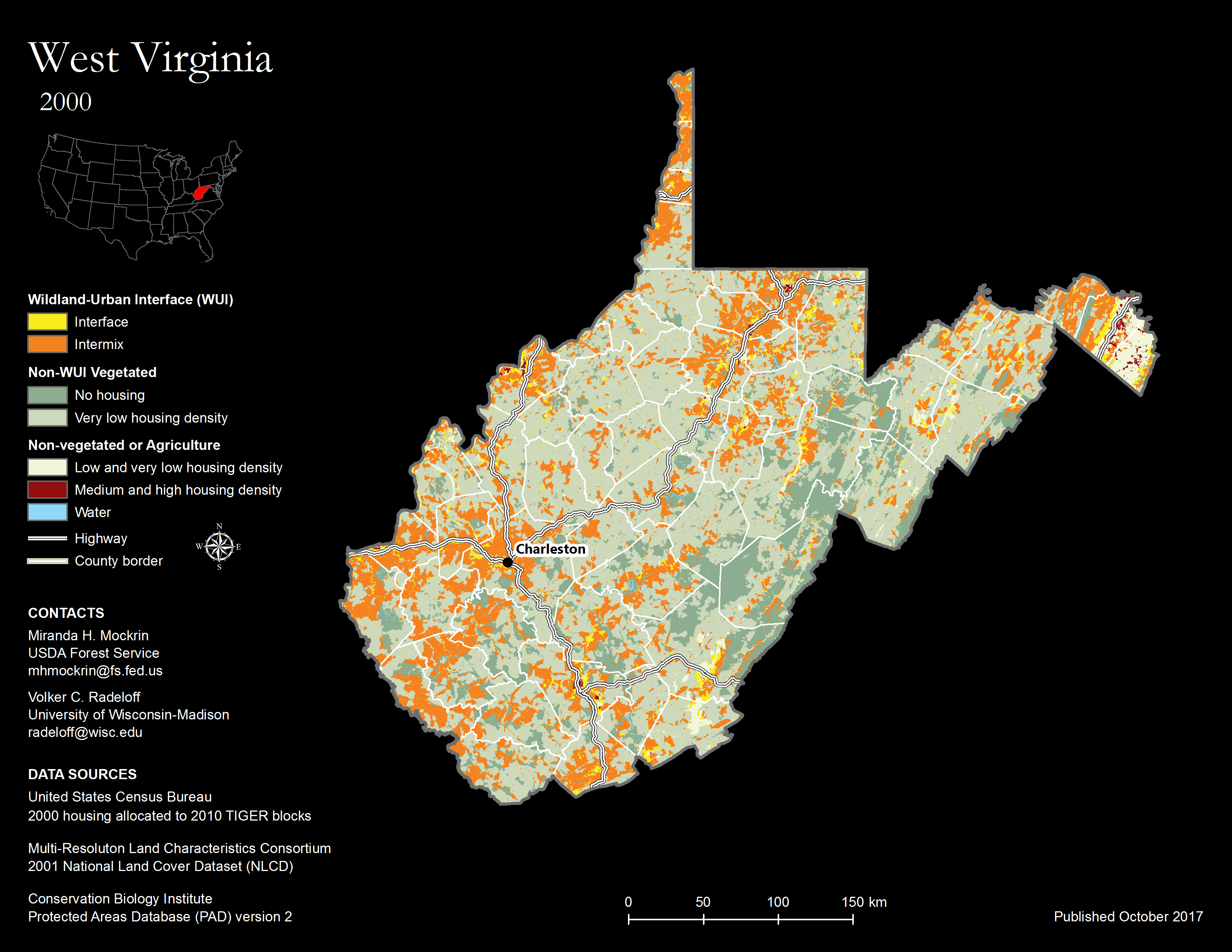
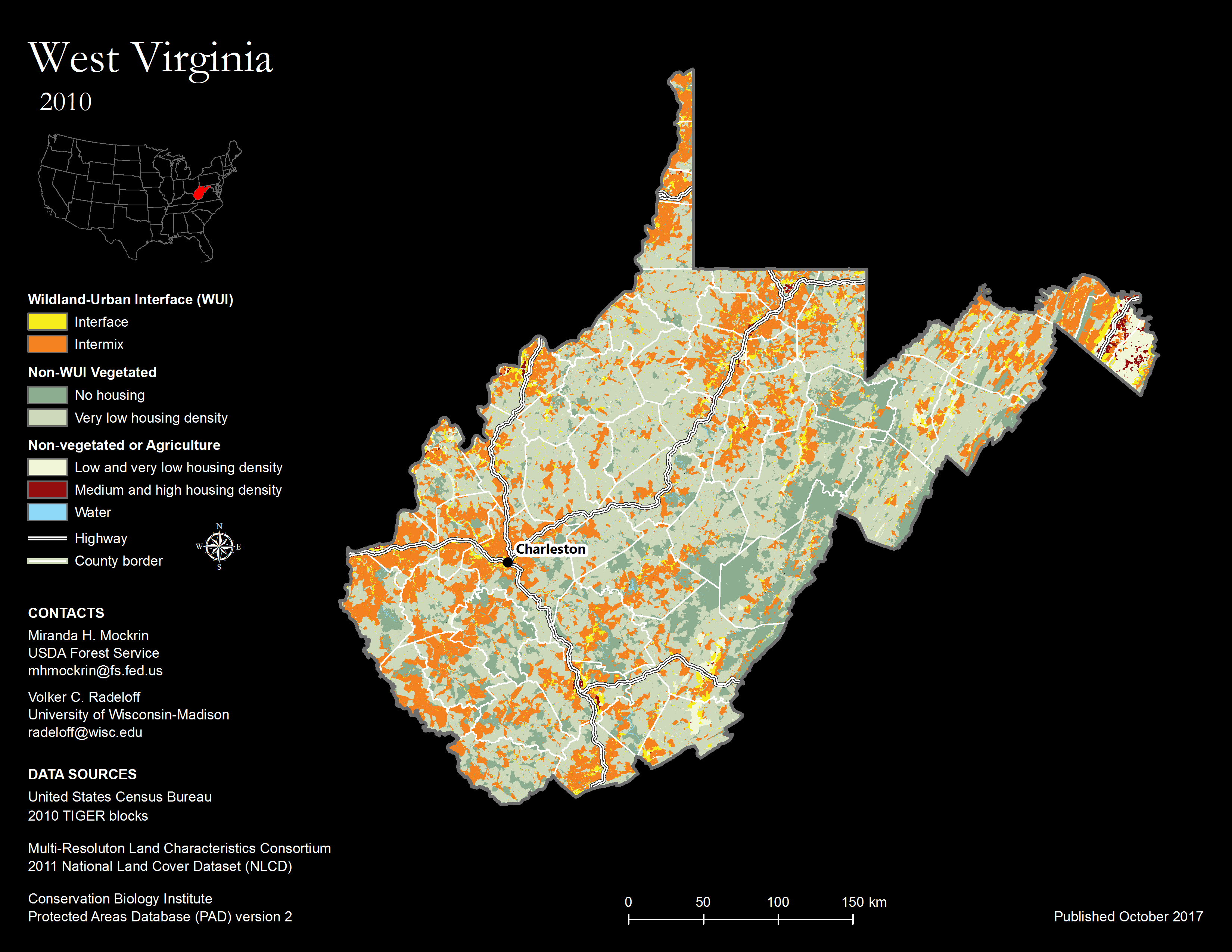
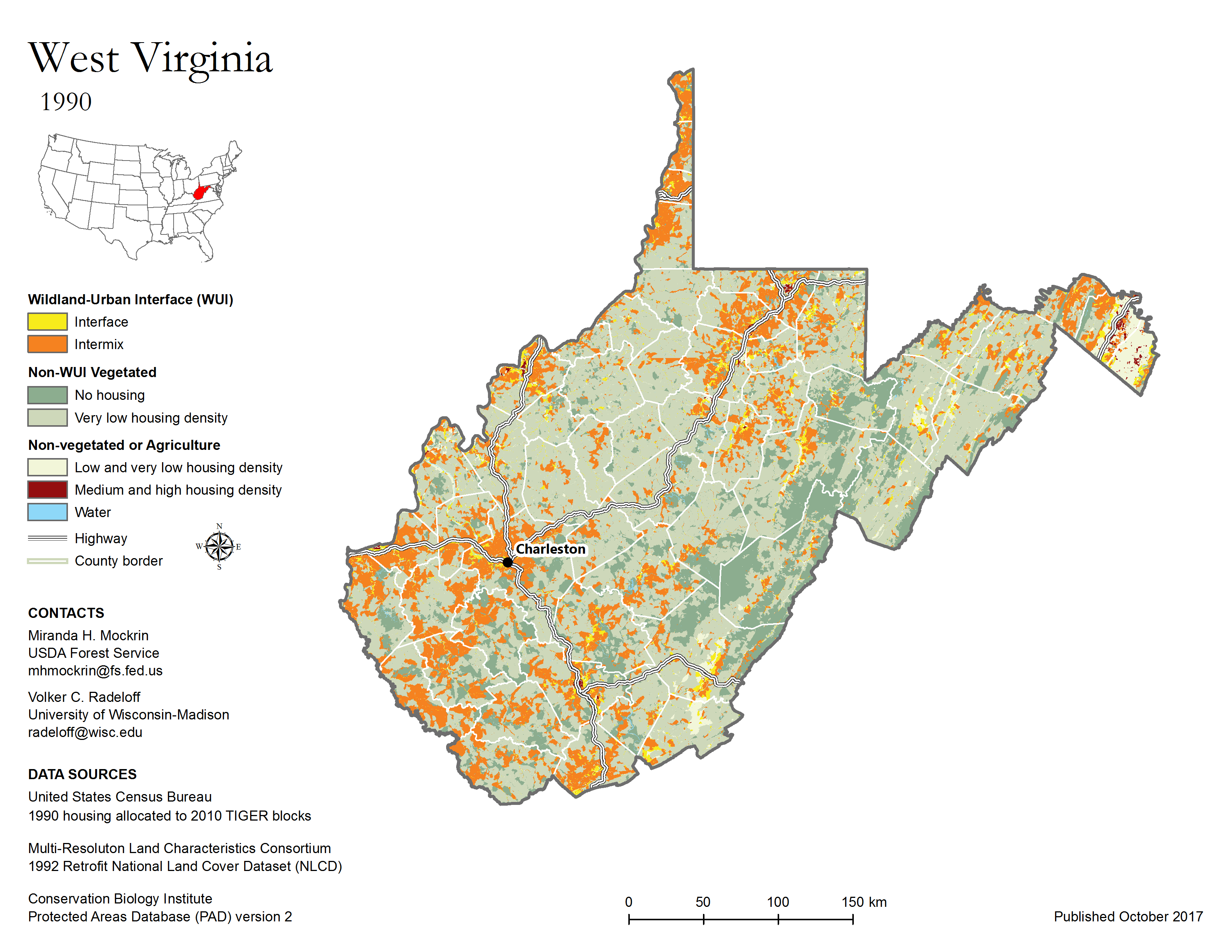
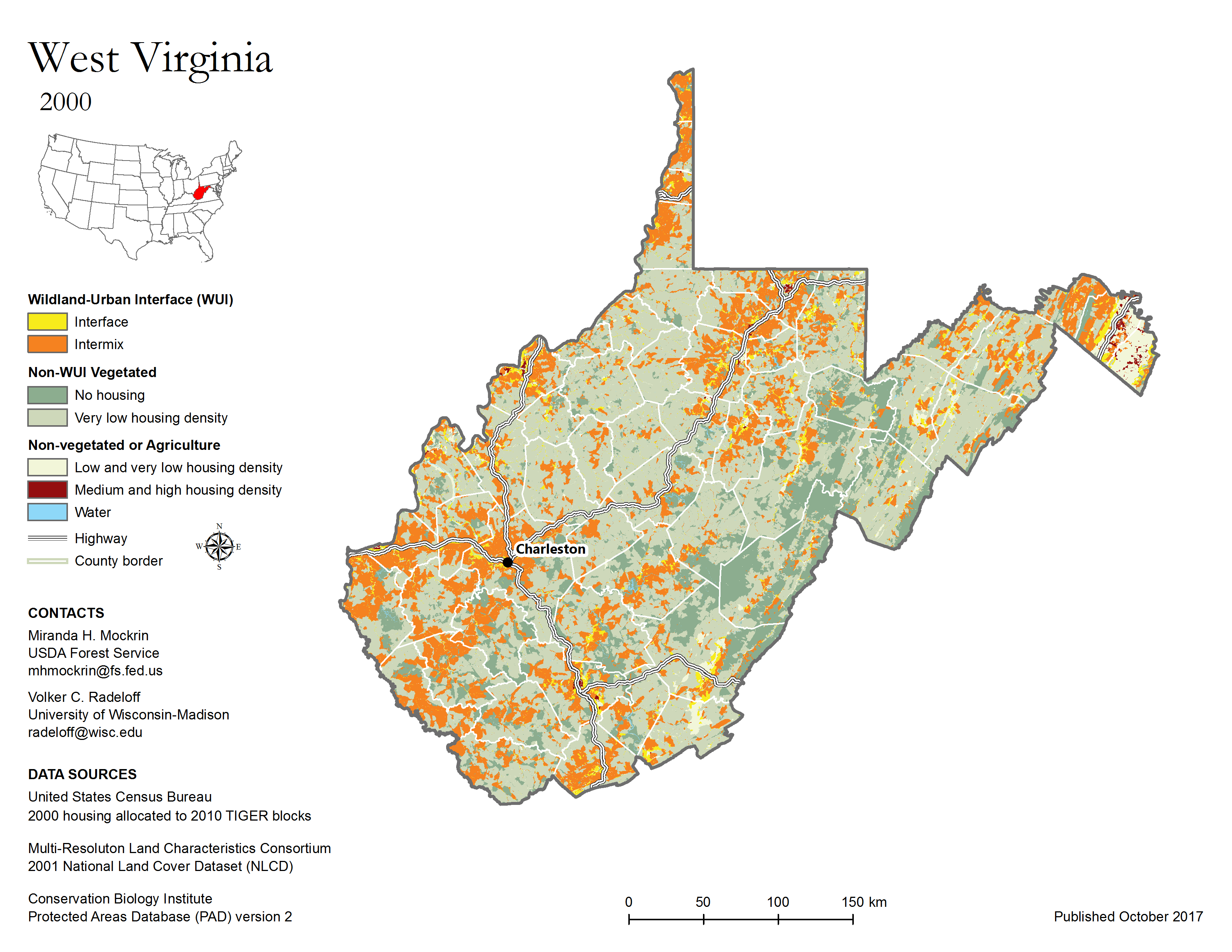
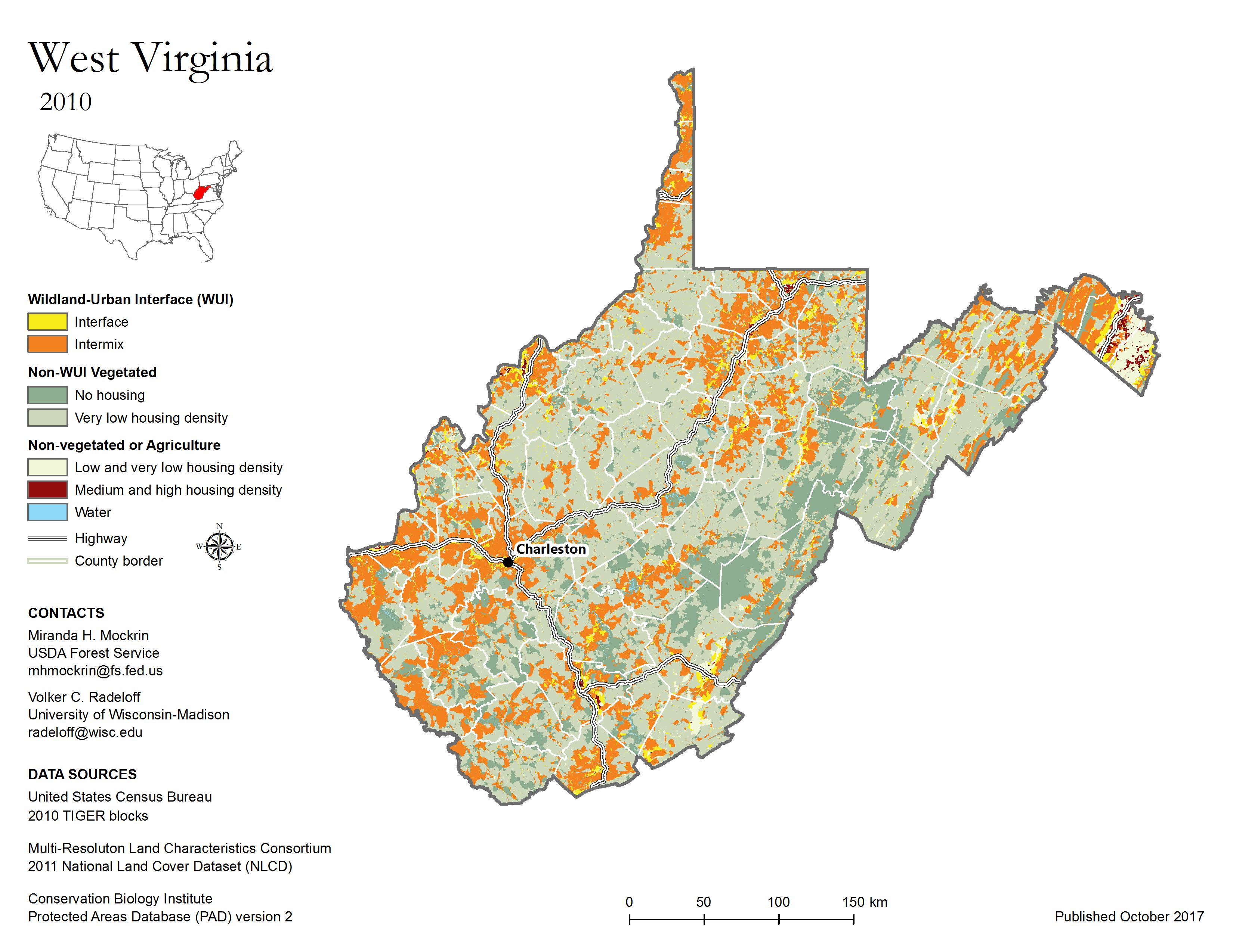
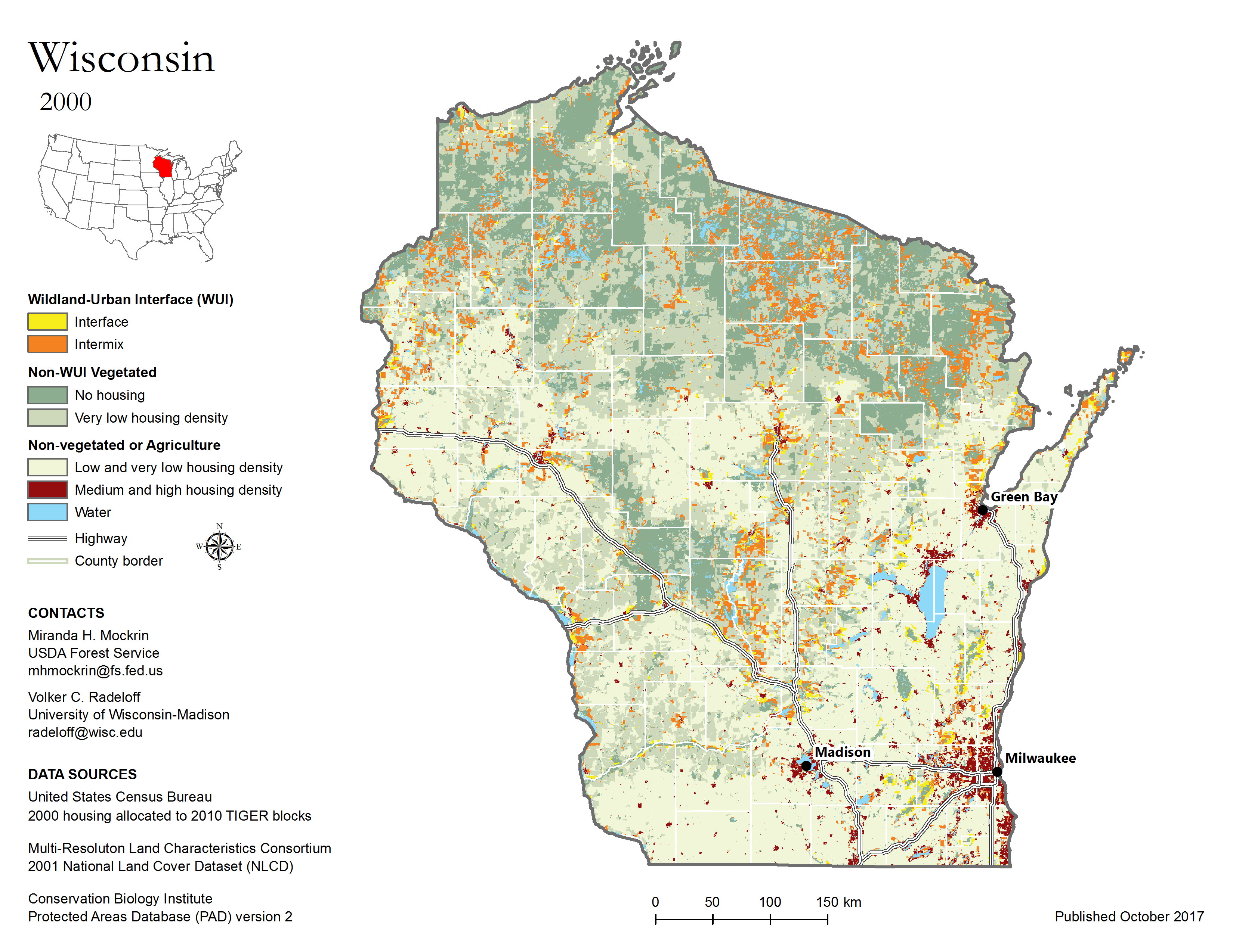
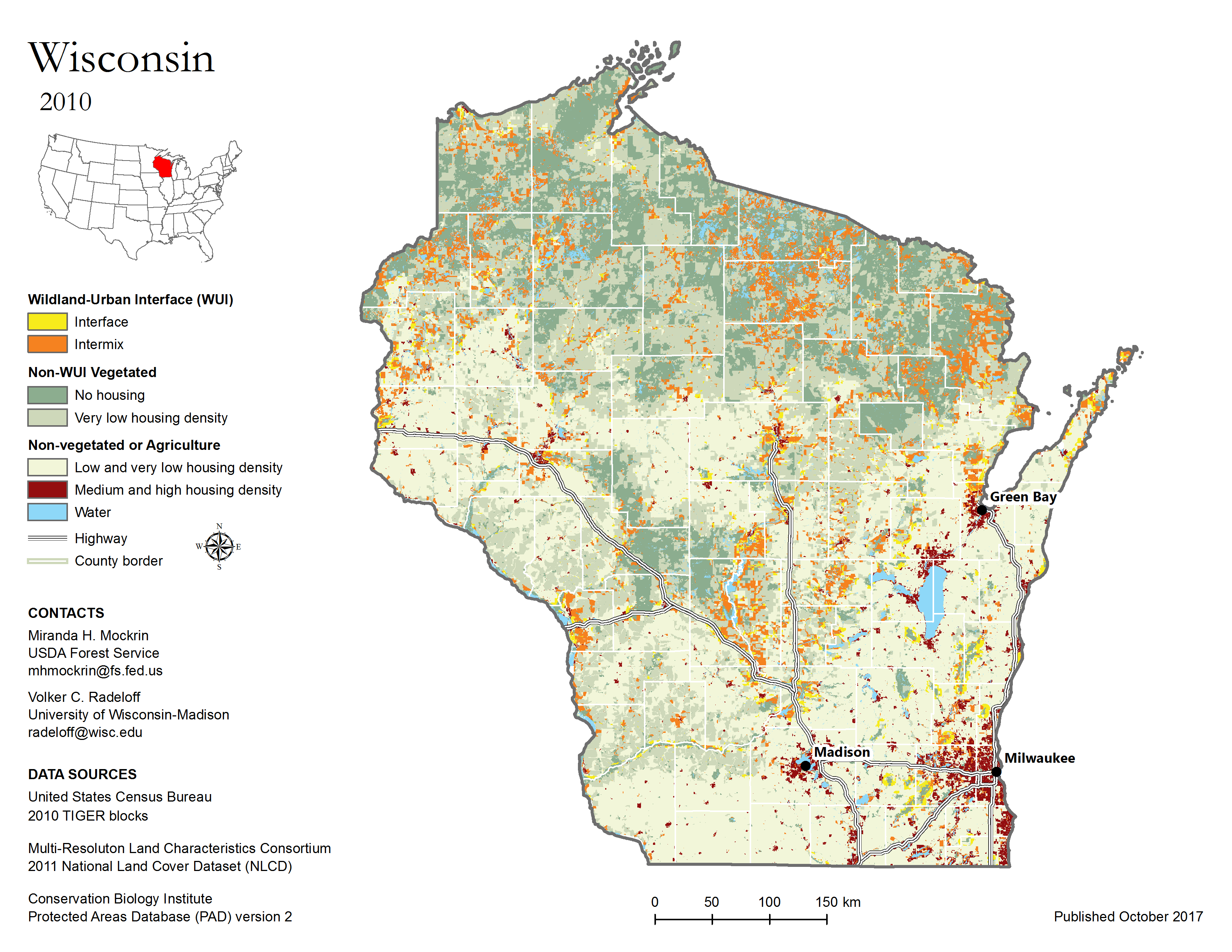
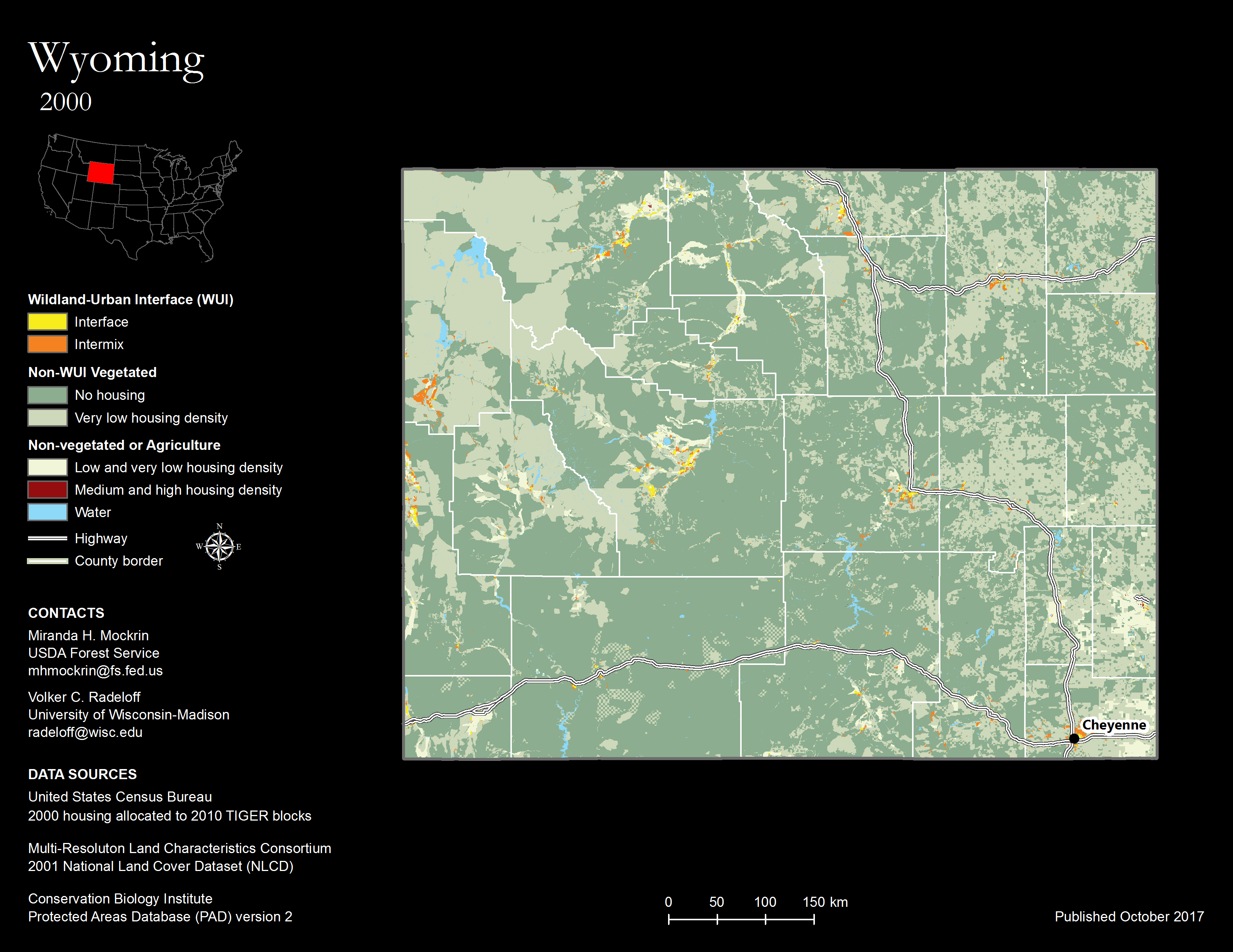
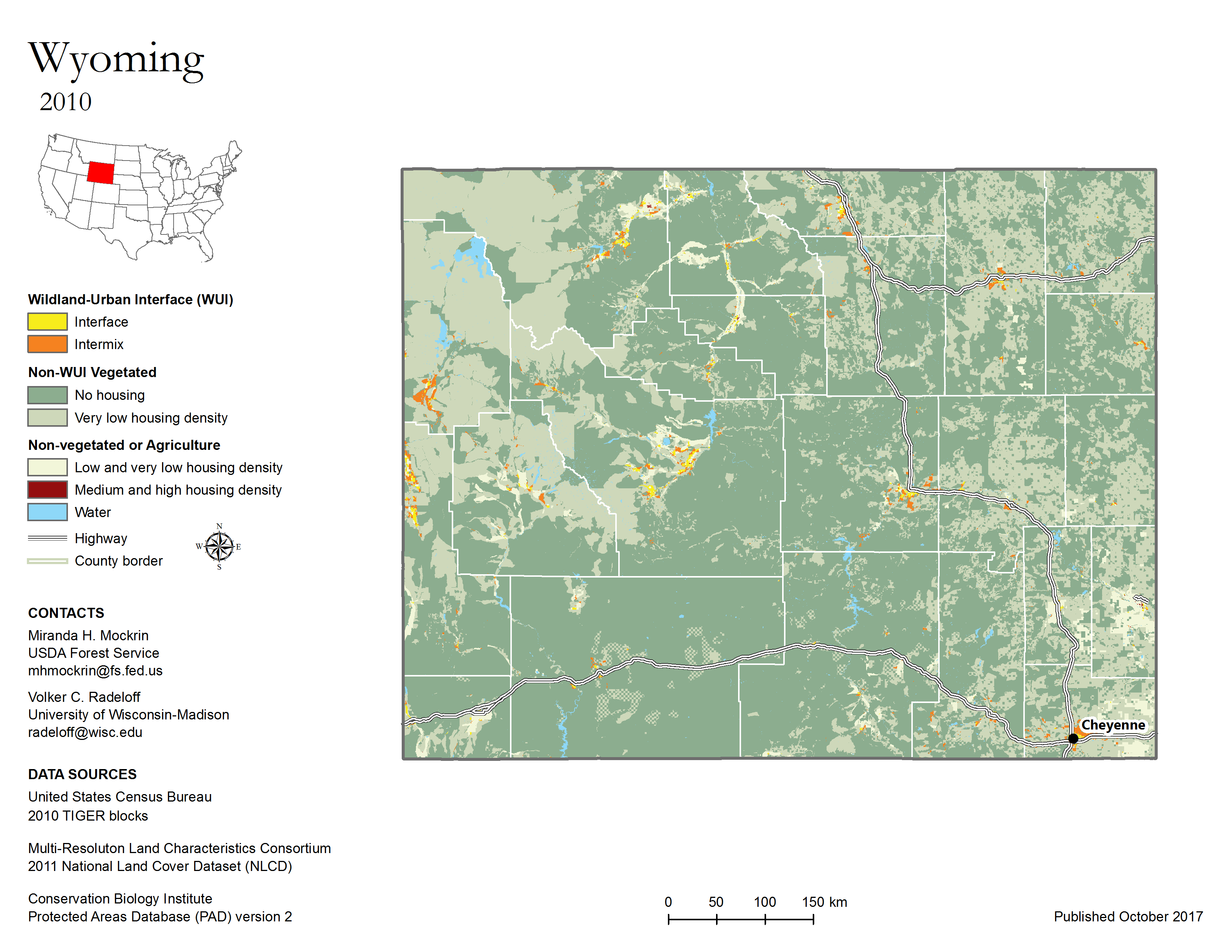
WUI maps are intended to illustrate where the WUI was located in 1990, 2000, and 2010. We map two types of WUI: intermix and interface. Intermix WUI are areas where housing and vegetation intermingle; interface WUI are areas with housing in the vicinity of contiguous wildland vegetation. WUI GIS data were designed to provide a spatially detailed national assessment of the Wildland Urban Interface (WUI) across the conterminous U.S. to support inquiries into the effects of housing growth on the environment, and to inform both national policy and local land management concerning the WUI and associated issues. These data are useful within a GIS for mapping and analysis at national, state, and local levels and are available for download by state as compressed ESRI Shapefiles (.shp), or for the entire U.S. as a compressed file geodatabase (.gdb). Detailed metadata is included with each archive.