Spatial Analysis For Conservation and Sustainability
Remote Sensing
Satellite images provide a wonderful record of the last fifty years of global change. We have pioneered new methods to map wildlife habitat and proxies for biodiversity and habitat, as well as agricultural abandonment and other types of land use change for large areas. We analyze MODIS/VIIRS data across the globe, Landsat and Sentinel-2 across continents, and high-resolution CORONA spy satellite imagery across countries.
The thermal environment limits species ranges through its influence on physiology and resource distributions
and thus affects species richness patterns over broad spatial scales. Understanding how temperature drives
species richness patterns is particularly important in the context of global change and for effective conservation
planning. Landsat 8's Thermal Infrared Sensor (TIRS) allows direct mapping of temperature at moderate spatial
resolutions (100 m, downscaled by the USGS to 30 m), overcoming limitations inherent in coarse interpolated
weather station data that poorly capture fine-scale temperature patterns over broad areas. TIRS data thus offer
the unique opportunity to understand how the thermal environment influences species richness patterns. Our
aim was to develop and assess the ability of TIRS-based temperature metrics to predict patterns of winter bird
richness across the conterminous United States during winter, a period of marked temperature stress for birds.
We used TIRS data from 2013-2018 to derive metrics of relative temperature and intra-seasonal thermal heterogeneity.
To quantify winter bird richness across the conterminous US, we tabulated the richness only for
resident bird species, i.e., those species that do not move between the winter and breeding seasons, from the
North American Breeding Bird Survey, the most extensive survey of birds in the US. We expected that relative
temperature and thermal heterogeneity would have strong positive associations with winter bird richness because
colder temperatures heighten temperature stress for birds, and thermal heterogeneity is a proxy for
thermal niches and potential thermal refugia that can support more species. We further expected that both the
strength of the effects and the relative importance of these variables would be greater for species with greater
climate sensitivity, such as small-bodied species and climate-threatened species (i.e., those with large discrepancies
between their current and future distributions following projected climate change). Consistent with
our predictions, relative temperature and thermal heterogeneity strongly positively influenced winter bird
richness patterns, with statistical models explaining 37.3% of the variance in resident bird richness. Thermal
heterogeneity was the strongest predictor of small-bodied and climate-threatened species in our models, whereas
relative temperature was the strongest predictor of large-bodied and climate-stable species. Our results demonstrate
the important role that the thermal environment plays in governing winter bird richness patterns and
highlight the previously underappreciated role that intra-seasonal thermal heterogeneity may have in supporting
high winter bird species richness. Our findings thus illustrate the exciting potential for TIRS data to guide
conservation planning in an era of global change.
Viewed from satellite images, the Caucasus Mountains are a mosaic of forests, rangelands and agriculture stretched across rugged topography between the Caspian and Black Seas. The political and social history in this region is long and turbulent and most recently has resulted in land abandonment. Globally, agricultural land returning to a wilder state is not a trend we are used to seeing. However, land abandonment does not always equate to thriving ecosystems.
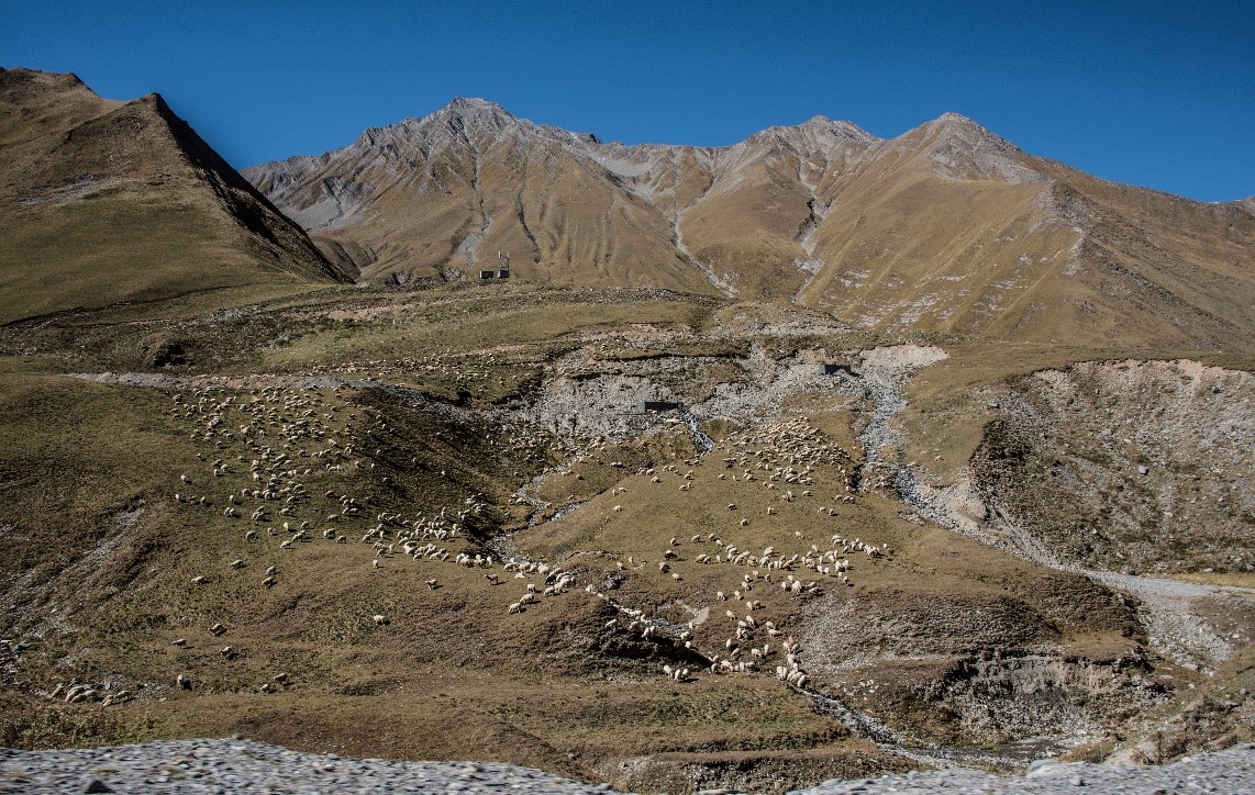
Sheep grazing on the eroded mountain side between Steantsminda and Gudauri townlets in Georgia. Photo by Volker Radeloff.
Land degradation is another important force shaping this part of the world, and often it can be traced to livestock overgrazing. In many cases, cattle or sheep are grazed near villages, rather than dispersed across the landscape. This creates a distinctive pattern that turns up in satellite imagery.
The Caucasus Mountains have been farmed intensively for thousands of years. The grasslands and forests that we see today are not in an unaltered state, but rather have changed through time in response to human pressures. Some changes happen on the ground quickly, while others are subtle and have happened over long periods of time, but in general, both can be detected with remote sensing. In the broadest sense, the goal of this research is to find those changes and determine why they are happening.
Katarzyna Ewa Lewinska (Kasia) joined the SILVIS Lab in the summer of 2018 to work with the team studying land use in the Caucasus Mountains. With a strong remote sensing background, an eye for detail, and an intense curiosity about complex problems like this one, she has already begun to make progress.
And why is it important to understand how land cover is changing and what is driving these changes? Land cover influences the ranges of many species, the health of watersheds, nutrient cycling, and the global carbon balance. Our understanding of carbon balance is limited, and carbon sequestration is not uniform across land cover types, but rather influenced by many local-scale factors including land degradation. In models, changing the way degradation is accounted for can yield results that vary by 40-200%, and so it is important to be intentional about the way degradation is defined. Besides being a complex problem, it is also a far reaching one with important implications for understanding the carbon balance and natural resources management of our planet, as 75% of land area is currently degraded and this proportion is projected to increase to 90% in the next 20 years.
Fig 1: High resolution true color images (captured from Google Earth) showing high-mountain summer pasture in North-West Azerbaijan in 2006 and 2017. Yellow arrow in the 2017 scene shows location of a shepherds hut and enclosure. The graph above presents soil endmember time series showing an overall increase in soil reflectance over time. Timing of acquisition of both images is marked in red on the graph.
Because the Caucasus Mountains are so diverse, this region is an ideal natural laboratory for understanding land use and degradation. Kasia explains the incredible variation in her study system: besides the normal degradation, the complex political and social layer, and the projected climate change, the region at its most basic level remains huge and diverse. In the northwest the climate is mild; in the southeast it’s dry and tropical. Only two of the world’s biomes are not represented here. And then there are mountains.
It is no wonder that this region has already been the focus of SILVIS Lab research. Among other projects, current postdoc He Yin and PhD student Johanna Buchner have created land use/land cover maps that track the changes occurring on this landscape every 5 years since 1987.
Kasia hopes to begin disentangling the roles of grazing and climate change in land degradation, and to become more familiar with the region’s ecology through fieldwork in the coming years. Although it’s still in the early stages, this project has a lot of momentum, and it will be interesting to see what is uncovered.
The Caucuses region (encompassing parts of Russia, Georgia, Armenia and Azerbaijan) has experienced extreme political upheavals. The collapse of the Soviet Union meant that the four countries became sovereign. Their powerful neighbors — Russia, Iran and Turkey – maintained strong geopolitical interests in the newly independent nations of Georgia, Armenia and Azerbaijan. As a result, the Caucasus has experienced four armed conflicts since 1991. In light of such extreme social and political disruption, Johanna wanted to know how cropland and forests had changed.
Figure 1: Land cover/ land use map of the Caucasus.
From previous research, some by former SILVIS lab members Drs. Mihai Nita and Catalina Munteanu, we know that some areas in Eastern Europe saw rapid cropland abandonment after the USSR collapsed. Other areas experienced forest clearing during the soviet era, and forest regrowth afterwards. Why do countries that are ostensibly similar geopolitically show such a wide range of land use outcomes?
“I want to make a clear link between land use and socio-political changes, but to do that you first have to describe where and when the land use changes have taken place.” Johanna says. To do that, she used Landsat imagery from 1987 to 2015 and mapped changes in land use and land cover.
Johanna found that there was some cropland abandonment in the Caucasus, particularly during the transition period in the 1990s and the time of armed conflicts. However, the cropland abandonment rate is far lower than the one apparent in eastern European countries that also experienced the breakdown of the Soviet Union. She has also found that forest as stayed surprisingly steady during the study period in the Caucasus.
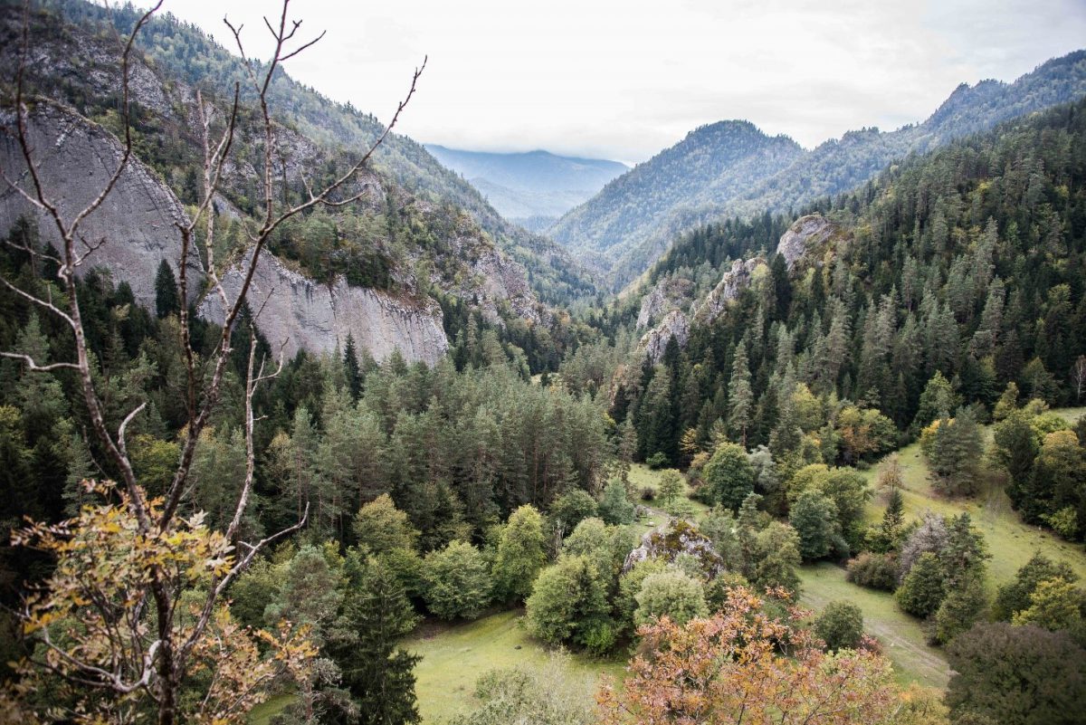
Figure 2: Coniferous and mixed forest in Borjomi, Georgia. (Picture: V.Radeloff)
Her findings are rather surprising, since we expect political instability to interfere with cropland, and to make forests vulnerable for illegal harvesting. But in the Caucasus, Johanna explains, the steep, inaccessible terrain may have protected the forests from large clear cuts; even though the extracting of single valuable trees is widespread. Cropland, on the other hand is related to demand for food: cultivation continued wherever possible, unless we find armed conflicts in the region.
Figure 3: Preliminary results of abandoned arable land in Chechnya between 1987 and 2015
“What I can say is that land use patterns and outcomes are extremely dependent on the local context, especially in such a diverse region like the Caucasus” Johanna cautioned.
A Cooper’s hawk (Accipiter cooperi) in an urban nature conservancy. Prey abundance seems to be the driving factor in their colonization and persistence in urban areas. Photo: Ashley Olah 2014.
The effect of urbanization on wildlife is varied; some species adapt to urbanization, and others do not. For accipiter hawks, urbanization might not be all that bad. By combining remote sensing with citizen science, UW-Madison researchers recently found that in Chicago, increases in imperviousness and tree cover reduced the probability of colonization of urban areas by accipiter hawks, while increases in prey abundance (i.e. songbirds) increased the probability of colonization. In addition, the stabilization of urbanization coincided with a leveling off of hawk occupancy. These recent findings can help scientists understand how wildlife may respond and adapt to urbanization in other areas. To see if these trends reoccur in urban environments in very different biomes, Sofia Kozidis will conduct research that expands upon the Chicago findings to improve understanding of how avian predators respond to urbanization over a larger range of conditions. She will expand the area of study from one urban area, Chicago, to other major urban areas that have high accipiter hawk occupancy and a wealth of Project FeederWatch data.
A pine warbler (Setophaga pinus) visits a suet feeder in a residential backyard. Abundance of songbird species visiting bird feeders affects where accipiter hawks colonize and persist in urban areas. Photo: Ashley Olah 2014.
Project FeederWatch is a citizen science project in which participants count the birds visiting their backyard bird feeders periodically between November and April. This data is used by scientists to track long-term trends in winter bird distribution and abundance. Using FeederWatch data from 1996 to 2018, Sofia will identify occupancy patterns in urban areas that have a high abundance of accipiter hawks while also seeking to assess impacts of hawk’s presence on songbird populations. The expectation is that, as was found in Chicago, accipiter hawk occupancy will increase over time. However, it is possible that colonization and occupancy patterns could differ between cities depending on factors such as climate, city layout, and the surrounding environment. If patterns in certain urban areas differ from the expectation, Sofia will analyze those areas using remote sensing tools to see if she can determine factors associated with unexpected patterns, ultimately helping to elucidate the range of responses of accipiter hawks to urbanization. Sofia’s research highlights the usefulness of citizen science projects, which generates larger amounts of data than could be collected by one researcher alone and connects citizens to scientific research.
Humans are rapidly transforming the Earth’s ecosystems, with profound consequences for biodiversity. To predict how species will respond to rapidly changing environments, biodiversity science needs better datasets of biodiversity patterns and species distribution. Dr. Laura Farwell is part of a team on a mission to advance and broaden the use of Landsat satellite data for biodiversity science by characterizing habitat heterogeneity at a medium resolution (30 m), across the conterminous U.S.
Map of habitat heterogeneity across the conterminous U.S., based on 30-m resolution standard deviation texture (21×21 moving window) of NDVI (index of vegetation greenness) from Landsat 8 imagery. Darker green areas indicate regions with higher habitat heterogeneity.
Ecological processes influence patterns of species diversity at multiple scales, and landscape grain strongly affects habitat niches and thus biodiversity potential. Vertebrate species in particular tend to select habitat based on parameters acting at multiple scales. For example, several bird species might strongly prefer large patches of primary forests at broader scales, but at a finer scale habitat selection might be strongly influenced by the amount of heterogeneity within habitat patches. Habitat heterogeneity can also influence species diversity patterns as a result of specialization by certain species on different habitat types. And in general, high heterogeneity increases opportunities for species coexistence. It has been hypothesized that avian diversity is strongly influenced by local scale ecosystem patterns. Vegetation structure is one example of a local scale characteristic that many birds seem to key in on, particularly for nest site selection. But collecting these types of data on the ground is logistically difficult and time consuming. If we can characterize habitat heterogeneity using remotely sensed images, this can potentially be a powerful tool for biodiversity science, allowing rapid classification of vegetation, as well as inference about habitat quality and ecological niches.
A set of indices collectively called image texture holds promise for meeting this need. These indices characterize the amount and pattern of contrast in the tonal values of adjacent pixels, a product of the unique spectral signature of different plant species and combinations within the area covered by the pixels. First-order image texture measures differences in spectral values within a defined neighborhood (e.g., a 3×3 window) surrounding each pixel. More advanced image texture analysis involves 2nd-order texture measures based on a spectral value co-occurrence matrix (GLCM) or local indicators of spatial autocorrelation. It has previously been shown that image texture measures are powerful predictors of avian species richness, in an upper Midwestern U.S. grassland-savanna-woodland system, and in a desert- ecosystem. Building on what has been learned in previous studies, Laura will calculate two 1st-order textures (range and standard deviation), two 2nd-order textures (contrast and angular second moment), plus one local indicator of spatial autocorrelation (the G* statistic).
Map of North American Breeding Bird Survey (BBS) route locations in the conterminous United States. Each breeding season, approximately 4,000 BBS routes are surveyed across the study area. Laura will compare texture measures of habitat heterogeneity with BBS data, with the goal of mapping patterns of avian biodiversity across the conterminous U.S.
A strength of Laura’s project is the use of Landsat data at 30 m resolution as the basis of texture measures, as this resolution is relevant to many animal species. Laura will characterize image texture across the entire conterminous U.S. She will calculate texture of two different Landsat products- NDVI (which indicates vegetation greenness) and the SWIR band (which highlights leaf and soil moisture content). She will also calculate texture of the cumulative Dynamic Habitat Index currently being derived by PhD student Elena Razenkova, which characterizes plant productivity.
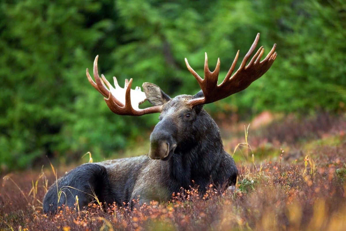
Dynamic Habitat Indices (DHI) have been used to understand and predict patterns of species richness across the globe, but Elena Razenkova has found a new application for these new remotely sensed measures of productivity. Elena found that DHI was correlated with Moose abundance over the last three decades in the former USSR and current Russia.
Moose abundance in the former Soviet Union can be predicted from the DHI (source: pexels.com)
Moose are important for subsistence, culture, and ecosystem function across much of the boreal region of the northern hemisphere. Like many species that occur at high latitudes, they experience population fluctuations from year to year, which can be difficult to predict. Elena used a long-term data set of Moose winter track counts in the former USSR and Russia from 1981 to 2010 to determine how Moose abundance has fluctuated over time.
Elena hypothesized that changes in ecosystem productivity from year to year may contribute to changes in Moose populations; however, because Moose occupy such a broad geographic area, measuring productivity on the ground would be a difficult task. NASA’s earth observing satellite-mounted MODIS (Moderate Resolution Imaging Spectroradiometer), collects data on Earth’s environmental conditions over time, which can be used to develop Dynamic Habitat Indices going back decades.
Dynamic Habitat Indices provide summaries of vegetation productivity over time, which is correlated with the richness of animal species in a given area. Vegetation productivity is also thought to affect the reproduction and survival of many animal species, leading to changes in their abundance over time. Dynamic habitat indices include cumulative productivity, minimum productivity, and variation in productivity, making them a comprehensive data source to test whether Moose abundance is correlated with productivity over the last 30 years in the USSR and Russia.
Elena found that DHI along with other environmental data such as climate, explained 79% of the variation in moose abundance in the different administrative regions of the USSR and Russia. The predictive power of the DHI model decreased somewhat from the 1980s to the 2000s, suggesting a possible role for increases in human-induced changes in Moose abundance, corresponding to the breakup of the USSR.
Elena’s research demonstrates an exciting new use for DHI: understanding and predicting the abundance of individual animal species. This may have important applications in determining animal abundance over time and across broad spatial extents. Elena hopes to look at patterns of abundance of several other animal species to determine if DHI is an equally important predictor of abundance among different taxonomic and functional groups. DHI could also serve as a helpful resource to predict how the abundance of some animal species will change in response to global changes that affect vegetation productivity and seasonality.
Agricultural land abandonment is a prominent land use change across the globe. From Eastern Europe to the core of the Amazonian forest, land dedicated to agriculture has been abandoned. These new unused land areas may provide opportunities for conservation and carbon storage. They can also be seen as potential threats to social security and to the spread of fire. Agriculture abandonment is also an important indicator of economic growth and stability. However, abandoned agriculture, and closely related land cover classes such as fallow fields, and grasslands, are not yet routinely mapped with remote sensing. He Yin wants to contribute to the science of remote sensing by creating agriculture abandonment maps that have high precision in time and location. Better maps (i.e. with greater resolution) would help improve our understanding of the drivers that lead to agricultural land abandonment and would be useful for planning sustainable landscapes.
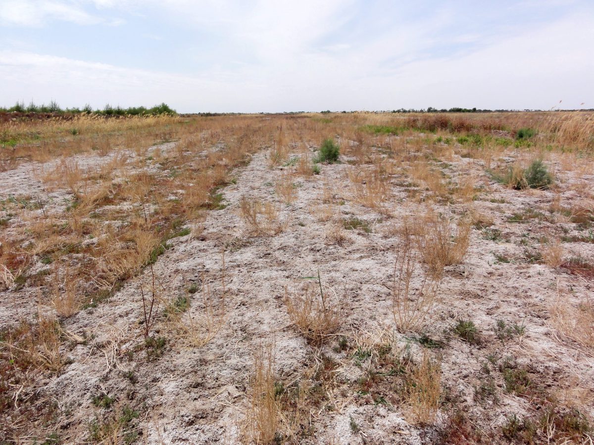
Figure 2 A field abandoned due to soil salinization (Khorezm, Uzbekistan)
Satellite images have precious information on plant phenology, which is the “key” to distinguishing active agriculture from other land use types. For instance, early in the season a plowed field has open soil ready to be planted. Then, as plants grow taller the amount of green leaf area increases. Later in the season, when crops are ready for the market, comes the harvest, and the amount of leaf area decreases. “These abrupt changes in the amount of plants in a field can be detected in the satellite images, and allows us to confirm that the field is under production” – says, He Yin.
Agricultural land abandonment mapping is challenging because of the heterogeneity and complexity of agricultural land use. Some years a field may be left fallow, to give time for the soil to recover. However, fallow land is not abandoned land. A fallow field may return to production after a year or two. An abandoned field contrasts with a production field in that abandoned field presents a natural decay of the vegetation late in the growing season. He Yin used a technique called ‘temporal segmentation’ to map land abandonment from 30-m Landsat time series (Yin et al. 2018). “When a field has no agriculture for more than 5 years, then we classify it as abandoned land”.
Figure 3: Example of a temporal segmentation with related Landsat imagery (RGB: NIR, SWIR 1, Red), for the pixel indicated by either a black or white crosshair (Yin et al., 2018)
However, Landsat images are not immune from problems. From a Landsat time series, there is a set of images that are not useful because they contain clouds or part of the picture is shaded by topographic features. This increases inaccuracy and limits the areas that can be included in analysis. To solve this challenge, He Yin is planning to use a new NASA product, the Harmonized Landsat Sentinel-2. This product merges imagery from Landsat with imagery from Sentinel-2 and the merged product provides increased temporal resolution of the data. “Repeated 5-day observations will likely improve our mapping precision,” says He Yin.
He Yin and his colleagues mapped land abandonment in the Caucasus recently (Yin et al. 2018), and are ready now for a much larger challenge. They are starting to map agriculture abandonment globally. They want to test their time series approach in many regions of the world, using the improved set of satellite imagery provided by Harmonized Landsat Sentinel-2. He Yin hopes that these explorations will help to have better maps of land abandonment from places with varying topographies and biomes, and, most importantly, where agricultural systems are complex.
Ecological regionalisations delineate areas of similar environmental conditions, ecological processes,
and biotic communities, and provide a basis for systematic conservation planning and management.
Most regionalisations are made based on subjective criteria, and can not be readily revised, leading to
outstanding questions with respect to how to optimally develop and define them. Advances in remote
sensing technology, and big data analysis approaches, provide new opportunities for regionalisations,
especially in terms of productivity patterns through both photosynthesis and structural surrogates.
Here we show that global terrestrial productivity dynamics can be captured by Dynamics Habitat
Indices (DHIs) and we conduct a regionalisation based on the DHIs using a two-stage multivariate
clustering approach. Encouragingly, the derived clusters are more homogeneous in terms of species
richness of three key taxa, and of canopy height, than a conventional regionalisation. We conclude
with discussing the benefits of these remotely derived clusters for biodiversity assessments and
conservation. The clusters based on the DHIs explained more variance, and greater within-region
homogeneity, compared to conventional regionalisations for species richness of both amphibians and
mammals, and were comparable in the case of birds. Structure as defined by global tree height was
also better defined by productivity driven clusters than conventional regionalisations. These results
suggest that ecological regionalisations based on remotely sensed metrics have clear advantages over
conventional regionalisations for certain applications, and they are also more easily updated.
Remotely sensed data can help to identify both suitable habitat for individual species, and environmental conditions
that foster species richness, which is important when predicting how biodiversity will respond to global change. The
question is how to summarize remotely sensed data so that they are most relevant for biodiversity analyses, and the
Dynamic Habitat Indices are three metrics designed for this. Our goals here were to a) derive, for the first time, the
Dynamic Habitat Indices (DHIs) globally, and b) use these to evaluate three hypotheses (available energy, environmental
stress, and environmental stability) that attempt to explain global variation in species richness of
amphibians, birds, and mammals. The three DHIs summarize three key measures of vegetative productivity: a)
annual cumulative productivity, which we used to evaluate the available energy hypothesis that more energy is
associate with higher species richness; b) minimum productivity throughout the year, which we used to evaluate the
environmental stress hypothesis that higher minima cause higher species richness, and c) seasonality, expressed as
the annual coefficient of variation in productivity, which we used to evaluate the environmental stability hypothesis
that less intra-annual variability causes higher species richness. We calculated the DHIs globally at 1-km resolution
from MODIS vegetation products (NDVI, EVI, LAI, fPAR, and GPP), based on the median of the good observations of
all years from the entire MODIS record for each of the 23 or 46 possible dates (8- vs. 16-day composites) during the
year, and calculated species richness for three taxa (amphibians, birds, and mammals) at 110-km resolution from
species range maps from the IUCN Red List. We found marked global patterns of the DHIs, and strong support for all
three hypotheses. The three DHIs for a given vegetation product were well correlated (Spearman rank correlations
ranging from −0.6 (cumulative vs. variation DHIs) to −0.93 (variation vs. minimum DHI)). Similarly, DHI components
derived from different MODIS vegetation products were well correlated (0.8–0.9), and correlations of the
DHIs with temperature and precipitation were moderate and strong respectively. All three DHIs were well correlated
with species richness, showing in ranked order positive correlations for cumulative DHI based on GPP (Spearman
rank correlations of 0.75, 0.63, and 0.67 for amphibians, resident birds, and mammals respectively) and minimum
DHI (0.73, 0.83, and 0.62), and negative for variation DHI (−0.69, −0.83, and −0.59). Multiple linear models of all
three DHIs explained 67%, 65%, and 61% of the variability in species richness of amphibians, resident birds, and
mammals, respectively. The DHIs, which are closely related to well-established ecological hypotheses of biodiversity,
can predict species richness well, and are promising for application in biodiversity science and conservation.
Aim: Populations of large ungulates are dwindling worldwide. This is especially so for
wild sheep, which compete with livestock for forage, are disturbed by shepherds and
their dogs, and are exposed to disease transmissions from livestock. Our aim was to
assess spatial patterns in realized niche overlap between wild and domestic sheep to
better understand where potential competition might arise, and thus to identify priority
areas for wild sheep recovery.
Location: Southern Caucasus (220,000 km2).
Methods: We studied Gmelin’s mouflon (Ovis orientalis gmelinii), an ancestor of domestic
sheep, to investigate seasonal habitat use and niche overlap with domestic
sheep. To map habitat, we analysed mouflon occurrences collected during 2006–
2016, and domestic sheep occurrences from shepherd camp locations digitized on
high-resolution
satellite imagery. We mapped areas of potential competition between
mouflon and domestic sheep and assessed potential habitat displacement.
Results: Mouflon and domestic sheep niches overlapped substantially (overlap index
I = 0.89, where 1 means perfect overlap) but were not identical. Mouflon habitat was
less widespread than domestic sheep habitat (14,000 vs. 40,270 km2) and tended to
be located in more rugged areas with less vegetation cover. We identified 51 priority
patches as reintroduction candidates if grazing pressure and poaching were
reduced.
Main conclusions: Our results suggest that competition with domestic sheep might
have pushed mouflon into marginal habitat. Thus, conservation efforts focusing on
current mouflon habitat might miss suitable reintroduction sites. We demonstrate
that a combined habitat model for wild and domestic sheep can identify general
sheep habitat, which might be more useful for conservation planning than understanding
current mouflon habitat selection. Our results highlight that considering
competition with livestock is important for large ungulate conservation, both in
terms of reactive (e.g., lessening livestock pressure in prime habitat) and proactive
strategies (e.g., reintroduction in areas with low contemporary overlap).